- Clayton-le-Woods
-
Coordinates: 53°41′50″N 2°39′37″W / 53.697116°N 2.660309°W
Clayton-le-Woods 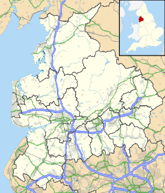
 Clayton-le-Woods
Clayton-le-Woods shown within LancashirePopulation 14,528 (2001 Census) OS grid reference SD560222 Parish Clayton-le-Woods District Chorley Shire county Lancashire Region North West Country England Sovereign state United Kingdom Post town CHORLEY, LEYLAND Postcode district PR6, PR25 Dialling code 01772, 01257 Police Lancashire Fire Lancashire Ambulance North West EU Parliament North West England UK Parliament Chorley List of places: UK • England • Lancashire Clayton-le-Woods is a large village and civil parish of the Borough of Chorley, in Lancashire, England. According to the United Kingdom Census 2001 it has a population of 14,528.[1]
Contents
Geography
Situated to the north of the town of Chorley, Clayton-le-Woods is only a few miles from the city of Preston and next door to the small towns of Leyland and Bamber Bridge. The villages of Whittle-le-Woods, Brindle and the new Buckshaw Village are also located next to Clayton-le-Woods. Clayton-le-Woods is seen as being a leafy green middle class suburban area where the majority of people are white Britons.
The village is divided in two by Cuerden Valley Park and the River Lostock, the western part bordering Leyland and the eastern bordering Whittle-le-Woods. The village is close to different junctions of the motorway network, junctions 28 & 29 of the M6, junction 8 of the M61, and junction 2 of the M65.
Community
The village has five primary schools in its vicinity, which demonstrates its suburban middle class status. The primary schools are, Clayton-le-Woods CE, Lancaster Lane, Westwood Road, Manor Road and St Bedes RC. A library was built in the village in 1985, located in Clayton Green next to Cuerden Valley Park.[2]
There are a number of pubs, a large supermarket, a sports centre and two hotels all located within the village.
Charcoal burning is still being carried out by coppicing the woods, in the grounds of nearby Cuerden Hall.[3] There are also Linen hand weaver's cottages which are located on Sheep Hill Lane[4]
Gallery
-

The Hayrick pub
-

Cuerden Valley Park
-

Clayton Brook footpath
-

Clayton Green Asda
References
- ^ Clayton-le-Woods CP (Parish). URL accessed 30 June 2007.
- ^ "Welcome to the Library and Information Service web site - History of Clayton Green". Lancashire County Council. http://www.lancashire.gov.uk/libraries/librarydetails/libhist.asp?name=Clayton%20Green. Retrieved 2008-02-26.
- ^ Chorley : Clayton-le-Woods
- ^ Lancashire Parish Portal
External Links
- Clayton-le-Woods chorley.gov.uk.
- Parish council, etc
Ceremonial county of Lancashire North West England Portal Unitary authorities Boroughs or districts Major settlements Accrington • Adlington • Bacup • Barnoldswick • Blackburn • Blackpool • Brierfield • Burnley • Burscough • Carnforth • Chorley • Clayton-le-Moors • Cleveleys • Clitheroe • Colne • Darwen • Earby • Fleetwood • Garstang • Great Harwood • Haslingden • Kirkham • Lancaster • Leyland • Longridge • Lytham St Annes • Morecambe • Nelson • Ormskirk • Oswaldtwistle • Padiham • Penwortham • Poulton-le-Fylde • Preesall • Preston • Rawtenstall • Rishton • Skelmersdale • Wesham • Whitworth
See also: List of civil parishes in LancashireRivers Canals Topics Categories:- Geography of Chorley
- Villages in Lancashire
- Civil parishes in Lancashire
-


Wikimedia Foundation. 2010.