- Nassau County, Florida
-
Nassau County, Florida 
Seal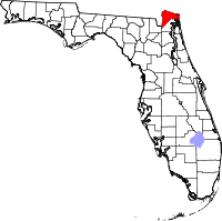
Location in the state of Florida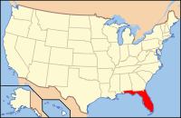
Florida's location in the U.S.Founded December 29, 1824 Seat Fernandina Beach Area
- Total
- Land
- Water
725.86 sq mi (1,880 km²)
651.55 sq mi (1,688 km²)
74.30 sq mi (192 km²), 10.24%Population
- (2010)
- Density
73,314
112/sq mi (43.43/km²)Website www.nassaucountyfl.com Nassau County is a county located in the state of Florida. As of 2000, the population was 57,663. The U.S. Census Bureau 2008 estimate for the county was 69,835.[1] Its county seat is Fernandina Beach, Florida.[2]
Nassau County is part of the Greater Jacksonville Metropolitan area.
Contents
History
Nassau County was created in 1824. It was named for the Duchy of Nassau in Germany.
Law and government
Nassau County is governed by the five-member Nassau County Board of County Commissioners, who are elected to four-year terms by the voters. The terms are staggered so that either three or two commissioners (alternately) are up for election every two years.
The main environmental and agricultural body is the Nassau County Soil and Water Conservation District, which works closely with other area agencies.
Local law enforcement is conducted by the Nassau County Sheriff's Office. The sheriff of the NCSO is Tommy Seagraves.
Geography
According to the 2000 census, the county has a total area of 725.86 square miles (1,880.0 km2), of which 651.55 square miles (1,687.5 km2) (or 89.76%) is land and 74.30 square miles (192.4 km2) (or 10.24%) is water,[3] much of it in the Atlantic Ocean. Fernandina Beach is located on Amelia Island, the county’s one inhabited island.
Topography
There are 12 distinct topographical zones in Nassau County. Most of these zones run in narrow bands stretching from north to south, although this is less true as one approaches the Atlantic coast.
- Directly against the western border with Baker County, the topography ranges from fairly flat to slightly elevated. Drainage is poor and the soil is sandy.
- Moving east, there are some areas (mostly in the northern and central county) of higher ground with much better drainage.
- East of these areas are some lower places, especially in the south, that are level and have extremely poor drainage.
- Eastward again, there is a stretch that ranges from a few miles in the extreme northern areas to about 6-8 miles (13 km) wide in the southern area, including Hilliard and much of County Road 108 and State Road 301. This area again has very poor drainage, low-lying land, and fairly sandy soil.
- East of this are scattered areas of high, sandy land with spotty or poor drainage.
- East of this, there is an area including Callahan with very sandy soil on top, and clay underneath. This section of the county is heavily permeated by small creeks and rivers, which bring with them low, poorly drained soils. This zone extends across the entire county from north to south at a fairly consistent width of about 3-4 miles (6.4 km), except in the north, where it widens to nearly 6 miles (9.7 km) across.
- East of this area is a large band of land with a consistent width of about 8 miles (13 km). The land is low and level with extremely poor drainage, and it is permeated by small creeks and rivers. In the northern section, this is where some tributaries join the St. Marys River, while in the south a number of tributaries drain together into the Nassau River, which flows into the Nassau Sound and the Atlantic Ocean.
- East of this area is a section of land about 3 miles (4.8 km) in width that has extremely sandy soils with bad drainage all around.
- Further eastward is a large area, including Yulee and O'Neil, about 4 miles (6.4 km) in width, with poor drainage and sandy soil at higher elevations, pockmarked by large reas of low lands with even worse drainage.
- To the south is an area of low-lying, organic soils which are essentially marshes and wetlands along the northern bank of the Nassau River, continuing into the Nassau Sound.
- Still eastward and somewhat to the north is a large area of marshes and organic soils which characterize area wetlands. There are many small islands in this area, and it is permeated by the Bells River and Jolly River, which empty into the Cumberland Sound to the north, just below Cumberland Island.
- Amelia Island, the easternmost section of the county, is characterized by poor drainage in the west and better drained, higher, sandier land as one travels eastward towards the beach. The northern area of the island features salty marshlands surrounding Egan’s Creek, which runs directly beneath Atlantic Boulevard in Fernandina Beach.
Adjacent counties
- Camden County, Georgia - north
- Duval County, Florida - south
- Baker County, Florida - southwest
- Charlton County, Georgia - west
Current major highways
Freeways and expressways
Surface roads
 US 1 (New Kings Road)
 US 17
US 17 US 23
US 23 US 301
 A1A
A1A SR 2 (Crawford Road)
 SR 15A (Mickler Street)
 SR 108 (River Road/Brandies Avenue/Dr. Martin Luther King Jr. Avenue)
 SR 115 (Lem Turner Road)
 SR 119
 SR 200 (Buccaneer Trail)
Economy
Nassau County’s economy is very diverse, ranging from agricultural activity (mostly in the form of tree farms) in the west and central areas, to a variety of activities closer to Amelia Island. Much of the land used for tree farming is owned by Rayonier, a major employer in the area, and the owner of a large pulp mill in Fernandina Beach. Historically, tree farming, trucking, and pulp production have characterized a large portion of the local economy. However, extensive growth is occurring in the outlying small towns in the rural western area, and the home construction market is still quite strong. Fernandina Beach has long been known for professional industries such as real estate, legal services, and medical care, and is also the closest city to two upscale resorts: the Ritz-Carlton Hotel and Amelia Island Plantation. In the central area of the county, a private tract of land known as White Oak Plantation was once owned by a wealthy family who ran the area as a private zoo, complete with exotic animals such as giraffes and large albino cats. Numerous public figures, including former President Bill Clinton, have travelled to the resort in the past as a vacation spot.
Demographics
Historical populations Census Pop. %± 1840 1,892 — 1850 2,164 14.4% 1860 3,644 68.4% 1870 4,247 16.5% 1880 6,635 56.2% 1890 8,294 25.0% 1900 9,654 16.4% 1910 10,525 9.0% 1920 11,340 7.7% 1930 9,375 −17.3% 1940 10,826 15.5% 1950 12,811 18.3% 1960 17,189 34.2% 1970 20,626 20.0% 1980 32,894 59.5% 1990 43,941 33.6% 2000 57,663 31.2% 2010 73,314 27.1% [4][5][6] As of the census[7] of 2000, there were 57,663 people, 21,980 households, and 16,528 families residing in the county. The population density was 34/km² (88/sq mi). There were 25,917 housing units at an average density of 15/km² (40/sq mi). The racial makeup of the county was 90.02% White, 7.74% Black or African American, 0.43% Native American, 0.46% Asian, 0.03% Pacific Islander, 0.32% from other races, and 1.00% from two or more races. 1.51% of the population were Hispanic or Latino of any race.
According to the 2000 Census, the largest European ancestry groups in Nassau County were: English (36.2%), Irish (13.6%) and German (11.7%).
There were 21,980 households out of which 32.80% had children under the age of 18 living with them, 61.20% were married couples living together, 9.90% had a female householder with no husband present, and 24.80% were non-families. 20.10% of all households were made up of individuals and 7.70% had someone living alone who was 65 years of age or older. The average household size was 2.59 and the average family size was 2.97.
In the county the population was spread out with 25.00% under the age of 18, 7.20% from 18 to 24, 28.80% from 25 to 44, 26.30% from 45 to 64, and 12.60% who were 65 years of age or older. The median age was 38 years. For every 100 females there were 97.30 males. For every 100 females age 18 and over, there were 94.80 males.
The median income for a household in the county was $46,022, and the median income for a family was $52,477. Males had a median income of $37,027 versus $25,443 for females. The per capita income for the county was $22,836. About 6.40% of families and 9.10% of the population were below the poverty line, including 10.90% of those under age 18 and 8.90% of those age 65 or over.
Education
Nassau County is home to:
Nine elementary schools
- Atlantic Elementary (2-3)
- Fernandina Beach, Fla. 32034
- Bryceville Elementary (K-5)
- Bryceville, Fla. 32009
- Callahan Elementary (PreK-2)
- Callahan, Fla. 32011
- Callahan Intermediate (3-5)
- Callahan, Fla. 32011
- Emma Love Hardee Elementary (4-5)
- Fernandina Beach, Fla.
- Hilliard Elementary (PreK-5)
- Hilliard, Fla.
- Southside Elementary (PreK-1)
- Fernandina Beach, Fla.
- Yulee Elementary (3-5)
- Yulee, Fla.
- Yulee Primary (PreK-2)
- Yulee, Fla.
Three middle schools
- Callahan Middle (6-8)
- Mascot: Ramblers
- Callahan, Fla.
- Mascot: Ramblers
- Fernandina Beach Middle (6-8)
- Mascot: Pirates
- Fernandina Beach, Fla.
- Mascot: Pirates
- Yulee Middle(6-8)
- Mascot: Hornets
- Yulee, Fla.
- Mascot: Hornets
Three high schools
- Fernandina Beach High (9-12)
- Mascot: Pirates
- Fernandina Beach, Fla.
- Mascot: Pirates
- West Nassau County High (9-12)
- Mascot: Warriors
- Callahan, Fla.
- Mascot: Warriors
- Yulee High (9-12)
- Mascot: Hornets
- Yulee, Fla.
- Mascot: Hornets
One Middle-Senior High school
- Hilliard Middle-Senior High (6-12)
- Mascot: Flashes
- Hilliard, Fla.
- Mascot: Flashes
The Betty Cook Center, established and run by Florida State College at Jacksonville, offers classes for a variety of post-secondary degrees.
Municipalities
Incorporated
- Town of Callahan
- City of Fernandina Beach
- Town of Hilliard
Unincorporated
- Amelia City
- American Beach
- Andrews
- Boulogne
- Bryceville
- Chester
- Crandall
- Crawford
- Dahoma
- Dyal
- Evergreen
- Franklintown
- Glenwood
- Gross
- Hedges
- Hero
- Ingle
- Italia
- Keene
- Kent
- Kings Ferry
- Lessie
- Nassau Village-Ratliff
- Nassauville
- O'Neil
- Verdie
- Yulee Heights
- Yulee
Local media
There are four newspapers in Nassau County. The largest, the Fernandina Beach News-Leader, is owned by Community Newspapers Incorporated, a media company headed by Tom Wood and Dink NeSmith. The Nassau County Record is also owned by Community Newspapers Incorporated. Both of these periodicals are available by subscription or from newsstands. The Westside Journal, an independent newspaper, is published by Florida Sun Printing, and is available for free through the mail and usually features submitted copy. My Nassau Sun, a community section of The Florida Times-Union, is also available for free by subscription for delivery cost.
Notable Residents
- Howie Kendrick, Major League Baseball player for the Anaheim Angels
- Daniel Thomas, National Football League player for the Miami Dolphins
Historic places
- Hoyt House, 804 Atlantic Avenue,
- Historic Nassau County Courthouse, 416 Centre Street
- United States Post Office, Custom House, and Courthouse (Fernandina, Florida, 1912), NE corner Centre and 4th streets
References
- ^ http://www.census.gov/popest/counties/tables/CO-EST2005-01-12.xls census.gov
- ^ "Find a County". National Association of Counties. http://www.naco.org/Counties/Pages/FindACounty.aspx. Retrieved 2011-06-07.
- ^ "Census 2000 U.S. Gazetteer Files: Counties". United States Census. http://www.census.gov/tiger/tms/gazetteer/county2k.txt. Retrieved 2011-02-13.
- ^ http://www.census.gov/population/www/censusdata/cencounts/files/fl190090.txt
- ^ http://factfinder2.census.gov/faces/tableservices/jsf/pages/productview.xhtml?pid=DEC_10_PL_QTPL&prodType=table
- ^ http://mapserver.lib.virginia.edu/
- ^ "American FactFinder". United States Census Bureau. http://factfinder.census.gov. Retrieved 2008-01-31.
Further reading
- Jan H. Johannes, Yesterday's Reflections, (1976, 1984)
- Jan H. Johannes, Yesterday's Reflections II, (2000) ISBN 0-9677419-0-4
- Jan H. Johannes, Tidewater Amelia: Historic homes & buildings of Amelia Island, Cumberland Island, St. Marys, Fort George Island, (2002) ISBN 0-9677419-2-0
External links
Economy
- Amelia Island Plantation
- Federal Aviation Administration Air Route Traffic Control Center ZJX
- Rayonier
- The Ritz Carlton
Local media
Cultural
Government links/Constitutional offices
- Nassau County Clerk of Courts official website for County Government
- Nassau County Board of County Commissioners
- Nassau County Supervisor of Elections
- Nassau County Property Appraiser
- Nassau County Sheriff's Office
- Nassau County Public Library
- Nassau County Tax Collector
Special districts
- Nassau County School District
- St. Johns River Water Management District
- Nassau County Economic Development Board
- Nassau County Soil and Water Conservation District
Judicial branch
- Public Defender, 4th Judicial Circuit of Florida serving Duval, Clay, and Nassau counties
- Office of the State Attorney, 4th Judicial Circuit of Florida
- Circuit and County Court, 4th Judicial Circuit of Florida

Camden County, Georgia Charlton County, Georgia 
Atlantic Ocean  Nassau County, Florida

Baker County Duval County Municipalities and communities of Nassau County, Florida City 
Towns CDPs Unincorporated
communitiesAmelia City | American Beach | Becker | Boulogne | Bryceville | Crawford | Chester | Dahoma | Dyal | Evergreen | Franklintown | Glenwood | Hedges | Ingle | Italia | Kent | Kings Ferry | Lessie | Nassauville | O'Neil | Verdie | Yulee Heights
Categories:- Florida counties
- Nassau County, Florida
- 1824 establishments in the United States
- Populated places established in 1824
- Greater Jacksonville


Wikimedia Foundation. 2010.