- Marion County, Florida
-
For counties with a similar name, see Marion County (disambiguation).
Marion County, Florida 
Seal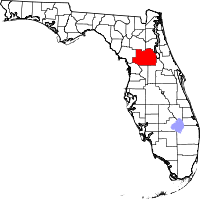
Location in the state of Florida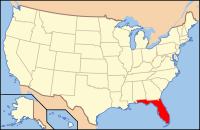
Florida's location in the U.S.Founded March 14, 1844 Seat Ocala Area
- Total
- Land
- Water
1,663.01 sq mi (4,307 km²)
1,578.86 sq mi (4,089 km²)
84.15 sq mi (218 km²), 5.06%Population
- (2010)
- Density
331,298
210/sq mi (81.02/km²)Website www.marioncountyfl.org Marion County is a county located in the U.S. state of Florida. The U.S. Census Bureau 2006 estimate for the county is 316,183.[1] Its county seat is Ocala[2].
Marion County is coextensive with the Ocala Metropolitan Statistical Area, a metropolitan statistical area (MSA) designated by the Office of Management and Budget and used for statistical purposes by the Census Bureau and other agencies. The Ocala, Florida Standard Metropolitan Statistical Area was first defined in 1981.
Contents
History
Marion County was created in 1844 from portions of Alachua, Mosquito (Orange), and Hillsborough counties. Until 1853, Marion County included most of what are now Lake and Sumter counties. In 1849, Putnam County was created and took the northeast portion of Marion. Levy County’s creation took some of the western portion of Marion in 1877. The county is named after General Francis Marion of South Carolina, a guerilla fighter and hero of the American Revolutionary War. The Act creating the county of Marion of the Territory of Florida was signed on March 14, 1844, by the territorial governor, R. K. Call. Many of the early settlers of Marion County were from South Carolina. The county motto is "Kingdom of the Sun." Farms in the county are known for breeding champion race horses such as Affirmed and Needles.
Sheriff's Office
Shortly after Marion County was formed the first known Sheriff, William Strifel, was appointed over the county, but the only known fact was that Sheriff Strifel only served for the remainder of that year. The Marion County Sheriff’s Office came into being as a result of the State Charter in 1845.
The first Sheriff was Edmund Davis Howse, who was sworn in on October 31, 1845. Sheriff Howse served until 1851. The first jail was built about 1847 on the northwest corner of what is now the downtown square in Ocala. Marion County’s first real courthouse was planned in 1850, and constructed on the town square in 1851. It was described as a two story, stately looking frame building of colonial design. The first floor contained offices, with the courtroom on the second. The jail was described as a small building about fifteen feet square, with two stories. The entrance to the lower floor was through the upper floor. In 1854, a new jail was constructed away from the Square because of complaints that the jail detracted from the new courthouse on the square.
Simeon Halvenston was the second Sheriff of Marion County, and served from 1852 to 1855, apparently not finishing his term due to the political situation. Norman A. McLeod was installed as Sheriff in 1856, but lasted only a short time before Simeon Halvenston was re-elected, serving the second time from 1857-1859. In 1859, Daniel Cappleman was elected the fifth Sheriff of Marion County, serving from 1860 to 1863.
Geography
According to the 2000 census, the county has a total area of 1,663.01 square miles (4,307.2 km2), of which 1,578.86 square miles (4,089.2 km2) (or 94.94%) is land and 84.15 square miles (217.9 km2) (or 5.06%) is water.[3]
Location and Terrain
 General Francis Marion
Marion County is generally composed of rolling hills, some high and some low. The majority of its trees consist of live oaks, pine, and palm trees. Marion County is considered the southernmost county in North Central Florida, and the northernmost county in Central Florida.
It is about a two hour drive from many of Florida's major cities, Orlando is 75 minutes to the southeast while Daytona Beach is about 90 minutes to the east. Tampa is about 75 minutes to the southwest. Jacksonville is roughly a two hour drive northeast. Miami is about five hours to the southeast. Fort Lauderdale is about a four-hour drive from Marion County.
Marion County also has three large lakes at its opposite borders. Orange Lake is in the far northern part of Marion County, near the border with Alachua County. Lake Kerr is in the northeastern part of the county, near the town of Salt Springs, which is near the border with Putnam County. Lake Weir, the largest of the three, is in the far southern region near the border with Lake County. Part of Lake George is in Marion County also.
Marion County is inland, centered between the Atlantic Ocean to the east and the Gulf of Mexico to the west. Because of this, Marion County is not affected as much by hurricanes as the more coastal counties to its east and west are. However, tornadoes are a major threat to this region of the state. Although Marion County is not near either of Florida's coasts, it is situated slightly to the west. Therefore, it takes a little less than an hour to get to the Gulf of Mexico while it takes about half an hour longer to get to the Atlantic Ocean.
Adjacent counties
- Putnam County, Florida - northeast
- Volusia County, Florida - east
- Lake County, Florida - southeast
- Sumter County, Florida - south
- Citrus County, Florida - southwest
- Levy County, Florida - west
- Alachua County, Florida - northwest
National protected area
- Ocala National Forest (part)
Demographics
Historical populations Census Pop. %± 1850 3,338 — 1860 8,609 157.9% 1870 10,804 25.5% 1880 13,046 20.8% 1890 20,796 59.4% 1900 24,403 17.3% 1910 26,941 10.4% 1920 23,968 −11.0% 1930 29,578 23.4% 1940 31,243 5.6% 1950 38,187 22.2% 1960 51,616 35.2% 1970 69,030 33.7% 1980 122,488 77.4% 1990 194,833 59.1% 2000 258,916 32.9% 2010 331,298 28.0% [4][5][6] As of the census[7] of 2000, there were 258,916 people, 106,755 households, and 74,621 families residing in the county. The population density was 164 people per square mile (63/km²). There were 122,663 housing units at an average density of 78 per square mile (30/km²). The racial makeup of the county was 84.16% White, 11.55% Black or African American, 0.45% Native American, 0.70% Asian, 0.02% Pacific Islander, 1.69% from other races, and 1.44% from two or more races. 6.03% of the population were Hispanic or Latino of any race. According to the 2000 Census the largest European ancestry groups in Marion County were English (18.7%), German (16.7%) and Irish (14.0%).
There were 106,755 households out of which 24.70% had children under the age of 18 living with them, 55.60% were married couples living together, 10.70% had a female householder with no husband present, and 30.10% were non-families. 25.00% of all households were made up of individuals and 13.00% had someone living alone who was 65 years of age or older. The average household size was 2.36 and the average family size was 2.79.
In the county the population was spread out with 21.40% under the age of 18, 6.40% from 18 to 24, 23.80% from 25 to 44, 23.90% from 45 to 64, and 24.50% who were 65 years of age or older. The median age was 44 years. For every 100 females there were 93.30 males. For every 100 females age 18 and over, there were 89.90 males.
The median income for a household in the county was $31,944, and the median income for a family was $37,473. Males had a median income of $28,836 versus $21,855 for females. The per capita income for the county was $17,848. About 9.20% of families and 13.10% of the population were below the poverty line, including 20.20% of those under age 18 and 7.40% of those age 65 or over.
Government and infrastructure
The Florida Department of Corrections operates facilities in unincorporated areas in the county, including the Lowell Correctional Institution and the Lowell Annex.[8][9] The annex houses Florida's female death row.[10]
Communities
Incorporated
Unincorporated
- Summerfield
- Fort McCoy
- Marion Oaks
- Silver Springs Shores
- Salt Springs
- Anthony
- The Villages (partly)
- Orange Springs
Law Enforcement
- Marion County Sheriff's Office
- Belleview Police Departments
- Dunnellon Police Departments
- Ocala Police Departments
Education
Public school system
- 28 elementary schools
- 8 middle schools
- 1 4-8 school
- 1 K-8 center
- 8 high schools
- 3 charter schools
- 14 special needs schools
Elementary schools
- Anthony Elementary School
- Belleview Elementary School
- Belleview-Santos Elementary School
- College Park Elementary School
- Dr. N.H. Jones Elementary (Magnet)
- Dunnellon Elementary School
- East Marion Elementary School
- Eighth Street Elementary School
- Emerald Shores Elementary School
- Evergreen Elementary School
- Fessenden Elementary School
- Fort McCoy School (K-8)
- Katie Fay Elementary School
- Greenway Elementary School
- Hammett Bowen Jr. Elementary School
- Harbour View Elementary School
- Horizon Academy at Marion Oaks(4th-8th)
- Madison Street Academy of Visual and Performing Arts (Magnet)
- Maplewood Elementary School
- Oakcrest Elementary School
- Ocala Springs Elementary School
- Reddick-Collier Elementary School
- Romeo Elementary School
- Saddlewood Elementary School
- Shady Hill Elementary School
- South Ocala Elementary School
- Sparr Elementary School
- Stanton-Weirsdale Elementary School
- Sunrise Elementary School
- Ward-Highlands Elementary School
- Wyomina Park Elementary School
Middle schools
- Belleview Middle School
- Dunnellon Middle School
- Fort King Middle School
- Horizon Academy at Marion Oaks(4th-8th)
- Howard Middle School
- Lake Weir Middle School
- Liberty Middle School
- North Marion Middle School
- Osceola Middle School
High schools
- Belleview High School
- Dunnellon High School
- Forest High School
- Lake Weir High School
- Marion Technical Institute
- North Marion High School
- Trinity Catholic High School
- Vanguard High School
- West Port High School
Marion County Public Schools Homepage
See also
References
- ^ "Annual Estimates of the Population of Metropolitan and Micropolitan Statistical Areas: April 1, 2000, to July 1, 2006" (XLS). U.S. Census Bureau. http://www.census.gov/population/www/estimates/metro_general/2006/CBSA-EST2006-01.xls. Retrieved 2008-03-10.[dead link]
- ^ "Find a County". National Association of Counties. http://www.naco.org/Counties/Pages/FindACounty.aspx. Retrieved 2011-06-07.
- ^ "Census 2000 U.S. Gazetteer Files: Counties". United States Census. http://www.census.gov/tiger/tms/gazetteer/county2k.txt. Retrieved 2011-02-13.
- ^ http://www.census.gov/population/www/censusdata/cencounts/files/fl190090.txt
- ^ http://factfinder2.census.gov/faces/tableservices/jsf/pages/productview.xhtml?pid=DEC_10_PL_QTPL&prodType=table
- ^ http://mapserver.lib.virginia.edu/
- ^ "American FactFinder". United States Census Bureau. http://factfinder.census.gov. Retrieved 2008-01-31.
- ^ "Lowell Correctional Institution." Florida Department of Corrections. Retrieved on August 31, 2010.
- ^ "Lowell Annex." Florida Department of Corrections. Retrieved on August 31, 2010.
- ^ "Death Row Fact Sheet." Florida Department of Corrections. Retrieved on August 15, 2010.
External links
Government links/Constitutional offices
- Marion County Fire Rescue
- Marion County Board of County Commissioners
- Marion County Supervisor of Elections
- Marion County Property Appraiser
- Marion County Sheriff's Office
- Marion County Tax Collector
Special districts
- Marion County School Board
- Southwest Florida Water Management District
- St. Johns River Water Management District
Judicial branch
- Marion County Clerk of Courts
- Public Defender, 5th Judicial Circuit of Florida serving Citrus, Hernando, Lake, Marion, and Sumter counties
- Office of the State Attorney, 5th Judicial Circuit of Florida
- Circuit and County Court for the 5th Judicial Circuit of Florida
Tourism links
- Everything you need to know about The Rainbow River, Dunnellon Florida
- Ocala/Marion County Chamber of Commerce
- Ocala/Marion Visitors' & Convention Bureau
Miscellaneous links
- Photographs From the State Library & Archives of Florida.
Middle Schools Belleview Middle School · Dunnellon Middle School · Fort King Middle School · Howard Middle School · Lake Weir Middle School · Liberty Middle School · North Marion Middle School · Osceola Middle School ·Elementary
SchoolsAnthony Elementary School · Belleview Elementary School · Belleview-Santos Elementary School · College Park Elementary School · Dr. N.H. Jones Elementary (Magnet) · Dunnellon Elementary School · East Marion Elementary School · Eighth Street Elementary School · Emerald Shores Elementary School · Evergreen Elementary School · Fessenden Elementary School · Fort McCoy School (K-8) · Greenway Elementary School · Hammett Bowen Jr. Elementary School · Harbour View Elementary School · Madison Street Academy of Visual and Performing Arts (Magnet) · Maplewood Elementary School · Oakcrest Elementary School · Ocala Springs Elementary School · Reddick-Collier Elementary School · Romeo Elementary School · Saddlewood Elementary School · Shady Hill Elementary School · South Ocala Elementary School · Sparr Elementary School · Stanton-Weirsdale Elementary School · Sunrise Elementary School · Ward-Highlands Elementary School · Wyomina Park Elementary School
Alachua County Putnam County Levy County 
Volusia County  Marion County, Florida

Citrus County Sumter County Lake County Municipalities and communities of Marion County, Florida Cities 
Towns CDP Unincorporated
communitiesAnthony | Boardman | Candler | Citra | Dallas | Eastlake Weir | Emathla | Eureka | Evinston‡ | Fairfield | Fellowship | Flemington | Fort McCoy | Huntington | Irvine | Kendrick | Lowell | Lynne | Marion Oaks | Martel | Martin | Moss Bluff | Ocklawaha | Orange Lake | Orange Springs | Rainbow Lake Estates | Salt Springs | Santos | Shady | Silver Springs | Sparr | Summerfield | Weirsdale | Zuber
Footnotes ‡This populated place also has portions in an adjacent county or counties
Categories:- Florida counties
- Marion County, Florida
- 1844 establishments in the United States
- Populated places established in 1844


Wikimedia Foundation. 2010.