- Manatee County, Florida
-
Manatee County, Florida 
Seal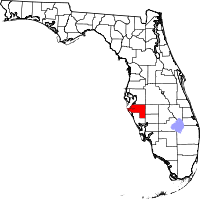
Location in the state of Florida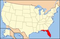
Florida's location in the U.S.Founded 9 January 1855 Seat Bradenton Area
- Total
- Land
- Water
892.75 sq mi (2,312 km²)
741.03 sq mi (1,919 km²)
151.72 sq mi (393 km²), 16.99%Population
- (2010)
- Density
322,833
436/sq mi (168.22/km²)Website www.mymanatee.org Manatee County is a county in the state of Florida. According to the 2010 census by the U.S. Census Bureau there are 322,833 people living in Manatee Country.[1] Manatee County is part of the North Port-Bradenton-Sarasota Metropolitan Statistical Area. Every January, the Manatee County Fair takes place at the fairgrounds.
Contents
History
The area now known as "Manatee County" was inhabited by Native Americans for thousands of years. It may have been the landing site for the De Soto Expedition.
Manatee County was created in 1855. It was named for the Florida manatee (commonly called a "sea cow" though it is distantly related to the elephant), which is endangered and the state's official marine mammal.
Geography
According to the 2000 census, the county has a total area of 892.75 square miles (2,312.2 km2), of which 741.03 square miles (1,919.3 km2) (or 83.01%) is land and 151.72 square miles (393.0 km2) (or 16.99%) is water.[2]
Adjacent counties
- Hillsborough County, Florida – north (narrow strip of Hillsborough County separates Manatee County from Pinellas County)
- Polk County, Florida – northeast corner
- Hardee County, Florida – east
- DeSoto County, Florida – southeast
- Sarasota County, Florida – south
National protected areas
- De Soto National Memorial
- Passage Key National Wildlife Refuge
- Lake Manatee State Park
- Myakka River State Park
Demographics
Historical populations Census Pop. %± 1860 854 — 1870 1,931 126.1% 1880 3,544 83.5% 1890 2,895 −18.3% 1900 4,663 61.1% 1910 9,550 104.8% 1920 18,712 95.9% 1930 22,502 20.3% 1940 26,098 16.0% 1950 34,704 33.0% 1960 69,168 99.3% 1970 97,115 40.4% 1980 148,442 52.9% 1990 211,707 42.6% 2000 264,002 24.7% 2010 322,833 22.3% [3][4][5] As of the census[6] of 2000, there were 264,002 people, 112,460 households, and 73,773 families residing in the county. The population density was 356/sq mi (138/km²). There were 138,128 housing units at an average density of 186/sq mi (72/km²). The racial makeup of the county was 86.36% White, 8.19% Black or African American, 0.28% Native American, 0.90% Asian, 0.05% Pacific Islander, 2.84% from other races, and 1.39% from two or more races. 9.30% of the population were Hispanic or Latino of any race. 2005 Census estimates show the racial composition of the county as being 77.6% non-Hispanic whites, 11.8% Latino, 8.7% African-American and 1.3% Asian. (Source=http://quickfacts.census.gov/qfd/states/12/12081.html)
In 2000 there were 112,460 households out of which 23.00% had children under the age of 18 living with them, 52.70% were married couples living together, 9.40% had a female householder with no husband present, and 34.40% were non-families. 28.40% of all households were made up of individuals and 15.00% had someone living alone who was 65 years of age or older. The average household size was 2.29 and the average family size was 2.78.
In the county the population was spread out with 20.70% under the age of 18, 6.50% from 18 to 24, 24.60% from 25 to 44, 23.30% from 45 to 64, and 24.90% who were 65 years of age or older. The median age was 44 years. For every 100 females there were 93.50 males. For every 100 females age 18 and over, there were 90.50 males.
The median income for a household in the county was $38,673, and the median income for a family was $46,576. Males had a median income of $31,607 versus $25,007 for females. The per capita income for the county was $22,388. About 7.10% of families and 10.10% of the population were below the poverty line, including 15.30% of those under age 18 and 6.20% of those age 65 or over.
Economy
Bealls of Florida has its headquarters in unincorporated Manatee County.[7][8]
Places
 Map of Manatee County indicating incorporated municipalities. Number corresponds to list at left.
Incorporated
- City of Anna Maria
- City of Bradenton
- City of Bradenton Beach
- City of Holmes Beach
- Town of Longboat Key
- City of Palmetto
Unincorporated Census Designated Places
- Bayshore Gardens
- Cortez
- Ellenton
- Memphis
- Samoset
- South Bradenton
- West Bradenton
- West Samoset
- Whitfield
Other unincorporated places
- Duette
- Village of the Arts
- Myakka City
- Oneco
- Parrish
- Terra Ceia
- Gillette
- Palm View
- Memphis Heights
- Palm View
- Manavista
- Fort Hamer
- Rutland
- Manhattan
- Oak Knol
- Waterbury
- Verna
- Old Myakka
- Marsh Island
- Snead Island
- Rattlesnake Key
- Rye
- Elwood Park
- Ward Lake
- Cedar Hammock
- Willow
- Foxleigh
- Lake Manatee
- Tara
- Lakewood Ranch
See also
References
- ^ "Error: no
|title=specified when using {{Cite web}}". http://2010.census.gov/2010census/data/. - ^ "Census 2000 U.S. Gazetteer Files: Counties". United States Census. http://www.census.gov/tiger/tms/gazetteer/county2k.txt. Retrieved 2011-02-13.
- ^ http://www.census.gov/population/www/censusdata/cencounts/files/fl190090.txt
- ^ http://factfinder2.census.gov/faces/tableservices/jsf/pages/productview.xhtml?pid=DEC_10_PL_QTPL&prodType=table
- ^ http://mapserver.lib.virginia.edu/
- ^ "American FactFinder". United States Census Bureau. http://factfinder.census.gov. Retrieved 2008-01-31.
- ^ "Contact Us." Bealls (Florida). Retrieved on December 14, 2009.
- ^ "Samoset CDP, Florida." U.S. Census Bureau. Retrieved on December 14, 2009.
External links
Government links/Constitutional offices
- Manatee County Board of County Commissioners official website
- Manatee County Supervisor of Elections
- Manatee County Property Appraiser
- Manatee County Sheriff's Office
- Manatee County Tax Collector
- Manatee County Search & Rescue
Special districts
- Manatee County Public Schools
- Southwest Florida Water Management District
- Port Authority of Manatee County, Florida
Judicial branch
- Manatee County Clerk of Courts
- Office of the State Attorney, 12th Judicial Circuit of Florida serving DeSoto, Manatee, and Sarasota counties
- Circuit and County Court for the 12th Judicial Circuit of Florida
Tourism links
- Manatee Chamber of Commerce
- Florida Gulf Islands Bradenton Area Convention and Visitors Bureau
- Village of the Arts

Hillsborough County Polk County Gulf of Mexico 
Hardee County  Manatee County, Florida

Sarasota County DeSoto County Municipalities and communities of Manatee County, Florida County seat: Bradenton Cities 
Town CDPs Bayshore Gardens | Cortez | Ellenton | Memphis | Samoset | South Bradenton | West Bradenton | West Samoset | Whitfield
Unincorporated
communitiesMyakka City | Oneco | Parrish | Tallevast | Terra Ceia | Lakewood Ranch
Footnotes ‡This populated place also has portions in an adjacent county or counties
Categories:- Florida counties
- Manatee County, Florida
- 1855 establishments in the United States
- Bradenton–Sarasota–Venice metropolitan area


Wikimedia Foundation. 2010.