- Sumter County, Florida
Infobox U.S. County
county = Sumter County
state = Florida

founded = 8 January1853
seat = Bushnell | area_total_sq_mi =580
area_water_sq_mi =35
area percentage = 5.96%
census yr = 2006
pop = 68768
density_km2 =38
web = www.sumtercountyfl.gov/
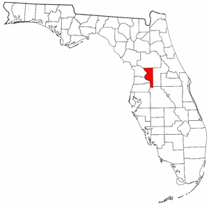
|Sumter County is a
county located in the state ofFlorida ,United States . As of the 2000 Census, the population was 53,345. The 2006 Census estimate puts its population at 68,768 [http://www.census.gov/popest/counties/tables/CO-EST2006-01-12.xls] . Itscounty seat isBushnell, Florida GR|6 and the largest incorporatedmunicipality isWildwood, Florida . The Villages, an unincorporated community, is its most populous location. Sumter County was affected by the massive Florida tornado outbreak of February 2, 2007 and declared astate of emergency .History
Sumter County was created in 1853. It was named for General Thomas Sumter, a hero of the
American Revolutionary War . The county in the past, and to this day by some, is nicknamed "Hog County" most likely because it is home to a large population of wild hogs. Hog hunting is still a favorite pastime of locals in the more rural portions of the county.Although extremely rural, in recent years Sumter County has sustained an exceptionally large increase in population, almost solely due to the expansion of The Villages retirement complex, a significant portion of which is in the county. This has dramatically changed the demographics of the county and has brought in significant income.
Geography
According to the U.S. Census Bureau, the county has a total area of 580
square mile s (1,503km² ), of which, 546 square miles (1,413 km²) of it is land and 35 square miles (90 km²) of it (5.96%) is water.Adjacent counties
*
Marion County, Florida - north
*Lake County, Florida - east
*Polk County, Florida - southeast
*Pasco County, Florida - southwest
*Citrus County, Florida - west
*Hernando County, Florida - westDemographics
As of the
census GR|2 of 2000, there were 53,345 people, 20,779 households, and 15,043 families residing in the county. Thepopulation density was 98 people per square mile (38/km²). There were 25,195 housing units at an average density of 46 per square mile (18/km²). The racial makeup of the county was 82.60% White, 13.78% Black or African American, 0.51% Native American, 0.41% Asian, 0.05% Pacific Islander, 1.16% from other races, and 1.49% from two or more races. 6.29% of the population were Hispanic or Latino of any race.There were 20,779 households out of which 18.80% had children under the age of 18 living with them, 60.90% were married couples living together, 8.40% had a female householder with no husband present, and 27.60% were non-families. 23.50% of all households were made up of individuals and 13.80% had someone living alone who was 65 years of age or older. The average household size was 2.27 and the average family size was 2.62.
In the county the population was spread out with 16.10% under the age of 18, 5.90% from 18 to 24, 23.30% from 25 to 44, 27.30% from 45 to 64, and 27.40% who were 65 years of age or older. The median age was 49 years. For every 100 females there were 113.10 males. For every 100 females age 18 and over, there were 113.90 males.
The median income for a household in the county was $32,073, and the median income for a family was $36,999. Males had a median income of $27,346 versus $21,145 for females. The
per capita income for the county was $16,830. About 9.60% of families and 13.70% of the population were below thepoverty line , including 26.00% of those under age 18 and 7.70% of those age 65 or over.Municipalities
Incorporated
# City of Bushnell
# City of Center Hill
# City of Coleman
# City of Webster
# City of WildwoodUnincorporated
*Lake Panasoffkee
*Linden
*Mabel
*The Villages
*St. Catherine
*Sumterville
*Tarrytown
*Wahoo
*Croom a CoocheeTransportation
Railroads
CSX operates one rail line within the county.
Amtrak formerly provided passenger rail service to Wildwood, but the stop was terminated in late 2004.cite web|url=http://www.sptimes.com/2004/10/29/Pasco/Loss_of_Amtrak_servic.shtml|title=St. Petersburg Times|work=Loss of Amtrak service shouldn't derail Dade City|accessdate=2004-10-29]Major roads
*Interstate 75
*Florida's Turnpike
*U.S. Route 301
*State Road 44
*County Road 470
*State and County Road 48
*County Road 476
*State Road 50
*State Road 471
* County Road 475
* County Road 466-A
* County Road 466
* County Road 462
* County Road 476-BReferences
External links
Government links/Constitutional offices
* [http://sumtercountyfl.gov/ Sumter County Board of County Commissioners]
* [http://www.sumterelections.org/ Sumter County Supervisor of Elections]
* [http://www.qpublic.net/sumter/ Sumter County Property Appraiser]
* [http://www.sum.net/sumterso/ Sumter County Sheriff's Office]
* [http://www.sumtertaxcollector.com/ Sumter County Tax Collector]pecial districts
* [http://www.sumter.k12.fl.us/ Sumter County School Board]
* [http://www.swfwmd.state.fl.us Southwest Florida Water Management District]Judicial branch
* [http://www.co.hernando.fl.us/judicial/ Public Defender, 5th Judicial Circuit of Florida] serving Citrus, Hernando, Lake, Marion, and Sumter counties
* [http://jud5.flcourts.org/sao/index-backup-091603.htm Office of the State Attorney, 5th Judicial Circuit of Florida]
* [http://jud5.flcourts.org/ Circuit and County Court for the 5th Judicial Circuit of Florida]Museum and Library Resources
* [http://ibistro.dos.state.fl.us/uhtbin/cgisirsi.exe/jVtnxgMDna/STA-FLA/138785558/18/X651/XSUBJECT/Sumter+County+(Fla.) Photographs] From the State Library & Archives of Florida.
* [http://www.uflib.ufl.edu/ufdc/?c=fdnl1&b=UF00028420 "The Sumter County Times,"] the local newspaper for Sumter County, Florida fully and openly available in the [http://www.uflib.ufl.edu/UFDC/?c=FDNL1 Florida Digital Newspaper Library]
Wikimedia Foundation. 2010.