- National Register of Historic Places listings in Hocking County, Ohio
-
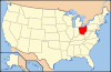
 Location of Hocking County in Ohio
This is a list of the National Register of Historic Places listings in Hocking County, Ohio.
This is intended to be a complete list of the properties and districts on the National Register of Historic Places in Hocking County, Ohio, United States. The locations of National Register properties and districts for which the latitude and longitude coordinates are included below, may be seen in a Google map.[1]
There are 13 properties and districts listed on the National Register in the county. Another property was once listed but has been removed.
-
- This National Park Service list is complete through NPS recent listings posted November 10, 2011.[2]
Current listings
[3] Landmark name [4] Image Date listed Location City or town Summary 1 Davis Works July 15, 1974 Southeastern quarter of Section 8, Town 11, Range 19
39°26′16.8″N 82°42′36″W / 39.438°N 82.71°W[5]Salt Creek Township 2 George Deffenbaugh Mound July 15, 1974 Northeast of Laurelville[6] Salt Creek Township 3 Haydenville Historic Town March 20, 1973 Haydenville
39°28′41″N 82°19′31″W / 39.478056°N 82.325278°WGreen Township 4 Hocking Valley Railway Historic District 
May 5, 1988 Roughly between Bridge #494 in Logan and Bridge #629 in Nelsonville
39°28′46″N 82°19′11″W / 39.479444°N 82.319722°WFalls Township, Green Township, Logan, and Starr Township Extends into Athens County 5 Inter County Highway 360 
December 20, 2002 Iles Rd., west of Logan
39°33′27″N 82°27′28″W / 39.5575°N 82.457778°WFalls Township 6 Charles Worth James House 
September 11, 1980 75 Hill St.
39°32′33″N 82°24′37″W / 39.5425°N 82.410278°WLogan 7 Karshner Mound July 15, 1974 Second terrace above Salt Creek
39°27′5.4″N 82°43′12″W / 39.4515°N 82.72°W[7]Salt Creek Township 8 Logan City Hall 
February 11, 1980 101 E. Main St.
39°32′23″N 82°24′24″W / 39.539722°N 82.406667°WLogan 9 Logan Historic District 
April 19, 2010 Roughly bounded by 2nd St., Spring St., Hill St., Keynes Dr., and Culver St.
39°32′24″N 82°24′25″W / 39.540028°N 82.406844°WLogan 10 McCarthy-Blosser-Dillon Building 
November 29, 1984 4 W. Main St.
39°32′25″N 82°24′32″W / 39.540278°N 82.408889°WLogan 11 Edith Ross Mound June 18, 1973 Address Restricted Salt Creek Township Near Laurelville 12 Saint John the Evangelist Catholic Church Complex 
March 13, 1997 351 N. Market St.
39°32′35″N 82°24′33″W / 39.543056°N 82.409167°WLogan 13 William H. Woodruff House July 29, 1982 35330 Linton Rd., southeast of Logan
39°31′26″N 82°21′57″W / 39.523889°N 82.365833°WGreen Township Former listing
[3] Landmark name Image Date listed Location City or town Summary 1 Ladies Comfort Station January 1, 1999 S. Mulberry St. Logan Listed on March 9, 1990 See also
References
- ^ The latitude and longitude information provided in this table was derived originally from the National Register Information System, which has been found to be fairly accurate for about 99% of listings. For about 1% of NRIS original coordinates, experience has shown that one or both coordinates are typos or otherwise extremely far off; some corrections may have been made. A more subtle problem causes many locations to be off by up to 150 yards, depending on location in the country: most NRIS coordinates were derived from tracing out latitude and longitudes off of USGS topographical quadrant maps created under the North American Datum of 1927, which differs from the current, highly accurate WGS84 GPS system used by Google maps. Chicago is about right, but NRIS longitudes in Washington are higher by about 4.5 seconds, and are lower by about 2.0 seconds in Maine. Latitudes differ by about 1.0 second in Florida. Some locations in this table may have been corrected to current GPS standards.
- ^ "National Register of Historic Places: Weekly List Actions". National Park Service, United States Department of the Interior. Retrieved on November 10, 2011.
- ^ a b Numbers represent an ordering by significant words. Various colorings, defined here, differentiate National Historic Landmark sites and National Register of Historic Places Districts from other NRHP buildings, structures, sites or objects.
- ^ "National Register Information System". National Register of Historic Places. National Park Service. . http://nrhp.focus.nps.gov/natreg/docs/All_Data.html.
- ^ Location derived from Thomas, Cyrus. Catalogue of Prehistoric Works East of the Rocky Mountains. Washington: GPO, 1891, 175. The NRIS lists the site as "Address Restricted"
- ^ Location derived from its Federal Register notice; the NRIS lists the site as "Address Restricted"
- ^ Location derived from Owen, Lorrie K., ed. Dictionary of Ohio Historic Places. Vol. 2. St. Clair Shores: Somerset, 1999, 776. The NRIS lists the site as "Address Restricted".
National Register of Historic Places in Ohio Lists by county Adams • Allen • Ashland • Ashtabula • Athens • Auglaize • Belmont • Brown • Butler • Carroll • Champaign • Clark • Clermont • Clinton • Columbiana • Coshocton • Crawford • Cuyahoga • Darke • Defiance • Delaware • Erie • Fairfield • Fayette • Franklin • Fulton • Gallia • Geauga • Greene • Guernsey • Hamilton • Hancock • Hardin • Harrison • Henry • Highland • Hocking • Holmes • Huron • Jackson • Jefferson • Knox • Lake • Lawrence • Licking • Logan • Lorain • Lucas • Madison • Mahoning • Marion • Medina • Meigs • Mercer • Miami • Monroe • Montgomery • Morgan • Morrow • Muskingum • Noble • Ottawa • Paulding • Perry • Pickaway • Pike • Portage • Preble • Putnam • Richland • Ross • Sandusky • Scioto • Seneca • Shelby • Stark • Summit • Trumbull • Tuscarawas • Union • Van Wert • Vinton • Warren • Washington • Wayne • Williams • Wood • Wyandot
Lists by city Other lists Municipalities and communities of Hocking County, Ohio City 
Villages Townships Unincorporated
communitiesCarbon Hill | Gibisonville | Haydenville | Rockbridge | South Bloomingville | Union Furnace
Footnotes ‡This populated place also has portions in an adjacent county or counties
Categories:- National Register of Historic Places in Ohio by county
- Hocking County, Ohio
-


Wikimedia Foundation. 2010.