- National Register of Historic Places listings in Knox County, Ohio
-
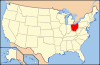
 Location of Knox County in Ohio
This is a list of the National Register of Historic Places listings in Knox County, Ohio.
This is intended to be a complete list of the properties and districts on the National Register of Historic Places in Knox County, Ohio, United States. The locations of National Register properties and districts for which the latitude and longitude coordinates are included below, may be seen in a Google map.[1]
There are 44 properties and districts listed on the National Register in the county.
-
- This National Park Service list is complete through NPS recent listings posted November 10, 2011.[2]
Current listings
[3] Landmark name [4] Image Date listed Location City or town Summary 1 Samuel Beers House 
November 6, 1979 W. Sandusky St.
40°28′49″N 82°33′08″W / 40.480278°N 82.552222°WFredericktown 2 Bell House 
November 6, 1979 53-57 N. Main St.
40°28′55″N 82°32′37″W / 40.481944°N 82.543611°WFredericktown 3 Brick Commercial Block 
November 6, 1979 Main and College Sts.
40°28′57″N 82°32′37″W / 40.4825°N 82.543611°WFredericktown 4 William Burch House 
November 6, 1979 Edgehill Dr. and Mount Vernon Ave.
40°28′49″N 82°32′26″W / 40.480278°N 82.540556°WFredericktown 5 Henry Cassell House 
November 6, 1979 23 High St.
40°29′03″N 82°32′40″W / 40.484167°N 82.544444°WFredericktown 6 Christ Church at the Quarry September 25, 1975 East of Gambier at the junction of Quarry Chapel and Monroe Mills Rds.
40°23′16″N 82°22′15″W / 40.387778°N 82.370833°WCollege Township 7 Wilson S. Cummings House 
November 6, 1979 Sandusky and Taylor Sts.
40°28′53″N 82°32′52″W / 40.481389°N 82.547778°WFredericktown 8 Elias Delashment House 
November 6, 1979 2nd St. and Edgehill Dr.
40°28′53″N 82°32′27″W / 40.481389°N 82.540833°WFredericktown 9 Early Greek Revival Cottage 
November 6, 1979 2nd and Chestnut Sts.
40°28′55″N 82°32′41″W / 40.481944°N 82.544722°WFredericktown 10 Early Greek Revival House 
November 6, 1979 Main and 2nd Sts.
40°28′55″N 82°32′35″W / 40.481944°N 82.543056°WFredericktown 11 East Gambier Street District November 18, 1976 100-519 E. Gambier St.
40°23′28″N 82°28′48″W / 40.391111°N 82.48°WMount Vernon 12 East High Street Historic District 
March 18, 1987 Roughly bounded by E. Chestnut St., S. Catherine St., E. Vine St., and S. Gay St.
40°23′35″N 82°28′51″W / 40.393056°N 82.480833°WMount Vernon 13 Fredericktown Presbyterian Church 
November 6, 1979 Main St. and Public Sq.
40°28′50″N 82°32′37″W / 40.480556°N 82.543611°WFredericktown 14 Gambier Historic District 
May 10, 2000 Roughly bounded by State Route 229, Meadow Ln., Brooklyn St., and the northern village boundary
40°22′35″N 82°23′43″W / 40.376389°N 82.395278°WGambier 15 Gothic Revival House 
November 6, 1979 High and N. Main Sts.
40°29′01″N 82°32′38″W / 40.483611°N 82.543889°WFredericktown 16 Greek Revival Commercial Building 
November 6, 1979 67-69 N. Main St.
40°28′55″N 82°32′37″W / 40.481944°N 82.543611°WFredericktown 17 Hosack House 
November 6, 1979 W. College St.
40°28′56″N 82°32′38″W / 40.482222°N 82.543889°WFredericktown 18 Kenyon College 
December 6, 1975 State Routes 229 and 308
40°22′29″N 82°23′50″W / 40.374722°N 82.397222°WGambier 19 Dr. King House 
November 6, 1979 Main and 2nd Sts.
40°28′54″N 82°32′37″W / 40.481667°N 82.543611°WFredericktown 20 Knox County Courthouse 
June 4, 1973 High St.
40°23′37″N 82°28′57″W / 40.393611°N 82.4825°WMount Vernon 21 Knox County Infirmary July 10, 1986 7516 Johnstown Rd., southwest of Mount Vernon
40°20′52″N 82°33′07″W / 40.347778°N 82.551944°WLiberty Township 22 Kokosing House February 19, 1985 221 Kokosing Dr.
40°22′42″N 82°24′14″W / 40.378333°N 82.403889°WGambier 23 Richard and Ann Loveridge House April 1, 2009 12526 Lower Green Valley Rd., northwest of Mount Vernon
40°25′10″N 82°31′46″W / 40.419508°N 82.529328°WMorris Township 24 James McFarland House March 9, 1990 7864 Newark Rd., south of Mount Vernon
40°20′55″N 82°28′15″W / 40.348611°N 82.470833°WClinton Township 25 McKee-Pumphrey House July 28, 1995 165 N. Market St.
40°16′19″N 82°21′15″W / 40.271944°N 82.354167°WMartinsburg 26 McLaughlin Mound December 11, 1972 Address Restricted Mount Vernon 27 Mill Road Bowstring Bridge 
December 5, 1979 Mill Rd. east of Bladensburg
40°16′35″N 82°16′22″W / 40.276389°N 82.272778°WJackson Township 28 Mount Liberty Tavern May 3, 1974 U.S. Route 36 in Mount Liberty
40°20′46″N 82°37′54″W / 40.346111°N 82.631667°WLiberty Township 29 North Main-North Gay Streets Historic District 
March 9, 1990 Roughly bounded by Curtis St., N. Gay St., Public Sq., and N. Main St.
40°23′50″N 82°29′05″W / 40.397222°N 82.484722°WMount Vernon 30 Old Davis and Dague Grocery Store 
November 6, 1979 Main and College Sts.
40°28′57″N 82°32′35″W / 40.4825°N 82.543056°WFredericktown 31 Old Greek Revival Farmhouse 
November 6, 1979 W. Sandusky St.
40°28′50″N 82°32′59″W / 40.480556°N 82.549722°WFredericktown Destroyed 32 Old Methodist Church 
November 6, 1979 Sandusky St. and Public Sq.
40°28′51″N 82°32′34″W / 40.480833°N 82.542778°WFredericktown 33 Old Telephone Building 
November 6, 1979 College and Chestnut Sts.
40°28′57″N 82°32′39″W / 40.4825°N 82.544167°WFredericktown 34 Pennsylvania Depot November 3, 1972 S. Main St. Mount Vernon 35 Raleigh Mound 
October 14, 1975 Mound St.
40°28′25″N 82°32′35″W / 40.47361°N 82.54306°W[5]Fredericktown Also known as the "Rowley Mound"[5] 36 James Reed House 
November 6, 1979 E. College St.
40°28′57″N 82°32′30″W / 40.4825°N 82.541667°WFredericktown 37 Round Hill December 12, 1976 E. Pleasant and N. McKenzie Sts.
40°23′56″N 82°28′48″W / 40.398889°N 82.48°WMount Vernon 38 Second Hosack House 
November 6, 1979 College and Chestnut Sts.
40°28′56″N 82°32′39″W / 40.482222°N 82.544167°WFredericktown 39 Sprague-Deaver House 
November 6, 1979 Sandusky and Pleasant Sts.
40°28′51″N 82°32′33″W / 40.480833°N 82.5425°WFredericktown 40 Stackhouse Mound and Works 
June 18, 1973 Off Montgomery Road east of Fredericktown
40°28′51″N 82°31′46″W / 40.48083°N 82.52944°W[6]Morris Township Originally listed as "Braddock Mound and Works"[7] 41 Enoch Thompson House November 25, 1980 South of Mount Vernon on State Route 661
40°16′08″N 82°30′59″W / 40.268889°N 82.516389°WMiller Township 42 Tuttle House 
July 12, 1976 33 E. College St.
40°28′57″N 82°32′31″W / 40.4825°N 82.541944°WFredericktown 43 Woodward Opera House October 10, 1975 Main and Vine Sts.
40°23′33″N 82°29′10″W / 40.3925°N 82.486111°WMount Vernon 44 Lyman Wright Building 
November 6, 1979 Main and 2nd Sts.
40°28′54″N 82°32′35″W / 40.481667°N 82.543056°WFredericktown See also
References
- ^ The latitude and longitude information provided in this table was derived originally from the National Register Information System, which has been found to be fairly accurate for about 99% of listings. For about 1% of NRIS original coordinates, experience has shown that one or both coordinates are typos or otherwise extremely far off; some corrections may have been made. A more subtle problem causes many locations to be off by up to 150 yards, depending on location in the country: most NRIS coordinates were derived from tracing out latitude and longitudes off of USGS topographical quadrant maps created under the North American Datum of 1927, which differs from the current, highly accurate WGS84 GPS system used by Google maps. Chicago is about right, but NRIS longitudes in Washington are higher by about 4.5 seconds, and are lower by about 2.0 seconds in Maine. Latitudes differ by about 1.0 second in Florida. Some locations in this table may have been corrected to current GPS standards.
- ^ "National Register of Historic Places: Weekly List Actions". National Park Service, United States Department of the Interior. Retrieved on November 10, 2011.
- ^ Numbers represent an ordering by significant words. Various colorings, defined here, differentiate National Historic Landmark sites and National Register of Historic Places Districts from other NRHP buildings, structures, sites or objects.
- ^ "National Register Information System". National Register of Historic Places. National Park Service. . http://nrhp.focus.nps.gov/natreg/docs/All_Data.html.
- ^ a b Location derived from its GNIS feature record; the NRIS lists the site as "Address Restricted".
- ^ Location derived from the GNIS feature record for the Braddock Mound; the NRIS lists the site as "Address Restricted".
- ^ Derived from its Federal Register notice; no other properties in Knox County were listed on that date
National Register of Historic Places in Ohio Lists by county Adams • Allen • Ashland • Ashtabula • Athens • Auglaize • Belmont • Brown • Butler • Carroll • Champaign • Clark • Clermont • Clinton • Columbiana • Coshocton • Crawford • Cuyahoga • Darke • Defiance • Delaware • Erie • Fairfield • Fayette • Franklin • Fulton • Gallia • Geauga • Greene • Guernsey • Hamilton • Hancock • Hardin • Harrison • Henry • Highland • Hocking • Holmes • Huron • Jackson • Jefferson • Knox • Lake • Lawrence • Licking • Logan • Lorain • Lucas • Madison • Mahoning • Marion • Medina • Meigs • Mercer • Miami • Monroe • Montgomery • Morgan • Morrow • Muskingum • Noble • Ottawa • Paulding • Perry • Pickaway • Pike • Portage • Preble • Putnam • Richland • Ross • Sandusky • Scioto • Seneca • Shelby • Stark • Summit • Trumbull • Tuscarawas • Union • Van Wert • Vinton • Warren • Washington • Wayne • Williams • Wood • Wyandot
Lists by city Other lists Municipalities and communities of Knox County, Ohio City 
Villages Centerburg | Danville | Fredericktown | Gambier | Gann | Martinsburg | Utica‡
Townships Unincorporated
communitiesFootnotes ‡This populated place also has portions in an adjacent county or counties
Categories:- National Register of Historic Places in Ohio by county
- Knox County, Ohio
-


Wikimedia Foundation. 2010.