- Mahwah, New Jersey
-
For the river named Mahwah, see Mahwah River.
Mahwah, New Jersey — Township — Map highlighting Mahwah's location within Bergen County. Inset: Bergen County's location within New Jersey Census Bureau map of Mahwah, New Jersey
Coordinates: 41°5′19″N 74°8′38″W / 41.08861°N 74.14389°W Country United States State New Jersey County Bergen Incorporated November 7, 1944 Government - Type Faulkner Act (Mayor-Council) - Mayor John DaPuzzo (acting) - Administrator Area - Total 26.2 sq mi (67.9 km2) - Land 25.9 sq mi (67.2 km2) - Water 0.3 sq mi (0.7 km2) Elevation[1] 249 ft (76 m) Population (2010 Census) - Total 25,890 - Density 988.2/sq mi (381.3/km2) Time zone Eastern (EST) (UTC-5) - Summer (DST) EDT (UTC-4) ZIP code 07430 Area code(s) 201 FIPS code 34-42750[2][3] GNIS feature ID 0882312[4] Website http://www.mahwahtwp.org Mahwah (pronounced MAH-wah[citation needed]) is a township in Bergen County, New Jersey, United States. As of the 2010 United States Census, the township population was 25,890. The name Mahwah is derived from the Lenni Lenape word "mawewi" which means "Meeting Place" or "Place Where Paths Meet".[5][6]
The area that is now Mahwah was originally formed as Hohokus Township on April 9, 1849, from portions of Franklin Township. On November 7, 1944, the area was incorporated by an Act of the New Jersey Legislature as the Township of Mahwah, based on the results of a referendum held that day, replacing Hohokus Township.[7]
New Jersey Monthly magazine ranked Mahwah as its 9th best place to live in its 2008 rankings of the "Best Places To Live" in New Jersey.[8]
Contents
History
 Scarlet Oak Pond, Ramapo Mountain Reservation
The Ramapough Mountain Indians were the original inhabitants of Mahwah (the meeting place) and surrounding area, and now number approximately 5,000 people living around the Ramapo Mountains of northern New Jersey and southern New York. The tribe is officially recognized by the states of New Jersey and New York, but does not have federal recognition.[9] Their tribal office is located on Stag Hill Road in Mahwah, and the Chief of the Ramapough Lenape Indian Nation is Dwaine Perry (as of March 2007).[10]
For 25 years Mahwah hosted the A&P Tennis Classic, a tune up for the U.S. Open tennis tournament held at the USTA National Tennis Center in Flushing, Queens.
The definitive history book of Mahwah is "From Pioneer Settlement to Suburb, A History of Mahwah, New Jersey, 1700–1976" by Henry Bischoff and Mitchell Kahn L.C 78-55451ISBN0-498-02218-8. Originally published by A.S. Barnes and Company, a re-print was issued in 2005 by the Mahwah Historical Society. The book is 469 pages long.
The 75-room, three-storey Crocker Mansion was built in 1901 for George Crocker, son of the railroad magnate Charles Crocker. The estate, located at Crocker Mansion Dr., Mahwah, is one of New Jersey's historical landmarks.[11]
Ford Motor Company operated an assembly plant in Mahwah from 1955 to 1982. At the time of its completion, it was the largest motor vehicle assembly plant in the United States. The Ford plant, along with other businesses such as American Brake Shoe and Foundry Company, helped contribute to the economic development of the town and its reputation for low home property taxes. The Mahwah town sports teams remain named Thunderbirds in honor of the Ford plant.
Mahwah, and the closure of the Ford plant, is mentioned in the opening line of the 1982 Bruce Springsteen song "Johnny 99".[12]
In August 1997, due to personal debt, then-Mayor David J. Dwork shot and killed himself in the town's mayoral offices. There were also unverified allegations of corruption.[13] Dwork was memorialized with a tree dedicated to him at the site of the Mahwah Public Library.
Dwork was succeeded by Richard J. Martel, then a township council member, who served for fourteen years until his own death, of natural causes, on March 7, 2011.[14] Martel himself was succeeded by Council President John DaPuzzo as acting mayor.
Geography
According to the United States Census Bureau, the township has a total area of 26.2 square miles (68 km2), of which, 25.9 square miles (67 km2) of it is land and 0.3 square miles (0.78 km2) of it (1.03%) is water. It is the largest municipality in Bergen County by area.
Mahwah is near the Ramapo Mountains and the Ramapo River. Interstate 287 passes through Mahwah, but the only point of access is at the New Jersey–New York border where 287 meets Route 17. Historic U.S. Route 202 also runs through Mahwah from Oakland, New Jersey, to Suffern, New York.
Mahwah is bordered by the towns of Upper Saddle River, Ramsey, Allendale, Wyckoff, Franklin Lakes, and Oakland in Bergen County, New Jersey; Ringwood in Passaic County, New Jersey; and Ramapo and Suffern in Rockland County, New York.
Several state and county parks are located in Mahwah, due to its large size and scenic terrain. They include Campgaw Mountain Reservation, Darlington County Park, Ramapo Mountain Reservation, and Ramapo Mountain State Forest. The Ramapo River runs through the western section of Mahwah.
Climate
Mahwah has a hot summer continental climate (Köppen climate classification Dfa).
Climate data for Mahwah Month Jan Feb Mar Apr May Jun Jul Aug Sep Oct Nov Dec Year Average high °F (°C) 36
(2)39
(4)49
(9)60
(16)71
(22)79
(26)84
(29)82
(28)75
(24)64
(18)53
(12)41
(5)61 Average low °F (°C) 18
(−8)20
(−7)29
(−2)39
(4)48
(9)57
(14)62
(17)61
(16)53
(12)41
(5)33
(1)24
(−4)40 Precipitation inches (mm) 3.79
(96.3)3.07
(78)4.36
(110.7)4.58
(116.3)5.14
(130.6)4.42
(112.3)4.29
(109)4.46
(113.3)4.86
(123.4)4.09
(103.9)4.44
(112.8)3.51
(89.2)51.01
(1,295.7)Source: [15] Demographics
Historical populations Census Pop. %± 1850 2,274 — 1860 2,352 3.4% 1870 2,632 11.9% 1880 2,920 10.9% 1890 2,373 * −18.7% 1900 2,610 * 10.0% 1910 1,881 * −27.9% 1920 2,081 10.6% 1930 3,536 69.9% 1940 3,908 10.5% 1950 4,880 24.9% 1960 7,376 51.1% 1970 10,800 46.4% 1980 12,127 12.3% 1990 17,905 47.6% 2000 24,062 34.4% 2010 25,890 7.6% * lost territory
Sources[16][17][18][19][20]As of the census[2] of 2000, there were 24,062 people, 9,340 households, and 6,285 families residing in the township. The population density was 927.9 people per square mile (358.3/km²). There were 9,577 housing units at an average density of 369.3 per square mile (142.6/km²). The racial makeup of the township was 87.93% White, 2.16% African American, 0.70% Native American, 6.31% Asian, 0.03% Pacific Islander, 1.50% from other races, and 1.38% from two or more races. Hispanic or Latino of any race were 4.27% of the population.
There were 9,340 households out of which 30.4% had children under the age of 18 living with them, 56.8% were married couples living together, 8.4% had a female householder with no husband present, and 32.7% were non-families. 28.0% of all households were made up of individuals and 7.3% had someone living alone who was 65 years of age or older. The average household size was 2.43 and the average family size was 3.01.
In the township the population was spread out with 22.2% under the age of 18, 9.7% from 18 to 24, 32.2% from 25 to 44, 25.2% from 45 to 64, and 10.7% who were 65 years of age or older. The median age was 37 years. For every 100 females there were 90.6 males. For every 100 females age 18 and over, there were 86.4 males.
The median income for a household in the township was $79,500, and the median income for a family was $94,484 (these figures had risen to $95,827 and $111,714 respectively as of the Census Bureau's 2007 estimate[21]). Males had a median income of $62,326 versus $42,527 for females. The per capita income for the township was $44,709. About 1.2% of families and 2.0% of the population were below the poverty line, including 1.8% of those under age 18 and 4.2% of those age 65 or over.
As of the 2010 census, Mahwah's population was 25,890, a change of 7.6%.[22]
Government
Local government
Mahwah is governed under the Faulkner Act (Mayor-Council) system of municipal government by a mayor and a seven-member Township Council. The legislative power of the municipality is exercised by a seven-member Township Council. Officials are elected at non-partisan elections, held every other May in even years, for four-year terms.[23]
As of 2011[update], the acting Mayor of Mahwah is John DaPuzzo, who had been President of the Township Council; DaPuzzo was chosen as mayor after the death of previous mayor Richard Martel.[24] DaPuzzo will serve as acting Mayor until January 1, 2012, after a successor is chosen in a November election.[25] Other Members of the Council are Council President John Roth, Vice President Harry Williams, Samuel A. Alderisio, H. Lisa DiGiulio, Roy B. Larson and John A. Spiech.[26]
Federal, state and county representation
Mahwah is in the 5th Congressional district. New Jersey's Fifth Congressional District is represented by Scott Garrett (R, Wantage Township). New Jersey is represented in the United States Senate by Frank Lautenberg (D, Cliffside Park) and Bob Menendez (D, Hoboken).
Mahwah is in the 40th District of the New Jersey Legislature, which is represented in the New Jersey Senate by Kevin J. O'Toole (R, Cedar Grove) and in the New Jersey General Assembly by Scott Rumana (R, Wayne) and David C. Russo (R, Ridgewood).[27]
Bergen County's County Executive is Kathleen Donovan (R, Rutherford; term ends December 31, 2014).[28] The Board of Chosen Freeholders is the county's legislative body and its seven members are elected at-large on a staggered basis, with two or three seats coming up for election each year.[29] As of 2011, Bergen County's Freeholders are Chairman John Driscoll, Jr. (R, 2012; Paramus),[30] Vice-Chairwoman Maura DeNicola (R, 2013; Franklin Lakes),[31] Chair Pro Tempore John D. Mitchell (R, 2013; Cliffside Park)[32] John A. Felice (R, 2013; River Edge),[33] David L. Ganz (D, 2011; Fair Lawn),[34] Robert G. Hermansen (R, 2012; Mahwah)[35] and Bernadette P. McPherson (D, 2011; Rutherford).[36][37] Other countywide constitutional officials are Sheriff Michael Saudino (R), Surrogate Michael R. Dressler (D, Cresskill) and County Clerk Elizabeth Randall (R, Westwood).[38]
 Sheraton Crossroads, Mahwah
Politics
As of April 1, 2006, out of a 2004 Census estimated population of 24,682 in Mahwah, there were 14,204 registered voters (57.5% of the population, vs. 55.4% in all of Bergen County). Of registered voters, 1,736 (12.2% vs. 20.7% countywide) were registered as Democrats, 3,443 (24.2% vs. 19.2% countywide) were registered as Republicans and 9,019 (63.5% vs. 60.1% countywide) were registered as Undeclared. There were six voters registered to other parties.[39]
On the national level, Mahwah leans toward the Republican Party. In the 2004 presidential election, Republican George W. Bush received 58% of the vote, defeating Democrat John Kerry, who received around 41%.[40]
Highlands protection
In 2004, the New Jersey Legislature passed the Highlands Water Protection and Planning Act, which regulates the New Jersey Highlands region. Mahwah was included in the highlands preservation area and is subject to the rules of the act and the Highlands Water Protection and Planning Council, a division of the New Jersey Department of Environmental Protection.[41] Some of the territory in the protected region is classified as being in the highlands preservation area, and thus subject to additional rules.[42]
Education
Public schools
The Mahwah Township Public Schools provides public education in Mahwah for students in prekindergarten through twelfth grade. Schools in the district (with 2008-09 enrollment data from the National Center for Education Statistics[43]) are four elementary schools — Lenape Meadows (PreK-3; 481 students), Betsy Ross (K-3; 305), George Washington School (K-3; 259) and Joyce Kilmer School (4-5; 537) — along with Ramapo Ridge Middle School (6-8; 887) and Mahwah High School (9-12; 1,030)
Private school
- Young World Day School (K-5)
Higher education
Vocational schools
- Lincoln Technical Institute
- Tax Training School
- O'Brien's Professional Travel School
Local corporations
- Inserra Supermarkets, a member of the ShopRite retail cooperative, operating approximately 22 stores.[44] It is a family-owned business and is one of the 500 largest private companies in the United States.
- Lawrence Erlbaum Associates, book publisher.
- Stryker Corp.'s orthopedic business.
- Radware Inc. American headquarters.
- DialAmerica Marketing corporate headquarters is based in Mahwah.[45]
- UPS world technology headquarters.
- Sharp Electronics, USA[46]
- TD Bank Atlantic Regional Headquarters is based here.
- As of 2009[update], the New York Stock Exchange is constructing a data center located on McCarthur Boulevard.[47]
- FedEx's regional distribution center
- Jaguar Cars and Land Rover vehicles North American Headquarters
Transportation
 Franklin Turnpike in Mahwah with the Manhattan skyline 30 miles (48 km) distant.
Interstate 287 and Route 17 merge in Mahwah, and U.S. Route 202 also passes through. The northern terminus of County Route 507 is also in Mahwah. Interstate 87, the New York Thruway is just outside the state in Suffern, New York.
New Jersey Transit rail service to Penn Station in Midtown Manhattan, Hoboken Terminal, and Newark is available from the Mahwah station on the Main Line and Bergen County Line. Passengers may also take advantage of express service on the same line from Suffern, New York, just across the state line.
Short Line Bus offers service to New York and intermediate locations.[48][49]
Notable residents
Notable current and former residents of Mahwah include:
- Roger Nash Baldwin (1884–1981), one of the founders of the American Civil Liberties Union (ACLU).[50]
- Stephen Birch (1872–1940), a leader of Kennecott Copper whose 730-acre (3.0 km2) farm was sold to the state and became the land for Ramapo College.[51]
- Curt Blefary (1943–2001), American League Rookie of the Year, 1965.[52]
- Lawrence Boadt (1942–2010), Roman Catholic priest and publisher.[53]
- Foxy Brown (born 1979), rapper.[54]
- Frank Chamberlin (born 1978), NFL linebacker.[55][56]
- Alan Geisler (1931–2009), food chemist best known for creating a popular hot dog sauce.[57]
- Henry Osborne Havemeyer (1847–1907), art collector and entrepreneur who founded the American Sugar Refining Company.[58]
- James Hoch, poet.[59]
- John Hollinger (born 1971), basketball analyst and writer for ESPN.com.[60]
- Joyce Kilmer (1886–1918), poet who lived with his family in Mahwah until his service and death in World War I.[61]
- Bob Kratch (born 1966) former guard on the Super Bowl XXV Champion New York Giants.[62]
- Ernst Lieb (born 1955), President and CEO of Mercedes-Benz USA.[63]
- Carl "Spider" Lockhart (1943-86), safety who played his entire career with the New York Giants.[64]
- Leonard Marshall (born 1961), former defensive end for the New York Giants.[65]
- Bill McCutcheon (1924–2002), Emmy and Tony Award-winning actor.[66]
- Les Paul (1915–2009), guitarist and inventor.[67]
- Al Sima (1921–93), pitcher for the Washington Senators and other teams.[68][69]
- Patrick Stickles (born 1985), guitarist and lead vocals for indie-punk band, Titus Andronicus.[70]
- Maia Wojciechowska (1927–2000), children’s author and winner of the Newbery Medal for her novel Shadow of a Bull.[71]
- Chris Wragge (born 1970), anchor, CBS News New York.[72]
- Jane Wyatt (1910–2006), actress known for her role in Father Knows Best.[73]
- Walt Zembriski (born 1935), golfer who played on the PGA Tour and the Senior PGA Tour.[74]
References
- ^ U.S. Geological Survey Geographic Names Information System: Township of Mahwah, Geographic Names Information System, accessed October 1, 2007.
- ^ a b "American FactFinder". United States Census Bureau. http://factfinder.census.gov. Retrieved 2008-01-31.
- ^ A Cure for the Common Codes: New Jersey, Missouri Census Data Center. Accessed July 14, 2008.
- ^ "US Board on Geographic Names". United States Geological Survey. 2007-10-25. http://geonames.usgs.gov. Retrieved 2008-01-31.
- ^ If You're Thinking of Living in: Mahwah, The New York Times, June 2, 1991.
- ^ Mahwah High School Mission Statement, Mahwah High School. Accessed October 9, 2006.
- ^ "The Story of New Jersey's Civil Boundaries: 1606–1968", John P. Snyder, Bureau of Geology and Topography; Trenton, New Jersey; 1969. p. 81.
- ^ "Best Places To Live - The Complete Top Towns List 1-100", New Jersey Monthly, February 21, 2008. Accessed February 24, 2008.
- ^ Kelley, Tina. "New Jersey Tribe Member Dies After Police Shooting at a Back-Roads Party", The New York Times, April 11, 2006. Accessed October 24, 2007. "New York and New Jersey recognize the Ramapoughs as a tribe, but the tribe has failed to obtain federal recognition. It has about 5,000 members."
- ^ Salazar, Carolyn; and Markos, Kibret. "Two Ramapoughs also charged in Mahwah encounter", The Record (Bergen County), March 28, 2007. Accessed October 24, 2007. "Caption: Fran Mann, Emil Mann's sister-in-law, hugging Ramapough chief Dwaine Perry after learning of the indictment Tuesday."
- ^ General Historic Information, Crocker Mansion. Accessed March 31, 2011.
- ^ "Johnny 99" Lyrics, BruceSpringsteen.net. Accessed June 13, 2008. "Well they closed down the auto plant in Mahwah late that month"
- ^ Smothers, Ronald. "Debt Drove A Mayor To Suicide, Widow Says", The New York Times, August 26, 1997. Accessed March 31, 2011. "Deep personal financial debt led the Mayor of Mahwah, N.J., David J. Dwork, to commit suicide in his township office on the night of Aug. 18, his widow, Johanna, said at a weekend memorial service."
- ^ Boucicaut, Barbara. "Mahwah mayor, Richard Martel, passes", Mahwah Suburban News, March 7, 2011. Accessed March 31, 2011.
- ^ "Average weather for Mahwah". Weather.com. http://www.weather.com/outlook/travel/businesstraveler/wxclimatology/monthly/graph/USNJ0283?from=36hr_bottomnav_business. Retrieved 13 August 2009.
- ^ Francis A. Walker, Superintendent of Census (1872). "Ninth Census Volume I. The Statistics of the Population of the United States; Table III. Population of Civil Divisions Less Than Counties" (ZIP). U.S. Census Bureau. http://www2.census.gov/prod2/decennial/documents/1870a.zip. Retrieved 2008-08-18.
- ^ Robert P. Porter, Superintendent (1891). "Population of The United States by Minor Civil Divisions" (ZIP). U.S. Census Bureau. http://www2.census.gov/prod2/decennial/documents/1890d9.zip. Retrieved 2008-08-18.
- ^ Wm. C. Hunt, Chief Statistician for Population. "Fourteenth Census of The United States: 1920; Population: New Jersey; Number of inhabitants, by counties and minor civil divisions" (ZIP). U.S. Census Bureau. http://www2.census.gov/prod2/decennial/documents/41084506no553.zip. Retrieved 2007-03-21.
- ^ Historical Population Trends in Bergen County (1900–2000), Bergen County, New Jersey. Accessed December 23, 2007.
- ^ New Jersey Resident Population by Municipality: 1930–1990, Workforce New Jersey Public Information Network. Accessed March 1, 2007.
- ^ Fact Sheet for Mahwah township, Bergen County, New Jersey, United States Census Bureau. Accessed June 5, 2009.
- ^ Staff. "Census 2010: Mahwah", The Record (Bergen County), February 9, 2011. Accessed March 31, 2011.
- ^ 2005 New Jersey Legislative District Data Book, Rutgers University Edward J. Bloustein School of Planning and Public Policy, April 2005, p. 169.
- ^ Pries, Allison; and Shilling, Erik. "Saddened Mahwah swears in new mayor", The Record (Bergen County), March 10, 2011. "The Township Council appointed its president, John DaPuzzo, as the new mayor on Wednesday, two days after the death of longtime Mayor Richard Martel."
- ^ Mayor, Township of Mahwah. Accessed March 31, 2011.
- ^ Township Council, Township of Mahwah. Accessed March 31, 2011.
- ^ "Legislative Roster: 2010-2011 Session". New Jersey Legislature. http://www.njleg.state.nj.us/members/roster.asp. Retrieved 2010-02-08.
- ^ Bergen County Executive, Bergen County, New Jersey. Accessed January 3, 2011.
- ^ What Is a Freeholder?, Bergen County, New Jersey. Accessed January 6, 2011.
- ^ Freeholder John Driscoll, Jr., Bergen County, New Jersey. Accessed January 11, 2011.
- ^ Maura R. DeNicola, Bergen County, New Jersey. Accessed January 11, 2011.
- ^ John D. Mitchell, Bergen County, New Jersey. Accessed January 11, 2011.
- ^ John A. Felice, Bergen County, New Jersey. Accessed January 11, 2011.
- ^ Freeholder David L. Ganz, Bergen County, New Jersey. Accessed January 11, 2011.
- ^ Freeholder Robert G. Hermansen, Bergen County, New Jersey. Accessed January 11, 2011.
- ^ Freeholder Bernadette P. McPherson, Bergen County, New Jersey. Accessed January 11, 2011.
- ^ Freeholder Home Page, Bergen County, New Jersey. Accessed January 3, 2011.
- ^ Constitutional Officers, Bergen County, New Jersey. Accessed January 3, 2011.
- ^ "County of Bergen: Voter Statistics by Municipality, Ward & District," Bergen County, New Jersey, dated April 1, 2006.
- ^ 2004 Presidential Election results: Bergen County, New Jersey Department of Law and Public Safety, Division of Elections, dated December 13, 2004.
- ^ "Assembly Committee Substitute for Assembly, No. 2635" (PDF). New Jersey Legislature. 2004-06-07. pp. 15–16. http://www.highlands.state.nj.us/njhighlands/actmaps/act/highlands_bill.pdf. Retrieved 2007-05-08.
- ^ "Highlands Municipalities". NJDEP. August 23, 2005. http://www.nj.gov/dep/highlands/municipalities.htm. Retrieved 2007-05-08.
- ^ Data for the Mahwah Township Public Schools, National Center for Education Statistics. Accessed March 31, 2011.
- ^ Holahan, Catherine. "ShopRite's Larry R. Inserra dies at 76 ", The Record (Bergen County), May 30, 2005. Accessed June 5, 2009.
- ^ Locations, DialAmerica. Accessed October 25, 2007.
- ^ Sharp USA facilities, Sharp Corporation. Accessed March 19, 2008. "Sharp Electronics Corporation (SEC) is the U.S. sales and marketing subsidiary of Japan's Sharp Corporation. SEC was established in the U.S. marketplace in 1962 and today the company's 500,000 sq ft (46,000 m2). headquarters is located in Mahwah, New Jersey."
- ^ Tangel, Andrew. "Mystery firm rings a bell", The Record (Bergen County), May 3, 2009. Accessed June 5, 2009.
- ^ "Township of Mahwah - Transportation". http://www.mahwahtwp.org/Cit-e-Access/webpage.cfm?TID=64&TPID=6760. Retrieved 2009-11-16.
- ^ "New Jersey Transit - Main/Bergen Lines". http://www.njtransit.com/pdf/rail/r0020.pdf. Retrieved 2009-11-16.
- ^ [1], accessed August 30, 2010.
- ^ Stephen Birch, National Mining Hall of Fame and Museum. Accessed August 23, 2010.
- ^ Curt Blefary biography page, accessed July 16, 2010.
- ^ Fox, Margalit. "Lawrence Boadt, Priest, Publisher and Bible Scholar, Dies at 67", The New York Times, July 30, 2010. Accessed August 23, 2010.
- ^ Maull, Samuel. "Foxy Brown Sentenced to a Year in Jail", The Washington Post, February 7, 2007. Accessed April 12, 2008.
- ^ Shalin, Mike. "Frank Chamberlin", Boston Herald, August 23, 1997. Accessed March 31, 2011. "When Frank Chamberlin left Mahwah, N.J., for Boston College, he was a linebacker expecting to play for Dan Henning. He had no way of knowing a gambling scandal would rock the school during his first year."
- ^ Frank Chamberlin player profile, accessed April 5, 2007.
- ^ Levin, Jay. "A final farewell to North Jerseyans we lost in '09", The Record (Bergen County), January 1, 2010. Accessed March 31, 2011. "Alan Geisler, 78, on Jan. 6. The Mahwah resident and food chemist created the familiar red onion sauce spooned over hot dogs."
- ^ [2], accessed July 27, 2010.
- ^ James Hoch, National Endowment for the Arts. Accessed March 10, 2011.
- ^ [3], accessed August 12, 2010.
- ^ Joyce Kilmer (1886–1918) - Author of Trees and Other Poems, accessed April 5, 2007.
- ^ Kane, Matt. "A Giant Patriot", Herald Journal, January 28, 2008. Accessed August 23, 2010.
- ^ Gruen, Mary. "Luxury car importer is driven", The Star-Ledger, December 27, 2007. Accessed March 31, 2011.
- ^ Staff. "PRO FOOTBALL; Jury Rules in Favor of Lockhart's Widow", The New York Times, October 30, 1993. Accessed October 24, 2011. "When Lockhart, a stockbroker then living in Mahwah, N.J., returned to St. Vincent's with the same complaint in 1981, he was diagnosed as having cancer of the lymph nodes. He was 43 when he died."
- ^ Sturken, Barbara. "Off the Field, Giants Call New Jersey Home", The New York Times, March 31, 1991. Accessed March 31, 2011. "This year's group includes Leonard Marshall, defensive end, who lives in Mahwah and is finishing an undergraduate degree in finance that he started at Louisiana State University; Perry Williams, defensive back, who lives in Passaic and is earning a master's in public administration, and John Washington, defensive lineman, who is at work on an M.B.A. "
- ^ Mclellan, Dennis. "Bill McCutcheon, 77; Comedic Actor", Los Angeles Times, January 12, 2002. Accessed March 31, 2011. "McCutcheon, who lived in Mahwah, N.J., died Wednesday of natural causes at a hospital in Ridgewood, N.J."
- ^ Fredrix, Emily. "Guitarist Les Paul plays for hometown", Yahoo! News via Associated Press, May 10, 2007. Accessed May 11, 2007. "Paul, who lives in Mahwah, N.J., has donated many artifacts and memorabilia for the planned exhibit, a $3 million project expected to open in 2010."
- ^ Sheehan, Joseph M. "Three-Hitter by Reynolds Helps Bombers Defeat Senators, 5 to 1; Single and 3 Straight Walks in 5th Cost Allie Shutout--Coleman Hits Homer With One On for Yankees in Eighth Inning Rizzuto Starts Rally An Impressive Performance", The New York Times, June 29, 1950. Accessed March 31, 2011. "Despite the final count, this was no breeze for Reynolds, who drew an unexpectedly formidable adversary in Al Sima, a 27-year-old 'southpaw from Mahwah, N. J., making his major league debut just a day after having been called up from Chattanooga of the Southern Association."
- ^ Al Sima, Baseball Almanac. Accessed August 12, 2010.
- ^ [4], "Senior year here in Mahwah / new world just around the corner.", accessed March 6, 2011
- ^ McAleavey, Teresa. "One Life - Maia Wojiechowska of Mahwah, Author", The Record (Bergen County), January 7, 1995. Accessed March 31, 2011.
- ^ Chris Wragge profile, DIY Network. Accessed July 6, 2008.
- ^ 'Father Knows Best' Actress Jane Wyatt Dies, NewsMax.com. October 23, 2007. Accessed September 2, 2007. "Wyatt was born in Campgaw, N.J., into a wealthy family in 1910, according to McDonald, her publicist."
- ^ Cavanaugh, Jack. "GOLF;Trevino Tied With No Ordinary Amateur", The New York Times, July 31, 1994. Accessed November 3, 2007. "WALT ZEMBRISKI, the 59-year-old former steelworker from Mahwah, N.J., who finished tied for second last year, shot a 75 and was at nine-over 153."
External links
- Mahwah Township official website
- Mahwah Environmental Volunteers Organization (M.E.V.O.)
- Mahwah Township Public Schools
- Mahwah Schools Foundation
- Mahwah 10k Race
- Mahwah Municipal Alliance
- Mahwah Township Public Schools's 2009–10 School Report Card from the New Jersey Department of Education
- Data for the Mahwah Township Public Schools, National Center for Education Statistics
- Guide to Mahwah in Bergen County, NJ
Municipalities and communities of Bergen County, New Jersey County seat: Hackensack Cities 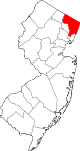
Boroughs Allendale | Alpine | Bergenfield | Bogota | Carlstadt | Cliffside Park | Closter | Cresskill | Demarest | Dumont | East Rutherford | Edgewater | Elmwood Park | Emerson | Englewood Cliffs | Fair Lawn | Fairview | Fort Lee | Franklin Lakes | Glen Rock | Harrington Park | Hasbrouck Heights | Haworth | Hillsdale | Ho-Ho-Kus | Leonia | Little Ferry | Lodi | Maywood | Midland Park | Montvale | Moonachie | New Milford | North Arlington | Northvale | Norwood | Oakland | Old Tappan | Oradell | Palisades Park | Paramus | Park Ridge | Ramsey | Ridgefield | River Edge | Rockleigh | Rutherford | Saddle River | Tenafly | Teterboro | Upper Saddle River | Waldwick | Wallington | Westwood | Wood-Ridge | Woodcliff Lake
Townships Lyndhurst | Mahwah | River Vale | Rochelle Park | Saddle Brook | South Hackensack | Teaneck | Washington Township | Wyckoff
Villages Unincorporated
communitiesCoordinates: 41°05′19″N 74°08′38″W / 41.08861°N 74.14389°W
Categories:- Mahwah, New Jersey
- Townships in Bergen County, New Jersey
- Faulkner Act Mayor-Council
- Place names in New Jersey of Native American origin
- Ramapos


Wikimedia Foundation. 2010.