- Mottram in Longdendale
-
Coordinates: 53°27′N 2°01′W / 53.45°N 2.01°W
Mottram in Longdendale 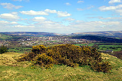
Mottram in Longdendale from Werneth Low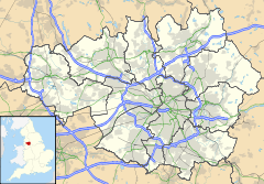
 Mottram in Longdendale
Mottram in Longdendale shown within Greater ManchesterOS grid reference SJ9995 Metropolitan borough Tameside Metropolitan county Greater Manchester Region North West Country England Sovereign state United Kingdom Post town HYDE Postcode district SK14 Dialling code 01457 Police Greater Manchester Fire Greater Manchester Ambulance North West EU Parliament North West England UK Parliament Stalybridge and Hyde List of places: UK • England • Greater Manchester For the former ancient parish, see Mottram in Longdendale (ancient parish).Mottram in Longdendale is an unparished village within the Metropolitan Borough of Tameside, in Greater Manchester, England. It lies in the valley of Longdendale, on the border with Derbyshire and close to the Peak District neighbouring Broadbottom and Hattersley. Mottram in Longdendale Parish was one of the eight ancient parishes of the Macclesfield Hundred of Cheshire. The larger Mottram parish was incorporated into Longdendale in 1936, remaining part of Cheshire, then incorporated into Tameside, as part of the provisions of the Local Government Act 1972 in 1974. Even as late as 1991, the town has the prefered name of Mottram in Longendale[1]
Contents
History
In 1795, Aikin in his book, "Forty Miles around Manchester", wrote
- Mottram is situated twelve miles from Manchester and seven for Stockport, on a high eminence one mile to the west of the Mersey, from which the river ground begins to rise; half the way being so steep as to make it difficult to access. It forms a long street well paved both in the town and some distance on the roads. It contains 127 houses, which are for the most part built of a thick flag stone, and covered with a thick, heavy slate, of nearly the same quality, no other covering being able to endure the strong blasts of wind which occasionally occur. Of late, many of the houses in the skirts of the town are built of brick. About fifty years ago, the houses were few in number, and principally situated on top of the hill, adjoining the church-yard, where is an ancient cross, and at a small distance the parsonage house, now gone much to decay and occupied by working people. It is only of late years that the town has had any considerable increase, which has been chiefly at the bottom of the hill, but some latterly on the top.[2]
In those days the River Etherow, was known as the Mersey. The nearby River Tame has added as acted as a border from the earliest of times separating the Anglo Saxon kingdoms of the Brigantes and Mercians. The ancient parish of Mottram in Longdendale (ancient parish) was the most northerly in Cheshire. [3] As such, Mottram came to prominence as a transport hub. It lies at the foot of two important pack horse routes over the Pennines. These were used to carry salt from Cheshire over to South Yorkshire, and to carry lime that was used soil improvement, from Chapel-en-le-Frith. [4] Later it was on the Manchester to Sheffield stage coach route, and has a flyer service to Manchester. Before the industrial revolution Mottram and Ashton had been the two significant towns in the area, the manor and manorial court house were situated in Mottram, but other towns such rapidly eclipsed Mottram in size and importance. Mottram was active in the early stages of industrialisation, and there were significant spinning concerns in Wedneshough Green and the Treacle Street areas of Mottram Moor, and printing and dyeing works on the Etherow at Broadbottom which until recently was considered part of the parish.[4]

The smaller early mills of Mottram became increasingly uneconomic and harder to run. Stalling industrialisation led to social conflict and widespread hunger in the area during 1812 stoked Luddite riots that led to the smashing of labour-reducing machines. The Luddites secretly drilled on Wedneshough Green. Again in 1842 leading local Chartists met on the green, and planned the closure of Stalybridge factories in the Plug Riots. By 1860 the population had peaked. The 1844 railway passed through the valley with stops at Hattersley and Broadbottom which were in the parish but not at the Mottram township. [4]
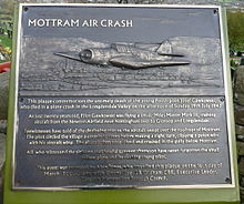
A Polish pilot called Josef Gawkowski was killed on July 19, 1942 when his aircraft crashed near Mottram on a training flight from RAF Newton in Nottinghamshire. A memorial plaque commemorating the pilot is located in Mottram Cemetery.
Geography
 Geology of the wider area
Mottram occupies a elevated site straddling the A57 trunk road from the end of the M67 to the junction with the A628 trunk road. It is 10 miles (16 km) east of Manchester, liying on land between 150m to 250m above mean sea level. The geology is mainly boulder clay above millstone grit,[5] but there are some small outcrops of coal from the Lancashire Coalfield in the vicinity. To the south and east of Mottram is the River Etherow and to the west is the Hurstclough Brook.
Longdendale bypass proposal
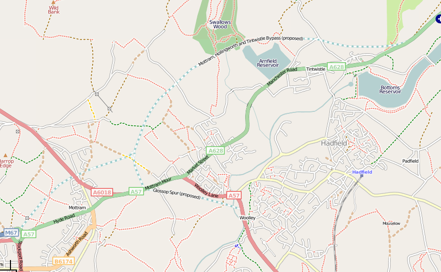
 A map showing the proposed route
The existing A628 trunk road connects the M67 from Manchester to the M1 in South Yorkshire. A single-carriageway road through the villages of Mottram in Longdendale, Hollingworth and Tintwistle and through the Peak District National Park, it is used by a relatively large number of heavy goods vehicles. The A628 is one of the most congested A-road routes in the country, with high volumes of traffic (including HGVs) using a road which is totally unsuitable for the volume and nature of traffic it carries[6] In addition the stretch through Mottram carries all the traffic from the A57,that links Manchester through Glossop to Sheffield over the Snake Pass, another major trans-pennine route. The congestion at peak time backs up through Glossop and Hadfield rendering local journeys impossible. To solve these problems the Longdendale Bypass was proposed. This was vigorously opposed, and has failed to be built, and dropped of the governments funding list. There is considerable local feeling that there is no viable alternative to a bypass.[7]
Landmarks
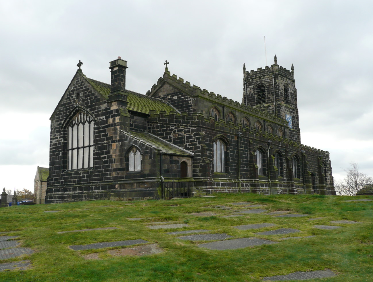
St Michael and All Angels Church dates from the later part of the 15th century. The church is a Grade II* Listed Building and was built in the Perpendicular Gothic style. The interior of St. Michael's was remodelled in 1854 but the exterior remains intact from the 15th and 16th centuries.[8] The church stands high up on Warhill overlooking the village of Mottram. In 2010, local vandals destroyed the church's windows which led to cork boards being used as replacements.
Sports
Mottram Cricket Club plays in the Derbyshire and Cheshire League. The club was founded in 1878.
Notable people
- Sir Edmund Shaa was a goldsmith, and Lord Mayor of London in 1482, dying there 20 April 1488. He appeared as a character in William Shakespeare's play, Richard III, and a bequest was used to found Stockport Grammar School.
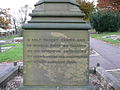
- Lawrence Earnshaw (c.1707–12 May 1767) was an inventor and machine-maker, who made an astronomical clock, and a machine to spin and reel cotton in one operation.[9][10]
-

Earnshaw Memorial
-
-
- John Chapman (1810–1877) was MP for Grimsby, High Sheriff of Cheshire, JP and Chairman of the Manchester, Sheffield and Lincolnshire Railway. He lived in Broadbottom.
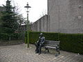
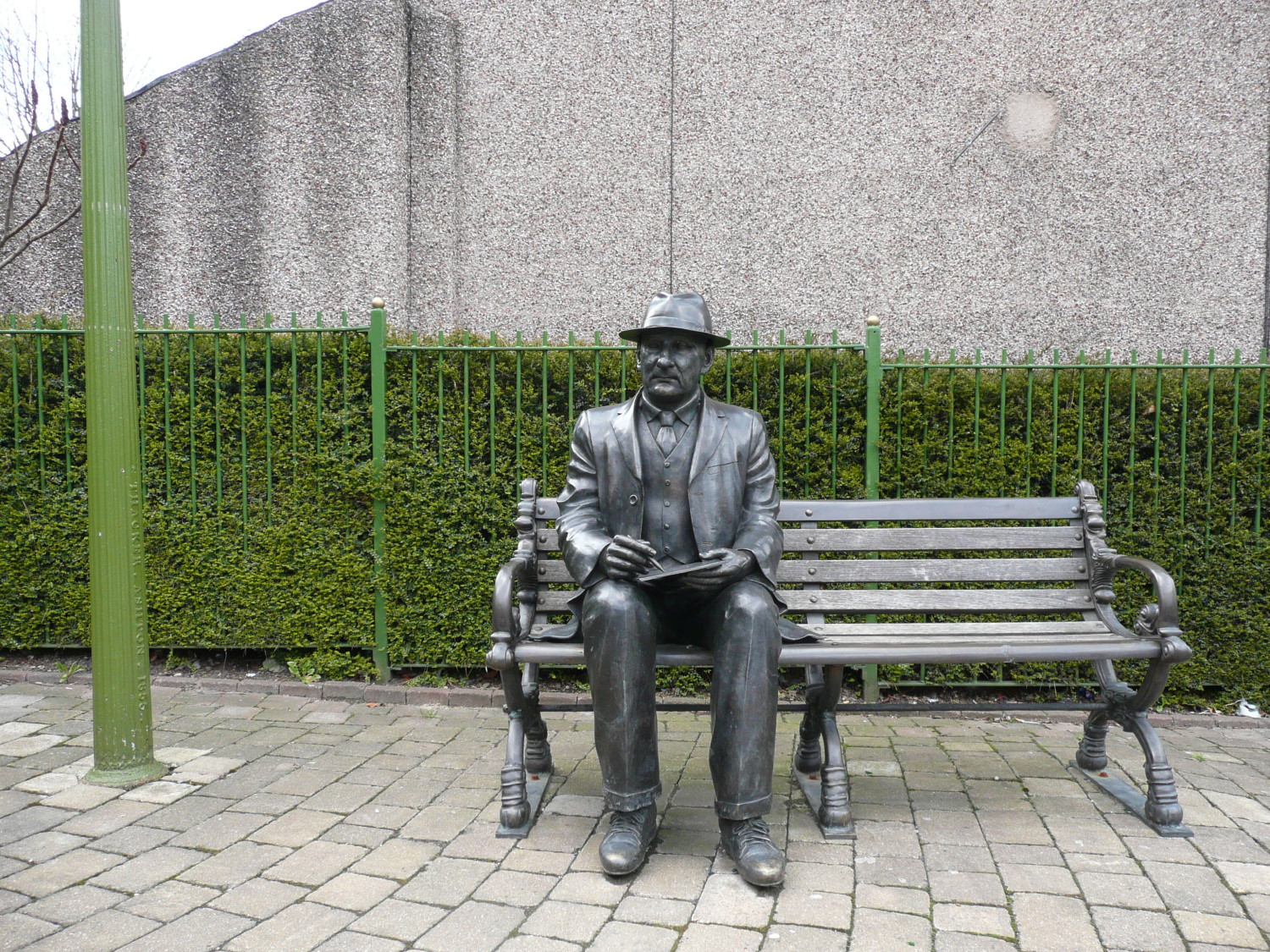
- The Stretford-born artist L.S. Lowry lived in Mottram from 1948 until his death in 1976. A bronze statue of him seated on a bench is located next to the junction of Hyde Road and Stalybridge Road, and there is a commemorative plaque on his former home, "The Elms" on Stalybridge Road.
-

L.S. Lowry Memorial
-
Famous former residents also include Kathy Staff (aka Nora Batty from the sitcom Last of the Summer Wine) and Harold Shipman, the UK's most prolific serial killer.
See also
References
- ^ E, Youngs (1991). "Local Administrative Units: Northern England". Relationships / unit history of LONGENDALE. Quoted, Vision of Britain Website: London: Royal Historical Society. pp. 645. http://www.visionofbritain.org.uk/relationships.jsp?u_id=10027536&c_id=10001043. Retrieved 28 October 2011.
- ^ Oliver, G.J (2008). "Tameside-Mottram history". Tameside Family Histories. http://tamesidefamilyhistory.co.uk/mottram.htm. Retrieved 28 October 2011.
- ^ Oliver, G.J (2008). "Tameside-Historic Boundaries". Tameside Family Histories. http://tamesidefamilyhistory.co.uk/boundaries.htm. Retrieved 28 October 2011.
- ^ a b c "Township Information - Mottram-in-Longdendale". TamesideMBC. 25 May 2011. http://www.tameside.gov.uk/longdendale/history. Retrieved 28 October 2011.
- ^ "6. Geology of Tameside". Contaminated Land Strategy. TamesideMBC. 28 February 2011. http://www.tameside.gov.uk/contaminatedland/strategy/part5. Retrieved 28 October 2011.
- ^ "Introduction". Longdendale Siege Committee website. http://www.mjpatch.pwp.blueyonder.co.uk/. Retrieved 2008-01-20.
- ^ "Suggested Alternative Solutions?". Longdendale Siege Committee website. http://www.mjpatch.pwp.blueyonder.co.uk/Suggested_alternatives_Nov_05.htm. Retrieved 2008-01-20.
- ^ Mike Nevell (1991). Tameside 1066-1700. Tameside Metropolitan Borough and University of Manchester Archaeological Unit. pp. 122, 140. ISBN 1-871324-02-5.
- ^ *Lawrence Earnshaw-Manchester2002 Website
- ^ *Lawrence Earnshaw-Tameside Website
- Bibliography
- A Tameside bibliography Published by Tameside MBC
External links
Categories:- Geography of Tameside
- Villages in Greater Manchester
- Towns and villages of the Peak District


Wikimedia Foundation. 2010.