- River Etherow
Infobox River
river_name = River Etherow
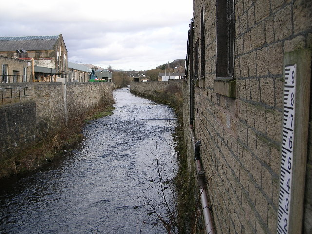
caption = The River Etherow inHollingworth
origin =Featherbed Moss
mouth =River Goyt
basin_countries =England
length =
elevation =
mouth_elevation =
discharge =
watershed =The River Etherow is a
river in the north west ofEngland , and atributary of theRiver Mersey .ource
It rises at
Featherbed Moss in theSheffield district ofSouth Yorkshire , then broadens into theLongdendale Chain of reservoirs in thePeak District National Park .Course
It emerges again in
Tintwistle ,Derbyshire , at the foot of Bottoms Reservoirdam , and at Melandra Castle,Gamesley , it is joined by theGlossop Brook (which takes in waters from the Shelf Brook, the HurstBrook and others).It enters the borough of
Tameside atHollingworth in the foothills of thePennines . It passes throughStockport and theEtherow Country Park .Mouth
Finally, it joins the
River Goyt . The River Tame also joins theRiver Goyt , and all three form theRiver Mersey .ee also
*
Rivers of the United Kingdom References
External links
* [http://www.ukawmn.ucl.ac.uk/site12/index.htm The United Kingdom Acid Waters Monitoring Network Site Number 12]
Wikimedia Foundation. 2010.
Look at other dictionaries:
Etherow Country Park — Etherow Café and Visitor Centre are on the banks of the Model Boating Pond Etherow Country Park is situated at Compstall, England between Marple Bridge and Romiley, in the Metropolitan Borough of Stockport, Greater Manchester. It was one of… … Wikipedia
River Mersey — Mersey redirects here. For other meanings, see Mersey (disambiguation). River Mersey River … Wikipedia
River Goyt — Infobox River river name = River Goyt |200px caption = origin = Pennines mouth = River Mersey basin countries = England length = elevation = 520mcite web url = http://publications.environment agency.gov.uk/epages/eapublications.storefront/45f71ee5… … Wikipedia
River Noe — Watermill on the River Noe, Brough on Noe. The waterwheel survives (just visible in the dark entrance in this picture), though it is no longer in use. Origin Kinder Scout … Wikipedia
River Tame, Greater Manchester — Infobox River river name = River Tame |200px caption = River Tame, seen here near Reddish Vale. origin = Denshaw, Greater Manchester mouth = River Mersey basin countries = England length = elevation = mouth elevation = 40m [cite web url =… … Wikipedia
River Croal — Coordinates: 53°33′0″N 2°22′57″W / 53.55°N 2.3825°W / 53.55; 2.3825 … Wikipedia
Glossop — Infobox UK place official name= Glossop country= England region= East Midlands static static image caption= Glossop from Higher Dinting population= 32,428 (2001 Census) os grid reference= SK0393 latitude= 53.4380 longitude= 1.9473 map type=… … Wikipedia
Mottram in Longdendale — Coordinates: 53°27′N 2°01′W / 53.45°N 2.01°W / 53.45; 2.01 … Wikipedia
Valehouse Reservoir — Infobox lake lake name = Valehouse Reservoir image lake = Longdendale4695.jpg caption lake = From the Rhodeswood dam (March 2008) image bathymetry = caption bathymetry = location = Derbyshire coords = coord|53|28|N|1|56|W|region:GB type:waterbody … Wikipedia
Longdendale — is a valley in the north west of England, north of Glossop and south east of Holmfirth. The name means long wooded valley . GeographyThe eastern part of the valley is in the non metropolitan county of Derbyshire and includes the village of… … Wikipedia