- Nicholasville, Kentucky
-
Nicholasville, Kentucky — City — Main Street Location of Nicholasville, Kentucky
Coordinates: 37°52′58″N 84°34′36″W / 37.88278°N 84.57667°WCoordinates: 37°52′58″N 84°34′36″W / 37.88278°N 84.57667°W Country United States State Kentucky County Jessamine Incorporated February 13, 1837 Government – Russell Meyer Area – Total 8.5 sq mi (22 km2) – Land 8.5 sq mi (22 km2) – Water 0.0 sq mi (0.1 km2) Elevation 938 ft (286 m) Population (2000) – Total 19,680 – Density 2,319.9/sq mi (895.7/km2) Time zone Eastern (EST) (UTC-5) – Summer (DST) EDT (UTC-4) ZIP codes 40340, 40356 Area code(s) 859 FIPS code 21-56136 GNIS feature ID 0499462 Nicholasville is the 11th largest city in state of Kentucky and the county seat of Jessamine County, Kentucky, United States.[1] The population was 19,680 at the 2000 census. It serves as both a residential area for commuters to Lexington, and as an employment and shopping center for central Kentucky.
Contents
Geography
Nicholasville is located at 37°52′58″N 84°34′36″W / 37.882670°N 84.576585°W (37.882670, -84.576585).[2]
According to the United States Census Bureau, the city has a total area of 8.5 square miles (22 km2), of which 8.5 square miles (22 km2) is land and 0.0 square miles (0.1 km²), or 0.35%, is water.
History
Nicholasville was founded by European Americans in 1798.[3]
Demographics
 Jessamine County Courthouse
As of the census[4] of 2000, there were 19,680 people, 7,370 households, and 5,498 families residing in the city. The population density was 2,319.8 per square mile (895.7 /km2). There were 7,783 housing units at an average density of 917.4 per square mile (354.2 /km2). The racial makeup of the city was 93.05% White, 4.38% African American, 0.25% Native American, 0.28% Asian, 0.05% Pacific Islander, 0.59% from other races, and 1.39% from two or more races. Hispanic or Latino of any race were 1.50% of the population.
There were 7,370 households out of which 40.8% had children under the age of 18 living with them, 55.7% were married couples living together, 14.7% had a female householder with no husband present, and 25.4% were non-families. 20.3% of all households were made up of individuals and 7.2% had someone living alone who was 65 years of age or older. The average household size was 2.63 and the average family size was 3.02.
In the city the population was spread out with 28.2% under the age of 18, 10.2% from 18 to 24, 33.9% from 25 to 44, 18.8% from 45 to 64, and 8.9% who were 65 years of age or older. The median age was 31 years. For every 100 females there were 91.6 males. For every 100 females age 18 and over, there were 86.2 males.
The median income for a household in the city was $37,462, and the median income for a family was $42,978. Males had a median income of $31,536 versus $22,275 for females. The per capita income for the city was $17,036. About 9.3% of families and 11.5% of the population were below the poverty line, including 16.1% of those under age 18 and 11.3% of those age 65 or over.

Transportation
Historical populations Census Pop. %± 1860 465 — 1870 1,089 134.2% 1880 2,303 111.5% 1890 2,157 −6.3% 1900 2,393 10.9% 1910 2,935 22.6% 1920 2,736 −6.8% 1930 3,128 14.3% 1940 3,192 2.0% 1950 3,406 6.7% 1960 4,275 25.5% 1970 5,829 36.4% 1980 10,400 78.4% 1990 13,603 30.8% 2000 19,680 44.7% Est. 2009 27,001 [5] 37.2% U.S. Census Bureau[6] U.S. highways
- U.S. Route 27 is a major north-south artery. From the Lexington city limits to the Business US 27 intersection north of the city center, it is a four-lane arterial highway with a center-turning lane. US 27 diverts to the western edge of the city center on a four-lane, controlled-access bypass and continues south of the city towards the Kentucky River.
- Construction began on the $16 million, 6-mile (9.7 km) Nicholasville bypass in March 1986. The four-lane, controlled-access bypass opened in 1988.[7] It has seven at-grade intersections and one diamond interchange.
- Business US 27 is a variable two and four-lane arterial route running north to south of the downtown, concluding at US 27 at both terminus's.
State routes
- Kentucky Route 29 is an east-west two-lane highway that stretches from the western fringes of the city west of the US 27 bypass to Business US 27 in downtown Nicholasville. It is known as Wilmore Road west of US 27, and Maple Street east.
- Kentucky Route 39 is a north-south highway that stretches from the farms south of the city before concluding at Business US 27 at downtown. It is known as Maple Street, and as Sulphur Wells Road and then Lancaster Road.
- Kentucky Route 169 is an east-west highway that cuts through the city center. It has intersections with US 27 and Business US 27. It is known as Keene Road northwest of the city center, then 3rd Street, Richmond Road and Union Mills Road on the east side.
- Kentucky Route 1980 is known as Ash Grove Road and travels into Fayette County to the east. It departs from US 27 just south of the Lexington city limits.
- Kentucky Route 3375 traverses west of US 27 north of the city center and is known as Catnip Hill Road.
Future roads
A new 7.4-mile (11.9 km) four-lane divided highway running from a Single-point urban interchange at US 27 north of Nicholasville to US 27 south of Nicholasville is being designed to serve the eastern half of Jessamine County's county seat.[8] The western Nicholasville bypass, signed as US 27, was completed in 1986[7] with an interchange at KY 29 and a few at-grade intersections.
The eastern bypass of Nicholasville will give commuters another option of bypassing the city, while serving the residents of the eastern half of Jessamine county. In September 2002, the Federal Highway Administration approved an "environmental assessment document".[8] Right-of-way purchase, estimated at $15 million, is slated to begin in 2006, with relocation of utility lines in 2007 and construction in 2008, and take two years and $73 million to complete.
The Kentucky Transportation Cabinet projects that when the highway opens, that 58,000 will use the western bypass and 45,000 will utilize the eastern bypass.[8]
Transportation planning
The Lexington Area MPO is responsible for transportation planning for Fayette and Jessamine Counties. This includes activities such as carpool matching, administering a commuter vanpool program, air quality forecasting, bicycle and pedestrian planning, congestion management, and developing transportation plans and documents.
References
- ^ "Find a County". National Association of Counties. http://www.naco.org/Counties/Pages/FindACounty.aspx. Retrieved 2011-06-07.
- ^ "US Gazetteer files: 2010, 2000, and 1990". United States Census Bureau. 2011-02-12. http://www.census.gov/geo/www/gazetteer/gazette.html. Retrieved 2011-04-23.
- ^ Columbia-Lipincott Gazeteer (New York: Columbia University Press, 1952) p. 1320
- ^ "American FactFinder". United States Census Bureau. http://factfinder.census.gov. Retrieved 2008-01-31.
- ^ Annual Estimates of Resident Population for Incorporated Cities in Kentucky: April 1, 2000 to July 1, 2009 United States Census Bureau. Retrieved on 2010-07-29
- ^ Historical Census Data Retrieved on 2010-02-29
- ^ a b Honeycutt, Valarie. "LEXINGTON TO GET $24 MILLION FOR ROADS STATE TO HELP CITY LAUNCH MORE THAN A DOZEN PROJECTS." Herald-Leader [Lexington] 5 Sept. 1986. 10 Jan. 2007.
- ^ a b c "Eastside Bypass Closer in Nicholasville ." Herald-Leader. 7 December 2001. Page B3.
External links
Municipalities and communities of Jessamine County, Kentucky County seat: NicholasvilleCities Nicholasville | Wilmore

Unincorporated
communitiesBrannon Woods | High Bridge
Lexington-Fayette Metropolitan Area Central city 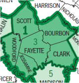
Municipalities with population
over 10,000Georgetown • Nicholasville • WinchesterMunicipalities with population
5,000-10,000Municipalities with population
under 5,000Counties County seats in Kentucky Albany • Alexandria • Barbourville • Bardstown • Bardwell • Beattyville • Bedford • Benton • Booneville • Bowling Green • Brandenburg • Brooksville • Brownsville • Burkesville • Burlington • Cadiz • Calhoun • Campbellsville • Campton • Carlisle • Carrollton • Catlettsburg • Clinton • Columbia • Covington • Cynthiana • Danville • Dixon • Eddyville • Edmonton • Elizabethtown • Elkton • Falmouth • Flemingsburg • Frankfort • Franklin • Frenchburg • Georgetown • Glasgow • Grayson • Greensburg • Greenup • Greenville • Hardinsburg • Harlan • Harrodsburg • Hartford • Hawesville • Hazard • Henderson • Hickman • Hindman • Hodgenville • Hopkinsville • Hyden • Independence • Inez • Irvine • Jackson • Jamestown • La Grange • Lancaster • Lawrenceburg • Lebanon • Leitchfield • Lexington • Liberty • London • Louisa • Louisville • Madisonville • Manchester • Marion • Mayfield • Maysville • McKee • Monticello • Morehead • Morganfield • Morgantown • Mount Olivet • Mount Sterling • Mount Vernon • Munfordville • Murray • New Castle • Nicholasville • Owensboro • Owenton • Owingsville • Paducah • Paintsville • Paris • Pikeville • Pineville • Prestonsburg • Princeton • Richmond • Russellville • Salyersville • Sandy Hook • Scottsville • Shelbyville • Shepherdsville • Smithland • Somerset • Springfield • Stanford • Stanton • Taylorsville • Tompkinsville • Vanceburg • Versailles • Warsaw • West Liberty • Whitesburg • Whitley City • Wickliffe • Williamsburg • Williamstown • Winchester50 most populous cities of Kentucky Categories:- Cities in Kentucky
- Populated places established in 1798
- Populated places in Jessamine County, Kentucky
- County seats in Kentucky
- Lexington–Fayette metropolitan area
- Populated places established in 1837
- U.S. Route 27 is a major north-south artery. From the Lexington city limits to the Business US 27 intersection north of the city center, it is a four-lane arterial highway with a center-turning lane. US 27 diverts to the western edge of the city center on a four-lane, controlled-access bypass and continues south of the city towards the Kentucky River.


Wikimedia Foundation. 2010.