- Wickliffe, Kentucky
Infobox Settlement
official_name = Wickliffe, Kentucky
settlement_type =City
nickname =
motto =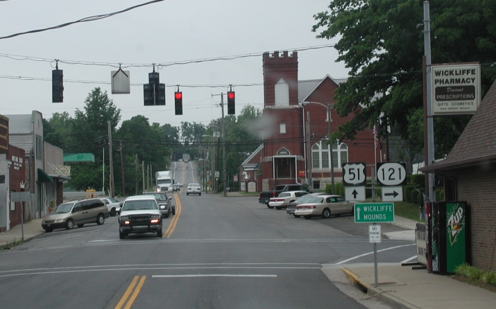
imagesize = 250px
image_caption = Downtown Wickliffe, KY
image_
mapsize = 250px
map_caption = Location of Wickliffe, Kentucky
mapsize1 =
map_caption1 =subdivision_type = Country
subdivision_name =United States
subdivision_type1 = State
subdivision_name1 =Kentucky
subdivision_type2 = County
subdivision_name2 = Ballard
government_footnotes =
government_type =
leader_title =
leader_name =
leader_title1 =
leader_name1 =
established_title =
established_date =unit_pref = Imperial
area_footnotes =area_magnitude =
area_total_km2 = 3.6
area_land_km2 = 3.6
area_water_km2 = 0.0
area_total_sq_mi = 1.4
area_land_sq_mi = 1.4
area_water_sq_mi = 0.0population_as_of = 2000
population_footnotes =
population_total = 794
population_density_km2 = 223.3
population_density_sq_mi = 578.3timezone = Central (CST)
utc_offset = -6
timezone_DST = CDT
utc_offset_DST = -5
elevation_footnotes =
elevation_m = 108
elevation_ft = 354
latd = 36 |latm = 58 |lats = 0 |latNS = N
longd = 89 |longm = 5 |longs = 13 |longEW = Wpostal_code_type =
ZIP code
postal_code = 42087
area_code = 270
blank_name = FIPS code
blank_info = 21-83064
blank1_name = GNIS feature ID
blank1_info = 0506708
website =
footnotes =Wickliffe is a city in Ballard County,
Kentucky ,United States . The population was 794 at the 2000 census. It is thecounty seat of Ballard CountyGR|6.Wickliffe is part of the Paducah, KY-IL Micropolitan Statistical Area.
Geography
Wickliffe is located at coor dms|36|57|60|N|89|5|13|W|city (36.966600, -89.086822)GR|1.
According to the
United States Census Bureau , the city has a total area of 1.4square mile s (3.5km² ), all of it land.The city sits on the
Mississippi River , about two miles south of the confluence of theOhio River and Mississippi River.Demographics
As of the
census GR|2 of 2000, there were 794 people, 327 households, and 216 families residing in the city. Thepopulation density was 578.3 people per square mile (223.8/km²). There were 384 housing units at an average density of 279.7/sq mi (108.2/km²). The racial makeup of the city was 94.33% White, 1.76% African American, 0.13% Native American, 0.88% Asian, 0.25% Pacific Islander, and 2.64% from two or more races. Hispanic or Latino of any race were 1.26% of the population.There were 327 households out of which 25.4% had children under the age of 18 living with them, 51.1% were married couples living together, 10.7% had a female householder with no husband present, and 33.9% were non-families. 30.0% of all households were made up of individuals and 15.9% had someone living alone who was 65 years of age or older. The average household size was 2.25 and the average family size was 2.74.
In the city the population was spread out with 19.0% under the age of 18, 10.2% from 18 to 24, 25.9% from 25 to 44, 26.3% from 45 to 64, and 18.5% who were 65 years of age or older. The median age was 42 years. For every 100 females there were 112.3 males. For every 100 females age 18 and over, there were 107.4 males.
The median income for a household in the city was $28,750, and the median income for a family was $35,417. Males had a median income of $30,556 versus $16,477 for females. The
per capita income for the city was $17,273. About 10.1% of families and 16.1% of the population were below thepoverty line , including 16.4% of those under age 18 and 25.5% of those age 65 or over.History
The modern day city of Wickliffe is home to a
Mississippian culture village now known only asWickliffe mounds . Wickliffe mounds was occupied from around 1100-1300 CE. Today, Wickliffe mounds is the 11th state historic site ofKentucky , and home to a research center and museum.In
1780 during theRevolutionary War , GeneralGeorge Rogers Clark established Fort Jefferson on a hill overlooking the Mississippi River one mile south of present-day Wickliffe. The fort was intended to protect what was then the western boundary of the infantUnited States from raids by theBritish Army and Native Americans. It was abandoned in1781 after a siege by the Chickasaw.The site later served as a
Union Army post during theAmerican Civil War . General Ulysses S. Grant directed a demonstration against the Confederate-held position at Columbus, Kentucky, in January 1862. Troops from the post joined in capturing Fort Henry in February 1862. It served as a Union supply post for operations in the western theater of the war.A 90-foot tall cross, the [http://ballardchamber.org/modules.php?name=Content&pa=showpage&pid=4 Fort Jefferson Memorial Cross at the Confluence] , was completed in 2000 on Fort Jefferson hill.
References
Kentucky Historical Society roadside historical marker 1309, "Fort Jefferson site," U.S. Highway 51 and 60.Kentucky Historical Society roadside historical marker 757, "Union Supply Base," U.S. Highway 51 and 60.
External links
* [http://kentucky.gov/Newsroom/parks/wickliffemounds.htm Wickliffe Mounds State Park]
* [http://www.thinkwestkentucky.com/ecotourism/wickliffe.htm Wickliffe Mounds Research Center]
Wikimedia Foundation. 2010.