- Grant County, Indiana
-
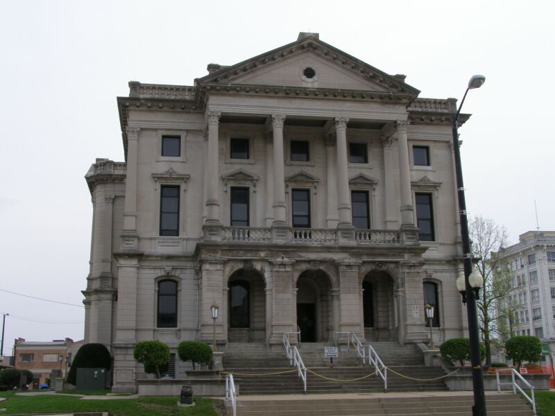
Grant County, Indiana 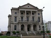 Grant County Courthouse in Marion, Indiana
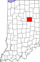
Location in the state of Indiana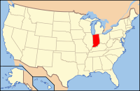
Indiana's location in the U.S.Founded 1831 Named for Samuel and Moses Grant Seat Marion Area
- Total
- Land
- Water
414.90 sq mi (1,075 km²)
414.07 sq mi (1,072 km²)
0.82 sq mi (2 km²), 0.20%Population
- (2010)
- Density
70,061
169/sq mi (65.21/km²)Congressional district 5th Time zone Eastern: UTC-5/-4 Footnotes: Indiana county number 27
Grant County is a county located in the U.S. state of Indiana. As of the 2010 census, the population was 70,061.[1] The county seat is Marion[2]. Important paleontological discoveries dating from the Pliocene epoch have been made at Pipe Creek Sinkhole in Grant County.
Contents
Geography
According to the 2010 census, the county has a total area of 414.90 square miles (1,074.6 km2), of which 414.07 square miles (1,072.4 km2) (or 99.80%) is land and 0.82 square miles (2.1 km2) (or 0.20%) is water.[3]
 Marion from the air.
Adjacent counties
- Huntington County (northeast)
- Wells County (east-northeast)
- Blackford County (east-southeast)
- Delaware County (southeast)
- Madison County (south)
- Tipton County (southwest)
- Howard County (west-southwest)
- Miami County (west-northwest)
- Wabash County (northwest)
Grant County, Indiana, is one of the few counties in the United States to border as many as nine counties. Indiana actually has 2 such counties, with nearby Allen County also bordering 9 counties. Allen and Grant Counties share Huntington and Wells Counties as common neighbors.
History
Grant County was formed in 1831. It was named for Captains Samuel and Moses Grant of Kentucky.[4]
Major highways
Interstates
 I-69
I-69
U.S. Highways
 US 35
US 35
Indiana State Roads
Climate and weather
Marion, Indiana Climate chart (explanation) J F M A M J J A S O N D 2.2321623719348283.660384.372493.981594.785633.782612.876532.664423.450332.93722Average max. and min. temperatures in °F Precipitation totals in inches Source: The Weather Channel[5] Metric conversion J F M A M J J A S O N D 550-9523-7769-291163109229100271512029179328167224126618685101723-6Average max. and min. temperatures in °C Precipitation totals in mm In recent years, average temperatures in Marion have ranged from a low of 16 °F (−9 °C) in January to a high of 85 °F (29 °C) in July, although a record low of −23 °F (−31 °C) was recorded in January 1985 and a record high of 108 °F (42 °C) was recorded in July 1936. Average monthly precipitation ranged from 2.03 inches (52 mm) in February to 4.73 inches (120 mm) in July.[5]
Government
See also: Government of IndianaThe county government is a constitutional body, and is granted specific powers by the Constitution of Indiana, and by the Indiana Code.
County Council: The county council is the legislative branch of the county government and controls all the spending and revenue collection in the county. Representatives are elected from county districts. The council members serve four year terms. They are responsible for setting salaries, the annual budget, and special spending. The council also has limited authority to impose local taxes, in the form of an income and property tax that is subject to state level approval, excise taxes, and service taxes.[6][7]
Board of Commissioners: The executive body of the county is made of a board of commissioners. The commissioners are elected county-wide, in staggered terms, and each serves a four-year term. One of the commissioners, typically the most senior, serves as president. The commissioners are charged with executing the acts legislated by the council, collecting revenue, and managing the day-to-day functions of the county government.[6][7]
Court: The county maintains a small claims court that can handle some civil cases. The judge on the court is elected to a term of four years and must be a member of the Indiana Bar Association. The judge is assisted by a constable who is also elected to a four-year term. In some cases, court decisions can be appealed to the state level circuit court.[7]
County Officials: The county has several other elected offices, including sheriff, coroner, auditor, treasurer, recorder, surveyor and circuit court clerk. Each of these elected officers serves a term of four years and oversees a different part of county government. Members elected to county government positions are required to declare party affiliations and to be residents of the county.[7]
Grant County is part of Indiana's 5th congressional district; Indiana Senate districts 17, 19 and 20;[8] and Indiana House of Representatives districts 31, 32 and 82.[9]
Demographics
As of the census[10] of 2000, there were 73,403 people, 28,319 households, and 19,568 families residing in the county. The population density was 177 people per square mile (68/km²). There were 30,560 housing units at an average density of 74 per square mile (28/km²). The racial makeup of the county was 89.23% White, 7.19% Black or African American, 0.44% Native American, 0.56% Asian, 0.04% Pacific Islander, 1.02% from other races, and 1.53% from two or more races. 2.43% of the population were Hispanic or Latino of any race. 23.0% were of American, 21.0% German, 11.7% English and 7.9% Irish ancestry according to Census 2000.
There were 28,319 households out of which 29.50% had children under the age of 18 living with them, 53.70% were married couples living together, 11.50% had a female householder with no husband present, and 30.90% were non-families. 26.70% of all households were made up of individuals and 11.50% had someone living alone who was 65 years of age or older. The average household size was 2.43 and the average family size was 2.92.
In the county the population was spread out with 23.60% under the age of 18, 11.80% from 18 to 24, 25.80% from 25 to 44, 23.80% from 45 to 64, and 15.00% who were 65 years of age or older. The median age was 37 years. For every 100 females there were 92.20 males. For every 100 females age 18 and over, there were 88.90 males.
The median income for a household in the county was $36,162, and the median income for a family was $44,304. Males had a median income of $33,767 versus $23,801 for females. The per capita income for the county was $18,003. About 8.40% of families and 11.80% of the population were below the poverty line, including 16.10% of those under age 18 and 8.70% of those age 65 or over.
Historical populations Census Pop. %± 1840 4,875 — 1850 11,092 127.5% 1860 15,797 42.4% 1870 18,487 17.0% 1880 23,618 27.8% 1890 31,493 33.3% 1900 54,693 73.7% 1910 51,426 −6.0% 1920 51,353 −0.1% 1930 51,066 −0.6% 1940 55,813 9.3% 1950 62,156 11.4% 1960 75,741 21.9% 1970 83,955 10.8% 1980 80,934 −3.6% 1990 74,169 −8.4% 2000 73,403 −1.0% 2010 70,061 −4.6% Sources: United States Department of Commerce,
Bureau of the Census, Population Division[11]
Census Quickfacts[1]Localities
Cities and towns
Townships
- Center
- Fairmount
- Franklin
- Green
- Jefferson
- Liberty
- Mill
- Monroe
- Pleasant
- Richland
- Sims
- Van Buren
- Washington
Other places
See also
References
- ^ a b "Grant County QuickFacts". United States Census Bureau. http://quickfacts.census.gov/qfd/states/18/18053.html. Retrieved 2011-09-17.
- ^ "Find a County". National Association of Counties. http://www.naco.org/Counties/Pages/FindACounty.aspx. Retrieved 2011-06-07.
- ^ "Census 2010 U.S. Gazetteer Files: Counties". United States Census. http://www.census.gov/geo/www/gazetteer/files/Gaz_counties_national.txt. Retrieved 2011-10-10.
- ^ Kleber, John E. Encyclopedia of Kentucky. ISBN 0813117720. http://books.google.com/books?id=8eFSK4o. Retrieved 2008-09-29.[dead link]
- ^ a b "Monthly Averages for Marion, Indiana". The Weather Channel. http://www.weather.com/weather/wxclimatology/monthly/graph/USIN0390. Retrieved 2011-01-27.
- ^ a b Indiana Code. "Title 36, Article 2, Section 3". IN.gov. http://www.in.gov/legislative/ic/code/title36/ar2/ch3.html. Retrieved 2008-09-16.
- ^ a b c d Indiana Code. "Title 2, Article 10, Section 2" (PDF). IN.gov. http://www.in.gov/legislative/ic/code/title3/ar10/ch2.pdf. Retrieved 2008-09-16.
- ^ "Indiana Senate Districts". State of Indiana. http://www.in.gov/sos/elections/3006.htm. Retrieved 2011-07-14.
- ^ "Indiana House Districts". State of Indiana. http://www.in.gov/sos/elections/3005.htm. Retrieved 2011-07-14.
- ^ "American FactFinder". United States Census Bureau. http://factfinder.census.gov. Retrieved 2008-01-31.
- ^ Forstall, Richard L. (editor) (1996). Population of states and counties of the United States: 1790 to 1990 : from the twenty-one decennial censuses. United States Department of Commerce, Bureau of the Census, Population Division. pp. 50–53. ISBN 0-934213-48-8. http://books.google.com/books?id=Z12v1lrkv2IC&lpg=PA50&pg=PA50#v=onepage&q&f=false.

Wabash County Huntington County Howard County and Miami County 
Wells County and Blackford County  Grant County, Indiana

Tipton County Madison County Delaware County Municipalities and communities of Grant County, Indiana Cities 
Towns Townships Unincorporated
communitiesArcana | Brookhaven | Cole | Dooville | Doyle Ferguson | Farrville | Fox | Hackleman | Hanfield | Herbst | Home Corner | Jadden | Jalapa | Kiley | Lake Wood | Landess | Michaelsville | Mier | Normal | Point Isabel | Radley | Rigdon | Roseburg | Shadeland | Shady Hills | Sims | Weaver
Footnotes ‡This populated place also has portions in an adjacent county or counties
Categories:- Indiana counties
- Grant County, Indiana
- 1831 establishments in the United States
- Populated places established in 1831


Wikimedia Foundation. 2010.