- Delaware County, Indiana
-
Delaware County, Indiana 
Seal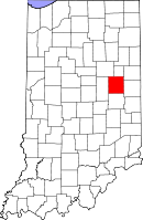
Location in the state of Indiana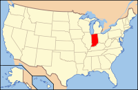
Indiana's location in the U.S.Founded 1827 Seat Muncie Area
- Total
- Land
- Water
395.91 sq mi (1,025 km²)
392.12 sq mi (1,016 km²)
3.78 sq mi (10 km²), 0.95%Population
- (2010)
- Density
117,671
299/sq mi (115.48/km²)Congressional district 6th Website www.co.delaware.in.us Footnotes: Indiana county number 18
Delaware County is a county located in the U.S. state of Indiana. As of 2010, the population was 117,671.[1] The county seat is Muncie.[2] It is part of the Muncie, IN, Metropolitan Statistical Area.
Contents
History
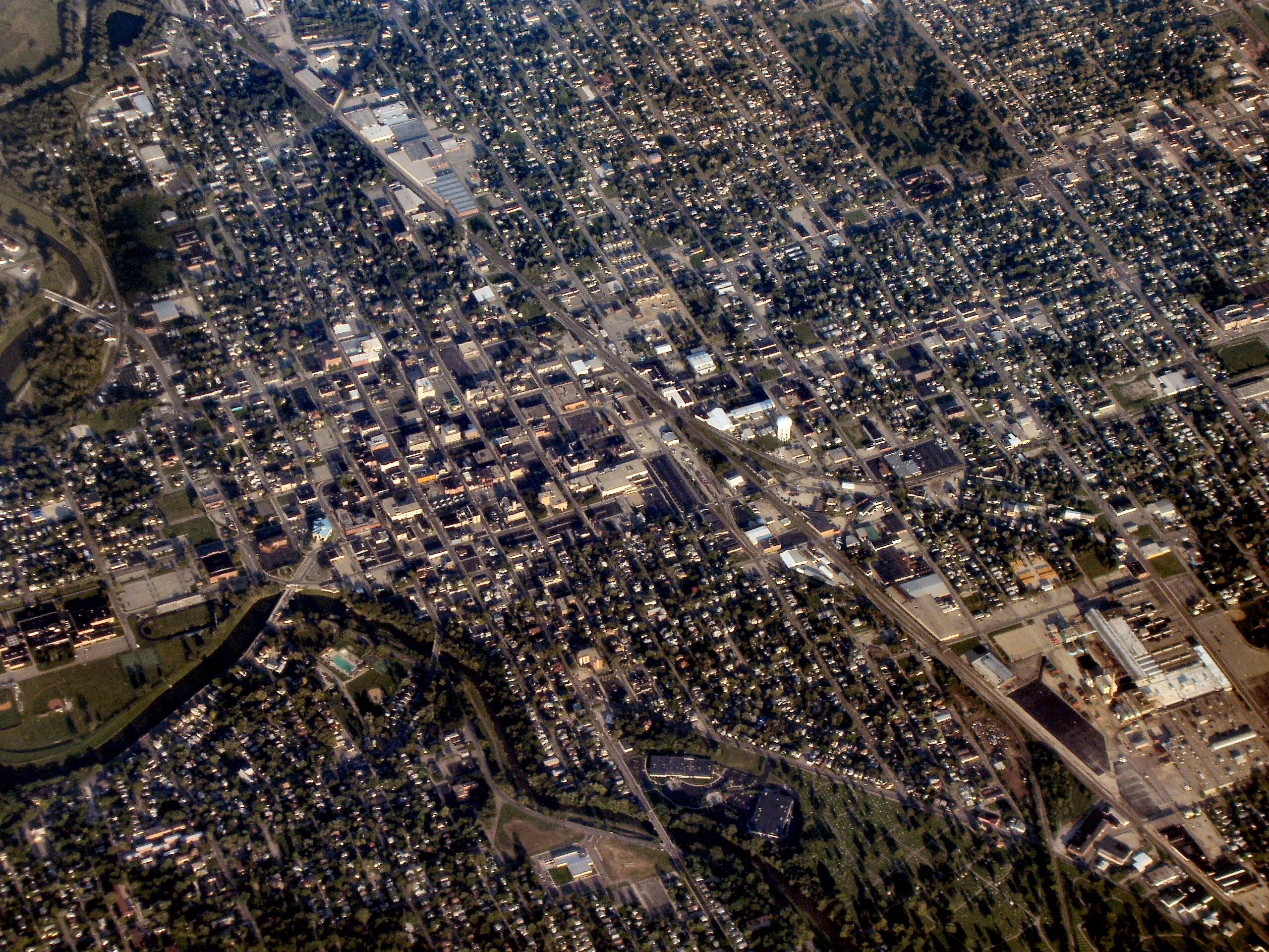
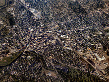 Muncie from the northwest.
Delaware County was formed in 1827. It was named for the Delaware, a Native American people who still lived in the county. The Delaware were removed from the county in the 1840s. The county was once home to The Prophet, the brother of Tecumseh who instigated a native uprising in 1811. David Conner was the first settler to live in the county in the early 1810s.[3]
Following the American Civil War the county experienced an economic boom after the discovery of natural gas that fueled rapid industrial growth in the surrounding area.
The first discovery of natural gas in Indiana occurred in the town of Eaton, in 1876. A company was drilling for coal and when they had reaching a depth of six-hundred feet, there was a great noise and bad smelling fumes began to come from the hole. After a partial investigation, many concluded that they had breached the ceiling of Hell, and the hole was quickly filled in. In 1884, when natural gas was discovered in nearby Ohio, the townsfolk recalled the incident and returned to the location and opened the state of Indiana's first natural gas well. The gas was so abundant and strong, that when the well was lit, the flames could be see from Muncie.[4]
Geography
According to the 2010 census, the county has a total area of 395.91 square miles (1,025.4 km2), of which 392.12 square miles (1,015.6 km2) (or 99.04%) is land and 3.78 square miles (9.8 km2) (or 0.95%) is water.[5]
Cities and towns
Townships
Major highways
 Interstate 69
 U.S. Route 35
 Indiana State Road 3
 Indiana State Road 28
 Indiana State Road 32
 Indiana State Road 67
 Indiana State Road 167
 Indiana State Road 332
Adjacent counties
- Blackford County (north)
- Jay County (northeast)
- Randolph County (east)
- Henry County (south)
- Madison County (west)
- Grant County (northwest)
Climate and weather
Muncie, Indiana Climate chart (explanation) J F M A M J J A S O N D 2.133162.338203.148293.661394.272514.38160485643.58362376542.664423.4503333822Average max. and min. temperatures in °F Precipitation totals in inches Source: The Weather Channel[6] Metric conversion J F M A M J J A S O N D 521-9573-7799-2911641062211109271610129188928177624126718686101773-6Average max. and min. temperatures in °C Precipitation totals in mm In recent years, average temperatures in Muncie have ranged from a low of 16 °F (−9 °C) in January to a high of 85 °F (29 °C) in July, although a record low of −29 °F (−34 °C) was recorded in January 1994 and a record high of 102 °F (39 °C) was recorded in June 1988. Average monthly precipitation ranged from 2.06 inches (52 mm) in January to 4.28 inches (109 mm) in June.[6]
Government
See also: Government of IndianaThe county government is a constitutional body, and is granted specific powers by the Constitution of Indiana, and by the Indiana Code.
County Council: The county council is the legislative branch of the county government and controls all the spending and revenue collection in the county. Representatives are elected from county districts. The council members serve four year terms. They are responsible for setting salaries, the annual budget, and special spending. The council also has limited authority to impose local taxes, in the form of an income and property tax that is subject to state level approval, excise taxes, and service taxes.[7][8]
Board of Commissioners: The executive body of the county is made of a board of commissioners. The commissioners are elected county-wide, in staggered terms, and each serves a four-year term. One of the commissioners, typically the most senior, serves as president. The commissioners are charged with executing the acts legislated by the council, collecting revenue, and managing the day-to-day functions of the county government.[7][8]
Court: The county maintains a small claims court that can handle some civil cases. The judge on the court is elected to a term of four years and must be a member of the Indiana Bar Association. The judge is assisted by a constable who is also elected to a four-year term. In some cases, court decisions can be appealed to the state level circuit court.[8]
County Officials: The county has several other elected offices, including sheriff, coroner, auditor, treasurer, recorder, surveyor, and circuit court clerk. Each of these elected officers serves a term of four years and oversees a different part of county government. Members elected to county government positions are required to declare party affiliations and to be residents of the county.[8]
Delaware County is part of Indiana's 6th congressional district; Indiana Senate district 26;[9] and Indiana House of Representatives districts 33, 34 and 35.[10]
Demographics
Historical populations Census Pop. %± 1820 3,677 — 1830 2,374 −35.4% 1840 8,843 272.5% 1850 10,843 22.6% 1860 15,753 45.3% 1870 19,030 20.8% 1880 22,926 20.5% 1890 30,131 31.4% 1900 49,624 64.7% 1910 51,414 3.6% 1920 56,377 9.7% 1930 67,270 19.3% 1940 74,963 11.4% 1950 90,252 20.4% 1960 110,938 22.9% 1970 129,219 16.5% 1980 128,587 −0.5% 1990 119,659 −6.9% 2000 118,769 −0.7% 2010 117,671 −0.9% Sources: United States Department of Commerce,
Bureau of the Census, Population Division[11]
Census Quickfacts[1]As of the census[12] of 2000, there were 118,769 people, 47,131 households, and 29,692 families residing in the county. The population density was 302 people per square mile (117/km²). There were 51,032 housing units at an average density of 130 per square mile (50/km²). The racial makeup of the county was 90.73% White, 6.72% Black or African American, 0.23% Native American, 0.66% Asian, 0.05% Pacific Islander, 0.47% from other races, and 1.13% from two or more races. 1.10% of the population were Hispanic or Latino of any race. 22.7% were of American, 20.9% German, 12.2% English and 9.8% Irish ancestry according to Census 2000.
There were 47,131 households out of which 27.80% had children under the age of 18 living with them, 48.50% were married couples living together, 10.90% had a female householder with no husband present, and 37.00% were non-families. 28.20% of all households were made up of individuals and 10.40% had someone living alone who was 65 years of age or older. The average household size was 2.37 and the average family size was 2.90.
In the county the population was spread out with 22.10% under the age of 18, 16.90% from 18 to 24, 25.60% from 25 to 44, 21.90% from 45 to 64, and 13.50% who were 65 years of age or older. The median age was 34 years. For every 100 females there were 92.20 males. For every 100 females age 18 and over, there were 89.20 males.
The median income for a household in the county was $34,659, and the median income for a family was $45,394. Males had a median income of $36,155 versus $23,268 for females. The per capita income for the county was $19,233. About 9.00% of families and 15.10% of the population were below the poverty line, including 15.70% of those under age 18 and 8.00% of those age 65 or over.
See also
References
- ^ a b "Delaware County QuickFacts". United States Census Bureau. http://quickfacts.census.gov/qfd/states/18/18035.html. Retrieved 2011-09-17.
- ^ "Find a County". National Association of Counties. http://www.naco.org/Counties/Pages/FindACounty.aspx. Retrieved 2011-06-07.
- ^ De Witt Clinton Goodrich & Charles Richard Tuttle (1875). An Illustrated History of the State of Indiana. Indiana: R. S. Peale & co.. pp. 556. http://books.google.com/books?id=YDIUAAAAYAAJ.
- ^ Gray, Ralph (1995). Indiana History: A Book of Readings. Indiana University Press. pp. 187. ISBN 025332629X.
- ^ "Census 2010 U.S. Gazetteer Files: Counties". United States Census. http://www.census.gov/geo/www/gazetteer/files/Gaz_counties_national.txt. Retrieved 2011-10-10.
- ^ a b "Monthly Averages for Muncie, Indiana". The Weather Channel. http://www.weather.com/weather/wxclimatology/monthly/graph/USIN0452. Retrieved 2011-01-27.
- ^ a b Indiana Code. "Title 36, Article 2, Section 3". IN.gov. http://www.in.gov/legislative/ic/code/title36/ar2/ch3.html. Retrieved 2008-09-16.
- ^ a b c d Indiana Code. "Title 2, Article 10, Section 2". IN.gov. http://www.in.gov/legislative/ic/code/title3/ar10/ch2.pdf. Retrieved 2008-09-16.
- ^ "Indiana Senate Districts". State of Indiana. http://www.in.gov/sos/elections/3006.htm. Retrieved 2011-01-23.
- ^ "Indiana House Districts". State of Indiana. http://www.in.gov/sos/elections/3005.htm. Retrieved 2011-01-23.
- ^ Forstall, Richard L. (editor) (1996). Population of states and counties of the United States: 1790 to 1990 : from the twenty-one decennial censuses. United States Department of Commerce, Bureau of the Census, Population Division. pp. 50–53. ISBN 0-934213-48-8. http://books.google.com/books?id=Z12v1lrkv2IC&lpg=PA50&pg=PA50#v=onepage&q&f=false.
- ^ "American FactFinder". United States Census Bureau. http://factfinder.census.gov. Retrieved 2008-01-31.
External links
- Delaware County, Indiana Geographic Information System
- Delaware County Weather
- Muncie Free Press - Delaware County News and Information
- Downtown Muncie
- ScanMuncie - Online Community Forums & Online Public Safety Radio Scanners
- Ball State University - External link
- Ball State University Libraries - External link

Grant County Blackford County Jay County Madison County 
Randolph County  Delaware County, Indiana

Henry County Municipalities and communities of Delaware County, Indiana City 
Towns Townships Unincorporated
communitiesAnthony | Aultshire | Bethel | Cammack | Cowan | Cross Roads | DeSoto | Drew | Gates Corner | Granville | Hyde Park | Janney | Liberty Corners | Mayfield | Middletown Park | Morningside | Mount Pleasant | New Burlington | Oakville | Progress | Reed Station | Royerton | Shideler | Smithfield | Stockport | West Muncie | Wheeling | Woodland Park
Footnotes ‡This populated place also has portions in an adjacent county or counties
Categories:- Indiana counties
- Delaware County, Indiana
- 1827 establishments in the United States
- Populated places established in 1827


Wikimedia Foundation. 2010.