- Douglas County, Missouri
-
Douglas County, Missouri 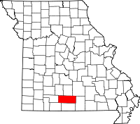
Location in the state of Missouri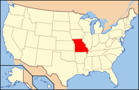
Missouri's location in the U.S.Founded October 29, 1857 Named for U.S. Senator Stephen A. Douglas (D-Illinois) Seat Ava Largest city Ava Area
- Total
- Land
- Water
814.60 sq mi (2,110 km²)
814.53 sq mi (2,110 km²)
0.07 sq mi (0 km²), 0.01PopulationEst.
- (2010)
- Density
13,684
16/sq mi (6/km²)Time zone Central: UTC-6/-5 Douglas County is a county located in South Central Missouri in the United States. As of the 2010 U.S. Census, the county's population was 13,684. The largest city and county seat is Ava[1]. The county was officially organized on October 29, 1857, and is named after U.S. Senator Stephen A. Douglas (D-Illinois) and later Democratic presidential candidate.
Contents
History
Previously, the county seat was located at Arno, Missouri, west of Ava. Prior to that, Vera Cruz (formerly called Red Bud) was the county seat. Vera Cruz is located on Bryant Creek, which flows through the middle of the county. After the American Civil War, during a period of general chaos, a group from the western part of the county broke into the Arno courthouse and removed the records back to Vera Cruz. Later in 1871, a new town site was selected, present-day Ava, near the location of the former U.S. Civil War military Post Office, Militia Spring. The location of this new town seemed to satisfy most of the residents of Douglas County to be their point of county government.
Geography
According to the 2000 census, the county has a total area of 814.60 square miles (2,109.8 km2), of which 814.53 square miles (2,109.6 km2) (or 99.99%) is land and 0.07 square miles (0.18 km2) (or 0.01%) is water.[2]
Adjacent counties
- Webster County (northwest)
- Wright County (north)
- Texas County (northeast)
- Howell County (east)
- Ozark County (south)
- Taney County (southwest)
- Christian County (west)
Major highways
National protected area
- Mark Twain National Forest (part)
Religion
According to the Association of Religion Data Archives County Membership Report (2000), Douglas County is a part of the Bible Belt with evangelical Protestantism being the majority religion. The most predominant denominations among residents in Douglas County who adhere to a religion are Southern Baptists (22.95%), Church of the Nazarene (16.28%), and Mormons (13.70%).
Demographics
As of the census[3] of 2000, there were 13,084 people, 5,201 households, and 3,671 families residing in the county. The population density was 16 people per square mile (6/km²). There were 5,919 housing units at an average density of 7 per square mile (3/km²). The racial makeup of the county was 96.86% White, 0.11% Black or African American, 0.95% Native American, 0.21% Asian, 0.02% Pacific Islander, 0.17% from other races, and 1.69% from two or more races. Approximately 0.84% of the population were Hispanic or Latino of any race. Among the major first ancestries reported in Douglas County are 31.3% American, 13.2% English, 12.3% German, and 9.7% Irish, according to Census 2000.
There were 5,201 households out of which 30.10% had children under the age of 18 living with them, 60.00% were married couples living together, 7.20% had a female householder with no husband present, and 29.40% were non-families. 26.10% of all households were made up of individuals and 13.00% had someone living alone who was 65 years of age or older. The average household size was 2.49 and the average family size was 2.99.
In the county the population was spread out with 25.80% under the age of 18, 7.00% from 18 to 24, 24.50% from 25 to 44, 25.60% from 45 to 64, and 17.10% who were 65 years of age or older. The median age was 40 years. For every 100 females there were 96.60 males. For every 100 females age 18 and over, there were 93.30 males.
The median income for a household in the county was $31,335, and the median income for a family was $36,648. Males had a median income of $22,706 versus $17,060 for females. The per capita income for the county was $16,710. About 12.90% of families and 17.50% of the population were below the poverty line, including 19.80% of those under age 18 and 18.20% of those age 65 or over.
Cities and towns
The county has only one incorporated town, which is the county seat, Ava.
Education
Of adults 25 years of age and older in Douglas County, 69.7% possesses a high school diploma or higher while 9.9% holds a bachelor's degree or higher as their highest educational attainment.
Public Schools
- Ava R-I School District - Ava
- Ava Elementary School (PK-04)
- Ava Middle School (05-08)
- Ava High School (09-12)
- Plainview R-VIII School District - Ava
- Plainview Elementary School (K-08)
- Skyline R-II School District - Norwood
- Skyline Elementary School (K-08)
Private Schools
- Ava Victory Academy - Ava - (PK-06) - Non-denominational Christian
- Mt. Zion Bible Academy - Ava - (PK-12) - Church of God[disambiguation needed
 ]
]
Politics
Local
Politics at the local level in Douglas County is completely controlled by the Republican Party. All of Douglas County’s elected officeholders are Republicans.
Office Incumbent Party Assessor Alishia Degase Republican Circuit Clerk Kim Hathcock Republican Clerk Karry Davis Republican Collector Laura Stillings Republican Commissioner – District 1 Richard Mitchell Republican Commissioner – District 2 Danny Dry Republican Coroner Rick Miller Republican Presiding Commissioner Larry Pueppke Republican Prosecuting Attorney Roger Wall Republican Public Administrator Linda Coonts Republican Recorder Tina Boyd Republican Sheriff Chris Degase Republican Surveyor Ray Riggs Republican Treasurer Teresa Miller Republican State
Past Gubernatorial Elections Results Year Republican Democratic Third Parties 2008 45.27% 3,014 48.95% 3,259 5.78% 385 2004 70.08% 4,412 28.40% 1,788 1.52% 96 2000 63.53% 3,317 34.73% 1,813 1.74% 91 1996 61.03% 3,145 36.06% 1,858 2.91% 150 In the Missouri House of Representatives, all of Douglas County is a part of Missouri’s 144th District and is currently represented by Tony Dugger (R-Hartville). In 2010, Dugger ran unopposed and was reelected with 100 percent of the vote.
Missouri House of Representatives - District 144 - Douglas County (2010) Party Candidate Votes % ±% Republican Tony Dugger* 4,341 100.00 +28.51 In the Missouri Senate, all of Douglas County is a part of Missouri's 20th District and is currently represented by Dan Clemens (R-Marshfield). Clemens is term limited and is finishing out his last term. He will be succeeded by fellow Republican Jay Wasson in the next legislative session in January 2011. The 20th Senatorial District consists of Christian, Douglas and Webster counties and parts of Greene County.
Missouri Senate - District 20 - Douglas County (2010) Party Candidate Votes % ±% Republican Jay Wasson 3,887 77.82 +8.45 Democratic Terry Traw 1,108 22.18 -8.45 Federal
In the U.S. House of Representatives, Douglas County is represented by Jo Ann Emerson (R-Cape Girardeau) who represents much of Southern Missouri as part of Missouri's 8th Congressional District.
U.S. House of Representatives - District 8 - Douglas County (2010) Party Candidate Votes % ±% Republican Jo Ann Emerson 3,441 66.30 -5.67 Democratic Tommy Sowers 1,360 26.20 +1.81 Independent Larry Bill 204 3.93 +3.93 Libertarian Rick Vandeven 185 3.57 +1.82 Political Culture
Past Presidential Elections Results Year Republican Democratic Third Parties 2008 65.63% 4,405 31.88% 2,140 2.49% 167 2004 71.09% 4,498 27.52% 1,741 1.39% 88 2000 68.15% 3,599 29.27% 1,546 2.58% 136 1996 50.17% 2,601 33.64% 1,744 16.18% 839 Like most counties situated in Southwest Missouri, Douglas County is a Republican stronghold in presidential elections. George W. Bush carried Douglas County in 2000 and 2004 by more than two-to-one margins, and like many other rural counties throughout Missouri, Douglas County strongly favored John McCain over Barack Obama in 2008. No Democratic presidential nominee has won Douglas County in over 50 years.
Like most rural areas throughout the Bible Belt in Southwest Missouri, voters in Douglas County traditionally adhere to socially and culturally conservative principles which tend to strongly influence their Republican leanings. In 2004, Missourians voted on a constitutional amendment to define marriage as the union between a man and a woman—it overwhelmingly passed Douglas County with 85.78 percent of the vote. The initiative passed the state with 71 percent of support from voters as Missouri became the first state to ban same-sex marriage. In 2006, Missourians voted on a constitutional amendment to fund and legalize embryonic stem cell research in the state—it failed in Douglas County with 59.36 percent voting against the measure. The initiative narrowly passed the state with 51 percent of support from voters as Missouri became one of the first states in the nation to approve embryonic stem cell research. Despite Douglas County’s longstanding tradition of supporting socially conservative platforms, voters in the county have a penchant for advancing populist causes like increasing the minimum wage. In 2006, Missourians voted on a proposition (Proposition B) to increase the minimum wage in the state to $6.50 an hour—it passed Douglas County with 71.97 percent of the vote. The proposition strongly passed every single county in Missouri with 78.99 percent voting in favor as the minimum wage was increased to $6.50 an hour in the state. During the same election, voters in five other states also strongly approved increases in the minimum wage.
Missouri Presidential Preference Primary (2008)
In the 2008 Missouri Presidential Preference Primary, voters in Douglas County from both political parties supported candidates who finished in second place in the state at large and nationally.
- Former Governor Mike Huckabee (R-Arkansas) received more votes, a total of 1,343, than any candidate from either party in Douglas County during the 2008 Missouri Presidential Primaries. He also received 16 more votes than the total number of votes cast in the entire Democratic Primary in Douglas County.
Douglas County, Missouri 2008 Republican primary in Missouri John McCain 516 (21.15%) Mike Huckabee 1,343 (55.04%) Mitt Romney 270 (11.07%) Ron Paul 290 (12.09%) Douglas County, Missouri 2008 Democratic primary in Missouri Hillary Rodham Clinton 827 (62.32%) Barack Obama 454 (34.21%) John Edwards (withdrawn) 39 (2.94%) Municipalities and communities of Douglas County, Missouri City 
Townships Benton | Boone | Brown | Brush Creek | Bryan | Buchanan | Campbell | Cass | Champion | Clay | Clinton | Findley | Jackson | Lincoln | McKinley | McMurtrey | Miller | Richland | Spencer | Spring Creek | Walls | Washington | Wood
Unincorporated
communitiesBrushyknob | Drury | Gentryville | Smallett | Squires | Vanzant
Coordinates: 36°56′N 92°30′W / 36.93°N 92.50°W
See also
- National Register of Historic Places listings in Douglas County, Missouri
References
- ^ "Find a County". National Association of Counties. http://www.naco.org/Counties/Pages/FindACounty.aspx. Retrieved 2011-06-07.
- ^ "Census 2000 U.S. Gazetteer Files: Counties". United States Census. http://www.census.gov/tiger/tms/gazetteer/county2k.txt. Retrieved 2011-02-13.
- ^ "American FactFinder". United States Census Bureau. http://factfinder.census.gov. Retrieved 2008-01-31.
Further reading
- Searching for Booger County - Ozark Folk Histories, Sandy Ray Chapin, Boogeyman Books (2002) ISBN 978-0966807530
- Baldknobbers - Vigilantes on the Ozarks Frontier, Mary Hartman and Elmo Ingenthron, Pelican Publishing (1988) ISBN 978-0882896830
External links
- Digitized 1930 Plat Book of Douglas County from University of Missouri Division of Special Collections, Archives, and Rare Books
- http://quickfacts.census.gov/qfd/states/29/29067.html
Categories:- Missouri counties
- Douglas County, Missouri
- 1857 establishments in the United States


Wikimedia Foundation. 2010.