- DeKalb County, Missouri
-
DeKalb County, Missouri 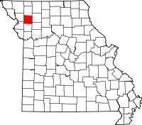
Location in the state of Missouri
Missouri's location in the U.S.Founded 1845 Named for ‘’American Revolutionary War’’ general ‘’Johann de Kalb’’ Seat Maysville Largest city Cameron Area
- Total
- Land
- Water
425.77 sq mi (1,103 km²)
424.20 sq mi (1,099 km²)
1.57 sq mi (4 km²), 0.37Population
- (2010)
- Density
12,892
27/sq mi (11/km²)Time zone Central: UTC-6/-5 DeKalb County is a county located in the U.S. state of Missouri. As of 2010, the population is 12,892. The county was organized in 1845 and is named after the American Revolutionary War general Johann de Kalb. The county along with Buchanan and Andrew counties in Missouri and Doniphan County, Kansas, is included in the St. Joseph Metropolitan Statistical Area, which had an estimated population of 122,306 in 2006.
Contents
Geography
According to the 2000 census, the county has a total area of 425.77 square miles (1,102.7 km2), of which 424.20 square miles (1,098.7 km2) (or 99.63%) is land and 1.57 square miles (4.1 km2) (or 0.37%) is water.[1]
Adjacent counties
- Gentry County (north)
- Daviess County (east)
- Caldwell County (southeast)
- Clinton County (south)
- Buchanan County (southwest)
- Andrew County (west)
Major highways
Demographics
Historical populations Census Pop. %± 1900 14,418 — 1910 12,531 −13.1% 1920 11,694 −6.7% 1930 10,270 −12.2% 1940 9,751 −5.1% 1950 8,047 −17.5% 1960 7,226 −10.2% 1970 7,305 1.1% 1980 8,222 12.6% 1990 9,967 21.2% 2000 11,597 16.4% As of the census[2] of 2000, there were 11,597 people, 3,528 households, and 2,473 families residing in the county. The population density was 27 people per square mile (11/km²). There were 3,839 housing units at an average density of 9 per square mile (3/km²). The racial makeup of the county was 89.09% White, 8.86% Black or African American, 0.66% Native American, 0.17% Asian, 0.01% Pacific Rim Islander, 0.27% from other races, and 0.93% from two or more races. 1.08% of the population were Hispanic or Latino of any race.
There were 3,528 households out of which 32.40% had children under the age of 18 living with them, 9.60% were married couples living together, 7.40% had a female householder with no husband present, and 29.90% were non-families. 26.90% of all households were made up of individuals and 14.70% had someone living alone who was 65 years of age or older. The average household size was 2.50 and the average family size was 3.04.
In the county the population was spread out with 20.70% under the age of 18, 8.20% from 18 to 24, 36.30% from 25 to 44, 20.90% from 45 to 64, and 13.90% who were 65 years of age or older. The median age was 38 years. For every 100 females there were 152.30 males. For every 100 females age 18 and over, there were 168.10 males.
The median income for a household in the county was $31,654, and the median income for a family was $37,329. Males had a median income of $28,434 versus $20,207 for females. The per capita income for the county was $12,687. About 7.20% of families and 10.80% of the population were below the poverty line, including 10.80% of those under age 18 and 75.20% of those age 65 or over.
Cities and towns
See also
- National Register of Historic Places listings in DeKalb County, Missouri
References
- ^ "Census 2000 U.S. Gazetteer Files: Counties". United States Census. http://www.census.gov/tiger/tms/gazetteer/county2k.txt. Retrieved 2011-02-13.
- ^ "American FactFinder". United States Census Bureau. http://factfinder.census.gov. Retrieved 2008-01-31.
External links
- Digitized 1930 Plat Book of DeKalb County from University of Missouri Division of Special Collections, Archives, and Rare Books

Gentry County Andrew County 
Daviess County  DeKalb County, Missouri

Buchanan County Clinton County Caldwell County Municipalities and communities of DeKalb County, Missouri Cities Cameron‡ | Clarksdale | Maysville | Osborn‡ | Stewartsville | Union Star

Villages Townships Adams | Camden | Colfax | Dallas | Grand River | Grant | Polk | Sherman | Washington
Unincorporated
communityFootnotes ‡This populated place also has portions in an adjacent county or counties
Categories:- Missouri counties
- DeKalb County, Missouri
- St. Joseph metropolitan area


Wikimedia Foundation. 2010.