- McDonald County, Missouri
-
McDonald County, Missouri 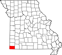
Location in the state of Missouri
Missouri's location in the U.S.Founded March 3, 1849 Named for Sergeant Alexander McDonald, a soldier in the American Revolutionary War Seat Pineville Largest city Anderson Area
- Total
- Land
- Water
539.70 sq mi (1,398 km²)
539.51 sq mi (1,397 km²)
0.19 sq mi (0 km²), 0.04%PopulationEst.
- (2010)
- Density
23,083
40/sq mi (16/km²)Time zone Central: UTC-6/-5 McDonald County is a county located in Southwest Missouri in the United States of America. As of the 2010 U.S. Census, the population was 23,083. Its county seat is Pineville[1]. The county was organized in 1849 and named for Sergeant Alexander McDonald, a soldier in the American Revolutionary War.
McDonald County is part of the Fayetteville–Springdale–Rogers, AR-MO Metropolitan Statistical Area.
Contents
Geography
According to the 2000 census, the county has a total area of 539.70 square miles (1,397.8 km2), of which 539.51 square miles (1,397.3 km2) (or 99.96%) is land and 0.19 square miles (0.49 km2) (or 0.04%) is water.[2]
Adjacent counties
- Newton County (north)
- Barry County (east)
- Benton County, Arkansas (south)
- Delaware County, Oklahoma (west)
- Ottawa County, Oklahoma (northwest)
Major highways
Demographics
Historical populations Census Pop. %± 1850 2,236 — 1860 4,008 79.2% 1870 3,756 −6.3% 1880 7,816 108.1% 1890 11,283 44.4% 1900 13,574 20.3% 1910 13,539 −0.3% 1920 12,690 −6.3% 1930 13,936 9.8% 1940 15,749 13.0% 1950 14,144 −10.2% 1960 11,798 −16.6% 1970 12,357 4.7% 1980 14,917 20.7% 1990 16,938 13.5% 2000 21,681 28.0% 2010 23,083 6.5% U.S. Decennial Census As of the census[3] of 2000, there were 21,681 people, 8,113 households, and 5,865 families residing in the county. The population density was 40 people per square mile (16/km²). There were 9,287 housing units at an average density of 17 per square mile (7/km²). The racial makeup of the county was 89.66% White, 0.18% Black or African American, 2.88% Native American, 0.14% Asian, 0.14% Pacific Islander, 3.70% from other races, and 3.30% from two or more races. Approximately 9.36% of the population were Hispanic or Latino of any race. 28.0% were of American, 11.5% German, 10.5% Irish and 6.6% English ancestry according to Census 2000.
There were 8,113 households out of which 35.70% had children under the age of 18 living with them, 57.60% were married couples living together, 9.60% had a female householder with no husband present, and 27.70% were non-families. 23.30% of all households were made up of individuals and 9.10% had someone living alone who was 65 years of age or older. The average household size was 2.65 and the average family size was 3.11.
In the county the population was spread out with 28.90% under the age of 18, 8.70% from 18 to 24, 28.60% from 25 to 44, 22.60% from 45 to 64, and 11.30% who were 65 years of age or older. The median age was 34 years. For every 100 females there were 102.60 males. For every 100 females age 18 and over, there were 99.50 males.
The median income for a household in the county was $27,010, and the median income for a family was $31,530. Males had a median income of $23,434 versus $18,157 for females. The per capita income for the county was $13,175. About 15.60% of families and 20.70% of the population were below the poverty line, including 28.60% of those under age 18 and 17.20% of those age 65 or over.
Education
Public School Districts
- McDonald County R-I School District - Anderson
- Noel Primary School (PK-02) - Noel
- Pineville Primary School (PK-02) - Pineville
- Anderson Elementary School (PK-05) - Anderson
- Noel Elementary School (03-08) - Noel
- Pineville Elementary School (03-08) - Pineville
- Rocky Comfort Elementary School (PK-08) - Rocky Comfort
- Southwest City Elementary School (PK-08) - Southwest City
- White Rock Elementary School (PK-08) - Pineville
- Anderson Middle School (07-08) - Anderson
- McDonald County R-I High School (09-12) - Anderson
History of McDonald County R-I School District
The present McDonald County R-I School District is the result of consolidations of several county school districts. The first two school districts to consolidate were the Pineville and Anderson school districts. This was the first step in what was a long-range plan to combine all of the remaining high schools in the county with the exception of the Goodman School District which would become a part of the Neosho school system. The plan for the Pineville–Anderson consolidation was approved and the state offered a $50,000 matching grant for the building of a new high school. If the remaining high schools were to have joined, an additional $200,000 in matching grants would have been recurred.
The first consolidated class from Pineville and Anderson was the Class of 1966. David Alumbaugh was a member of that class and remembers it was the class that elected the school mascot as the mustang and the school colors of red and black. There was not a new high school so each town maintained a high school faculty but all activities including athletics were combined. When asked what the mood of the people in Pineville was concerning the school consolidation, Alumbaugh said, “I don’t remember it being a great deal; most people considered it inevitable it was going to happen sooner or later." It was something that could not be stopped, according to Larry Warner who taught during the first year (1966) at the Pineville campus and then at the new high school in Anderson its next year. “It was something that was really needed. The faculty at the old Pineville High School was not very good either at the end of their careers or just beginning. The kids got along fine at the new school but it was the parents who fought.”
The next school district to consider joining Pineville and Anderson was the Noel School District. Noel Lawmen had a serious concern on where the new high school, which would serve all students, would be located. The proposed site was about a mile east of the city of Anderson at the junction of Highway 76 and then new Highway 71. The Noel patrons wanted a site more close to the center of the county which would be just north of the Indian River Bridge at the city of Lanagan. The Noel School Board sent a letter to the Missouri Department of Elementary & Secondary Education calling for a vote of the people of McDonald County on the site but this didn’t happen. The reasoning for there not being a countywide vote couldn’t be found, but the proposed new high school site had already been approved by the Missouri Department of Education.
It is interesting to note that once a school district was asked to be included in the reorganized district the people of the district asked to be included and the people of the reorganized district both voted. What this meant was that the people of Pineville and Anderson could vote in other districts even if that other district’s patrons didn’t want to come into the reorganized district, they had to. This led to many of the hard feelings that last even today in McDonald County about the school consolidation. With the addition of Noel to the reorganization there were only the high schools of Goodman, Rocky Comfort and Southwest City left. The school district of Goodman decided to join the school district of Neosho. This left Southwest City with its school population of 89 and Rocky Comfort with its high school population of 107 as the only other two schools left in the county. Southwest City, located only miles from the Arkansas and Oklahoma borders, had no other choice. There were no Missouri schools close to it so it asked and was voted into the reorganized plan. Rocky Comfort is located on the eastern edge of McDonald County and would have been much closer to reorganize with the town of Wheaton in Barry County. Rocky Comfort ended up joining the reorganization of the McDonald County schools.
Historic Crime in McDonald County
On August 17, 1897, Pineville was the site of a bank robbery which was one of the few at that time that involved a woman as an active participant in the actual robbery. Cora Hubbard, who was 20 at the time, John Sheets, a 23-year-old from Missouri, and 31-year-old Albert Whitfield “Whit” Tennison robbed the Mcdonald County Bank stealing a total of $589.23 (the equivalent of $15,700 in 2009 on the Consumer Price Index scale). All three were soon captured and imprisoned.
Cities and towns
Politics
Local
Politics at the local level in McDonald County is predominantly controlled by the Republican Party. In fact, all but one of McDonald County's elected officeholders are Republicans.
Office Incumbent Party Assessor Laura Pope Republican Circuit Clerk Gene Hall Republican Clerk Barbara Williams Republican Collector Brenda Gordon Republican Commissioner – Eastern District Sam Gaskill Republican Commissioner – Western District Ronnie Walker Republican Coroner Tracy Dowd Republican Presiding Commissioner Larry D. Jones Republican Prosecuting Attorney Jonathan Pierce Republican Public Administrator Donna Underwood Republican Recorder Kenny Underwood Republican Sheriff Robert M. Evenson Democratic Surveyor Travis Green Republican Treasurer Joye Helm Republican State
Past Gubernatorial Elections Results Year Republican Democratic Third Parties 2008 59.74% 4,766 36.63% 2,922 3.63% 290 2004 73.36% 5,622 24.71% 1,894 1.94% 148 2000 64.92% 4,216 32.14% 2,087 2.94% 191 1996 54.46% 3,297 41.89% 2,536 3.65% 221 In the Missouri House of Representatives, McDonald County is divided into two districts, both held by Republicans.
- District 130 - Rep. Kevin Wilson (R-Neosho). Wilson ran unopposed in 2008 and was reelected with 100% of the vote.
- District 131 - Rep. Marilyn Ruestman (R-Joplin). Ruestman ran unopposed in 2008 and was reelected with 100% of the vote.
McDonald County is a part of Missouri's 29th Senatorial District and is currently represented by State Senator Jack Goodman (R-Mt. Vernon). Goodman ran unopposed in 2008 and was reelected with 100% of the vote. The 29th Senatorial District consists of Barry, Lawrence, McDonald, Ozark, Stone and Taney counties in Southwest Missouri.
Federal
In the U.S. House of Representatives, McDonald County is represented by Roy Blunt (R-Strafford) who represents most of Southwest Missouri as part of Missouri's 7th Congressional District.
Political Culture
Past Presidential Elections Results Year Republican Democratic Third Parties 2008 67.60% 5,499 30.17% 2,454 2.23% 182 2004 70.46% 5,443 28.67% 2,215 0.86% 67 2000 68.31% 4,460 28.58% 1,866 3.11% 203 1996 50.36% 3,088 33.15% 1,980 16.49% 985 Like most counties situated in Southwest Missouri, McDonald County is a Republican stronghold in presidential elections. George W. Bush carried McDonald County in 2000 and 2004 by more than two-to-one margins, and like many other rural and exurban counties throughout Missouri, McDonald County strongly favored John McCain over Barack Obama in 2008. Despite the strength of Republicans at the presidential level here, Democrat Jimmy Carter did manage to carry McDonald County in 1976, making it the only county in Southwest Missouri to have been won by any Democrat in the past 50 years.
Like most areas throughout the Bible Belt in Southwest Missouri, voters in McDonald County traditionally adhere to socially and culturally conservative principles which tend to strongly influence their Republican leanings. In 2004, Missourians voted on a constitutional amendment to define marriage as the union between a man and a woman—it overwhelmingly passed McDonald County with 84.42 percent of the vote. The initiative passed the state with 71 percent of support from voters as Missouri became the first state to ban same-sex marriage. In 2006, Missourians voted on a constitutional amendment to fund and legalize embryonic stem cell research in the state—it failed in McDonald County with 57.02 percent voting against the measure. The initiative narrowly passed the state with 51 percent of support from voters as Missouri became one of the first states in the nation to approve embryonic stem cell research. Despite McDonald County’s longstanding tradition of supporting socially conservative platforms, voters in the county have a penchant for advancing populist causes like increasing the minimum wage. In 2006, Missourians voted on a proposition (Proposition B) to increase the minimum wage in the state to $6.50 an hour—it passed McDonald County with 76.37 percent of the vote. The proposition strongly passed every single county in Missouri with 78.99 percent voting in favor as the minimum wage was increased to $6.50 an hour in the state. During the same election, voters in five other states also strongly approved increases in the minimum wage.
Missouri Presidential Preference Primary (2008)
- Former Governor Mike Huckabee (R-Arkansas) received more votes, a total of 1,285, than any candidate from either party in McDonald County during the 2008 Missouri Presidential Primaries.
McDonald County, Missouri 2008 Republican primary in Missouri John McCain 674 (25.55%) Mike Huckabee 1,285 (48.71%) Mitt Romney 389 (14.75%) Ron Paul 233 (8.83%) McDonald County, Missouri 2008 Democratic primary in Missouri Hillary Rodham Clinton 1,060 (68.39%) Barack Obama 403 (26.00%) John Edwards (withdrawn) 55 (3.55%) Uncommitted 23 (1.48%) See also
- McDonald Territory
- National Register of Historic Places listings in McDonald County, Missouri
References
- ^ "Find a County". National Association of Counties. http://www.naco.org/Counties/Pages/FindACounty.aspx. Retrieved 2011-06-07.
- ^ "Census 2000 U.S. Gazetteer Files: Counties". United States Census. http://www.census.gov/tiger/tms/gazetteer/county2k.txt. Retrieved 2011-02-13.
- ^ "American FactFinder". United States Census Bureau. http://factfinder.census.gov. Retrieved 2008-01-31.
External links
- McDonald County High School
- McDonald County Alumni
- McDonald County
- Digitized 1930 Plat Book of McDonald County from [[University of
- [1]
Missouri]] Division of Special Collections, Archives, and Rare Books

Ottawa County, Oklahoma Newton County Delaware County, Oklahoma 
Barry County  McDonald County, Missouri

Benton County, Arkansas Municipalities and communities of McDonald County, Missouri Cities 
Villages Unincorporated
communitiesCaverna | Longview | Powell | Rocky Comfort | Tiff City
Categories:- Missouri counties
- McDonald County, Missouri
- Fayetteville–Springdale–Rogers metropolitan area
- 1849 establishments in the United States


Wikimedia Foundation. 2010.