- Municipality of Ashfield
-
Municipality of Ashfield
New South Wales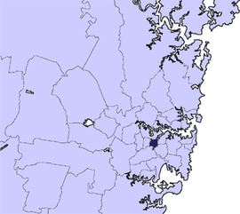
Population: 42,541(2009)[1] • Density: 5012.5/km² (12,982.3/sq mi) Area: 8 km² (3.1 sq mi) Mayor: Lyall Kennedy Council Seat: Ashfield Region: Metropolitan Sydney State District: Balmain, Strathfield, Canterbury Federal Division: Grayndler LGAs around Municipality of Ashfield: City of Canada Bay City of Canada Bay Municipality of Leichhardt Burwood Council Municipality of Ashfield Marrickville Council City of Canterbury City of Canterbury Marrickville Council  New Ashfield Civic Centre
The Municipality of Ashfield is a Local Government Area of Sydney, New South Wales, Australia. It lies approximately 10 kilometres west of the central business district.
Contents
Demographics
According to the Australian Bureau Statistics,[2] there:
- were 40,262 people as at 30 June 2006, the 54th largest Local Government Area in New South Wales. It was equal to 0.6% of the New South Wales population of 6,827,694
- was an increase of 152 people over the year to 30 June 2006, the 74th largest population growth in a Local Government Area in New South Wales. It was equal to 0.3% of the 58,753 increase in the population of New South Wales
- was, in percentage terms, an increase of 0.4% in the number of people over the year to 30 June 2006, the 109th fastest growth in population of a Local Government Area in New South Wales. In New South Wales the population grew by 0.9%
- was a fall in population over the 10 years to 30 June 2006 of 1,496 people or 3.6% (0.4% in annual average terms). In New South Wales the population grew by 622,966 or 10% (1.0% in annual average terms) over the same period.
Suburbs
The municipality comprises:
It also includes parts of:
Council
Ashfield Municipal Council is composed of twelve councillors elected proportionally; the municipality is divided into four wards, each electing three councillors. The mayor is not directly elected.[3] The current makeup of the council is as follows:[3]
Party Councillors Australian Labor Party 4 Independent 3 The Greens 3 Liberal Party of Australia 2 Total 12  The Municipality of Ashfield became a "no war zone" following a 2004 motion.
The current council, elected in 2008, is:[3]
Ward Councillor Party Notes East Ward Caroline Stott Independent Patrick Kelso Greens Alex Lofts Labor North East Ward Ted Cassidy Independent Lyall Kennedy Greens Mayor Lucille McKenna Labor Deputy Mayor North Ward Monica Wangmann Independent Mei Wang Labor Nick Adams Liberal - currently suspended South Ward Mark Drury Labor Marc Rerceretnam Greens Morris Mansour Liberal List of recent Mayors
Mayor Party Term Lyall Kennedy Greens 2011 - [4] Ted Cassidy Independent 2006 - 2011 Rae Desmond Jones Labor 2004 - 2006 Mark Bonanno Labor 1997 - 2004 Vincent Sicari No Aircraft Noise 1996 - 1997 Lew Herman Labor 1995 - 1996 Dr John Ward 1991 - 1995 Lew Herman Labor 1976 - 1991 Paul Whelan Labor 1972 - 1976 Richard Murden Liberal 1967 - 1972 The full list of Mayors going back to 1872 can be found here.
Housing
Housing is characterised equally by a mixture of 'grand Victorian' and Federation-era freestanding homes, and post-war medium-density unit dwellings ('flats' in Australian parlance).[citation needed]
Controversies
Cr Nick Adams has been involved in several controversies. In November 2005, he called for the eradication of pigeons from the municipality as a way of preventing the spread of so-called 'bird flu'. His motion was met with a combination of disbelief, laughter, and subsequent national notoriety. Councillor Marc Rerceretnam was widely quoted in response: "The mind boggles when I think of Ashfield pigeons flying to the border of Ashfield and stopping directly at the border, saying "oh no, that's Canterbury, I can't go into there" and flying back in again. I mean this, this is, what exactly is this motion trying to do?". The motion failed.[5]
In October 2006, Adams was "formally condemned by fellow councillors after racking up thousands of dollars worth of phone calls and Cabcharges for personal benefit."[6] Again in 2006, he denounced multiculturalism on national television only to be condemned by the community and the Ethnic Communities Council of NSW.[7]
In 2007, Adams was widely criticised for attempting to ban power tools from the Municipality.[8]
In late 2009, he was suspended from the Liberal Party for six months after a widely reported appearance on Channel Ten News where he verbally insulted the reporter. Ashfield Council's official investigation into the incident is ongoing.[9][10]
References
- ^ Australian Bureau of Statistics (30 March 2010). "Regional Population Growth, Australia, 2008–09". http://www.abs.gov.au/ausstats/abs@.nsf/Latestproducts/3218.0Main%20Features42008-09?opendocument&tabname=Summary&prodno=3218.0&issue=2008-09&num=&view=. Retrieved 3 June 2010.
- ^ "Regional Population Growth, Australia, 2005-06 (catalogue no.: 3218.0)". Australian Bureau of Statistics. http://abs.gov.au. Retrieved 2007-03-12.
- ^ a b c "Ashfield Municipal Council". 2008 Election results. Electoral Commission NSW. http://www.lg.elections.nsw.gov.au/LGE2008/result.Ashfield.html. Retrieved 2009-06-15.[dead link]
- ^ List of mayors taken from plaques inside Ashfield Council Chambers
- ^ http://www.abc.net.au/cgi-bin/common/printfriendly.pl?http://www.abc.net.au/am/content/2005/s1495770.htm
- ^ http://www.innerwestweekly.com.au/article/2006/10/18/853_news.html
- ^ http://www.eccnsw.org.au/downloads/bulletin/6407.doc.
- ^ http://www.ashfield.nsw.gov.au/files/media/2007archived/Media_Release__24.pdf
- ^ http://inner-west-courier.whereilive.com.au/news/story/ashfield-councillor-nick-adams-suspended-from-liberal-party/
- ^ http://www.altmedia.net.au/liberal-councillor’s-party-membership-suspended/14641
- Australian Bureau of Statistics, POA2131 2131 (Postal Area).
- ABC Online, Transcript of 'AM' program Wednesday, 2 November , 2005 08:24:00
External links
Regions of Sydney Local Government Areas of Sydney Ashfield · Auburn · Bankstown · Blacktown · Botany Bay · Burwood · Camden · Campbelltown · Canada Bay · Canterbury · Fairfield · The Hills · Holroyd · Hornsby · Hunter's Hill · Hurstville · Kogarah · Ku-ring-gai · Lane Cove · Leichhardt · Liverpool · Manly · Marrickville · Mosman · North Sydney · Parramatta · Penrith · Pittwater · Randwick · Rockdale · Ryde · Strathfield · Sutherland · City of Sydney · Warringah · Waverley · Willoughby · WoollahraList of Sydney suburbs Local Government Areas of New South Wales Metropolitan Sydney Inner SydneyAshfield · Botany Bay · Burwood · Canada Bay · Canterbury · Hurstville · Kogarah · Lane Cove · Leichhardt · Manly · Marrickville · Mosman · North Sydney · Randwick · Rockdale · Strathfield · Sydney · Waverley · Willoughby · WoollahraOuter SydneyAuburn · Bankstown · Blacktown · Camden · Campbelltown · Fairfield · The Hills · Holroyd · Hornsby · Hunter's Hill · Ku-ring-gai · Liverpool · Parramatta · Penrith · Pittwater · Ryde · Sutherland · WarringahSydney SurroundsMid North Coast Bellingen · Clarence Valley · Coffs Harbour · Greater Taree · Kempsey · Nambucca · Port Macquarie-Hastings · Lord Howe IslandMurray Murrumbidgee Carrathool · Coolamon · Cootamundra · Griffith · Gundagai · Hay · Junee · Leeton · Lockhart · Murrumbidgee · Narrandera · Temora · Wagga WaggaHunter Cessnock · Dungog · Gloucester · Great Lakes · Lake Macquarie · Maitland · Muswellbrook · Newcastle · Port Stephens · Singleton · Upper HunterIllawarra Richmond Tweed Southeastern Bega · Bombala · Boorowa · Cooma-Monaro · Eurobodalla · Goulburn Mulwaree · Harden · Palerang · Queanbeyan · Snowy River · Tumut · Upper Lachlan · Yass Valley · YoungNorthern Armadale Dumaresq · Glen Innes-Severn · Gunnedah · Guyra · Gwydir · Inverell · Liverpool Plains · Moree Plains · Narrabri · Tamworth · Tenterfield · Uralla · WalchaCentral West North Western Far West Categories:- Local Government Areas in Sydney


Wikimedia Foundation. 2010.