- Tulkarm
-
Tulkarem Other transcription(s) – Arabic طولكرم – Also spelled Tulkarem (official)
Tul Qarem (unofficial)– Hebrew טול כרם 
Municipal Seal of TulkaremLocation of Tulkarem within the Palestinian territories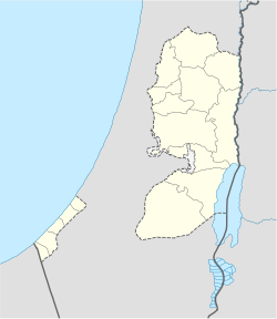
 Tulkarem
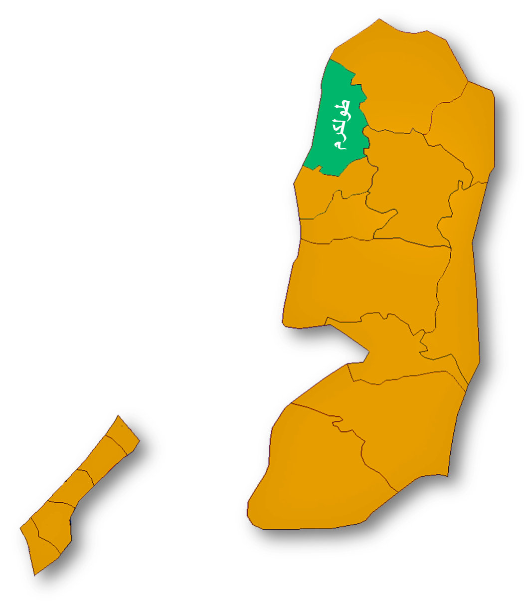
Coordinates: 32°18′41.50″N 35°01′37.34″E / 32.311528°N 35.0270389°ECoordinates: 32°18′41.50″N 35°01′37.34″E / 32.311528°N 35.0270389°E Governorate Tulkarm Founded 3rd Century Government – Type City – Head of Municipality Mahmoud al-Jallad Area – Jurisdiction 28,793 dunams (28.8 km2 / 11.1 sq mi) Population (2006) – Jurisdiction 58,950 (includes refugee camp) Name meaning High mountain vineyards Website www.mtulkarm.com  Al-Adawiah High School
 Paris Street, 2007.
Tulkarem or Tulkarm (Arabic: طولكرم, Ṭūlkarm; Hebrew: טול כרם) is a Palestinian city in the northern Samarian mountain range in the Tulkarm Governorate in the extreme northwestern West Bank adjacent to the Netanya and Haifa districts to the west, the Nablus and Jenin Districts to the east. According to the Palestinian Central Bureau of Statistics, Tulkarem city and the adjacent refugee camp had a population of approximately 58,962 inhabitants at mid-year 2006.[1] Its land area consists of 28,793 dunam with Israeli settlements, Israeli only roads, Israeli factories, and the West Bank Separation Barrier covering about 6,500 dunam of this land area .
Contents
History
Tulkarem was founded and settled by the Canaanites in 3000 BCE. The Romans also established the trading post at the Samaritan village of Berat Soreqa on top of the Samarian mountains.. After the Muslim conquest of Palestine in the 7th century CE, it received its current name "Tulkarem" which means "the bountiful mountain." The Arabic name is derived from the Aramaic words "Toor Karma," meaning "mount of vineyards." The modern locality was established by the Mamluks in the 13th century and it became a strategic center in western Palestine.[2]
In 1596, Tulkarem appeared in Ottoman tax registers as being in the Nahiya of Qaqun of the Liwa of Nablus. Tulkarem later became a caza of Haifa, It had a population of 176 Muslim households and paid taxes on wheat, barley, summercrops, olives, goats or beehives and a press for olives or grapes.[3]
Tulkarem gained more importance when the Ottomans—who ruled the area since 1517—granted the small town the status of a township and gained its own caza in 1886, giving it precedence over the nearby villages, during this time Qalqilya was also part of the district of Tulkarem. In addition, Tulkarem gained an Ottoman governor, bringing the residents who numbered only a few thousand and were mostly fellahin, closer to the government.[4] In 1908, the Ottomans turned Tulkarem into a major rail junction on the Hejaz railway line running up from Egypt and southern Palestine to Haifa and Akka in the northwest, Jerusalem, Nablus and Ramallah to the south, Lebanon to the north, and Syria and Transjordan to the east.[2][4] The local Burqawi family controlled the area around the city in the 19th century.[5] The Ottoman Army used Tulkarem as a one of their main bases during the World War I Sinai and Palestine campaign, but in 1918, the city was captured by British forces.[2]
At the time of the 1931 census, Tulkarm had 804 occupied houses and a population of 4540 Muslims, 1555 Christians, 300 Jews, 100 Samaritans, and 75 Druze. There is still at least one operational church in Tulkarm and it is one of the oldest churches in the world. The census also listed "Tul Karm Suburbs" as having 516 Muslims, 15 Jews and 10 Christians.[6]
Geography
Location
The city is situated on the western part of the northern West bank, on the Mediterranean in the foothills of the Samarian mountains about 15 kilometers (9.3 mi) west of Nablus and Jenin and 15 kilometers (9.3 mi) east of the Israeli coastal towns of Netanya and Haifa. It is bordered by the 1948 cease-fire line, the Center, and Haifa Districts in the west, Qalqiliya and Ramle Districts to the south.. Its central location between a plain and a mountain has made it commercially and strategically significant and has had a great effect on its growth. In the past, Tulkarem was a caravan station and a trading center for products from the city's surrounding villages and farms, as well as a point from which armies crossed to Egypt and the Levant (al-Sham).
Tulkarem is at the crossroads of three historically important arteries: A road which runs north from the Latrun area along the edge of the plain to Mount Carmel, Mount Tabor, Mount Gilboa Nazareth and the Galilee and the Golan Heights, a road which winds northward along the outer tier of hills from the Ajalon valley to the Jezreel Valley, and a road that rises from the Mediterranean Sea at modern-day Netanya east to Nablus. In the past it was a junction of the coastal railroad from north of Haifa to Cairo and a branch of the narrow gauge Hejaz railway to Damascus.
Archaeological findings reveal that an agglomeration has existed here at least since the Roman Period. In the past, Tulkarem has assumed the form of a small village, but it has expanded since the beginning of the 20th century due to an increase in the traffic passing through. This development came to a halt in the 1930s with the construction of the Petah Tikva-Hadera highway, which bypasses the town in the west. Despite the fact that the Israel-Jordan armistice border of 1949 encircled Tulkarem in the southwest, west and north-west, the city's population has increased considerably and it has become an administrative and agricultural center. The town has an agricultural school that was established during the British Mandate period with a monetary contribution by the philanthropist J.S. Kadoorie. In modern times, the school is recognized as a prominent community college in agriculture and teacher training.
Land use
Tulkarem was built on the foothills of the Samarian mountain range over a higher area than that surrounding it. The land which was formed as a result of the new fourth epoch consists mostly of creeping sands from the west to the east. The mountainous valleys carry quantities of alluvium and gravel to Tulkarem's lands in seasons of heavy rain and floods, thus creating fertile soil. In addition, an aquifer feeds numerous wells and springs in the area. Due to Tulkarm's proximity to the Mediterranean sea, palm trees are also very common. Tulkarem's arable land allows the city inhabitants to produce citrus fruits, melons, olives, olive oil, tomatoes, potatoes, wheat, sesame, peanut, eggplant, peppers, green beans, guava, and other products. Land designations in the West Bank are defined by the recent "Oslo II" interim agreement, where Tulkarem proper is located in Area A, or under full Palestinian control, however the Tulkarm Governateis highly fragmented due to Israeli checkpoints and road blocks. The area around Tulkarm however has numerous Israeli settlements such as the Shomron regional council and Hermesh, Tulkarm also has many Israeli Factories in and around the city, including area A since 1984, these pose a great health hazard to the local Palestinian population.
Climate
The climate of Tulkarm is Mediterranean and subtropical as the area surrounding it, with rainfall limited to the winter. The average temperature in the winter ranges from 8 to 16 °C (46 to 61 °F), while the average temperature in the summer ranges from 17 to 30 °C (63 to 86 °F). Tulkarem is distinguished by the moderating effect the sea breeze has on its climate because of its location on the Samarian mountains.. The average temperature doesn’t exceed 27 °C (81 °F) in August, while February's average temperature doesn’t fall below 13.5 °C (56 °F). Humidity is moderate in summer, about 40-70%, though it rises in winter to between 70-85%. Tulkarem receives in excess of 550 millimeters (22 in) of rain yearly, which is dispersed and intermittent, characteristic of the Mediterranean Basin.
Climate data for Tulkarm Month Jan Feb Mar Apr May Jun Jul Aug Sep Oct Nov Dec Year Average high °C (°F) 17.0
(62.6)17.5
(63.5)19.6
(67.3)23.9
(75.0)24.2
(75.6)28.3
(82.9)29.0
(84.2)30.0
(86.0)27.9
(82.2)26.0
(78.8)23.0
(73.4)19.2
(66.6)22.76 Average low °C (°F) 8.9
(48.0)8.7
(47.7)10.5
(50.9)13.6
(56.5)17.2
(63.0)20.6
(69.1)23.0
(73.4)23.6
(74.5)20.7
(69.3)18.5
(65.3)14.1
(57.4)10.9
(51.6)15.54 Precipitation mm (inches) 124.9
(4.917)92.2
(3.63)52.8
(2.079)23.6
(0.929)2.7
(0.106)2.8
(0.11)2.2
(0.087)0.7
(0.028)1.2
(0.047)28.0
(1.102)77.4
(3.047)135.5
(5.335)538.3
(21.193)Avg. precipitation days 13.9 11.7 8.6 3.6 1.4 3.2 2.0 0.7 0.8 3.9 8.0 11.8 63.7 Source: Israel Meteorological Service[7] Precipitation
The rainy season in the Tulkarem Governorate usually starts in October and continues through May. Between December and February, almost 70% of annual rainfall occurs, while 20% of annual rainfall occurs in October and November. Rain in June and September is rare and comes to negligible amounts. July and August have no rain at all, except for one rainfall of 1.5 millimeters (0.059 in) on July 10, 1995 in Tulkarem City (Tulkarm Agricultural Department). The mean annual rainfall in the city of Tulkarem is 642 millimeters (25.3 in) for the period from 1952 to 1995 (Tulkarem Agricultural Department).
Culture
The traditional costumes of women from Tulkarem were plain, dark-colored gowns with or without embroidery as most rural women from the north of Palestine.[8] Today, embroidery is the main source of income for the women of the city. The most popular embroidered images are maps of historic Palestine. Musakhan, the national dish of the Palestinian people originated in Tulkarem and the surrounding area. It roughly consists of taboon bread garnished with sumac and onions. Tulkarm shares many of its features including its dialect, which is very similar in most aspects to the Syrian dialect as Palestine was for a long period of time a integral part of Greater Syria. Tulkarm shares many of its cultural features with neighboring Haifa, Jenin, Nablus, Qalqilia, and Jaffa[2] Swimming for children has always been a significant pastime of the Tulkarm area because it had a significant port and a large beach on the shores of the Mediterranean sea which are now Netanya and Ceaserea.
Transportation
Roads
Roads in this district are classified into three categories, the first type is the solid surfaced roads with two lanes which connect Tulkarem and Qalqilya cities with other districts. The second one is the one-lane solid surfaced roads which connect most of the rural communities. The third type is the unpaved roads in the rural areas. In Tulkarm as in most of the west bank there are many kilometers of Israeli Only roads, that are newer, better built, and safer but the Palestinians are barred from using these Israeli only roads. It should be mentioned here that most of the Palestinian Only roads in the Tulkarem district lack the basic safety requirements.
Public transportation services
Transportation services available in the Tulkarem district comprise public buses both Egged Buses and Servees, taxis, and private vehicles. However, due to insufficiency of organized public transportation system, a high percentage of private vehicles are used by their owners to transport passengers between communities. This kind of transportation is considered dangerous due to lack of safety requirements and because drivers operating these vehicles are not qualified to work in public transportation. Added to this is the lack of insurance and licensing in most of these cars, which makes such transportation risky.
Communications
Nearly 21% of the population in the Tulkarem district have access to a limited number of lever-turned telephones in rural areas and 27% of the population have access to automatic switchboards.
Education
There is a two-year and a four-year college at Tulkarem called the Khodori Institute and Khodori University, Al-Quds Open University, and two colleges for An-Najah National University. There are four high schools—two for girls (Al'adawiyya and Jamal Abd-Al-Naser) and two for boys (Alfadeleyya and Ihsan Samarah). There is also the renowned Birzeit university near Ramallah and the University Of Haifa in Haifa and the Carmel.
Sports
Tulkarem has 2 semi-professional soccer teams; Thaqafi Tulkarem and Markez Shabab Tulkarem. Both are in the Palestinian League Division One and both are usually at or near the top of the standings.
People from Tulkarem
- Ekrem Akurgal, Turkish archaeologist born in 1911 in Tulkarem
- Khaled Abu Toameh, Palestinian Israeli-Arab Muslim journalist
- Shakeeb Dallal
- Rashad Qasas, Revered accountant
- Hasan Karmi
- Queen Rania of Jordan (born in Kuwait to parents from Tulkarem, family lives in Thnabeh Area in Tulkarem)
References
- ^ Projected Mid -Year Population for Tulkarm Governorate by Locality 2004- 2006 Palestinian Central Bureau of Statistics.
- ^ a b c d Semplici, Andrea and Boccia, Mario. Tulkarm: The Bountiful Mountain. Med Corporation. pp.3-8.
- ^ Wolf-Dieter Hütteroth and Kamal Abdulfattah (1977). Historical Geography of Palestine, Transjordan and Southern Syria in the Late 16th Century. Erlanger Geographische Arbeiten, Sonderband 5. Erlangen, Germany: Vorstand der Fränkischen Geographischen Gesellschaft. p. 137.
- ^ a b Karmi, 2004, p. 20.
- ^ Doumani, 1995, p.54.
- ^ E. Mills, ed (1932). Census of Palestine 1931. Population of Villages, Towns and Administrative Areas. Jerusalem: Government of Palestine. p. 58.
- ^ "Averages and Records for Tel Aviv (Precipitation, Temperature and Records [Excluding February and May written in the page)"]. Israel Meteorological Service. http://ims.gov.il/IMS/CLIMATE/LongTermInfo.
- ^ Karmi, 2004, p.22.
Bibliography
- Doumani, Beshara (1995). Rediscovering Palestine, Merchants and Peasants in Jabal Nablus, 1700-1900. University of California Press. http://content.cdlib.org/xtf/view?docId=ft896nb5pc&chunk.id=s2.1.3&toc.depth=1&toc.id=s1.1.6&brand=eschol
- Karmi, Ghada (2004). In Search of Fatima: A Palestinian Story. Verso. ISBN 9781859845615. http://books.google.com/?id=rrCZh9rLXaMC&pg=PA19&dq=Tulkarm+Ottoman
Palestinian refugee camps1 locations and populations as of 2005  Gaza Strip
986,034 refugees Jordan
2,127,877 refugees Lebanon
404,170 refugees Syria
Syria
432,048 refugees West Bank
699,817 refugeesAl-Shati (Beach) 76,109 Bureij 30,059 Deir al-Balah 20,188 Jabalya 175,646 Khan Yunis 60,662 Maghazi 22,536 Nuseirat 64,233 Rafah 90,638 Canada Camp disbanded Beddawi 15,695 Burj el-Barajneh 19,526 Burj el-Shemali 18,134 Dbayeh 4,223 Dikwaneh destroyed Ein el-Hilweh 44,133 El-Buss 9,840 Jisr el-Basha destroyed Mar Elias 1,406 Mieh Mieh 5,078 Nabatieh destroyed Nahr el-Bared 28,358 Rashidieh 24,679 Sabra Shatila 11,998 Tel al-Zaatar destroyed Wavel 7,357 Abu Dis Aida 3,260 Am'ari 8,083 Aqabat Jabr 5,197 al-'Arrub 9,180 Askar 31,894 'Azza 1,828 Balata 41,681 Deir Ammar 2,189 Dheisheh 10,923 Ein Beit al-Ma' 6,221 Ein as-Sultan 1,888 Far'a 12,836 Fawwar 7,072 Jalazone 9,284 Jenin 35,050 Kalandia 9,188 Nur Shams 8,179 Shuafat (Shu'fat) 9,567 Tulkarm 17,259 1 The UNRWA definition of a "Palestinian refugee" is a person "whose normal place of residence was Palestine between June 1946 and May 1948, who lost both their homes and means of livelihood as a result of the 1948 Arab-Israeli conflict ... UNRWA's definition of a refugee also covers the descendants of persons who became refugees in 1948." [1]Cities Tulkarm

Municipalities Anabta · Attil · Bal'a · Baqa ash-Sharqiyya · Beit Lid · Deir al-Ghusun · Dhinnaba · 'Illar · Kafr al-Labad · Qaffin · ZeitaVillages Far'un · Iktaba · Izbat Shufa · Al Jarushiya · Kafr Abbush · Kafr Jammal · Kafr Rumman · Kafr Sur · Kafr Zibad · Khureish · Kur · an-Nazla al-Gharbiya · an-Nazla ash-Sharqiya · an-Nazla al-Wusta · Nazlat Abu Nar · Nazlat 'Isa · Raml Zeita · Ramin · al-Ras · Saffarin · Seida · ShufaRefugee camps Nur Shams · Tulkarm camp Cities in Palestinian National Authority areasWest Bank Gaza Strip Categories:- Tulkarm Governorate
- Populated places established in the 3rd century
- Cities in the West Bank
- Tulkarm


Wikimedia Foundation. 2010.