- Hadera
-
Hadera Hebrew transcription(s) - Hebrew חֲדֵרָה - ISO 259 Ḥdera Arabic transcription(s) - Arabic الخضيرة 

Logo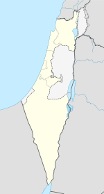
 Hadera
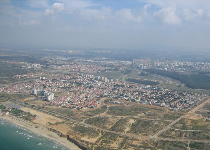
Coordinates: 32°27′N 34°55′E / 32.45°N 34.917°ECoordinates: 32°27′N 34°55′E / 32.45°N 34.917°E District Haifa Founded 1890 Government - Type City (from 1952) - Mayor Chaim Avitan Area - Total 53,000 dunams (53 km2 / 20.5 sq mi) Population (2009)[1] - Total 80,200 Name meaning Green (in Arabic) Website www.hadera.muni.il Hadera (Hebrew: חֲדֵרָה, Ḥadera; Arabic: الخضيرة, Al-Ḫuḍayraḧ) is a city located in the Haifa District of Israel approximately 45 kilometers (28.0 mi) from the major cities of Tel Aviv and Haifa. The city is located along 7 kilometers (4 mi) of the Israeli Mediterranean Coastal Plain. The city has a population of 80,200 which includes a high proportion of immigrants since 1990, notably from Ethiopia and the Soviet Union.[1]
Hadera was established in 1891 as a farming colony by members of the Zionist group, Hovevei Zion, from Lithuania and Latvia. By 1948, it was a regional center with a population of 11,800. It was declared a city in 1952. With an area of jurisdiction of 53,000 dunams.[2]
Several projects are under way to improve the quality of life in Hadera, including regenerating the city center, constructing a hi-tech business park, and building the world's largest desalination plant.[2]
Contents
History
Early years
Hadera was founded in 1891, in the early days modern Zionism by Eastern European immigrants from Lithuania and Latvia on land purchased by Yehoshua Hankin, known as the Redeemer of the Valley.[2][3] The land was purchased from Christian effendi Selim Khuri. This was the largest purchase of land in Palestine by a Zionist group, although the land was of low quality and mostly swampland. The only inhabitants prior to the purchase were a few families raising water buffaloes and selling reeds.[4] The town may derive its name from the Arabic word khadra, meaning "green" in reference to the wild weeds which covered the marshes on which the town is built.[3]
The first settlers lived in a house known as the Khan near Hadera's main synagogue.[5] Initially, Hadera was a lonely outpost of 10 families and 4 guards. In its early years, however, the town had issues with land ownership having drained the swamps with the aid of Egyptian workers sent to them by Baron Edmond de Rothschild.[6]
Old tombstones in the local cemetery reveal that out of a population of 540, 210 died of malaria.[7] Relations between the residents of Hadera and Bedouins were poor and guarding of the field was designated to the HaShomer organisation. By the early twentieth century, the town had become a regional economic center.[2] Land disputes in the area were resolved by the 1930s, by which time, the population had grown to 2,002 in 1931.[3][4] Free schooling was introduced in the city in 1937 in all schools apart from the Histadrut school.[8]
After 1948
 Hadera's Great Synagogue
Hadera's population began to grow dramatically after Israeli independence in 1948 as immigrants flocked to the country. Included in the immigrants to the city were not only Russian and other European immigrants but also 40 Yemenite families.[7] In 1964, Hadera was declared a city,[2] and in 1953, Israel's first paper mill opened in the city. Sponsored by investors from within Israel as well as from the United States, Brazil, and Australia, the mill was designed to meet all of Israel's paper needs.[9] It was also at this time that the Givat Olga neighborhood was constructed on the coast, and Beit Eliezer in the east of the city.[2]
From the 1990s
The city grew dramatically during the 1990s as it absorbed large numbers of Russian and Ethiopian immigrants.[2][3] Hadera, considered a safe place by its inhabitants, was jolted by several acts of terrorism, including a suicide bomber who blew himself up at a falafel stand on October 26, 2005, killing five civilians.[10] However, since the construction of the nearby West Bank barrier, the frequency of such incidents has dropped drastically. On August 4, 2006, three rockets fired by Hezbollah hit Hadera. Hadera is 50 miles (80 km) south of the Lebanese border and marked the farthest point inside Israel hit by Hezbollah.[11]
Geography
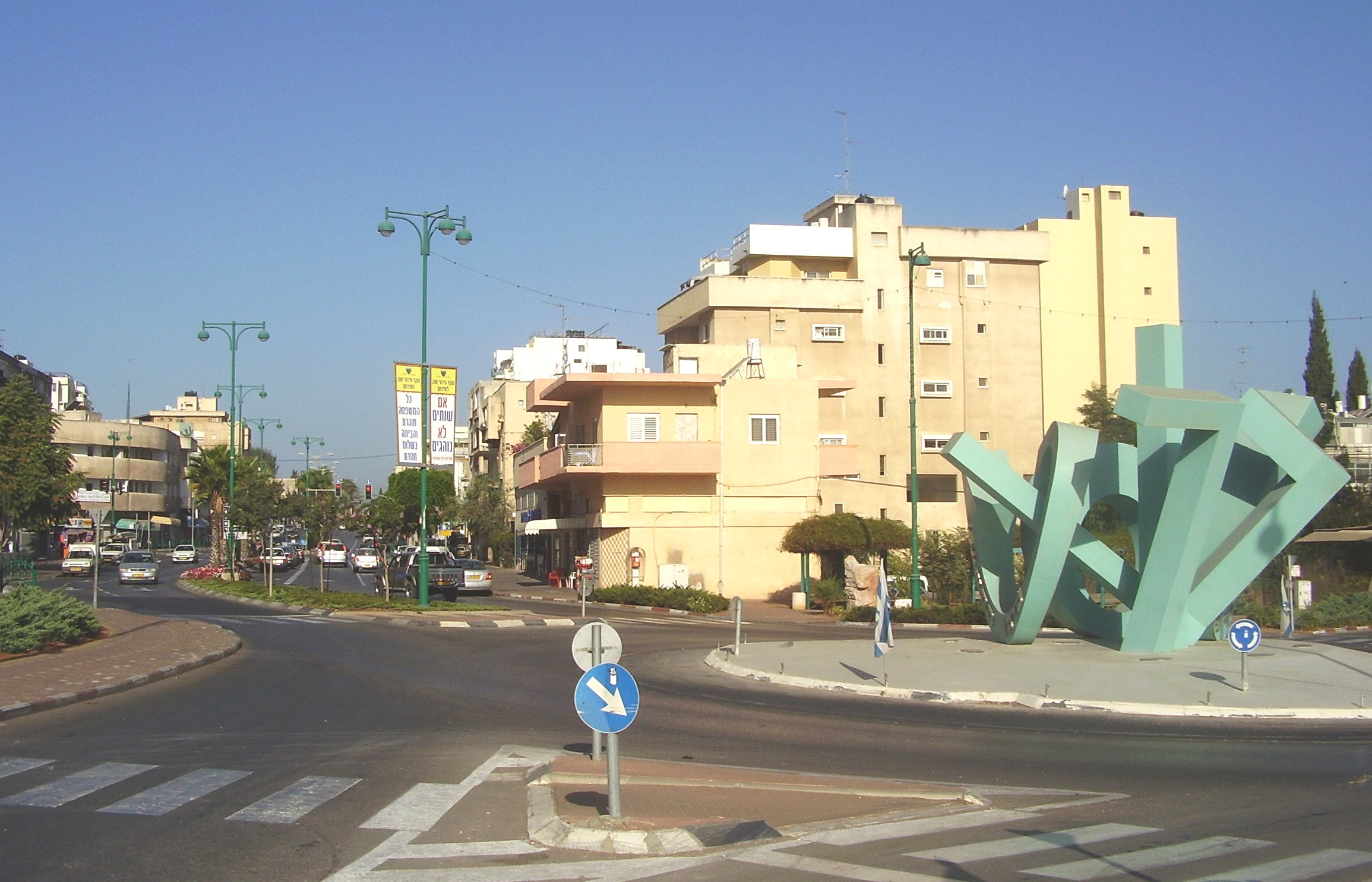
 Tisha circle and HaNasi Weizman Street
Hadera is located on the Israeli Mediterranean coastal plain, 45 kilometers north of Tel Aviv.[12] The city's jurisdiction covers 53,000 dunams (53.0 km2; 20.5 sq mi), making it the fourth largest city in the country. Nahal Hadera Park, a eucalyptus forest covering 1,300 dunams (1.3 km2; 0.5 sq mi) and Hasharon Park are located on the outskirts of Hadera.[2]
Transportation
Hadera lies along two main Israel Railways lines: the Coastal Line and the freight-only Eastern Line. The city's railway station is located in the west of the city and is on the Tel Aviv suburban line which runs between Binyamina and Ashkelon. The city center of Hadera is located near Israel's two main north-south highways; Highway 2, linking Tel Aviv to Haifa, and Highway 4.[2] This made Hadera an important junction for all coastal bus transportation after 1948 and into the 1950s.
Economy
 Orot Rabin chimneys
Hadera's importance as an economic center was first recognised when Israel's first paper mill was opened here in 1953. Hadera Paper continues to be a large employer in the city. In December 2009 the world's largest desalination plant of its type,[13] located within the municipal borders, was inaugurated.[2] Hadera is the location of the Orot Rabin Power Plant, Israel's largest power station.[14]
Demographics
According to the Israel Central Bureau of Statistics, as of December 2007, Hadera had a population of 77,100 which is growing at an annual rate of 1.2%.[1] As of 2003, the city had a population density of 1,516.6 per km2.[15] Of the city's population of 2003 of 74,900, approximately 22,400 were immigrants, many from Ethiopia.[15]
Hadera has grown steadily since 1948, when the city had a population of 11,800. In 1955, the population almost doubled to 22,500. In 1961 it rose to 25,600, 1972 to 32,200, and 1983, to 38,700.[15]
The median age in Hadera is 32.8, with 23,200 people 19 years of age or younger, 12.1% between 20 and 29, 14,100 between 30 and 44, 17,600 from 45 to 64, and 9,700, 65 or older.[16] As of 2007, there were 37,500 males and 39,200 females.[16]
In 2001, the ethnic makeup was 99.2% Jewish and other non-Arab, with no significant Arab population. In 2000, there were 27,920 salaried workers and 1,819 self-employed. The mean monthly wage in 2000 for a salaried worker was ILS 5,135, a real change of 8.0% over the course of 2000. Salaried males had a mean monthly wage of ILS 6,607 (a real change of 9.0%) compared with ILS 3,598 for females (a real change of 3.1%). The mean income for the self-employed was 6,584. A total of 1,752 people received unemployment benefits and 6,753 received income supplements.
Education
In 2001, there were 15,622 students studying at 42 schools (24 elementary schools with 7,933 students, and 21 high schools with 7,689 students). A total of 57.5% of 12th graders were entitled to a matriculation certificate.
The Democratic School of Hadera, which opened in 1987, was the first of its kind in Israel. The Technoda, an educational center for science and technology equipped with a state-of-the-art telescope and planetarium, is located in Hadera's Givat Olga neighborhood.[17]
Medical facilities
 The Hillel Yaffe Medical Center
Hadera is served by the Hillel Yaffe Medical Center.
Neighborhoods
- Kfar Brandeis
- Givat Olga[18]
- Beit Eliezer
- Haotzhar
- Hephzibah
- Neve Haim
- Nissan
- Bilu
- Nahaliel
International relations
Notable residents
- Sarit Hadad, singer
- Alon Stein, basketball player
Twin towns — Sister cities
Hadera is twinned with:
 Charlotte, North Carolina in the United States[19] since 2008
 Haren (Groningen) in the Netherlands
 Nuremberg in Germany since 1995
- Saint Paul, Minnesota in the United States since 1981
- Jacksonville, Florida in the United States
- Big Spring, Texas in the United States
 Rizhao in the People's Republic of China
 Derbent, Russia
See also
- Hadera Central Bus Station
References
- ^ a b c "Table 3 - Population of Localities Numbering Above 2,000 Residents". Israel Central Bureau of Statistics. 2010-06-30. http://www.cbs.gov.il/population/new_2010/table3.pdf. Retrieved 2010-10-30.
- ^ a b c d e f g h i j "New Urbanism, Israeli Style". Haaretz. http://www.haaretz.com/hasen/spages/1041619.html. Retrieved 2008-11-28.
- ^ a b c d "Hadera". Jewish Virtual Library. http://www.jewishvirtuallibrary.org/jsource/Society_&_Culture/geo/Hadera.html. Retrieved 2008-10-25.
- ^ a b Avneri, Aryeh L. (1984). The Claim of Dispossession: Jewish Land-Settlement and the Arabs, 1878-1948. Transaction Publishers. p. 93. ISBN 0878559647. http://books.google.com/books?id=ud1xBeZZRDsC&pg=PA94&dq=hadera&as_brr=3&ei=JzvmR_7ZJ42kzgSW38GbAQ&sig=fhCGE6vGEXSfIzbu15DW7F94Vc4#PPA93,M1. Retrieved 2008-10-25.
- ^ Jacobs, Daniel; Eber, Shirley; Silvani, Fransesca (1998). Israel and the Palestinian Territories: The Rough Guide. Rough Guides. ISBN 1858282489. http://books.google.com/books?id=JXoY2vCZ5AEC&pg=RA1-PA60&dq=hadera&as_brr=3&ei=JzvmR_7ZJ42kzgSW38GbAQ&sig=sGnvRkHdn6rmurrAAhBo_f75nls. Retrieved 2008-10-25.
- ^ Gilbert, Martin (1998). Israel, a History. Morrow. p. 9. ISBN 0688123627.
- ^ a b Winter, Dave (1999). Israel Handbook. Footprint Travel Guides. p. 532. ISBN 1900949482. http://books.google.com/books?id=nVpg7eE2wFYC&pg=PA532&dq=hadera&as_brr=3&ei=JzvmR_7ZJ42kzgSW38GbAQ&sig=x2OPL2cNfjbQqLS7IGD8nAQrnV0#PPA532,M1. Retrieved 2008-10-25.
- ^ Sternhell, Zeev (1999). The Founding Myths of Israel: Nationalism, Socialism, and the Making of the Jewish State. Princeton University Press. p. 255. ISBN 0691009678. http://books.google.com/books?id=itu-vLpwDS0C&pg=PA255&dq=hadera&lr=&as_brr=3&ei=nD7mR9WWHpG0yQSY9InCAg&sig=1upwsgcu9pU_pDwLN9e3M_u5t0Y. Retrieved 2008-10-25.
- ^ "First Paper Mill Opened in Israel; Plant at Hadera is Expected to Help Nation Cut Currency Gap $1,000,000 a Year". New York Times. 1953-12-18. http://select.nytimes.com/gst/abstract.html?res=F00C13FB3B55107B93CAA81789D95F478585F9. Retrieved 2008-10-25.
- ^ "Five die in Israel market bombing". BBC News. 2005-10-27. http://news.bbc.co.uk/1/hi/world/middle_east/4379052.stm. Retrieved 2010-01-05.
- ^ "For first time: Hizbullah targets Hadera area". 2006-08-04. http://www.ynetnews.com/articles/0,7340,L-3286401,00.html. Retrieved 2008-11-30.
- ^ Telfed takes on next target: Hadera
- ^ Rinat, Zafrir (2008-04-02). "Where will the water go? - Haaretz Daily Newspaper | Israel News". Haaretz.com. http://www.haaretz.com/hasen/pages/ShArtVty.jhtml?sw=hadera&itemNo=1137030. Retrieved 2011-09-16.
- ^ Paz, Shelly (2007-03-01). "Greenpeace protests at Hadera power plant | Israel | Jerusalem Post". Jpost.com. http://fr.jpost.com/servlet/Satellite?cid=1171894543384&pagename=JPost/JPArticle/ShowFull. Retrieved 2009-05-05.
- ^ a b c "Population and Density per Km² in Localities Numbering Above 5,000 Residents". 55th Statistical Yearbook. Israel Central Bureau of Statistics. 2003. http://www1.cbs.gov.il/shnaton55/st02_14.pdf. Retrieved 2008-03-15.
- ^ a b "Statistical Abstract of Israel 2008". Israel Central Bureau of Statistics. http://www1.cbs.gov.il/reader/shnaton/templ_shnaton_e.html?num_tab=st02_11x&CYear=2007. Retrieved 2008-11-29.
- ^ for the Stars
- ^ On Olga Hankin, for whom Givat Olga was named
- ^ "Charlotte Sister Cities Worldwide - Hadera". http://www.charlottesistercities.org/Default.aspx?tabid=218. Retrieved 2008-11-30.
External links
- Official website (Hebrew)
Haifa District Cities Baqa-Jatt · Hadera · Haifa · Kiryat Ata · Kiryat Bialik · Kiryat Motzkin · Kiryat Yam · Nesher · Or Akiva · Tirat Carmel · Umm al-Fahm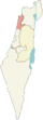
Local councils Ar'ara · Basma · Binyamina-Giv'at Ada · Daliyat al-Karmel · Fureidis · Isfiya · Jisr az-Zarqa · Kafr Qara · Katzir-Harish · Kiryat Tiv'on · Ma'ale Iron · Pardes Hanna-Karkur · Rekhasim · Zikhron Ya'akovRegional councils See also Haifa metropolitan area · KrayotOther sub-divisions: Center District · Jerusalem District · Judea and Samaria Area · North District · South District · Tel Aviv DistrictIsraeli cities with a 50,000+ population 500,000+ 200,000 – 499,999 100,000 – 199,999 50,000 – 99,999 Herzliya • Kfar Saba • Ra'anana • Hadera • Beit Shemesh • Modi'in-Maccabim-Re'ut • Lod • Nazareth • Ramla • Giv'atayim • Rahat • Nahariya • Kiryat AtaCategories:- Haifa District
- Hadera
- Historic Jewish communities
- Sharon plain


Wikimedia Foundation. 2010.