- National Register of Historic Places listings in Somerset County, Maine
-
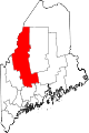
 Location of Somerset County in Maine
This is a list of the National Register of Historic Places listings in Somerset County, Maine.
This is intended to be a complete list of the properties and districts on the National Register of Historic Places in Somerset County, Maine, United States. Latitude and longitude coordinates are provided for many National Register properties and districts; these locations may be seen together in a Google map.[1]
There are 57 properties and districts listed on the National Register in the county, including 1 National Historic Landmark.
-
- This National Park Service list is complete through NPS recent listings posted November 10, 2011.[2]
Contents: Counties in Maine Androscoggin - Aroostook - Cumberland - Franklin - Hancock - Kennebec - Knox - Lincoln - Oxford - Penobscot - Piscataquis - Sagadahoc - Somerset - Waldo - Washington - York Current listings
[3] Landmark name [4] Image Date listed Location City or town Summary 1 Anson Grange No. 88 April 28, 2004 10 Elm St.
44°51′16″N 69°53′55″W / 44.854444°N 69.898611°WNorth Anson 2 Arnold Trail to Quebec October 1, 1969 Along the Kennebec River, through Wayman and Flagstaff lakes along the Dead River and Chain of Ponds to Quebec, Canada
44°40′49″N 69°59′18″W / 44.680278°N 69.988333°WBingham Extends through Franklin, Kennebec, Sagadahoc, and Somerset counties 3 Bailey Farm Windmill June 28, 1988 State Route 16
44°51′45″N 69°55′49″W / 44.8625°N 69.930278°WNorth Anson 4 Asa Bates Memorial Chapel October 31, 2002 2 Ten Lots Rd.
44°35′29″N 69°41′51″W / 44.591389°N 69.6975°WFairfield Center 5 Bigelow-Page House April 20, 1988 20 High St.
44°46′10″N 69°43′13″W / 44.769444°N 69.720278°WSkowhegan 6 Bingham Free Meetinghouse June 3, 1976 S. Main St. (U.S. Route 201)
45°03′08″N 69°52′58″W / 45.052222°N 69.882778°WBingham 7 Birch Island House March 7, 1996 Birch Island
45°35′15″N 70°25′36″W / 45.5875°N 70.426667°WHoleb 8 Bloomfield Academy February 19, 1982 Main St.
44°45′37″N 69°43′04″W / 44.760278°N 69.717778°WSkowhegan 9 Caratunk Falls Archeological District May 30, 1986 Address Restricted Solon 10 Carrabasset Inn April 14, 2000 Junction of Union St. and State Route 8
44°51′10″N 69°53′44″W / 44.852778°N 69.895556°WNorth Anson 11 Gov. Abner Coburn House July 30, 1974 Main St.
44°45′43″N 69°43′00″W / 44.761944°N 69.716667°WSkowhegan 12 Concord Haven October 2, 1992 Eastern side of State Route 16, 1.7 miles north of its junction with Berry Rd.
44°58′34″N 69°52′42″W / 44.976111°N 69.878333°WEmbden 13 Connor-Bovie House January 18, 1974 22 Summit Street
44°35′14″N 69°36′03″W / 44.587222°N 69.600833°WFairfield 14 Cotton-Smith House June 18, 1992 42 High St.
44°35′11″N 69°36′02″W / 44.586389°N 69.600556°WFairfield 15 C. F. Douglas House December 18, 1978 State Route 8
44°42′46″N 69°47′44″W / 44.712778°N 69.795556°WNorridgewock 16 Dudley's Corner School House July 15, 2002 5 Dudley Corner Rd.
44°21′58″N 70°27′40″W / 44.366111°N 70.461111°WSkowhegan 17 Eaton School 
June 23, 1988 Junction of Main St. and Mercer Rd.
44°42′48″N 69°47′55″W / 44.713333°N 69.798611°WNorridgewock 18 Embden Town House October 16, 1989 Cross Town Rd.
44°54′42″N 69°55′57″W / 44.911667°N 69.9325°WEmbden 19 The Evegreens February 8, 1982 Address unknown[5] Solon 20 First Baptist Church, Former June 21, 1991 Western side of Main St., south of State Route 104
44°45′37″N 69°43′03″W / 44.760278°N 69.7175°WSkowhegan 21 Founders Hall October 9, 1979 S. Main St.
44°46′46″N 69°23′14″W / 44.779444°N 69.387222°WPittsfield 22 Amos Gerald House June 24, 1980 107 Main St.
44°35′05″N 69°35′54″W / 44.584722°N 69.598333°WFairfield 23 Gould House February 19, 1982 31 Elm St.
44°46′01″N 69°43′23″W / 44.766944°N 69.723056°WSkowhegan 24 Hinckley Good Will Home Historic District January 9, 1987 U.S. Route 201
44°40′05″N 69°37′59″W / 44.668056°N 69.633056°WHinckley 25 History House December 29, 1983 40 Elm St.
44°45′56″N 69°43′32″W / 44.765556°N 69.725556°WSkowhegan 26 Hodgdon Site April 23, 1980 Address Restricted Embden 27 Samuel Holden House December 14, 1995 Eastern side of U.S. Route 201, 0.25 miles north of its junction with an MDOT road
45°39′04″N 70°15′54″W / 45.651111°N 70.265°WMoose River 28 Ingalls House June 5, 1975 Off U.S. Route 2
44°40′39″N 69°56′18″W / 44.6775°N 69.938333°WMercer 29 Kromberg Barn January 22, 2009 Eastern side of E. Pond Rd., across from 462 E. Pond Rd.
44°37′08″N 69°46′10″W / 44.619°N 69.76937°WSmithfield 30 Lakewood Theater June 18, 1975 On the banks of Lake Wesserunsett
44°49′53″N 69°46′38″W / 44.831389°N 69.777222°WMadison 31 Lawrence Library December 31, 1974 Fairfield off U.S. Route 201
44°35′16″N 69°36′10″W / 44.587778°N 69.602778°WFairfield 32 Madison Public Library 
January 5, 1989 Old Point Ave.
44°47′46″N 69°52′48″W / 44.796111°N 69.88°WMadison 33 Sophie May House October 8, 1976 Sophie May Lane
44°43′04″N 69°48′03″W / 44.717778°N 69.800833°WNorridgewock 34 Mercer Union Meetinghouse January 9, 2007 Main St., 1/10 mile west of its junction with U.S. Route 2
44°40′37″N 69°55′54″W / 44.676944°N 69.931667°WMercer 35 Moose River Congregational Church October 8, 1998 Junction of U.S. Route 201 and Nichols Rd.
45°38′24″N 70°15′43″W / 45.64°N 70.261944°WJackman 36 New Portland Wire Bridge 
January 12, 1970 Wire Bridge Rd. over the Carrabassett River
44°53′27″N 70°05′37″W / 44.890833°N 70.093611°WNew Portland 37 Norridgewock Archeological District 
April 12, 1993 Address Restricted Madison and Starks 38 Norridgewock Female Academy March 7, 1996 Northern side of U.S. Route 2, 0.05 miles west of its junction with State Route 8
44°42′48″N 69°47′56″W / 44.713333°N 69.798889°WNorridgewock 39 Norridgewock Free Public Library February 4, 1982 Sophie May Lane
44°43′04″N 69°47′56″W / 44.717778°N 69.798889°WNorridgewock 40 Old Point and Sebastian Rale Monument April 2, 1973 South of Madison off Alternate U.S. Route 201
44°46′08″N 69°53′17″W / 44.768889°N 69.888056°WMadison 41 Pittsfield Public Library January 4, 1983 Main St.
44°46′55″N 69°26′50″W / 44.781944°N 69.447222°WPittsfield 42 Pittsfield Railroad Station January 23, 1980 Central St.
44°46′57″N 69°23′02″W / 44.7825°N 69.383889°WPittsfield 43 Pittsfield Universalist Church July 14, 1983 N. Main and Easy Sts.
44°47′03″N 69°22′55″W / 44.784167°N 69.381944°WPittsfield 44 Pittston Farm July 10, 2000 Western end of Seboomook Lake at its confluence with the south branch of the Penobscot River
45°53′39″N 69°57′47″W / 45.894167°N 69.963056°WPittston Academy Grant 45 Quincy Building October 4, 1978 South of Hinckley
44°39′45″N 69°37′40″W / 44.6625°N 69.627778°WHinckley 46 Skowhegan Fire Station October 20, 1983 Island Ave.
44°45′50″N 69°43′09″W / 44.763889°N 69.719167°WSkowhegan 47 Skowhegan Free Public Library April 14, 1983 Elm St.
44°45′58″N 69°43′15″W / 44.766111°N 69.720833°WSkowhegan 48 Skowhegan Historic District February 19, 1982 Madison Ave., Water St. and Russell St.
44°45′57″N 69°43′05″W / 44.765833°N 69.718056°WSkowhegan 49 Somerset Academy July 19, 1984 Academy St.
44°55′36″N 69°40′34″W / 44.926667°N 69.676111°WAthens 50 Somerset County Courthouse November 8, 1984 Court St.
44°45′59″N 69°43′10″W / 44.766389°N 69.719444°WSkowhegan 51 South Solon Meetinghouse June 16, 1980 5 miles southeast of Solon
44°54′47″N 69°46′44″W / 44.913056°N 69.778889°WSolon 52 Spaulding House December 18, 1978 Main St.
44°42′51″N 69°47′45″W / 44.714167°N 69.795833°WNorridgewock 53 Steward-Emery House December 17, 1992 Main St., 0.25 miles north of its junction with State Route 16
44°51′24″N 69°53′52″W / 44.856667°N 69.897778°WNorth Anson 54 Temples Historic District May 12, 1983 Madison Ave.
44°51′22″N 69°53′46″W / 44.856111°N 69.896111°WNorth Anson 55 Henry Knox Thatcher House October 29, 2002 Old State Route 3 and Elm St.
44°40′40″N 69°56′03″W / 44.677778°N 69.934167°WMercer 56 Weston Homestead November 23, 1977 North of Madison on Weston Ave.
44°49′13″N 69°52′13″W / 44.820278°N 69.870278°WMadison 57 Samuel Weston Homestead November 10, 1980 South of Skowhegan on U.S. Route 201
44°44′50″N 69°39′55″W / 44.747222°N 69.665278°WSkowhegan See also
References
- ^ The latitude and longitude information provided in this table was derived originally from the National Register Information System, which has been found to be fairly accurate for about 99% of listings. For about 1% of NRIS original coordinates, experience has shown that one or both coordinates are typos or otherwise extremely far off; some corrections may have been made. A more subtle problem causes many locations to be off by up to 150 yards, depending on location in the country: most NRIS coordinates were derived from tracing out latitude and longitudes off of USGS topographical quadrant maps created under North American Datum of 1927, which differs from the current, highly accurate GPS system used by Google maps. Chicago is about right, but NRIS longitudes in Washington are higher by about 4.5 seconds, and are lower by about 2.0 seconds in Maine. Latitudes differ by about 1.0 second in Florida. Some locations in this table may have been corrected to current GPS standards.
- ^ "National Register of Historic Places: Weekly List Actions". National Park Service, United States Department of the Interior. Retrieved on November 10, 2011.
- ^ Numbers represent an ordering by significant words. Various colorings, defined here, differentiate National Historic Landmark sites and National Register of Historic Places Districts from other NRHP buildings, structures, sites or objects.
- ^ "National Register Information System". National Register of Historic Places. National Park Service. . http://nrhp.focus.nps.gov/natreg/docs/All_Data.html.
- ^ The NRIS gives no community or address information for this site; however, several places with this name are located in Solon
U.S. National Register of Historic Places Topics Lists by states Alabama • Alaska • Arizona • Arkansas • California • Colorado • Connecticut • Delaware • Florida • Georgia • Hawaii • Idaho • Illinois • Indiana • Iowa • Kansas • Kentucky • Louisiana • Maine • Maryland • Massachusetts • Michigan • Minnesota • Mississippi • Missouri • Montana • Nebraska • Nevada • New Hampshire • New Jersey • New Mexico • New York • North Carolina • North Dakota • Ohio • Oklahoma • Oregon • Pennsylvania • Rhode Island • South Carolina • South Dakota • Tennessee • Texas • Utah • Vermont • Virginia • Washington • West Virginia • Wisconsin • WyomingLists by territories Lists by associated states Other Municipalities and communities of Somerset County, Maine Towns Anson | Athens | Bingham | Cambridge | Canaan | Caratunk | Cornville | Detroit | Embden | Fairfield | Harmony | Hartland | Jackman | Madison | Mercer | Moose River | Moscow | New Portland | Norridgewock | Palmyra | Pittsfield | Ripley | St. Albans | Skowhegan | Smithfield | Solon | Starks
Plantations Unorganized
territoriesCDPs Anson | Bingham | Fairfield | Hartland | Madison | Norridgewock | Pittsfield | Skowhegan
Other
villagesFlagstaff | North Anson | Rockwood
Categories:- National Register of Historic Places in Maine by county
- Somerset County, Maine
-


Wikimedia Foundation. 2010.