- Northwest Somerset, Maine
-
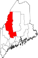
Northwest Somerset is an unorganized territory in Somerset County, Maine, United States. The population was 46 at the 2000 census.
Contents
Geography
According to the United States Census Bureau, the unorganized territory has a total area of 1,835.3 km² (708.6 mi²). 1,701.9 km² (657.1 mi²) of it is land and 133.5 km² (51.5 mi²) of it (7.27%) is water.
Townships
The territory contains 20 townships[1] plus parts of two other townships (shared with Northeast Somerset).
- Carrying Place
- Carrying Place Town
- Dead River
- Bigelow
- Bow Town
- Pierce Pond
- T3R4 BKP WKR
- Flagstaff
- Lower Enchanted
- Spring Lake (T3R5 BKP WKR)
- King & Bartlett
- Upper Enchanted
- Hobbstown
- Haynestown (T5 R6)
- Bradstreet
- Rayton (T5 R7)
- Appleton
- Attean
- Holeb
- Forsyth
Demographics
As of the census[2] of 2000, there were 46 people, 18 households, and 10 families residing in the unorganized territory. The population density was 0.0/km² (0.1/mi²). There were 452 housing units at an average density of 0.3/km² (0.7/mi²). The racial makeup of the unorganized territory was 89.13% White, 8.70% Native American and 2.17% Asian.
There were 18 households out of which 27.8% had children under the age of 18 living with them, 50.0% were married couples living together, and 38.9% were non-families. 16.7% of all households were made up of individuals and 5.6% had someone living alone who was 65 years of age or older. The average household size was 2.56 and the average family size was 3.00.
In the unorganized territory the population was spread out with 23.9% under the age of 18, 6.5% from 18 to 24, 30.4% from 25 to 44, 32.6% from 45 to 64, and 6.5% who were 65 years of age or older. The median age was 42 years. For every 100 females there were 155.6 males. For every 100 females age 18 and over, there were 133.3 males.
The median income for a household in the unorganized territory was $31,875, and the median income for a family was $35,000. Males had a median income of $26,250 versus $16,250 for females. The per capita income for the unorganized territory was $15,161. None of the population or the families were below the poverty line.
References
Municipalities and communities of Somerset County, Maine Towns Anson | Athens | Bingham | Cambridge | Canaan | Caratunk | Cornville | Detroit | Embden | Fairfield | Harmony | Hartland | Jackman | Madison | Mercer | Moose River | Moscow | New Portland | Norridgewock | Palmyra | Pittsfield | Ripley | St. Albans | Skowhegan | Smithfield | Solon | Starks
Plantations Unorganized
territoriesCentral Somerset | Northeast Somerset | Northwest Somerset | Seboomook Lake
CDPs Anson | Bingham | Fairfield | Hartland | Madison | Norridgewock | Pittsfield | Skowhegan
Other
villagesFlagstaff | North Anson | Rockwood
Coordinates: 45°22′33″N 70°17′13″W / 45.37583°N 70.28694°W
Categories:- Unorganized territories in Maine
- Populated places in Somerset County, Maine

Wikimedia Foundation. 2010.