- Maryland Route 459
-
Maryland Route 459
Tuxedo Road Route information Maintained by MDSHA Length: 1.25 mi[1] (2.01 km) Major junctions South end:  US 50 in Cheverly
North end:  MD 201 in Cheverly
Highway system Maryland highway system
Interstate • US • State • Minor • Former • Turnpikes←  MD 458
MD 460  →
→Maryland Route 459 (MD 459) is a state highway in the U.S. state of Maryland. Known for much of its length as Tuxedo Road, the state highway runs 1.25 mi (2.01 km) from U.S. Route 50 (US 50) north to MD 201 within Cheverly. MD 459 serves an industrial area in Cheverly. The state highway also connects the town to the Cheverly station of the Washington Metro. Due to being an intermodal connector, the very short section of MD 459 south of US 50 is a part of the National Highway System.[2] The state highway was constructed in the early 1930s. MD 459 originally followed Cheverly Avenue through the middle of Cheverly, but the state highway was rolled back to US 50 in the 1970s.
Contents
Route description
MD 459 begins at the intersection of Columbia Park Road and an exit ramp from eastbound US 50 (John Hansen Highway).[1] Columbia Park Road continues south as a county-maintained highway, crossing the Amtrak Northeast Corridor, MARC's Penn Line, and the Orange Line (Washington Metro) of the Washington Metro and passing the entrance to the Cheverly Metro Station before turning east through an industrial area.[3] From its origin, MD 459 (Columbia Park Road) crosses US 50 then intersects both an entrance ramp to westbound US 50 and Cheverly Avenue, which passes through the heart of Cheverly.[3] MD 459 turns west and passes through an industrial area as Tuxedo Road, a two-lane road with a speed limit of 35 mph (56 km/h).[1][3] The old alignment of MD 459, MD 973 (Tuxedo Road), continues straight as the speed limit drops to 25 mph (40 km/h) and the state highway passes under the Alexandria Extension of CSX's Capital Subdivision.[1][3] Tuxedo Road ends at an intersection with Kenilworth Avenue, which is the old alignment of MD 201, and ramps to and from US 50 west.[3] MD 459 turns north onto Kenilworth Avenue, a divided highway with two lanes northbound.[1][3] The state highway passes exit ramps from both directions of MD 201 before the southbound direction ends at Frolich Lane.[1] MD 459 continues north as a single lane a short distance until that lane merges with northbound MD 201 (Kenilworth Avenue).[3]
History
The first portion of present day MD 459 to be paved was Kenilworth Avenue, which at the time was MD 201, by 1930.[4] The state highway was completed through Cheverly in 1933.[5] At that time, MD 459 followed Tuxedo Road as it does today, but instead of turning south on Columbia Park Road, the state highway turned north on Cheverly Avenue and ended at MD 202.[6] Columbia Park Road's partial interchange with US 50 was completed in the 1960s, but it was not until the 1970s that MD 459 was taken off of Cheverly Avenue.[7][8]
Junction list
The entire route is in Cheverly in Prince George's County.
Mile
[1]Destinations Notes 0.00 Columbia Park Road – Cheverly Metro Station Southern terminus; Exit ramp from US 50 east 0.05 US 50 west (John Hanson Highway) / Cheverly Avenue – Washington, Cheverly0.94 US 50 west (John Hanson Highway) – WashingtonMD 459 turns north onto Kenilworth Avenue 1.18 Frolich Lane MD 459 becomes one-way northbound 1.25 MD 201 north (Kenilworth Avenue) – BladensburgNorthern terminus References
- ^ a b c d e f g "Highway Location Reference: Prince George's County" (PDF). Maryland State Highway Administration. 2008. http://apps.roads.maryland.gov/KeepingCurrent/performTrafficStudies/dataAndStats/hwyLocationRef/2008_hlr_all/co16.pdf. Retrieved 2010-03-22.
- ^ Federal Highway Administration (August 2003) (PDF). National Highway System: Washington, DC-MD-VA (Map). http://www.fhwa.dot.gov/planning/nhs/maps/md/washingtondc_md.pdf. Retrieved 2010-03-22.
- ^ a b c d e f g Google, Inc. Google Maps – Maryland Route 459 (Map). Cartography by Google, Inc. http://maps.google.com/maps?f=d&source=s_d&saddr=Columbia+Park+Rd&daddr=38.9174315,-76.9223256+to:Kenilworth+Ave%2FMD-201+N&geocode=FczVUQId_Fxq-w%3BFTfVUQIdK0Jq-ymzpOdGVMe3iTFb9rTf0pMHZQ%3BFbDtUQId9iVq-w&hl=en&mra=ls&sll=38.923376,-76.929569&sspn=0.000958,0.002411&ie=UTF8&t=h&z=16&via=1. Retrieved 2010-03-22.
- ^ Maryland State Roads Commission (JPG). Map of Maryland (Map) (1930 ed.). http://commons.wikimedia.org/wiki/File:Maryland_State_Highway_Map_-_1930.jpg. Retrieved 2010-03-22.
- ^ Maryland State Roads Commission (PDF). Map of Maryland (Map) (1933 ed.). http://commons.wikimedia.org/wiki/File:Maryland_State_Highway_Map_-_1933.pdf. Retrieved 2010-03-22.
- ^ Maryland State Roads Commission (PDF). Map of Maryland (Map) (1939 ed.). http://commons.wikimedia.org/wiki/File:Maryland_State_Highway_Map_-_1939.pdf. Retrieved 2010-03-22.
- ^ Maryland State Roads Commission (PDF). Map of Maryland (Map) (1970 ed.). http://commons.wikimedia.org/wiki/File:Maryland_State_Highway_Map_-_1970.pdf. Retrieved 2010-03-22.
- ^ Maryland State Highway Administration (PDF). Map of Maryland (Map) (1980 ed.). http://commons.wikimedia.org/wiki/File:Maryland_State_Highway_Map_-_1980.pdf. Retrieved 2010-03-22.
External links
Roads in Prince George's County, Maryland Maryland State Highways 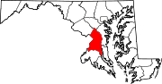
U.S. Routes Interstate Highways Roads by name Categories:- State highways in Maryland
- Roads in Prince George's County, Maryland


Wikimedia Foundation. 2010.