- Maryland Route 501
-
Maryland Route 501
Chillum Road Route information Maintained by MDSHA Length: 1.68 mi[1] (2.70 km) Major junctions West end:  MD 212 in Chillum
East end:  MD 500 in Chillum
Highway system Maryland highway system
Interstate • US • State • Minor • Former • Turnpikes← MD 500MD 502  →
→Maryland Route 501 (MD 501) is a state highway in the U.S. state of Maryland. Known as Chillum Road, the state highway runs 1.68 mi (2.70 km) from MD 212 east to MD 500 within Chillum. MD 501 was constructed in the early 1930s.
Contents
Route description
MD 501 begins at an intersection with MD 212 (Riggs Road) in Chillum. Chillum Road continues west as a two-lane county highway toward New Hampshire Avenue. MD 501 heads southeast as a four-lane undivided highway with a speed limit of 35 mph (56 km/h) through a mix of apartment complexes and single-family residences. After crossing Sargent Road, which is former MD 211, the state highway crosses a stream then parallels Northwest Branch. After passing under the Green Line of the Washington Metro, MD 501 enters a commercial area and meets its eastern terminus at MD 500 (Queens Chapel Road). Chillum Road continues east as a two-lane county highway into the town of Mount Rainier.
History
Before its construction as a state highway, the only existing portion of Chillum Road was between MD 212 and Sargent Road.[2] That segment was rebuilt and the portion east to MD 500 was constructed by 1933.[3]
Junction list
The entire route is in Chillum in Prince George's County.
Mile
[1]Destinations Notes 0.00 Chillum Road west Western terminus MD 212 (Riggs Road) – Langley Park, Washington0.46 Sargent Road Former MD 211 1.68 MD 500 (Queens Chapel Road) – Hyattsville, WashingtonEastern terminus Chillum Road east – Mount Rainier References
- ^ a b "Highway Location Reference: Prince George's County" (PDF). Maryland State Highway Administration. 2008. http://apps.roads.maryland.gov/KeepingCurrent/performTrafficStudies/dataAndStats/hwyLocationRef/2008_hlr_all/co16.pdf. Retrieved 2010-03-25.
- ^ Maryland State Roads Commission (JPG). Map of Maryland (Map) (1930 ed.). http://commons.wikimedia.org/wiki/File:Maryland_State_Highway_Map_-_1930.jpg. Retrieved 2010-03-25.
- ^ Maryland State Roads Commission (PDF). Map of Maryland (Map) (1933 ed.). http://commons.wikimedia.org/wiki/File:Maryland_State_Highway_Map_-_1933.pdf. Retrieved 2010-03-25.
External links
Roads in Prince George's County, Maryland Maryland State Highways 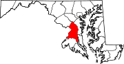
U.S. Routes Interstate Highways Roads by name Categories:- State highways in Maryland
- Roads in Prince George's County, Maryland


Wikimedia Foundation. 2010.