- Maryland Route 810
-
Maryland Route 810
Route information Maintained by MDSHA Highway system Maryland highway system
Interstate • US • State • Minor • Former • Turnpikes←  MD 807
MD 813  →
→Maryland Route 810 (MD 810) is a collection of unsigned state highways in the U.S. state of Maryland. These eleven highways are sections of old alignments of and service roads related to the present and old alignments of MD 210 (Indian Head Highway) in Accokeek in southwestern Prince George's County. The segments of MD 810 are designated in roughly alphabetical order from south to north with MD 810A near the Charles County line and MD 810K at the intersection of MD 210 and MD 373.
- MD 810A is the designation for a 0.16-mile (0.26 km) stretch of Livingston Road a short distance east of the Charles County line. The state highway intersects Independence Road on a tangent, meets Beech Lane (MD 210K) at a perpendicular intersection, crosses MD 210, and intersects MD 210J immediately before its northern terminus.[1][2]
- MD 810B is the designation for a 0.04-mile (0.064 km) section of Spring Grove Drive heading east from Beech Lane on the northbound side of MD 210.[1][3]
- MD 810C is the designation for a 0.04-mile (0.064 km) section of Dale Lane heading east from Beech Lane on the northbound side of MD 210.[1][4]
- MD 810D is the designation for a 0.04-mile (0.064 km) section of Maple Lane heading east from Beech Lane on the northbound side of MD 210.[1][5]
- MD 810E is the designation for a 0.08-mile (0.13 km) stretch of Pine Drive. The state highway begins at Beech Lane, crosses MD 210, and intersects Beretta Drive (MD 210L) immediately before its northern terminus.[1][6]
- MD 810F is the designation for a 0.10-mile (0.16 km) segment of Holly Way between Holly Road (MD 210M) and Pine Lane (MD 810G) on the southbound side of MD 210.[1][7]
- MD 810G is the designation for a 0.06-mile (0.097 km) section of Pine Lane between MD 210 and Holly Way (MD 810F) on the southbound side of MD 210.[1][8]
- MD 810H is the designation for a 0.11-mile (0.18 km) stretch of Manning Road that begins at the southbound direction of MD 210 and intersects MD 210N before reaching the northern terminus.[1][9]
- MD 810I is the designation for a 0.69-mile (1.11 km) segment of Manning Road that begins at the northbound direction of MD 210 and heads east to its eastern terminus just beyond MD 228 (Berry Road), where Manning Road continues as a county highway. The two segments of Manning Road terminate at the same point on MD 210 but there is no access across MD 210's median.[1][10]
- MD 810J is the designation for a 0.10-mile (0.16 km) section of Livingston Road that runs from Biddle Road (MD 210S) east to the intersection of MD 210 and MD 373 (Livingston Road).[1][11]
- MD 810K is the designation for a 0.10-mile (0.16 km) stretch of Bryan Point Road that runs from a dead end adjacent to the MD 210–MD 373 intersection to Biddle Road (MD 210S).[1][12]
References
- ^ a b c d e f g h i j k "Highway Location Reference: Prince George's County" (PDF). Maryland State Highway Administration. 2008. http://apps.roads.maryland.gov/KeepingCurrent/performTrafficStudies/dataAndStats/hwyLocationRef/2008_hlr_all/co16.pdf. Retrieved 2010-06-23.
- ^ Google, Inc. Google Maps – Maryland Route 810A (Map). Cartography by Google, Inc. http://maps.google.com/maps?f=d&source=s_d&saddr=Gabriel+Dr&daddr=Livingston+Rd&geocode=FZONTQIdiEto-w%3BFRWXTQIdbkxo-w&hl=en&mra=ls&sll=38.638165,-77.050885&sspn=0.00383,0.009645&ie=UTF8&t=h&z=17. Retrieved 2010-06-23.
- ^ Google, Inc. Google Maps – Maryland Route 810B (Map). Cartography by Google, Inc. http://maps.google.com/maps?f=d&source=s_d&saddr=Maryland+810B+E%2FSpring+Grove+Dr&daddr=Maryland+810B+E%2FSpring+Grove+Dr&geocode=FZyeTQIds2Bo-w%3BFUidTQIdCmNo-w&hl=en&mra=ls&sll=38.640724,-77.045075&sspn=0.000957,0.002411&ie=UTF8&t=h&z=20. Retrieved 2010-06-23.
- ^ Google, Inc. Google Maps – Maryland Route 810C (Map). Cartography by Google, Inc. http://maps.google.com/maps?f=d&source=s_d&saddr=Dale+Ln%2FMaryland+810C+E&daddr=Dale+Ln%2FMaryland+810C+E&geocode=FdKhTQId7GRo-w%3BFXWgTQIdOGdo-w&hl=en&mra=ls&sll=38.641344,-77.043793&sspn=0.001915,0.004823&ie=UTF8&t=h&z=20. Retrieved 2010-06-23.
- ^ Google, Inc. Google Maps – Maryland Route 810D (Map). Cartography by Google, Inc. http://maps.google.com/maps?f=d&source=s_d&saddr=Beech+Ln&daddr=Maple+Ln%2FMaryland+810D+E&geocode=FXCkTQIdXGho-w%3BFQWjTQIdl2po-w&hl=en&mra=ls&sll=38.641629,-77.041959&sspn=0.00383,0.009645&ie=UTF8&t=h&z=20. Retrieved 2010-06-23.
- ^ Google, Inc. Google Maps – Maryland Route 810E (Map). Cartography by Google, Inc. http://maps.google.com/maps?f=d&source=s_d&saddr=Pine+Dr&daddr=Pine+Dr&geocode=FQC_TQIdjIho-w%3BFY7CTQIdN4Vo-w&hl=en&mra=ls&sll=38.650377,-77.035891&sspn=0.000957,0.002411&ie=UTF8&ll=38.650055,-77.035806&spn=0.000957,0.002411&t=h&z=19. Retrieved 2010-06-23.
- ^ Google, Inc. Google Maps – Maryland Route 810F (Map). Cartography by Google, Inc. http://maps.google.com/maps?f=d&source=s_d&saddr=Holly+Way%2FMaryland+810F+N&daddr=Holly+Way%2FMaryland+810F+N&geocode=FbLdTQIdxqRo-w%3BFfbhTQIdFqlo-w&hl=en&mra=ls&sll=38.658111,-77.026123&sspn=0.003829,0.009645&ie=UTF8&t=h&z=18. Retrieved 2010-06-23.
- ^ Google, Inc. Google Maps – Maryland Route 810G (Map). Cartography by Google, Inc. http://maps.google.com/maps?f=d&source=s_d&saddr=Maryland+810G+W%2FPine+Ln&daddr=Holly+Way%2FMaryland+810F+N&geocode=FcbfTQIdIqxo-w%3BFfbhTQIdFqlo-w&hl=en&mra=ls&sll=38.658005,-77.0276&sspn=0.001914,0.004823&ie=UTF8&t=h&z=19. Retrieved 2010-06-23.
- ^ Google, Inc. Google Maps – Maryland Route 810H (Map). Cartography by Google, Inc. http://maps.google.com/maps?f=d&source=s_d&saddr=MD-210+S&daddr=Manning+Rd+W&geocode=FQD2TQIdWMZo-w%3BFTH7TQIdx8Zo-w&hl=en&mra=ls&sll=38.663748,-77.019483&sspn=0.001931,0.004823&ie=UTF8&ll=38.664352,-77.019508&spn=0.001914,0.004823&t=h&z=18. Retrieved 2010-06-23.
- ^ Google, Inc. Google Maps – Maryland Route 810I (Map). Cartography by Google, Inc. http://maps.google.com/maps?f=d&source=s_d&saddr=Manning+Rd+E&daddr=Manning+Rd+E&geocode=Ffr0TQIdxcZo-w%3BFYLlTQIdDOZo-w&hl=en&mra=ls&sll=38.662015,-77.015973&sspn=0.003829,0.009645&ie=UTF8&t=h&z=16. Retrieved 2010-06-23.
- ^ Google, Inc. Google Maps – Maryland Route 810J (Map). Cartography by Google, Inc. http://maps.google.com/maps?f=d&source=s_d&saddr=Livingston+Rd&daddr=Livingston+Rd&geocode=FdwPTgIdsuRo-w%3BFVgRTgIdlt1o-w&hl=en&mra=ls&sll=38.670274,-77.011145&sspn=0.003828,0.009645&ie=UTF8&t=h&z=19. Retrieved 2010-06-23.
- ^ Google, Inc. Google Maps – Maryland Route 810K (Map). Cartography by Google, Inc. http://maps.google.com/maps?f=d&source=s_d&saddr=Bryan+Point+Rd&daddr=Bryan+Point+Rd&geocode=FcIQTgIdJuRo-w%3BFbATTgIdVN5o-w&hl=en&mra=ls&sll=38.67125,-77.013355&sspn=0.001914,0.004823&ie=UTF8&t=h&z=19. Retrieved 2010-06-23.
Roads in Prince George's County, Maryland Maryland State Highways 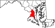
U.S. Routes Interstate Highways Roads by name Categories:- State highways in Maryland
- Roads in Prince George's County, Maryland


Wikimedia Foundation. 2010.