- Muskogee County, Oklahoma
-
Muskogee County, Oklahoma 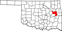
Location in the state of Oklahoma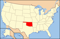
Oklahoma's location in the U.S.Founded 1907 Seat Muskogee Area
- Total
- Land
- Water
839 sq mi (2,173 km²)
814 sq mi (2,108 km²)
25 sq mi (65 km²), 3%PopulationEst.
- (2010)
- Density
70,990
102/sq mi (39.32/km²)Muskogee County is a county located in the U.S. state of Oklahoma. As of 2010, the population was 70,990. Its county seat is Muskogee.[1]
Contents
Government
The county seat of the County is Muskogee, Oklahoma. All elected officials and county services are headquartered there.
Office Current Officer Since Party County Commissioner - District 1 Gene Wallace 2003 Democratic County Commissioner - District 2 Stephen Wright 2009 Democratic County Commissioner - District 3 Dexter Payne 1999 Democratic County Sheriff Charles Pearson 2001 Democratic County Clerk Karen Anderson 1996 Democratic County Treasurer Glenn Scott Democratic County Assessor Dan Ashwood Democratic District Attorney Larry Moore 2007 Democratic District Court Clerk Paula Sexton Democratic Geography
According to the U.S. Census Bureau, the county has a total area of 2,173 km² (839 mi²). 2,108 km² (814 mi²) is land and 65 km² (25 mi²) (3%) is water.
Major highways
 Interstate 40
 U.S. Highway 62
 U.S. Highway 64
 U.S. Highway 69
 State Highway 2
 State Highway 10
 State Highway 16
 State Highway 72
- Muskogee Turnpike
Adjacent counties
- Wagoner County (north)
- Cherokee County (northeast)
- Sequoyah County (east)
- Haskell County (southeast)
- McIntosh County (southwest)
- Okmulgee County (west)
- Tulsa County (northwest)
National protected area
- Sequoyah National Wildlife Refuge (part)
Demographics
 The Arkansas River in Muskogee County. The Webbers Falls Lock and Dam on the river are part of the navigation system on the river, maintained by the U.S. Army Corps of Engineers.
As of the census[2] of 2000, there were 69,451 people, 26,458 households, and 18,467 families residing in the county. The population density was 33/km² (85/mi²). There were 29,575 housing units at an average density of 14/km² (36/mi²). The racial makeup of the county was 63.73% White, 13.16% Black or African American, 14.88% Native American, 0.58% Asian, 0.03% Pacific Islander, 1.19% other races, and 6.43% from two or more races. 2.67% of the population were Hispanic or Latino of any race.
There were 26,458 households, of which 31.80% had children under the age of 18 living with them, 52.80% were married couples living together, 13.30% had a female householder with no husband present, and 30.20% were non-families. 26.70% of all households were made up of individuals; 12.30% were someone living alone who was 65 years of age or older. The average household size was 2.51, and the average family size was 3.03.
The age distribution of the population was 25.90% under the age of 18, 9.50% from 18 to 24, 26.70% from 25 to 44, 22.60% from 45 to 64, and 15.30% 65 or older. The median age was 37 years. For every 100 females there were 93.30 males. For every 100 females age 18 and over, there were 88.90 males.
The median income of households in the county was $28,438, and the median income per family was $34,793. Males had a median income of $28,670 versus $20,457 for females. The per capita income for the county was $14,828. About 14.10% of families and 17.90% of the population were below the poverty line, including 24.00% of those under age 18 and 14.70% of those age 65 or over.
Cities and towns
NRHP sites
The following sites in Muskogee County are listed on the National Register of Historic Places:
- Administration Building - Post Hospital, Fort Gibson
- Central Baptist Church, Muskogee
- Cherokee National Cemetery, Fort Gibson
- Commandant's Quarters, Fort Gibson
- V. R. Coss House, Muskogee
- Dragoon Commandant's Quarters, Fort Gibson
- W.E.B. DuBois School, Summit
- Escoe Building, Muskogee
- First Baptist Church, Muskogee
- F. B. Fite House and Servant's Quarters, Muskogee
- Grant Foreman House, Muskogee
- Fort Davis, Muskogee
- Fort Gibson, Fort Gibson
- 1876 Indian Administration Building, Muskogee
- Manhattan Building, Muskogee
- Manual Training High School for Negroes, Muskogee
- George A. Murphy House, Muskogee
- Muskogee County Courthouse, Muskogee
- Nancy Taylor No. 1 Oil Well Site, Haskell
- Nash-Swindler House, Fort Gibson
- Officer's Quarters, Fort Gibson
- Oktaha School, Oktaha
- A. W. Patterson House, Muskogee
- Post Adjutant's Office, Fort Gibson
- Post Blacksmith Shop, Fort Gibson
- Pre-Statehood Commercial District, Muskogee
- Railway Exchange Building, Muskogee
- Andrew W. Robb House, Muskogee
- Seawell-Ross-Isom House, Fort Gibson
- Severs Hotel, Muskogee
- Sheltered Shelter District, Warner
- St. Thomas Primitive Baptist Church, Summit
- Surety Building, Muskogee
- Taft City Hall, Taft
- A. C. Trumbo House, Muskogee
- Union Agenc, Muskogee
- United States Post Office and Courthouse, Muskogee
- Ward Chapel AME Church, Muskogee
- J. C. Welch House, Muskogee
References
- ^ "Find a County". National Association of Counties. http://www.naco.org/Counties/Pages/FindACounty.aspx. Retrieved 2011-06-07.
- ^ "American FactFinder". United States Census Bureau. http://factfinder.census.gov. Retrieved 2008-01-31.
Municipalities and communities of Muskogee County, Oklahoma City 
Towns Boynton | Braggs | Council Hill | Fort Gibson‡ | Haskell | Oktaha | Porum | Summit | Taft | Wainwright | Warner | Webbers Falls
CDPs River Bottom | Sand Hills | Simms | Sour John
Unincorporated
communitiesBacone | Beland | Briartown | Chase | Crekola | Georgetown | Grandview Heights | Hyde Park | Keefeton | Martin | McLain | Pumpkin Center
Footnotes ‡This populated place also has portions in an adjacent county or counties
Categories:- Oklahoma counties
- Muskogee County, Oklahoma
- 1907 establishments in the United States
- Populated places established in 1907


Wikimedia Foundation. 2010.