- Dewey County, Oklahoma
-
Dewey County, Oklahoma 
Location in the state of Oklahoma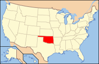
Oklahoma's location in the U.S.Founded 1892, Seat Taloga Area
- Total
- Land
- Water
1,008 sq mi (2,611 km²)
1,000 sq mi (2,590 km²)
8 sq mi (21 km²), 0.81%Population
- (2000)
- Density
4,743
5/sq mi (2/km²)Congressional district 3rd Time zone Central: UTC-6/-5 Dewey County is a county located in the U.S. state of Oklahoma. As of 2000, the population was 4,743. Its county seat is Taloga[1].
Contents
Geography
According to the U.S. Census Bureau, the county has a total area of 1,008 square miles (2,610.7 km2), of which 1,000 square miles (2,590.0 km2) is land and 8 square miles (20.7 km2) (0.81%) is water.
Major highways
 U.S. Highway 60
 U.S. Highway 183
 U.S. Highway 270/U.S. Highway 281
 State Highway 34
- State Highway 47
 State Highway 51
Adjacent counties
- Woodward County & Major County (north)
- Blaine County (east)
- Custer County (south)
- Roger Mills County (southwest)
- Ellis County (northwest)
Historical populations Census Pop. %± 1900 8,819 — 1910 14,132 60.2% 1920 12,434 −12.0% 1930 13,250 6.6% 1940 11,981 −9.6% 1950 8,789 −26.6% 1960 6,051 −31.2% 1970 5,656 −6.5% 1980 5,922 4.7% 1990 5,551 −6.3% 2000 4,743 −14.6% 2010 4,810 1.4% Demographics
 Age pyramid for Dewey County, Oklahoma, based on census 2000 data.
As of the census[2] of 2000, there were 4,743 people, 1,962 households, and 1,336 families residing in the county. The population density was 5 people per square mile (2/km²). There were 2,425 housing units at an average density of 2 per square mile (1/km²). The racial makeup of the county was 92.16% White, 0.13% Black or African American, 4.64% Native American, 0.06% Asian, 0.02% Pacific Islander, 0.72% from other races, and 2.28% from two or more races. 2.68% of the population were Hispanic or Latino of any race.
There were 1,962 households out of which 26.70% had children under the age of 18 living with them, 59.80% were married couples living together, 5.00% had a female householder with no husband present, and 31.90% were non-families. 30.00% of all households were made up of individuals and 16.40% had someone living alone who was 65 years of age or older. The average household size was 2.35 and the average family size was 2.93.
In the county, the population was spread out with 23.30% under the age of 18, 7.10% from 18 to 24, 22.90% from 25 to 44, 25.70% from 45 to 64, and 21.00% who were 65 years of age or older. The median age was 43 years. For every 100 females there were 94.90 males. For every 100 females age 18 and over, there were 91.30 males.
The median income for a household in the county was $28,172, and the median income for a family was $36,114. Males had a median income of $26,675 versus $18,548 for females. The per capita income for the county was $15,806. About 11.40% of families and 15.00% of the population were below the poverty line, including 17.60% of those under age 18 and 15.80% of those age 65 or over.
Cities and towns
See also
References
- ^ "Find a County". National Association of Counties. http://www.naco.org/Counties/Pages/FindACounty.aspx. Retrieved 2011-06-07.
- ^ "American FactFinder". United States Census Bureau. http://factfinder.census.gov. Retrieved 2008-01-31.
External links
Municipalities and communities of Dewey County, Oklahoma City 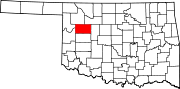
Towns Unincorporated
communitiesAledo | Burmah | Cestos | Fay | Lenora | Rhea | Webb
Categories:- Oklahoma counties
- Dewey County, Oklahoma


Wikimedia Foundation. 2010.