- Cotton County, Oklahoma
-
Cotton County, Oklahoma 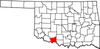
Location in the state of Oklahoma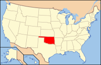
Oklahoma's location in the U.S.Founded 1912 Seat Walters Area
- Total
- Land
- Water
642 sq mi (1,663 km²)
637 sq mi (1,649 km²)
5 sq mi (14 km²), 0.83%Population
- (2000)
- Density
6,614
10/sq mi (4/km²)Time zone Central: UTC-6/-5 Cotton County is a county located in the U.S. state of Oklahoma. As of 2000, the population was 6,614. Its county seat is Walters[1].
When Oklahoma achieved statehood in 1907, the area which is now Cotton County fell within the boundaries of Comanche County.[2] It was split off in 1912, becoming the last county created in Oklahoma; it was named for the county's primary crop.[3]
Contents
History
The county got its name in 1912, when residents elected to split from Comanche County and name the new county for the primary crop in the region at the time.[3] Randlett was assigned as a temporary county seat until a November 4, 1912 election made Walters, Oklahoma the permanent location.[3]
Wheat became more prevalent than and corn just as prevalent as cotton as early as 1915.[3] In 1934, corn had dwindled and winter wheat, cotton and oats had become the primary crops.[3]
The county population has generally declined since 1920.[3]
Geography
According to the U.S. Census Bureau, the county has a total area of 642 square miles (1,662.8 km2), of which 637 square miles (1,649.8 km2) is land and 5 square miles (12.9 km2) (0.83 percent) is water.
The eastern portion of the county is in the Cross Timbers region.[3] Its creeks and streams drain to the southeast into the Red River, which borders the county on the south.[3]
Major highways
 Interstate 44
 U.S. Highway 70
 U.S. Highway 277
 U.S. Highway 281
 State Highway 5
 State Highway 53
 State Highway 65
Adjacent counties
- Comanche County (north)
- Stephens County (northeast)
- Jefferson County (southeast)
- Clay County, Texas (south)
- Wichita County, Texas (southwest)
- Tillman County (west)
Economy
The county's economy has long revolved around agriculture, specifically crops such as cotton and wheat and livestock such as cattle and poultry.[3] Beginning in the late 1910s, oil and gas grew as a strong industry, the county had 290 producing wells in 1920, 32 of which were gas.[3] The southern portion of the county had Devol refineries, pumping stations, and pipelines.[3] A large retail outlet, Temple's B & O Cash Store, shipped merchandise nationwide, before being bought by Sears and Roebuck in 1929 and later closed in 1954.[3]
In 1997 the county held 69,988 cattle and ranked eleventh in the state for poultry sold.[3]
Demographics
 Age pyramid for Cotton County, Oklahoma, based on census 2000 data.
The county's population has generally declined since it stood at 16,679 in 1920.[3] As of the census[4] of 2000, there were 6,614 people, 2,614 households, and 1,840 families residing in the county. The population density was 10 people per square mile (4/km²). There were 3,085 housing units at an average density of 5 per square mile (2/km²). The racial makeup of the county was 84.70% White, 2.86% Black or African American, 7.42% Native American, 0.12% Asian, 0.03% Pacific Islander, 1.81% from other races, and 3.05% from two or more races. 4.85% of the population were Hispanic or Latino of any race.
There were 2,614 households out of which 31.30% had children under the age of 18 living with them, 57.60% were married couples living together, 9.70% had a female householder with no husband present, and 29.60% were non-families. 27.30% of all households were made up of individuals and 14.90% had someone living alone who was 65 years of age or older. The average household size was 2.46 and the average family size was 3.00.
In the county, the population was spread out with 25.40% under the age of 18, 7.40% from 18 to 24, 26.70% from 25 to 44, 22.80% from 45 to 64, and 17.80% who were 65 years of age or older. The median age was 39 years. For every 100 females there were 98.60 males. For every 100 females age 18 and over, there were 94.60 males.
The median income for a household in the county was $27,210, and the median income for a family was $35,129. Males had a median income of $28,443 versus $19,101 for females. The per capita income for the county was $14,626. About 13.70% of families and 18.20% of the population were below the poverty line, including 24.40% of those under age 18 and 16.90% of those age 65 or over.
Cities and towns
See also
References
- ^ "Find a County". National Association of Counties. http://www.naco.org/Counties/Pages/FindACounty.aspx. Retrieved 2011-06-07.
- ^ Department of the Interior, General Land Office. State of Oklahoma (Map) (1907 ed.). http://www.odot.org/hqdiv/p-r-div/maps/state-maps/pdfs/1873.pdf. Retrieved 2008-09-14.
- ^ a b c d e f g h i j k l m n O'Dell, Larry, "Cotton County," Encyclopedia of Oklahoma History and Culture (accessed June 15, 2010).
- ^ "American FactFinder". United States Census Bureau. http://factfinder.census.gov. Retrieved 2008-01-31.
External links
Municipalities and communities of Cotton County, Oklahoma City 
Towns Unincorporated
communitiesAhpeatone | Cookietown | Emerson Center | Fivemile Corner | Hooper | Hulen | Taylor
Categories:- Oklahoma counties
- Cotton County, Oklahoma
- 1912 establishments in the United States
- Populated places established in 1912


Wikimedia Foundation. 2010.