- Khorramshahr
-
For the administrative subdivision, see Khorramshahr County.
Khorramshahr
خرمشهر— city — 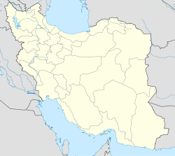
 Khorramshahr
Coordinates: 30°26′23″N 48°09′59″E / 30.43972°N 48.16639°ECoordinates: 30°26′23″N 48°09′59″E / 30.43972°N 48.16639°E Country  Iran
IranProvince Khuzestan County Khorramshahr Bakhsh Central Population (2006) – Total 123,866 Time zone IRST (UTC+3:30) – Summer (DST) IRDT (UTC+4:30) Khorramshahr (Persian: خرمشهر, also Romanized as Khorramchahre and Khurramshahr; also known as Khorram Shahr Ābādān and Khūnīn Shahr; formerly, Al-Muhammarah, Mohammerah, and Muhammerah)[1] is a city in and the capital of Khorramshahr County, Khuzestan Province, Iran. At the 2006 census, its population was 123,866, in 26,385 families.[2]
Khorramshahr is a port city located approximately 10 kilometres (6.2 mi) north of Abadan. The city extends to the right bank of the Shatt al-Arab waterway near its confluence with the Haffar arm of the Karun river.
Contents
History
In ancient times, the area where the city exists today was under the waters of the Persian Gulf, before becoming a part of the vast marshlands and the tidal flats at the mouth of the Karun River. The small town known as Piyan, and later Bayan appeared in the area no sooner than the late Parthian time in the 1st. Century AD. Whether or not this was located at the where Khurramshahr is today, is highly debatable.
During the Islamic centuries, the Daylamite Buwayhid king, Panah Khusraw Adud ad-Dawlah ordered the digging of a canal to join Karun River (which at the time emptied independently into the Persian Gulf through the Bahmanshir channel, to the Arvand Rud/Shatt al-Arab (the joint estuary of the Tigris and Euphrates rivers. The extra water made the joint estuary more reliably navigable. The channel thus created was known as the Haffar, Arabic for "excavated," "dugout," which exactly described what the channel was. The Haffar soon became the main channel of the Karun, as it is in the present day. Establishment of a port town at the confluence of the Haffar and the Arvand Rud/Shatt al-Arab is natural and may be expected. However, there is absolutely no mention of such a place in the geographical records, while there are an ample mentions of the port of Abadan nearby.
The modern city was founded in 1812 by Sheikh Yusuf bin Mardo, when steam navigation began on the Karun, who named it Muhammarah (Arabic for 'reddish,' an allusion to the red clay fort build by the Sheikh in the port). The name remained until the 1930s, when the Iranian Academy of Culture (the Farhangistan), in its extensive amending of toponyms in Iran/Persia, renamed the city Khurram Shahr, "The Pleasant City."
Sheikhdom
In the early 18h century Mohammerah became a Sheikhdom.
The first Sheikh was Ali Mardan of the Muhaisin clan of the Bani Kaab Arab tribe. Succeeding Sheikhs were:
- 1800s? – 1819 Sheikh Yusuf bin Mardo
- 1819–1881 Sheikh Jabir al-Kaabi Khan bin Mardo
- 1881–1897 Sheikh Maz'al Khan ibn Jabir Khan, styled Muaz us-Sultana
- 1897–1925 Sheikh Khaz'al Khan ibn Jabir, styled Sardar-i Aqdas
The Iran–Iraq War
Main article: Battle of KhorramshahrDuring the Iran–Iraq War it was extensively ravaged by Iraqi forces as a result of Saddam Hussein's scorched earth policy. Prior to the war, Khorramshahr had grown extensively to become Iran's primary non-oil port city, and home to some of the most sprawling neighborhoods in Iran. The population was predominantly wealthy and upper class, and along with Abadan, the prevalent culture was that of modern Iranian cosmopolitanism.
 An Iranian woman in front of a mosque during Iraqi invasion of Khorramshahr in September–October 1980.
The battle of Khorramshahr was the first major engagement between Iraqi and Iranians forces in the war. After occupying the city on October 26, the city remained in Iraqi hands until April 1982, when the Iranians launched Operation Beit ol-Moqaddas (Persian: بیت المقدس) to recapture the Khuzestan province. The first attack (April 24 to May 12) consisted of 70,000 Pasdaran and succeeded in pushing the Iraqis out of the Ahvaz-Susangerd area. The Iraqis withdrew back to Khorramshahr and, on May 20, launched a counter attack against the Iranians, which was repulsed. The Iranians then launched an all out assault on Khorramshahr, capturing two of the defense lines in the Pol-e No and Shalamcheh region. The Iranians gathered around the Shatt al-Arab(Known as Arvand Rud in Iran) waterway, surrounding the city and, thus, beginning the second siege. The Iranians finally recaptured the city on May 24 after two days of bitter fighting, capturing 19,000 soldiers from a demoralized Iraqi Army after the fighting was over. Over 2,000 of these prisoners were executed[citation needed]. As a result, the Iraqis now know May 24 as “Martyr’s Day”, although the Iranians celebrate this day as the Liberation of Khorramshahr.
By the end of the war, Khorramshahr had been completely devastated by Saddam Hussein's forces, with very few buildings left intact. Other major urban centres such as Abadan and Ahvaz were also left in ruins, though nowhere nearly as bad as Khorramshahr. The city of Khorramshahr was one of the primary and most important frontlines of the war and has thus achieved mythic status amongst the Iranian population.
Economy
The economy of Khorramshahr is still largely affected by the destruction and depopulation of the city's residents in the 1980s during the first years of the Iran–Iraq War. The main activities are, however, essentially the same as before the war, petroleum production and exports and imports through the city port, though on a much smaller scale as restoration is not yet totally complete, even though almost two decades have passed since the end of the war. Residents originally from Khorramshahr have also slowly been returning to the city, rebuilding their houses and businesses.
Climate
Khorramshahr has long, hot summers and mild, short winters. The mean temperature in summer is 55 degrees celsius?, maximum temperature in summer could soar up to 66 degrees Celsius while in winters the minimum temperature could fall around -3 degrees Celsius. The annual rainfall is 200 mm. Khorramshahr experiences many sandstorms.
Marine Science & Technology University of Khorramshahr
In 1976, in Filieh, an area bordering the port city of Khorramshahr, the Persian Gulf Southern Branch of Jondi Shahpour University, Ahvaz (Shahid Chamran University), was established comprising two colleges: the College of Marine Sciences and the College of Maritime Management and Economics. But this newly established center was closed soon after due to the war imposed on Iran. This college recommenced academically in 1993, admitting 10 MS students in the fields of physical oceanography and marine biology on Shahid Chamran’s campus. With the start of the postwar reconstruction of the war torn cities of Abadan and Khorramshahr in 1998, the Southern Branch was moved back to Khorramshahr, expanding its academic scope by admitting undergraduate students in the fields of marine biology, environmental sciences and fisheries.
In 2003, this institute separated from Shahid Chamran University and became Khorramshahr University of Marine Science and Technology (KMSU), with access to open waters, the Arvand and Bahmanshir rivers, and adjacency to the Shadegan and Hor Swamps, situated in the Arvand Free Zone.
References
- ^ Khorramshahr can be found at GEOnet Names Server, at this link, by opening the Advanced Search box, entering "-3071225" in the "Unique Feature Id" form, and clicking on "Search Database".
- ^ "Census of the Islamic Republic of Iran, 1385 (2006)" (Excel). Islamic Republic of Iran. http://www.amar.org.ir/DesktopModules/FTPManager/upload/upload2360/newjkh/newjkh/06.xls.
External links
- Khorramshahr.net
- Khorramshahr Photo Gallery from the Khuzestan Governorship
- Khorramshahr Post-War Photo Slideshow
- Liberation of Khorramshahr, Triumph of True Faith
 Chisholm, Hugh, ed (1911). "Muhamrah". Encyclopædia Britannica (11th ed.). Cambridge University Press.
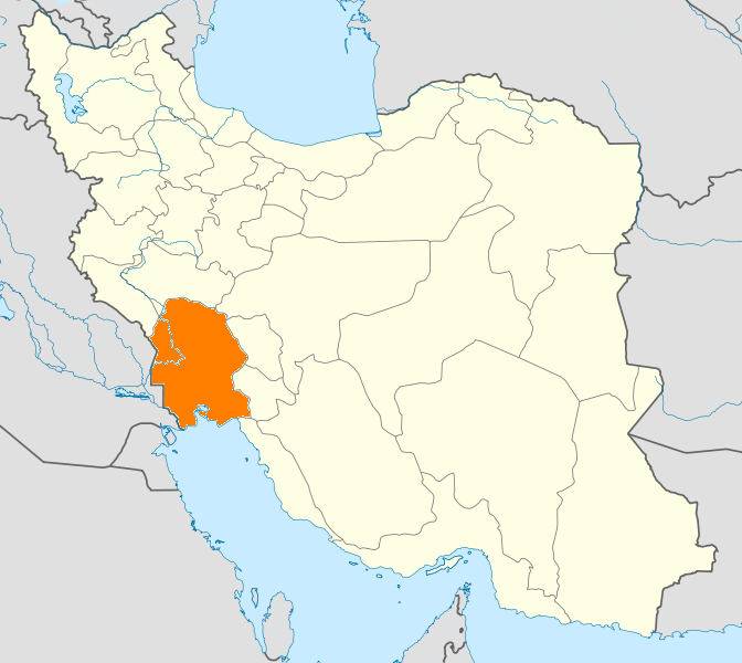
 Khuzestan Province
Capital 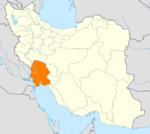
Counties (A-K)
and CitiesAhvaz · HamidiyehAndika CountyQaleh-ye KhvajehAndimeshk · HoseyniyehBagh-e Malek CountyBagh-e Malek · Qaleh Tall · SeydunBavi CountySusangerd · BostanGotvand CountyGotvand · Jannat MakanHaftgel CountyHaftgelHendijan · ZahrehHoveyzeh CountyHoveyzeh · RafiCounties (L-Z)
and CitiesOmidiyeh · JayezanRamshir CountyRamshirSights Abadan's museum · Gundishapur · Acropole of Shush · Apadana in Susa · Arjan castle, Behbahan · Asak ancient city, Hendijan · Chagadom tappe fire temple · Chogha Mish Proto-Elamite site · Chogha Zanbil · Dav o Dokhtar castle, Ramhormoz · Dez Dam · Eshkaft-e Salman · Gargar bridge, Shushtar · Haft Tepe · Hoor-al-azim lagoon · Imamzadeh Roudband, Dezful · Imamzadeh Sabz-e-ghaba, Dezful · Karkheh dam · Khorramshahr mosque, Battle of Khorramshahr · Kul-e Farah · lake of Karkheh dam · Lake of Karun · Lali bridge · Meyangaran lagoon · Rangooni's mosque · Salasel castle, Shushtar · Shadegan lagoon · Shevi waterfall, Dezful · Shush-Daniel · Shushtar Historical Hydraulic System · Shushtar Watermills · Susa · Shush Castle · Taryana · Tobiron valley, Dezful · Tomb of Daniel, Shush · White bridge, Ahvaz · Ya'qub-i Laith's tomb, Dezful
Categories:- Khorramshahr County
- Cities in Iran
- Cities in Khuzestan Province
- Port cities and towns in Iran


Wikimedia Foundation. 2010.