- Easley Covered Bridge
-
Easley CB 
The Easley Covered Bridge near Rosa, Alabama.Carries bridge closed to motor traffic Crosses Dub Branch, Calvert Prong of the Little Warrior River Locale Rosa, Alabama Maintained by Blount County Commission ID number 01-05-12 (WGCB) Design Town Lattice truss Total length 95 ft (29 m) Width 10 ft (3 m) clearance Load limit 3 US tons (2.72 metric tons) Vertical clearance 9 ft (3 m) Construction end 1927 Coordinates 33°58′16.12″N 86°31′7.39″W / 33.9711444°N 86.5187194°W Easley Covered Bridge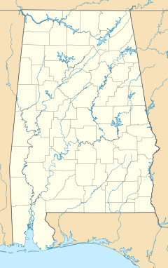

Nearest city: Rosa, AL Coordinates: 33°58′16.12″N 86°31′7.39″W / 33.9711444°N 86.5187194°WCoordinates: 33°58′16.12″N 86°31′7.39″W / 33.9711444°N 86.5187194°W Built: 1927 Governing body: County NRHP Reference#: 81000125 [1] Significant dates Added to NRHP: August 20, 1981 Designated ARLH: March 3, 1976 The Easley Covered Bridge, also known as the Old Easley Covered Bridge or Rosa Covered Bridge, is a county-owned wood and metal combination style covered bridge that spans Dub Branch of the Calvert Prong of the Little Warrior River in Blount County, Alabama, United States. It is located on Easley Bridge Road off U.S. Route 231, just south of the town of Rosa, about 5 miles (8 kilometers) northwest of Oneonta. Coordinates are 33°58′16.12″N 86°31′7.39″W / 33.9711444°N 86.5187194°W (33.971144, -86.518719).
Built in 1927, the 95-foot (29-meter) bridge is a town lattice truss construction over a single span. Its WGCB number is 01-05-12. The Easley Covered Bridge was listed on the Alabama Register of Landmarks and Heritage on March 3, 1976. It was listed on the National Register of Historic Places on August 20, 1981. It is currently the oldest and shortest of three historic covered bridges still existing in Blount County. The bridge is closed to motor vehicle traffic due to safety concerns, but is still accessible from both sides of Easley Bridge Road. It is maintained by the Blount County Commission and the Alabama Department of Transportation.
Contents
History
The Easley Covered Bridge was built by a crew led by Zelmer C. Tidwell and uncle Forrest Tidwell in 1927 over Dub Branch. Other than occasional repair work, this bridge has been in continuous use since it was constructed until its closure in 2009.
The Blount County Commission is currently working to secure funds for structural analysis and conservation of its three remaining covered bridges. They were closed as of 2009 due to safety concerns (the Horton Mill Covered Bridge was closed in 2007 after vandalism occurred but reopened in late 2009). According to signs posted on both ends of the Easley Covered Bridge, the Blount County Commission is being criticized for lack of maintenance to its covered bridges over recent years.
Dimensions
Main Span Length: 35.1 ft (10.7 m)
Total Span Length: 83.0 ft (25.3 m)
Deck Width: 10.8 ft (3.3 m)
Vertical Clearance: 9.0 ft (2.7 m)
Above measurements are approximate and unofficial. Total span length is not always the same as total bridge length. [2]
See also
References
- ^ "National Register Information System". National Register of Historic Places. National Park Service. 2007-08-20. http://nrhp.focus.nps.gov/natreg/docs/All_Data.html.
- ^ "Historic Bridges Database". Historic Bridges of the United States. James Baughn. 2007-11-08. http://bridgehunter.com/al/blount/440/.
- Dale J. Travis Covered Bridges. Easley CB: Credits. Retrieved Aug. 20, 2007 and Dec. 16, 2009.
- Bridges to the Past: Alabama's Covered Bridges. Easley CB: Credits. Retrieved Aug. 20, 2007.
- Alabama Bureau of Tourism & Travel. Easley CB: Credits. Retrieved Aug. 20, 2007.
- The Decatur Daily. Easley CB: Credits. Retrieved Aug. 20, 2007.
- Alabamiana: A Guide to Alabama. Easley CB: Credits. Retrieved Aug. 20, 2007.
- American Profile.com. Easley CB:Credits. Retrieved Aug. 20, 2007.
- Southern Living: Tunnels in Time. Easley CB: Credits. Retrieved Sep. 24, 2007.
- BhamWiki. Easley CB: Credits. Retrieved Oct. 30, 2008.
External links
U.S. National Register of Historic Places Topics Lists by states Alabama • Alaska • Arizona • Arkansas • California • Colorado • Connecticut • Delaware • Florida • Georgia • Hawaii • Idaho • Illinois • Indiana • Iowa • Kansas • Kentucky • Louisiana • Maine • Maryland • Massachusetts • Michigan • Minnesota • Mississippi • Missouri • Montana • Nebraska • Nevada • New Hampshire • New Jersey • New Mexico • New York • North Carolina • North Dakota • Ohio • Oklahoma • Oregon • Pennsylvania • Rhode Island • South Carolina • South Dakota • Tennessee • Texas • Utah • Vermont • Virginia • Washington • West Virginia • Wisconsin • WyomingLists by territories Lists by associated states Other Categories:- Covered bridges in Alabama
- Bridges completed in 1927
- National Register of Historic Places in Blount County, Alabama
- Bridges on the National Register of Historic Places in Alabama
- Properties on the Alabama Register of Landmarks and Heritage
- Wooden bridges in the United States
- Buildings and structures in Blount County, Alabama
- Transportation in Blount County, Alabama
- Visitor attractions in Blount County, Alabama
- Road bridges in Alabama
- Pedestrian bridges in Alabama
- Former road bridges in the United States


Wikimedia Foundation. 2010.