- Doğanşehir
-
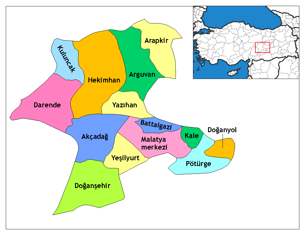
Doğanşehir, also known as Muhacir, Viransehir, Viranşehir[1], is a district of Malatya Province of Turkey. The mayor is İbrahim Karaman (CHP).
Contents
History
Pre-1402
County's first yerleşimininb BC By the Romans in 66 years to spread Christianity in Asia is thought to Create. Change text 758 yılma hand in hand Bizanslılar'm remaining until Zipetra named county, the date of the Abbasid caliph Harun Reşit were seized by the development has been, up to 857 years, the remaining districts in the hands of Arabs, then passed into the hands Bizanslılar'm, Yildirim Beyazit in 1399 by the Ottoman he was part of territory, in 1401 and was sacked by Timurlane.
1402-1928
In 1515 the Ottoman territories before attending 1877'den name Viransehir township or the county Harapşehir, 1877-1878 Ottoman-Russian War in Posof, Ardahan, Şavşat, Artvin and Trabzon were brought from place to place because of the immigrant population of the village was called.
Post-1928
A village in the township is connected to the same Besni merkzi olmuştur, was therdistrict center in 1929. 1933 Doğanşehir city name field, separated from 1 April 1946 by an independent Akçadağ district to district status has been linked to the Malatya.Bolt can be visited locations Dam, Polat Fish Plateau, Sulu Cave, slapstick, exile, Exchange, Harapşehir İçmece the Beypınarı, Acıpınar Plateau, Sıtmapınarı, Yıldızsubaşı, grove of screaming, Kayapınar, Sürmeli I'ınarı, Erkenek, Sakaltutan Juice, Değir men Deresi, Reşadiye Spring, Kayapınar.KöyleriBucak and villages Topraktepe'de total population is 47,191. Connected to the District of township and village names are: Altıntop, Beğre, Bıçakçı, with Sergeant, screaming, Çömlekoba, Dedeyazı Apple, Eskiköy, Fındıkköy, body, Günedoğru, Gürobası, Hudutköy, Kadı with Kapıdere, Karaterzi, Kelhalil, Koçdere, Small and , Örencik, Polat, Polatdere, Suçatı, Şatırobası, Topraktepe, Yolkoru, Yuval, Bolt, Erkenek, Karanlıkdere, Kurucaova, Reşadiye, with Sava, Beautiful Village.
It is rich in history and mall is located in Tarihİlçe district. The district centres on the ruins of walls BC In the Byzantine period were made in 66 years. Mesire as places in the valley, waterfalls and natural places Erkenek, located in the town Pinarbasi Bolt on.
1986 Eathquake
Result of the earthquake disaster in 1986, Reşadiye Village was divided into two. Half of the village on the fault line was moved Çelikhan way. This thus formed two Reşadiye Villages. The 'moved' in to the village close to the beautiful village was officially re-named.
Geography
The altitude of the town in Malatya Province, 58 km away to the sea level elevation is 1,290 meters. Both Plains and mountains are part of the landscape to the east of the town of Adiyaman province, Çelikhan District, in southern province of Adiyaman and Gölbaşı Besni districts, west of Kahramanmaras Elbistan District, north east and Yeşilyurt Akçadağ districts are located.
- Latitude. 38.0919444°, Longitude. 37.8788889° [2]
- An artificial pond or lake at Polat Barajı, 12.2km away, acts as the local resivior [1]
- A major streem 19.7km away is a irrigation water channel cut in the land at Melet Deresi [1]
- A local dam, which is a barrier constructed across a one of the nearby streams to impound water is 19.6km away at Sürgü Barajı [1]
The nearest towns are Altıntop (3.5km away) [1], Günedoğru (6km away) [1] Çığlık (6.8km away) [1]
Demographics
- Area: 1290 km ²
- Total municipal Population: 60,708 (According to the 2000 General Population Census)
- City Population: 13,517 (according to the 2000 General Population Census)
- City Population: 14,794 (according to [1] in 2011)
- Population Density: 50 per km
The area of the town is 1,290 km ². General population according to year 2000 census total population of 60,708 and 13,517 population centres, villages and township population of 47,191 'roll', 5 district of the town, 6 of the municipality has 31 villages.
Dogansehir is in the same time zone as Istanbul. [2]
Economy
District's most important source of income is agriculture. In recent years, significant improvement in fruit industry as a source of livelihood. Apricots and apples are the most important of these products, with a is a significant increase in apple production in recent years. Livestock is usually farmed in the village. Both the district and the villages of central and traditional values, importance is given to local custom.
Tourism is important to, with a TravelingLuck Hotels in the town [3].
Transport
The nearest railway/railroad station s located 13km away at Kadılı İstasyonu and 18. 5 km away at Suçatı İstasyonu. It has facilities comprising ticket office, platforms, etc. and handled train passengers and rail-freight. [1] The local mountain passes are used for transportation from one side to the other of the local mountain ranges at Kömürcü Gediği (18.7km away) , Reşadiye Geçidi (23.2km away) and Bitme Geçidi (24.7km away).[1]
See also
Reflist
- ^ a b c d e f g h i j "Doğanşehir / Dogansehir, Malatya, Turkey, Asia". TR: Travelingluck.com. http://travelingluck.com/Asia/Turkey/Malatya/_316440_Do%C4%9Fan%C5%9Fehir.html#geography. Retrieved 2011-10-06.
- ^ a b "Doğanşehir / Dogansehir, Malatya, Turkey, Asia". TR: Travelingluck.com. http://travelingluck.com/Asia/Turkey/Malatya/_316440_Do%C4%9Fan%C5%9Fehir.html#geography. Retrieved 2011-10-06.
- ^ "Stay at the finest hotels with TravelingLuck Hotels". Travelingluck.com. http://travelingluck.com/Hotel/search?lon=37.8788889&lat=38.0919444&limit=20&verbose=true. Retrieved 2011-10-06.
External sources
Coordinates: 38°05′45″N 37°52′45″E / 38.095833333333°N 37.879166666667°E
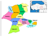
 Doğanşehir in Malatya Province (in the Eastern Anatolia region) of Turkey
Urban districts 
Rural districts RegionsAegean Black Sea Central Anatolia Eastern Anatolia Marmara Mediterranean Southeastern Anatolia Categories:- Districts of Malatya
- Eastern Anatolia Region
- Populated places in Malatya Province
Wikimedia Foundation. 2010.