- North Barsham, Norfolk
-
Coordinates: 52°52′39″N 0°50′43″E / 52.877570°N 0.845309°E
North Barsham 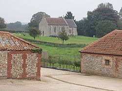
The parish church of All Saints, North Barsham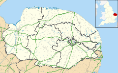
 North Barsham
North Barsham shown within NorfolkPopulation 224 (parish, 2001 census) OS grid reference TF9133 - London 119 Parish Barsham District North Norfolk Shire county Norfolk Region East Country England Sovereign state United Kingdom Post town Fakenham Postcode district NR 21 Dialling code 01328 Police Norfolk Fire Norfolk Ambulance East of England EU Parliament East of England UK Parliament North Norfolk List of places: UK • England • Norfolk North Barsham is a village within the civil parish of Barsham in the English county of Norfolk.[1] The village is one of four settlements within the parish of Barsham. The other villages are West Barsham, East Barsham and Houghton St Giles. North Barsham is 5 miles north of the town of Fakenham, 22.8 miles west of Cromer and 119 miles north of London. The nearest railway station is at Sheringham for the Bittern Line which runs between Sheringham, Cromer and Norwich. The nearest airport is Norwich International Airport.
External links
- Map sources for North Barsham, Norfolk
References
- ^ OS Explorer Map 24 - Norfolk Coast Central. ISBN 0 319 21726 4.
Categories:- Villages in Norfolk
- Norfolk geography stubs


Wikimedia Foundation. 2010.