- National Register of Historic Places listings in Yellowstone County, Montana
-
 Location of Yellowstone County in Montana
This is a list of the National Register of Historic Places listings in Yellowstone County, Montana. It is intended to be a complete list of the properties and districts on the National Register of Historic Places in Yellowstone County, Montana, United States. The locations of National Register properties and districts for which the latitude and longitude coordinates are included below, may be seen in a Google map.[1]
There are 29 properties and districts listed on the National Register in the county, including 2 National Historic Landmarks.
-
- This National Park Service list is complete through NPS recent listings posted November 10, 2011.[2]
Listings county-wide
[3] Landmark name Image Date listed Location City or town Summary 1 Acme Building November 9, 2005 109-111 N. Broadway
45°46′59″N 108°30′14″W / 45.783056°N 108.503889°WBillings 2 Antelope Stage Station January 19, 1983 East of Broadview
46°02′38″N 108°43′53″W / 46.043889°N 108.731389°WBroadview 3 Armour Cold Storage July 7, 2004 1 S. Broadway
45°46′50″N 108°30′12″W / 45.780556°N 108.503333°WBillings 4 Billings Chamber of Commerce Building January 20, 1972 303 N. 27th St.
45°47′05″N 108°30′19″W / 45.784722°N 108.505278°WBillings 5 Billings Historic District March 13, 1979 Roughly bounded by N. 23rd and N. 25th Sts. and 1st and Montana Aves.; also 2600 (2528), 2604-2606, 2608, 2610-2614, and 2624 Montana Ave.
45°47′02″N 108°29′59″W / 45.783889°N 108.499722°WBillings Second set of addresses represents a boundary increase, the Billings Townsite Historic District, added on April 20, 2006 6 Billings Old Town Historic District September 16, 2010 Generally bounded by Montana Ave. on the north; S. 26th on the east; 1st Ave., S on the south; and S. 30th St. on the west
45°46′50″N 108°30′15″W / 45.780556°N 108.504167°WBillings 7 Billings West Side School March 20, 2002 415 Broadwater Ave.
45°46′40″N 108°31′32″W / 45.777778°N 108.525556°WBillings 8 Black Otter Trail January 5, 2007 Black Otter Trail
45°48′02″N 108°29′49″W / 45.800556°N 108.496944°WBillings 9 Boothill Cemetery April 17, 1979 North of Billings
45°48′09″N 108°28′48″W / 45.8025°N 108.48°WBillings 10 Dude Rancher Lodge July 22, 2010 415 N. 29th St.
45°47′05″N 108°30′35″W / 45.784722°N 108.509722°WBillings 11 Electric Building March 1, 2002 113-115 Broadway
45°47′04″N 108°30′22″W / 45.784444°N 108.506111°WBillings 12 Abraham and Carrie Erb House June 9, 2005 110 4th Ave.
45°40′12″N 108°46′32″W / 45.67°N 108.775556°WLaurel 13 Fire House No. 2 February 29, 1980 201 E. 30th St.
45°46′39″N 108°30′12″W / 45.7775°N 108.503333°WBillings 14 Hoskins Basin Archeological District November 20, 1974 Address Restricted Billings 15 L and L Building October 1, 1979 2624 Minnesota Ave.
45°46′53″N 108°30′07″W / 45.78148°N 108.50193°WBillings 16 Laurel Downtown Historic District September 16, 2010 Roughly bounded by the Burlington Northern Santa Fe Railway Company tracks to the south, Third St., S. to the north, Wyoming Ave. Laurel 17 Masonic Temple April 17, 1986 2806 3rd Ave., N.
45°47′01″N 108°30′25″W / 45.783611°N 108.506944°WBillings 18 Preston B. Moss House April 30, 1982 914 Division St.
45°46′46″N 108°30′55″W / 45.77944°N 108.51528°W[4]Billings 19 Austin North House November 23, 1977 622 N. 29th St.
45°47′11″N 108°30′41″W / 45.786389°N 108.511389°WBillings 20 I.D. O'Donnell House November 23, 1977 105 Clark Ave.
45°46′49″N 108°31′02″W / 45.780278°N 108.517222°WBillings 21 Oliver Building October 1, 1979 2702 Montana Ave.
45°46′54″N 108°30′14″W / 45.78179°N 108.50376°WBillings 22 Parmly Billings Memorial Library October 26, 1972 2822 Montana Ave.
45°46′50″N 108°30′18″W / 45.780556°N 108.505°WBillings 23 Pictograph Cave 
October 15, 1966 7 miles southeast of Billings in Indian Caves Park
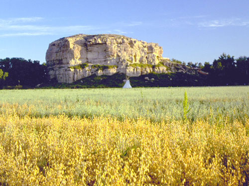
45°44′12″N 108°25′56″W / 45.736667°N 108.432222°WBillings 24 Pompey's Pillar 
October 15, 1966 West of Pompey
45°59′44″N 108°00′17″W / 45.995556°N 108.004722°WPompey's Pillar 25 Prescott Commons April 30, 1982 Rimrock Rd.
45°47′52″N 108°33′08″W / 45.797778°N 108.552222°WBillings 26 Harold and Marion Ruth House June 21, 2007 111 Emerald Dr.
45°48′21″N 108°28′56″W / 45.805833°N 108.482222°WBillings 27 U.S. Post Office and Courthouse-Billings 
March 14, 1986 2602 1st Ave., N.
45°46′58″N 108°30′10″W / 45.782778°N 108.502778°WBillings 28 Christian Yegen House October 1, 1979 208 S. 35th St.
45°46′26″N 108°30′36″W / 45.773889°N 108.51°WBillings 29 Peter Yegen House April 16, 1980 209 S. 35th St.
45°46′27″N 108°30′35″W / 45.774167°N 108.509722°WBillings See also
- List of National Historic Landmarks in Montana
- National Register of Historic Places listings in Montana
References
- ^ The latitude and longitude information provided in this table was derived originally from the National Register Information System, which has been found to be fairly accurate for about 99% of listings. For about 1% of NRIS original coordinates, experience has shown that one or both coordinates are typos or otherwise extremely far off; some corrections may have been made. A more subtle problem causes many locations to be off by up to 150 yards, depending on location in the country: most NRIS coordinates were derived from tracing out latitude and longitudes off of USGS topographical quadrant maps created under the North American Datum of 1927, which differs from the current, highly accurate WGS84 GPS system used by Google maps. Chicago is about right, but NRIS longitudes in Washington are higher by about 4.5 seconds, and are lower by about 2.0 seconds in Maine. Latitudes differ by about 1.0 second in Florida. Some locations in this table may have been corrected to current GPS standards.
- ^ "National Register of Historic Places: Weekly List Actions". National Park Service, United States Department of the Interior. Retrieved on November 10, 2011.
- ^ Numbers represent an ordering by significant words. Various colorings, defined here, differentiate National Historic Landmark sites and National Register of Historic Places Districts from other NRHP buildings, structures, sites or objects.
- ^ Location derived from the house's website; the NRIS lists it as "Address Restricted"
U.S. National Register of Historic Places Topics Lists by states Alabama • Alaska • Arizona • Arkansas • California • Colorado • Connecticut • Delaware • Florida • Georgia • Hawaii • Idaho • Illinois • Indiana • Iowa • Kansas • Kentucky • Louisiana • Maine • Maryland • Massachusetts • Michigan • Minnesota • Mississippi • Missouri • Montana • Nebraska • Nevada • New Hampshire • New Jersey • New Mexico • New York • North Carolina • North Dakota • Ohio • Oklahoma • Oregon • Pennsylvania • Rhode Island • South Carolina • South Dakota • Tennessee • Texas • Utah • Vermont • Virginia • Washington • West Virginia • Wisconsin • WyomingLists by territories Lists by associated states Other Municipalities and communities of Yellowstone County, Montana Cities 
Town CDPs Unincorporated
communitiesActon | Comanche | Hesper | Pompey's Pillar
Indian reservation Footnotes ‡This populated place also has portions in an adjacent county or counties
Categories:- National Register of Historic Places in Montana by county
- Yellowstone County, Montana
-


Wikimedia Foundation. 2010.