- Collegeville, Pennsylvania
-
Borough of Collegeville Borough Country United States State Pennsylvania County Montgomery Elevation 207 ft (63.1 m) Coordinates 40°11′08″N 75°27′30″W / 40.18556°N 75.45833°W Area 1.6 sq mi (4.1 km2) - land 1.6 sq mi (4 km2) - water 0.1 sq mi (0 km2), 6.25% Population 5,089 (2010) Density 5,150.7 / sq mi (1,988.7 / km2) Incorporated 1896 Government Council-manager Mayor Albert Stagliano Timezone EST (UTC-5) - summer (DST) EDT (UTC-4) ZIP Codes 19426, 19473 Area code 610  Location of Collegeville in Montgomery County
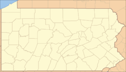
 Location of Collegeville in Pennsylvania
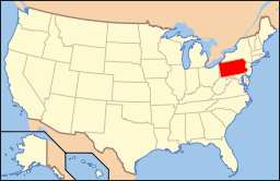 Location of Pennsylvania in the United States
Website: http://www.collegeville-pa.gov Collegeville is a borough in Montgomery County, Pennsylvania, 30 miles (48 km) northwest of Philadelphia on the Perkiomen Creek. Collegeville was incorporated in 1896. It is the seat of Ursinus College, opened in 1869. The population was 5,089 at the 2010 census.
Contents
Geography
Collegeville is located at 40°11′8″N 75°27′30″W / 40.18556°N 75.45833°W (40.185554, -75.458273)[1].
According to the United States Census Bureau, the borough has a total area of 1.6 square miles (4.1 km2), of which, 1.6 square miles (4.1 km2) of it is land and 0.1 square miles (0.26 km2) of it (3.70%) is water.
Economy
Collegeville and the surrounding area are rapidly growing. The borough of Collegeville is home to Ursinus College, as well as many local businesses. Outside of the borough, Pfizer's pharmaceutical division has a global campus.[2] There is also a GlaxoSmithKline research and development facility. Collegeville is the home of the Church House (headquarters) of the Pennsylvania Southeast Conference of the United Church of Christ.
Demographics
Historical populations Census Pop. %± 1930 878 — 1940 976 11.2% 1950 1,900 94.7% 1960 2,254 18.6% 1970 3,191 41.6% 1980 3,406 6.7% 1990 4,227 24.1% 2000 4,628 9.5% 2010 5,089 10.0% www.dvrpc.org/data/databull/rdb/db82/appedixa.xls As of the 2010 census, the population of the borough was 89.4% White, 4.0% Black or African American, 0.2% Native American, 3.8% Asian, and 1.9% were two or more races. 2.4% of the population were of Hispanic or Latino ancestry [2].
As of the census[3] of 2000, there were 8,032 people, 1,408 households, and 1,010 families residing in the borough. The official population figure includes the population of Graterford Prison which is located in Graterford, PA, outside the borough limits. The actual population of Collegeville Borough is 4,612, according to the Borough secretary. The population density was 5,150.7 people per square mile (1,987.9/km²). There were 1,438 housing units at an average density of 922.1 per square mile (355.9/km²). The racial makeup of the borough was 61.83% White, 31.19% African American, 0.10% Native American, 2.13% Asian, 0.01% Pacific Islander, 3.93% from other races, and 0.81% from two or more races. Hispanic or Latino of any race were 5.13% of the population.
There were 2,000 households out of which 38.3% had children under the age of 18 living with them, 61.9% were married couples living together, 7.2% had a female householder with no husband present, and 28.2% were non-families. 21.4% of all households were made up of individuals and 5.7% had someone living alone who was 65 years of age or older. The average household size was 2.67 and the average family size was 3.17.
In the borough the population was spread out with 12.9% under the age of 18, 17.6% from 18 to 24, 42.9% from 25 to 44, 21.4% from 45 to 64, and 5.2% who were 65 years of age or older. The median age was 35 years. For every 100 females there were 240.2 males. For every 100 females age 18 and over, there were 275.6 males.
The median income for a household in the borough was $77,499, and the median income for a family was $90,733. Males had a median income of $40,185 versus $39,236 for females. The per capita income for the borough was $23,080. About 1.0% of families and 2.0% of the population were below the poverty line, including none of those under age 18 and 2.1% of those age 65 or over.
Politics and government
Collegeville has a city manager form of government with a mayor and a seven-member borough council. The mayor is Albert Stagliano.
The borough is part of the Sixth Congressional District (represented by Rep. Jim Gerlach), the 150th State House District (represented by Rep. Mike Vereb) and the 44th State Senate District (represented by Sen. John Rafferty, Jr.).
Notable people
- Horace Ashenfelter,[4] winner of the steeplechase at the 1952 Summer Olympics at Helsinki and Sullivan Award winner as outstanding amateur athlete for the year 1952.
- Michael R. Matz,[5] an American Olympics equestrian rider and Thoroughbred horse trainer who won the 2006 Kentucky Derby.
- CM Punk[citation needed], former WWE World Heavyweight Champion, lived in Collegeville between December 2003 and August 2005.
- Elin Hilderbrand[6] is a romance novelist.
- Jennifer Carfagno, host of the show First Outlook on The Weather Channel.
- Rock band The Bloodhound Gang are from Collegeville.
References
- ^ "US Gazetteer files: 2010, 2000, and 1990". United States Census Bureau. 2011-02-12. http://www.census.gov/geo/www/gazetteer/gazette.html. Retrieved 2011-04-23.
- ^ [1]
- ^ "American FactFinder". United States Census Bureau. http://factfinder.census.gov. Retrieved 2008-01-31.
- ^ sports-reference.com,"Horace Ashenfelter"
- ^ sports-reference.com, "Michael Matz". Accessed 1 April 2010.
- ^ amazon.com "About the author". Accessed 24 November 2008.
External links
Categories:- Populated places established in 1698
- Boroughs in Montgomery County, Pennsylvania


Wikimedia Foundation. 2010.