- Marlborough Township, Montgomery County, Pennsylvania
-
Not to be confused with East Marlborough Township, Chester County, Pennsylvania or West Marlborough Township, Chester County, Pennsylvania.
Marlborough Township Township Country United States State Pennsylvania County Montgomery Elevation 643 ft (196 m) Coordinates 40°23′00″N 75°25′59″W / 40.3833333°N 75.43306°W Area 12.7 sq mi (32.9 km2) - land 12.5 sq mi (32 km2) - water 0.2 sq mi (1 km2), 1.57% Population 3,178 (2010) Density 247.6 / sq mi (95.6 / km2) Timezone EST (UTC-5) - summer (DST) EDT (UTC-4) Area code 215  Location of Marlborough Township in Montgomery County
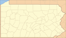
 Location of Marlborough Township in Pennsylvania
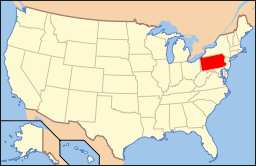 Location of Pennsylvania in the United States
Website: http://www.marlboroughpa.org/pages/home.html Historical populations Census Pop. %± 1930 966 — 1940 1,138 17.8% 1950 1,432 25.8% 1960 1,875 30.9% 1970 2,465 31.5% 1980 2,849 15.6% 1990 3,116 9.4% 2000 3,104 −0.4% 2010 3,178 2.4% www.dvrpc.org/data/databull/rdb/db82/appedixa.xls.</ref> Marlborough Township is a township in Montgomery County, Pennsylvania, United States. The population was 3,178 at the 2010 census.
It is part of the Upper Perkiomen School District.
Contents
Geography
According to the United States Census Bureau, the township has a total area of 12.7 square miles (32.9 km²), of which, 12.5 square miles (32.5 km²) of it is land and 0.2 square miles (0.4 km²) of it (1.34%) is water. It is drained by the Perkiomen Creek into the Schuylkill River and consists mainly of rolling hills and valleys. Its villages include Hoppenville, Perkiomenville (also in Upper Frederick,) and Sumneytown. Its numbered routes are 29 and 63, which has its NW terminus on north-to-south 29 in Green Lane. Other local roads of note include Finland Road, Geryville Pike, Hoppenville Road, Knight Road, Swamp Creek Road, and Upper Ridge Road.
Adjacent municipalities
- Upper Hanover Township (northwest)
- Upper Frederick Township (southwest)
- Green Lane (west)
- Lower Frederick Township (tangent to the south)
- Upper Salford Township (south)
- Salford Township (southeast)
- West Rockhill Township, Bucks County (east)
- Milford Township, Bucks County (northeast)
Demographics
As of the 2010 census, the township was 97.4% White, 1.0% Black or African American, 0.2% Native American, 0.2% Asian, and 1.0% were two or more races. 1.2% of the population were of Hispanic or Latino ancestry [1].
As of the census[1] of 2000, there were 3,104 people, 1,174 households, and 888 families residing in the township. The population density was 247.6 people per square mile (95.6/km²). There were 1,222 housing units at an average density of 97.5/sq mi (37.7/km²). The racial makeup of the township was 97.55% White, 0.71% African American, 0.13% Native American, 0.16% Asian, 0.64% from other races, and 0.81% from two or more races. Hispanic or Latino of any race were 1.10% of the population.
There were 1,174 households out of which 32.5% had children under the age of 18 living with them, 67.0% were married couples living together, 6.1% had a female householder with no husband present, and 24.3% were non-families. 19.8% of all households were made up of individuals and 6.9% had someone living alone who was 65 years of age or older. The average household size was 2.63 and the average family size was 3.06.
In the township the population was spread out with 23.6% under the age of 18, 6.6% from 18 to 24, 28.1% from 25 to 44, 28.9% from 45 to 64, and 12.8% who were 65 years of age or older. The median age was 40 years. For every 100 females there were 99.0 males. For every 100 females age 18 and over, there were 98.3 males.
The median income for a household in the township was $60,170, and the median income for a family was $68,750. Males had a median income of $47,188 versus $31,667 for females. The per capita income for the township was $26,273. About 0.8% of families and 2.3% of the population were below the poverty line, including 0.7% of those under age 18 and 5.3% of those age 65 or over.
Government and Politics
Presidential elections results Year Republican Democrat 2008 50.3% 838 48.5% 809 2004 53.2% 838 45.8% 721 2000 53.8% 655 40.9% 498 1996 46.0% 516 37.8% 424 1992 39.5% 492 34.5% 430 Board of Supervisors
- Carl Ascoli, Chairman
- Frank T. McCauley, Jr., Vice-chairman
- Brian Doremus
References
- ^ "American FactFinder". United States Census Bureau. http://factfinder.census.gov. Retrieved 2008-01-31.
Categories:- Townships in Montgomery County, Pennsylvania


Wikimedia Foundation. 2010.