- Denton, Maryland
-
Denton, Maryland — Town — 
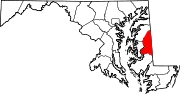
SealLocation of Denton, Maryland
Coordinates: 38°53′2″N 75°49′36″W / 38.88389°N 75.82667°WCoordinates: 38°53′2″N 75°49′36″W / 38.88389°N 75.82667°W Country United States State Maryland County Caroline Government – Mayor Robert Clendaniel – Town Admin. Donald Mulrine Area – Total 2.6 sq mi (6.7 km2) – Land 2.5 sq mi (6.4 km2) – Water 0.1 sq mi (0.3 km2) Elevation 43 ft (13 m) Population (2000) – Total 2,960 – Density 1,205.0/sq mi (465.2/km2) Time zone Eastern (EST) (UTC-5) – Summer (DST) EDT (UTC-4) ZIP code 21629 Area code(s) 410 FIPS code 24-22725 GNIS feature ID 0590087 Website http://www.dentonmaryland.com Denton is a town in Caroline County, Maryland, United States. The population was 2,960 at the 2000 census. It is the county seat of Caroline County[1]. Denton is the birthplace of former Delaware governor Sherman W. Tribbitt and author Sophie Kerr, as well as the long time home of former Maryland governor Harry Hughes. The town's ZIP code is 21629. The primary telephone exchange is 479 and the area code is 410. The town is served by Maryland Routes 404, 313, 328, and 16. It borders the Choptank River. It is home to WKDI radio (840 AM).
Contents
Geography
Denton is located at 38°53′2″N 75°49′36″W / 38.88389°N 75.82667°W (38.883853, -75.826556)[2].
According to the United States Census Bureau, the town has a total area of 2.6 square miles (6.7 km2), of which, 2.5 square miles (6.5 km2) of it is land and 0.1 square miles (0.26 km2) of it (4.65%) is water.
Demographics
As of the census[3] of 2000, there were 2,960 people, 1,140 households, and 697 families residing in the town. The population density was 1,205.0 people per square mile (464.6/km²). There were 1,264 housing units at an average density of 514.6 per square mile (198.4/km²). The racial makeup of the town was 71.66% White, 25.44% African American, 0.34% Native American, 0.37% Asian, 0.24% from other races, and 1.96% from two or more races. Hispanic or Latino of any race were 1.86% of the population.
There were 1,140 households out of which 31.1% had children under the age of 18 living with them, 37.7% were married couples living together, 17.7% had a female householder with no husband present, and 38.8% were non-families. 33.5% of all households were made up of individuals and 15.0% had someone living alone who was 65 years of age or older. The average household size was 2.29 and the average family size was 2.90.
In the town the population was spread out with 23.3% under the age of 18, 8.3% from 18 to 24, 26.8% from 25 to 44, 19.6% from 45 to 64, and 22.0% who were 65 years of age or older. The median age was 39 years. For every 100 females there were 87.3 males. For every 100 females age 18 and over, there were 80.4 males.
The median income for a household in the town was $34,936, and the median income for a family was $42,583. Males had a median income of $27,475 versus $20,504 for females. The per capita income for the town was $18,631. About 6.6% of families and 8.1% of the population were below the poverty line, including 7.4% of those under age 18 and 7.6% of those age 65 or over.
Communities in Denton
- Anthony
- Calvert Acres
- Chapel Branch
- Country Life Acres
- Garland Lake
- Oil City
- Mallard Landing
- Riding Acres
- Savannah Overlook
- Smith Landing
- Tower MHP
- West Denton
- Waymen Wharf
Town Officials and Staff
Mayor: Robert L. Clendaniel[4]
Town Council Members: Dennis D. Porter, Agnes G. Case, Dean W. Danielson, Conway Gregory[4]
Town Administrator: Donald H. "Machine Gun" Mulrine Jr.[4]
Clerk Treasurer: Karen L. Monteith[4]
Chief of Police: Rodney R. Cox[4]
Director of Public Works: Scott Getchell[4]
Director of Planning and Codes: William D. Kastning[4]References
- ^ "Find a County". National Association of Counties. http://www.naco.org/Counties/Pages/FindACounty.aspx. Retrieved 2011-06-07.
- ^ "US Gazetteer files: 2010, 2000, and 1990". United States Census Bureau. 2011-02-12. http://www.census.gov/geo/www/gazetteer/gazette.html. Retrieved 2011-04-23.
- ^ "American FactFinder". United States Census Bureau. http://factfinder.census.gov. Retrieved 2008-01-31.
- ^ a b c d e f g "Town Council and Staff - Government". The Official Town of Denton Website. http://www.dentonmaryland.com/government/town-council-staff.asp. Retrieved 11 May 2011.
External links
Municipalities and communities of Caroline County, Maryland County seat: DentonTowns Denton | Federalsburg | Goldsboro | Greensboro | Henderson | Hillsboro | Marydel | Preston | Ridgely | Templeville‡
Unincorporated
communitiesAmerican Corner | Andersontown | Baltimore Corner | Bethlehem | Burrsville | Choptank | Gilpin Point | Grove | Harmony | Hickman | Hobbs | Jumptown | Linchester | Oakland | Oil City | Reliance‡ | Tanyard | Two Johns | West Denton | Whiteleysburg | Williston
Footnotes ‡This populated place also has portions in an adjacent county or counties
County seats of Maryland Cities Annapolis | Cambridge | Cumberland | Frederick | Hagerstown | Rockville | Salisbury | Westminster
Independent municipality Towns Bel Air | Centreville | Chestertown | Denton | Easton | Elkton | La Plata | Leonardtown | Oakland | Princess Anne | Snow Hill | Upper Marlboro
CDPs Categories:- Towns in Maryland
- Populated places in Caroline County, Maryland
- County seats in Maryland


Wikimedia Foundation. 2010.