- Olney, Maryland
-
Olney, Maryland — CDP — Location of Olney, Maryland
Coordinates: 39°9′11″N 77°4′29″W / 39.15306°N 77.07472°W Country United States State Maryland County Montgomery Area – Total 13.0 sq mi (33.7 km2) – Land 13.0 sq mi (33.6 km2) – Water 0.0 sq mi (0.0 km2) Elevation 541 ft (165 m) Population (2000) – Total 31,438 – Density 2,420.1/sq mi (934.4/km2) Time zone Eastern (EST) (UTC-5) – Summer (DST) EDT (UTC-4) ZIP codes 20830, 20832, 20833 Area code(s) 301 FIPS code 24-58900 GNIS feature ID 0590948 Olney, a census-designated place and an unincorporated area of Montgomery County, Maryland, USA, is located in the north central part of the county, twenty miles (32 km) north of Washington, D.C. It was largely agricultural until the 1960s, when growth of the Washington suburbs led to its conversion into a mostly residential area. As generally defined, Olney had a total population of 31,438 in the 2000 census. In July 2007, Money magazine ranked Olney as 17 (the highest ranked town in Maryland) out of the top 100 in its "America's Best Places To Live" edition.
Contents
History
Originally known as Mechanicsville, the village which became Olney was established in 1800. The area was mostly farmland, but it soon began attracting artisans. Early residents Sarah Brooke and Dr. Charles Farquhar were devotees of the English poet William Cowper, and named their home after the poet's hometown. The area was in turn named for their home, which still stands and is known as the Olney House.
The Brooke family held the largest tracts of land in Olney, whose central village was at the intersection of the Rockville to Baltimore road, and the one which connected Washington with Westminster, Maryland, to the north. The Quaker community in Sandy Spring thrived just to Olney's east. The Sandy Spring Museum is a historical museum featuring educational programs and displays. St. John's Episcopal Church was established in 1842 and survives to this day.
After the siege of Washington by the British in 1814 during the War of 1812, President Madison and his family passed through Olney en route to taking refuge in the neighboring town of Brookeville. Although not as involved in the Civil War as areas of Maryland to the west, Olney residents still experienced the tug-of-war between loyalty to the plantation economy of the South and to the Federal government in Maryland's midst.
Geography
As an unincorporated area, Olney's boundaries are not officially defined. The United States Census Bureau defines a Census-Designated Place of Olney centered at 39°9' North and 77°5' West. It has a total area of 13.0 square miles (34 km2). None of the area is covered with water.
Olney's town center sits at the intersection of state route 97 (Georgia Ave.) and route 108 (Olney-Laytonsville Road). The town, larger than any other in the neighboring areas, lies south of Brookeville, west of Sandy Spring, east of Rockville and north of Aspen Hill.
Demographics
At the 2000 census[1], there were 31,438 people, 10,274 households, and 8,650 families residing in the area. The population density is 2,420.1 people per square mile (934.4/km²). There are 10,415 housing units at an average density of 801.7 per square mile (309.6/km²). The racial makeup of the area is 79.04% White, 8.78% African American, 8.03% Asian, 5.01% Hispanic or Latino, and 0.48% Native American.
There are 10,274 households, of which 49.1% have children under the age of 18 living with them, 71.4% are married couples living together, 10.2% have a female householder with no husband present, and 15.8% are non-families. The average household size is 3.04 and the average family size is 3.34.
31.2% of residents are under the age of 18, 5.6% from 18 to 24, 29.9% from 25 to 44, 26.9% from 45 to 64, and 6.4% 65 years of age or older. The median age is 37 years. For every 100 females there are 93.5 males.
According to a 2007 estimate,[2] the median household income is $116,319, and the median family income is $126,849. Males have a median income of $69,911 versus $45,818 for females. The per capita income for the area is $35,267. 2.6% of the population and 1.9% of families are below the poverty line.
Olney, Maryland has the distinction of having the highest per-capita population of cutters in the United States. Nearly 12% of high school youths answered a survey indicating that they had engaged in self-mutilation. Demographers and social psychologists have attributed this high proportion of "cutting behavior" to the dark underside of suburban living that contrasts sharply with the seemingly idyllic exterior of Olney.[citation needed]
Recreational facilities
 Soccer at Freeman Fields
Playgrounds, playing fields and courts are available throughout Olney and the surrounding area. Many of the parks are public and some belong to homeowners or other private associations. Public parks include Olney Manor Park (featuring the Olney Swim Center, a year-round indoor public pool), Southeast Olney Park, Longwood Park, Cherrywood Park, Bowie Mill Park, and the OBGC Park at Freeman Fields.
Olney is also home to a private country club and a golf driving range.
Education
Olney has various public and private schools, including three private elementary schools. Brooke Grove Elementary School, a public elementary school in Olney, was awarded the prestigious Blue Ribbon School for Excellence. There are three Montgomery County Public School clusters that bisect Olney, with some children attending elementary and middle schools that send students on to Magruder High School and others attending schools that send students to Sherwood High School or James Hubert Blake High School. The new Our Lady Of Good Counsel High School building opened in January 2007, enabling the Roman Catholic high school to relocate to Olney from Wheaton, Maryland. The new building of Washington Christian Academy recently opened in Olney, completing its long term goal to relocate to the blossoming suburb.
Arts and community activities
Although largely a residential area, Olney maintains ties to its cultural past. The stately Olney Inn was destroyed by fire in March, 1978, but the historic Olney Ale House continues to operate on the east edge of town. Farther east lies the Sandy Spring Museum and Woodlawn Manor Living History Museum [1] where visitors may learn more about the area or visit historic Woodlawn Manor c 1800 for Tea & Tour. Olney is also home to Montgomery General Hospital, a branch of the Montgomery County Library, the Olney Aquatic Center, and the Norbeck golf course.
The Olney Theatre presents professional level dramatic and musical live theatrical productions in its large and modern playhouse on the East edge of town, drawing audiences from across the Maryland and DC region.
Olney is also home to the Olney Big Band and Olney Concert Band. The Olney Concert Band is directed by Brian Damron, who is also a music teacher at James Hubert Blake High School.
Religious institutions
Ohev Shalom Talmud Torah Congregation of Olney, commonly known as OSTT, is a modern orthodox synagogue located on Georgia Avenue in Olney.[3]
Notable residents
- Harold L. Ickes, President Roosevelt's Secretary of Interior, owned a 250-acre (1.0 km2) farm from 1937 until his death in 1952. His wife maintained the farm after his death until she sold it in 1971.[4] The Ickes' large white house still stands in the middle of the original core of the Olney Oaks development/subdivision.
- Frank Miller, an artist and film director best known for his film noir-style comic book stories, is an Olney native.
- Johnny "Cakes" Auville, from the Junkies on 106.7 WJFK, resides in Olney.
References
- ^ "American FactFinder". United States Census Bureau. http://factfinder.census.gov. Retrieved 2008-01-31.
- ^ Olney CDP, Maryland - Fact Sheet - American FactFinder
- ^ "Synagogue History". Ohev Sholom - The National Synagogue. http://www.ostns.org/history.shtml. Retrieved April 11, 2011.
- ^ Homeland Village Community Association Home Page
External links
- Olney, Maryland Community web page
- Olney, Maryland Chamber of Commerce web page
- The Olney Crier - Olney Maryland community announcements
Coordinates: 39°09′11″N 77°04′29″W / 39.153022°N 77.0747°W
Municipalities and communities of Montgomery County, Maryland Cities 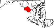
Towns Villages &
Special Tax DistrictsCDPs Ashton-Sandy Spring | Aspen Hill | Bethesda | Brookmont | Burtonsville | Cabin John | Calverton‡ | Chevy Chase | Clarksburg | Cloverly | Colesville | Damascus | Darnestown | Fairland | Forest Glen | Friendship Village | Germantown | Hillandale‡ | Kemp Mill | Montgomery Village | North Bethesda | North Kensington | North Potomac | Olney | Potomac | Redland | Rossmoor | Silver Spring | South Kensington | Travilah | Wheaton–Glenmont | White Oak
Other
communitiesAshton | Beallsville | Boyds | Brinklow | Carderock | Carole Highlands | Comus | Dawsonville | Derwood | Dickerson | Ednor | Fairview | Glenmont | Hyattstown | Kentlands | Norbeck | North Bethesda Market | Seneca | Sandy Spring | Shady Grove | Sherwood Forest | Spencerville | Wheaton
Footnotes ‡This populated place also has portions in an adjacent county or counties
Categories:- Unincorporated communities in Maryland
- Populated places in Montgomery County, Maryland
- Census-designated places in Maryland
- Populated places established in 1800


Wikimedia Foundation. 2010.