- Cockeysville-Hunt Valley, Maryland
Infobox Settlement
official_name = Cockeysville, Maryland
settlement_type = CDP
nickname =
motto =
imagesize =
image_caption =
image_
imagesize =
image_caption =
image_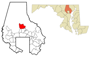
mapsize =
map_caption =
mapsize1 =
map_caption1 =subdivision_type = Country
subdivision_name =United States
subdivision_type1 = State
subdivision_name1 =Maryland
subdivision_type2 = County
subdivision_name2 = Baltimore
government_footnotes =
government_type =
leader_title =
leader_name =
leader_title1 =
leader_name1 =
established_title =
established_date =unit_pref = Imperial
area_footnotes =
area_magnitude =
area_total_km2 = 29.6
area_land_km2 = 29.2
area_water_km2 = 0.4
area_total_sq_mi = 11.4
area_land_sq_mi = 11.3
area_water_sq_mi = 0.1population_as_of = 2000
population_footnotes =
population_total = 19388
population_density_km2 = 663.5
population_density_sq_mi = 1718.4timezone = Eastern (EST)
utc_offset = -5
timezone_DST = EDT
utc_offset_DST = -4
elevation_footnotes =
elevation_m = 94
elevation_ft = 308
latd = 39 |latm = 28 |lats = 24 |latNS = N
longd = 76 |longm = 37 |longs = 36 |longEW = Wpostal_code_type =
ZIP code s
postal_code = 21030, 21031, 21065
area_code = 410, 443
blank_name = FIPS code
blank_info = 24-18250
blank1_name = GNIS feature ID
blank1_info = 0589994
website =
footnotes =Cockeysville is an
unincorporated community and acensus-designated place in Baltimore County,Maryland ,United States . The population was 19,388 at the 2000 census. A part of this area is known as Hunt Valley, at about alatitude of 39.5°North andlongitude 76.7°West .Hunt Valley is served by the
Cockeysville, Maryland post office, and also is home to a satellite campus of theCommunity College of Baltimore County .History
Cockeysville was named after the Cockey family which helped establish the town. Thomas Cockey (1676-1737) settled in Limestone Valley in 1725 at Taylor's Hall (an area now just north of Padonia Road and east of I-83). Joshua Frederick Cockey (1765-1821) built one of the first homes in the area in 1798 and built the first commercial structure (a hotel) in 1810 in what would become the village of Cockeysville. His son, Judge Joshua F. Cockey (1800-1891) lived lifelong in the village and built the train station (what would be part of the
Pennsylvania Railroad ) and accompanying commercial buildings in the 1830s.Cockeysville was the scene of some Civil War activity. Confederate soldiers pushed into the Baltimore area intending to cut off the city and Washington from the north. On
July 10 ,1864 Cavalry General Bradley T. Johnson led troops into Cockeysville, destroying telegraph lines and tearing up track along theNorthern Central Railway . They also burned the first bridge over the Gunpowder Falls, just beyond nearby Ashland, Maryland.President Abraham Lincoln travelled through Cockeysville on the Northern Central Railway enroute to
Gettysburg, Pennsylvania to deliver theGettysburg Address onNovember 19 ,1863 . Less than two years later, onApril 21 ,1865 , Lincoln's Funeral Train also passed through Cockeysville on its way fromWashington, D.C. to his final resting place atSpringfield, Illinois . [cite book |author=Daniel Carroll Toomey |title=Baltimore During the Civil War |publisher=Toomey Press |date=1997 |isbn=0961267070 |pages=p. 170 ] [cite web |title=The Route of Abraham Lincoln's Funeral Train |url=http://members.aol.com/RVSNorton1/Lincoln51.html |date=1996-12-29 |accessdate=2008-04-15]After the war, Joshua F. Cockey, III (1837-1920) founded the National Bank of Cockeysville (1891) and other commercial ventures in the community, as well as developed dwellings along the York Turnpike (now York Road) that made up the village of Cockeysville.
Geography
Cockeysville is located at coor dms|39|28|24|N|76|37|36|W|city (39.473273, -76.626703)GR|1.
According to the
United States Census Bureau , the CDP has a total area of 11.4 square miles (29.6 km²), of which, 11.3 square miles (29.2 km²) of it is land and 0.2 square miles (0.4 km²) of it (1.31%) is water.The town lies north of the Baltimore beltway (I-695) along I-83 and York Road. It is bordered on the north by
Hunt Valley, Maryland , on the east by theLoch Raven Reservoir , on the south byLutherville-Timonium, Maryland , and on the west byMays Chapel, Maryland . Most commercial activity is concentrated along York Road.Transportation
Roads
York Road
Maryland Route 45, better known as York Road, is the main commercial corridor that runs through the Cockeysville and Hunt Valley areas.
hawan Road/Tufton Avenue
Shawan Road/Tufton Avenue runs west-east between Hunt Valley and the
Owings Mills /Reisterstown area. It is identified as "Shawan Road" from York Road to Falls Road, and "Tufton Avenue" from Falls Road to its end atGreenspring Avenue /Worthington Avenue. The road is mostly undeveloped west ofI-83 , but is used by many motorists as a cross-county route betweenOwings Mills orReisterstown andHunt Valley . However, there are a few notable landmarks on the road, including:Hunt Valley Town Center ,Hunt Valley Light Rail Stop ,Oregon Ridge Park , and the home of formerMajor League Baseball starCal Ripken Jr. . Shawan Road is exit 20 offI-83 .Warren Road
Warren Road begins as exit 18 off
I-83 , then continues in an eastward direction through Cockeysville, mostly as a residential two-lane road. The road originally ran east to the town of Warren, Maryland, which was a mill town on the Gunpowder Falls, flooded out in the 1920s with the enlargement of the Loch Raven Reservoir. Today Warren Rd goes over the reservoir and changes names to Merrymans Mill Road on the east side. Located on Warren Road is theWarren Road Light Rail Stop .Maryland Transit Administration Bus Route 9 also operates on most of Warren Road.Cranbrook Road
Padonia Road
Padonia Road is an extension of Broadway Road which starts at
Greenspring Avenue inOwings Mills , then changes names to Padonia Road at Falls Road. The road then continues east in a winding pattern through an upscale community, until at reaches an interchange withI-83 (exit 17). The following few blocks are mostly commercial, lined withshopping center s, offices, andhotel s. Soon after York Road, Padonia Road once again becomes residential up until its end. Located on this residential section isDulaney High School .Beaver Dam Road/McCormick Road
Beaver Dam Road is the continuation to Deereco Road in Timonium. Beaver Dam Road runs north and then northwest, crossing I-83, then reaching
Shawan Road . At this point is the entrance toOregon Ridge Park . The road changes into Cuba Road at this point, and continues north to Western Run Road.Near the crossing over I-83, Beaver Dam splits into McCormick Road, which runs north, parallel to I-83 just east, through an industrial and business area, until it reaches
Hunt Valley Town Center . The Light Rail has a stop in this area identified as the "McCormick Road" stop, and Bus Route 9 runs along part of McCormick Road.Paper Mill Road
Public transportation
Cockeysville and Hunt Valley are well known in the Baltimore area as a result of their public transportation, particularly the Light Rail line. Hunt Valley is the northern terminus of the line, and the area is also served by Bus Route 9. Only one-half of light rail trains operate to the Hunt Valley area during rush hours, with the other half running only as far as the Timonium Fairgrounds Station at these times. The frequency of service past this point is only 20 minutes during rush hour, and 15 minutes midday and on weekends when all trains operate to Hunt Valley. Bus Route 9 operates at similar frequencies at most times.
Demographics
As of the
census GR|2 of 2000, there were 19,388 people, 9,176 households, and 4,450 families residing in the CDP. Thepopulation density was 1,718.4 people per square mile (663.6/km²). There were 9,606 housing units at an average density of 851.4/sq mi (328.8/km²). The racial makeup of the CDP was 77.97% White, 8.87% African American, 0.29% Native American, 9.89% Asian, 0.02% Pacific Islander, 1.02% from other races, and 1.94% from two or more races. Hispanic or Latino of any race were 3.39% of the population.There were 9,176 households out of which 22.5% had children under the age of 18 living with them, 35.9% were married couples living together, 9.2% had a female householder with no husband present, and 51.5% were non-families. 38.9% of all households were made up of individuals and 7.1% had someone living alone who was 65 years of age or older. The average household size was 2.10 and the average family size was 2.87.
In the CDP the population was spread out with 18.9% under the age of 18, 13.3% from 18 to 24, 36.5% from 25 to 44, 21.2% from 45 to 64, and 10.1% who were 65 years of age or older. The median age was 33 years. For every 100 females there were 93.7 males. For every 100 females age 18 and over, there were 93.8 males.
The median income for a household in the CDP was $43,681, and the median income for a family was $62,266. Males had a median income of $40,732 versus $32,177 for females. The
per capita income for the CDP was $29,080. About 4.7% of families and 8.2% of the population were below thepoverty line , including 7.1% of those under age 18 and 5.5% of those age 65 or over.Local institutions
"Schools"
*Padonia International Elementary
*Warren Elementary School
*Cockeysville Middle School
*Dulaney High School (in neighboring Timonium)"Library"
*Cockeysville Public LibraryCommerce and Industry
A
quarry , dating back to the 19th century, produceslimestone andmarble , including some of the marble used in the construction of theWashington Monument . It is said that the whiter portion towards the bottom half of the monument originated from this quarry, but since construction was halted when money ran low, the monument had to be finished using a cheaper, different colored stone.The main commercial attraction in the Hunt Valley area is the
Hunt Valley Towne Centre , formerly Hunt Valley Mall, located along Shawan Road. Located nearby are several upscalehotel s and other shopping centers.Hunt Valley is the home of Greetings & Readings,
Firaxis Games ,BreakAway Games ,Sinclair Broadcast Group ,McCormick & Company ,AAI Corporation ,AmTote ,Dunbar , TESSCO Technologies, andKCI Technologies, Inc. It was the former home ofNoxell Corporation , makers ofNoxzema , before Noxell was acquired byProcter and Gamble in the early 1990s. It was also the former home ofPHH Corporation , prior to its relocation a few miles north toSparks, Maryland . MicroProse, a leadingvideo game developer from the 1980s, was originally based in Hunt Valley, as was Maryland Specialty Wire, a manufacturer of stainless steel wire for over fifty years, until its closure in 2003. The Marriott Hunt Valley Inn is a frequent site ofNational Football League meetings andscience fiction conventions , hostingBalticon , [http://www.shore-leave.com Shore Leave] , [http://www.farpointcon.com Farpoint] , Horrorfind and other theme-related conventions.References
External links
* [http://www.hsobc.org/ Historical Society of Baltimore County]
* [http://www.huntvalley.com/ Cockeysville - Hunt Valley]
Wikimedia Foundation. 2010.