- Mountain View, Contra Costa County, California
-
For the city in Santa Clara County, see Mountain View, California. For other places called "Mountain View", see Mountain View (disambiguation).
Mountain View — Census-designated place — Location in Contra Costa County and the state of California
Coordinates: 38°00′32″N 122°07′03″W / 38.00889°N 122.1175°WCoordinates: 38°00′32″N 122°07′03″W / 38.00889°N 122.1175°W Country  United States
State  California
County Contra Costa Government – N/A – Senate Mark DeSaulnier (D) – Assembly Joan Buchanan (D) – U. S. Congress George Miller (D) Area[1] – Total 0.290 sq mi (0.751 km2) – Land 0.290 sq mi (0.751 km2) – Water 0 sq mi (0 km2) 0% Elevation 108 ft (32 m) Population (2010) – Total 2,372 – Density 8,179.3/sq mi (3,158.5/km2) Time zone PST (UTC-8) – Summer (DST) PDT (UTC-7) ZIP code 94553 Area code(s) 510 FIPS code 06-49670 U.S. Geological Survey Geographic Names Information System: Mountain View, Contra Costa County, California Mountain View is a census-designated place (CDP) in Contra Costa County, California, United States. The population was 2,372 at the 2010 census.
Contents
Geography
Mountain View is located at 38°00′32″N 122°07′02″W / 38.00889°N 122.11722°W.[2]
According to the United States Census Bureau, the CDP has a total area of 0.3 square miles (0.75 km²), all of it land.
Demographics
2010
The 2010 United States Census[3] reported that Mountain View had a population of 2,372. The population density was 8,182.2 people per square mile (3,159.2/km²). The racial makeup of Mountain View was 1,896 (79.9%) White, 60 (2.5%) African American, 30 (1.3%) Native American, 70 (3.0%) Asian, 20 (0.8%) Pacific Islander, 155 (6.5%) from other races, and 141 (5.9%) from two or more races. Hispanic or Latino of any race were 524 persons (22.1%).
The Census reported that 2,344 people (98.8% of the population) lived in households, 28 (1.2%) lived in non-institutionalized group quarters, and 0 (0%) were institutionalized.
There were 939 households, out of which 295 (31.4%) had children under the age of 18 living in them, 369 (39.3%) were opposite-sex married couples living together, 138 (14.7%) had a female householder with no husband present, 71 (7.6%) had a male householder with no wife present. There were 89 (9.5%) unmarried opposite-sex partnerships, and 11 (1.2%) same-sex married couples or partnerships. 241 households (25.7%) were made up of individuals and 44 (4.7%) had someone living alone who was 65 years of age or older. The average household size was 2.50. There were 578 families (61.6% of all households); the average family size was 2.99.
The population was spread out with 480 people (20.2%) under the age of 18, 253 people (10.7%) aged 18 to 24, 708 people (29.8%) aged 25 to 44, 749 people (31.6%) aged 45 to 64, and 182 people (7.7%) who were 65 years of age or older. The median age was 36.5 years. For every 100 females there were 99.8 males. For every 100 females age 18 and over, there were 102.1 males.
There were 1,013 housing units at an average density of 3,494.3 per square mile (1,349.2/km²), of which 572 (60.9%) were owner-occupied, and 367 (39.1%) were occupied by renters. The homeowner vacancy rate was 3.9%; the rental vacancy rate was 6.6%. 1,446 people (61.0% of the population) lived in owner-occupied housing units and 898 people (37.9%) lived in rental housing units.
2000
As of the census[4] of 2000, there were 2,468 people, 959 households, and 589 families residing in the CDP. The population density was 8,729.1 people per square mile (3,403.2/km²). There were 995 housing units at an average density of 3,519.2 per square mile (1,372.0/km²). The racial makeup of the CDP was 84.00% White, 2.07% Black or African American, 1.30% Native American, 2.23% Asian, 0.28% Pacific Islander, 4.74% from other races, and 5.39% from two or more races. 14.51% of the population were Hispanic or Latino of any race.
There were 959 households out of which 35.3% had children under the age of 18 living with them, 40.0% were married couples living together, 14.8% had a female householder with no husband present, and 38.5% were non-families. 27.3% of all households were made up of individuals and 6.5% had someone living alone who was 65 years of age or older. The average household size was 2.53 and the average family size was 3.07.
In the CDP the population was spread out with 26.3% under the age of 18, 8.3% from 18 to 24, 37.0% from 25 to 44, 20.7% from 45 to 64, and 7.8% who were 65 years of age or older. The median age was 35 years. For every 100 females there were 97.1 males. For every 100 females age 18 and over, there were 98.9 males.
The median income for a household in the CDP was $51,986, and the median income for a family was $52,857. Males had a median income of $42,685 versus $34,583 for females. The per capita income for the CDP was $26,071. About 5.4% of families and 8.5% of the population were below the poverty line, including 3.6% of those under age 18 and 13.6% of those age 65 or over.
References
- ^ U.S. Census
- ^ U.S. Geological Survey Geographic Names Information System: Mountain View, Contra Costa County, California
- ^ All data are derived from the United States Census Bureau reports from the 2010 United States Census, and are accessible on-line here. The data on unmarried partnerships and same-sex married couples are from the Census report DEC_10_SF1_PCT15. All other housing and population data are from Census report DEC_10_DP_DPDP1. Both reports are viewable online or downloadable in a zip file containing a comma-delimited data file. The area data, from which densities are calculated, are available on-line here. Percentage totals may not add to 100% due to rounding. The Census Bureau defines families as a household containing one or more people related to the householder by birth, opposite-sex marriage, or adoption. People living in group quarters are tabulated by the Census Bureau as neither owners nor renters. For further details, see the text files accompanying the data files containing the Census reports mentioned above.
- ^ "American FactFinder". United States Census Bureau. http://factfinder.census.gov. Retrieved 2008-01-31.
Municipalities and communities of Contra Costa County, California Cities and towns 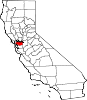
CDPs Acalanes Ridge | Alamo | Alhambra Valley | Bay Point | Bayview | Bethel Island | Blackhawk | Byron | Camino Tassajara | Castle Hill | Clyde | Contra Costa Centre | Crockett | Diablo | Discovery Bay | East Richmond Heights | El Sobrante | Kensington | Knightsen | Montalvin Manor | Mountain View | Norris Canyon | North Gate | North Richmond | Pacheco | Port Costa | Reliez Valley | Rodeo | Rollingwood | San Miguel | Saranap | Shell Ridge | Tara Hills | Vine Hill
Unincorporated
communitiesAlamo Oaks | Arbor | Avon | Bancroft | Bayo Vista | Bayview-Montalvin | Bixler | Blackhawk-Camino Tassajara | Bridgehead | Canyon | Christie | Cornwall | Crolona Heights | Diamond | Eastport | Four Corners | Franklin Canyon | Gateley | Glen Frazer | Hasford Heights | Herpoco | Hookston | Las Juntas | Los Medanos | Luzon | Maltby | Marsh Creek Springs | McAvoy | Meinert | Monsanto | Muir | Neroly | Newlove | Nichols | Oleum | Orinda Village | Orwood | Ozol | Rheem | Rock City | Selby | Shore Acres | Sobrante | Sparkle | Stege | Tassajara | Tormey | Valle Vista | Valona | Waldon | Walnut Heights | Werner
Ghost towns Acelanus | Ambrose | Atchison | Eckley | Empire | Hooper | Horse Haven | Judsonville | Junction | Nortonville | Ohmer | Point of Timber | Port Chicago | Schmidtville | Somersville | Stewartville | Tammukan | West Hartley | Winehaven
Categories:- Census-designated places in Contra Costa County, California


Wikimedia Foundation. 2010.