- Morris County, Kansas
-
Morris County, Kansas 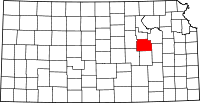
Location in the state of Kansas
Kansas's location in the U.S.Founded February 11, 1859 Seat Council Grove Area
- Total
- Land
- Water
702.84 sq mi (1,820 km²)
697.38 sq mi (1,806 km²)
5.46 sq mi (14 km²), 0.78%Population
- (2010)
- Density
5,923
8.7/sq mi (3.3/km²)Time zone Central: UTC-6/-5 Website www.MorrisCountyKS.org Morris County (standard abbreviation: MR) is a county located in the U.S. state of Kansas. As of the 2010 census, the county population was 5,923.[1] The largest city and county seat is Council Grove.
Contents
History
19th century
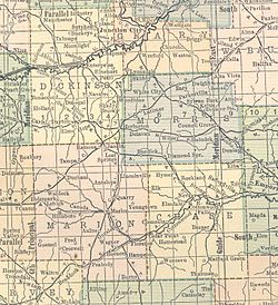 1914 railroad map.
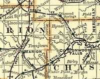 1893 Railroad Map.
 1845 Santa Fe Trail crossing Morris County
The county was established on ancient grounds of the Kaw American Indian tribe. Settlers and the Kaw lived in increasingly uneasy relationship as settlers encroached on native lands.[citation needed]
Council Grove, established by European Americans in 1825, was an important supply station on the Santa Fe Trail. The town was also the site of an encampment by John C. Fremont in 1845 and in 1849 the Overland Mail established a supply headquarters there.[citation needed]
The county was originally organized as Wise County in 1855. The county was named for Virginia Governor Henry A. Wise. When Wise presided over the hanging of abolitionist John Brown at Harpers Ferry in 1859, the county was renamed Morris, abolition supporters renamed the county in honor of Thomas Morris, a former United States Senator from Ohio who was an opponent of slavery.[citation needed]
In 1851, the Methodist Church established an Indian Mission at Morris County. Thirty Kaw boys lived and studied until 1854 when the tribe was removed to Oklahoma.[citation needed]
Between 1877 and 1879, Benjamin "Pap" Singleton, a former slave who escaped to freedom in 1846, staked out a settlement in Morris County for freedmen known as "Exodusters". Thousands of families migrated from the post-Reconstruction South to seek more opportunities and better living conditions in the Midwest.[citation needed]
In 1887, the Chicago, Kansas and Nebraska Railway built a main line from Topeka to Herington.[2] This main line connected Topeka, Valencia, Willard, Maple Hill, Vera, Paxico, McFarland, Alma, Volland, Alta Vista, Dwight, White City, Latimer, Herington. The Chicago, Kansas and Nebraska Railway was foreclosed in 1891 and taken over by Chicago, Rock Island and Pacific Railway, which shut down in 1980 and reorganized as Oklahoma, Kansas and Texas Railroad, merged in 1988 with Missouri Pacific Railroad, merged in 1997 with Union Pacific Railroad. Most locals still refer to this railroad as the "Rock Island".
In 1887, Atchison, Topeka and Santa Fe Railway built a branch line from Neva (3 miles west of Strong City) to Superior, Nebraska. This branch line connected Strong City, Neva, Rockland, Diamond Springs, Burdick, Lost Springs, Jacobs, Hope, Navarre, Enterprise, Abilene, Talmage, Manchester, Longford, Oak Hill, Miltonvale, Aurora, Huscher, Concordia, Kackley, Courtland, Webber, Superior. At some point, the line from Neva to Lost Springs was pulled but the right of way has not been abandoned. This branch line was originally called "Strong City and Superior line" but later the name was shortened to the "Strong City line". In 1996, the Atchison, Topeka and Santa Fe Railway merged with Burlington Northern Railroad and renamed to the current BNSF Railway.
20th century
The National Old Trails Road, also known as the Ocean-to-Ocean Highway, was established in 1912, and was routed through Herington, Delavan, Council Grove.
Law and government
Following amendment to the Kansas Constitution in 1986, the county remained a prohibition, or "dry", county until 1992, when voters approved the sale of alcoholic liquor by the individual drink with a 30% food sales requirement.[3]
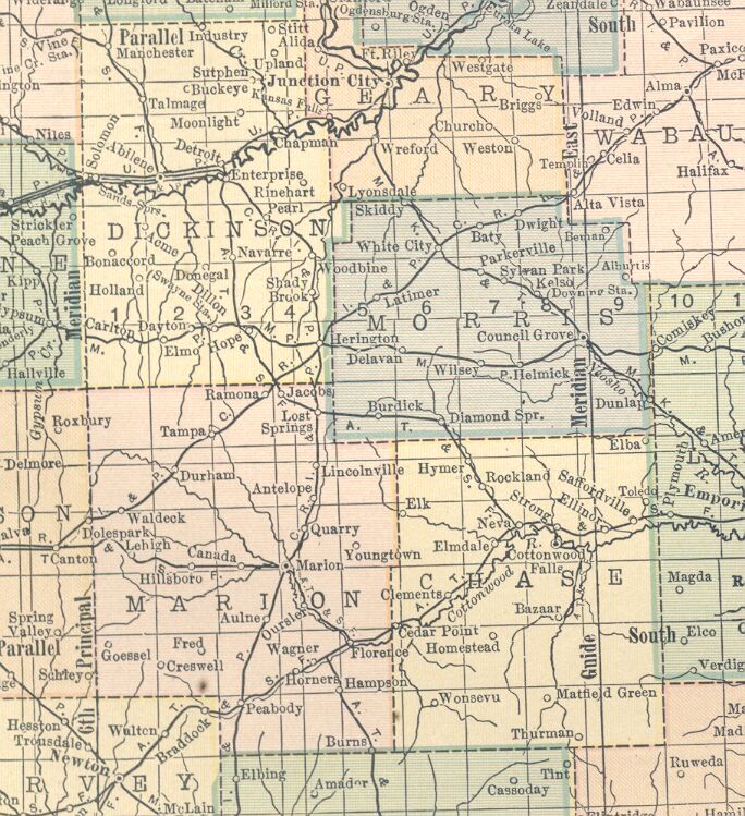
Geography
According to the 2000 census, the county has a total area of 702.84 square miles (1,820.3 km2), of which 697.38 square miles (1,806.2 km2) (or 99.22%) is land and 5.46 square miles (14.1 km2) (or 0.78%) is water.[4]
Adjacent counties
- Geary County (north)
- Wabaunsee County (northeast)
- Lyon County (southeast)
- Chase County (south)
- Marion County (southwest)
- Dickinson County (west)
Demographics
Historical populations Census Pop. %± 1900 11,967 — 1910 12,397 3.6% 1920 12,005 −3.2% 1930 11,859 −1.2% 1940 10,363 −12.6% 1950 8,485 −18.1% 1960 7,392 −12.9% 1970 6,432 −13.0% 1980 6,419 −0.2% 1990 6,198 −3.4% 2000 6,104 −1.5% 2010 5,923 −3.0% U.S. Decennial Census 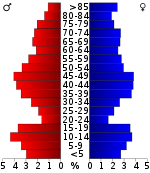 Age pyramid
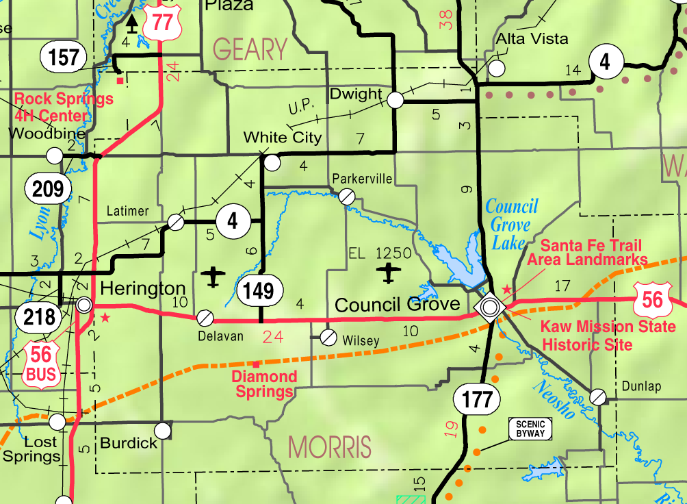
 2005 KDOT Map of Morris County (map legend)
As of the census[5] of 2000, there were 6,104 people, 2,539 households, and 1,777 families residing in the county. The population density was 9 people per square mile (3/km²). There were 3,160 housing units at an average density of 4 per square mile (2/km²). The racial makeup of the county was 97.49% White, 0.34% Black or African American, 0.33% Native American, 0.23% Asian, 0.02% Pacific Islander, 0.70% from other races, and 0.88% from two or more races. 2.23% of the population were Hispanic or Latino of any race.
There were 2,539 households out of which 30.20% had children under the age of 18 living with them, 60.70% were married couples living together, 6.60% had a female householder with no husband present, and 30.00% were non-families. 28.00% of all households were made up of individuals and 14.90% had someone living alone who was 65 years of age or older. The average household size was 2.37 and the average family size was 2.90.
In the county the population was spread out with 25.20% under the age of 18, 5.60% from 18 to 24, 23.90% from 25 to 44, 24.30% from 45 to 64, and 21.00% who were 65 years of age or older. The median age was 42 years. For every 100 females there were 97.00 males. For every 100 females age 18 and over, there were 93.30 males.
The median income for a household in the county was $32,163, and the median income for a family was $39,717. Males had a median income of $28,912 versus $21,239 for females. The per capita income for the county was $18,491. About 6.70% of families and 9.00% of the population were below the poverty line, including 10.40% of those under age 18 and 13.30% of those age 65 or over.
Cities and towns
Incorporated cities
Name and population (2004 estimate):
- Council Grove, 2,253
- White City, 492
- Dwight, 328
- Wilsey, 189
- Dunlap, 81
- Parkerville, 72
- Latimer, 21
- Less than 1 km2 (0 sq mi) of Herington (pop. 2,469) is within the county border with the majority of the city in Dickinson County.
Unincorporated community
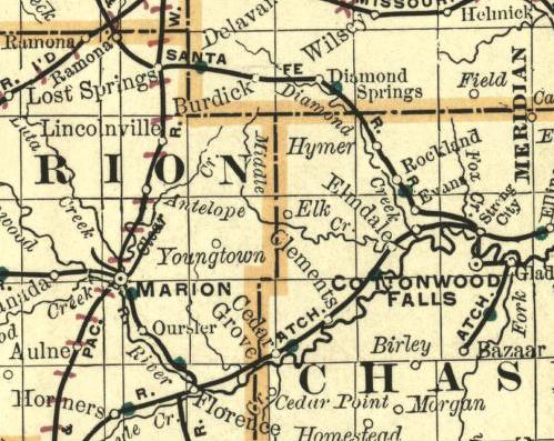
- Burdick
- Delavan
- Skiddy, the unincorporated hamlet of Skiddy lies less than one mile south of the Geary County line in north central Morris County.
Ghost towns
- Diamond Springs
Townships
Morris County is divided into eleven townships. The cities of Council Grove and Herington are considered governmentally independent and are excluded from the census figures for the townships. In the following table, the population center is the largest city (or cities) included in that township's population total, if it is of a significant size.
Sources: 2000 U.S. Gazetteer from the U.S. Census Bureau. Township FIPS Population
centerPopulation Population
density
/km² (/sq mi)Land area
km² (sq mi)Water area
km² (sq mi)Water % Geographic coordinates Highland 31975 94 1 (3) 93 (36) 0 (0) 0.03% 38°44′48″N 96°45′52″W / 38.74667°N 96.76444°W Overland 53750 60 1 (2) 88 (34) 0 (0) 0.01% 38°48′18″N 96°51′44″W / 38.805°N 96.86222°W Township 1 71202 551 2 (4) 356 (138) 1 (0) 0.28% 38°36′23″N 96°25′34″W / 38.60639°N 96.42611°W Township 2 71206 688 3 (7) 270 (104) 12 (5) 4.37% 38°42′42″N 96°30′4″W / 38.71167°N 96.50111°W Township 3 71210 503 5 (12) 109 (42) 0 (0) 0.06% 38°49′54″N 96°34′57″W / 38.83167°N 96.5825°W Township 4 71214 252 2 (4) 155 (60) 0 (0) 0.02% 38°47′19″N 96°39′17″W / 38.78861°N 96.65472°W Township 5 71218 686 7 (19) 93 (36) 0 (0) 0.02% 38°48′24″N 96°45′4″W / 38.80667°N 96.75111°W Township 6 71222 111 1 (4) 78 (30) 0 (0) 0.18% 38°44′5″N 96°51′46″W / 38.73472°N 96.86278°W Township 7 71227 258 2 (4) 170 (66) 0 (0) 0.10% 38°39′22″N 96°49′44″W / 38.65611°N 96.82889°W Township 8 71232 212 1 (3) 186 (72) 0 (0) 0.08% 38°33′56″N 96°48′36″W / 38.56556°N 96.81°W Township 9 71237 368 2 (5) 202 (78) 0 (0) 0.08% 38°38′2″N 96°39′28″W / 38.63389°N 96.65778°W Education
Unified school districts
- USD 417, Morris County
- Council Grove, Dunlap, Rural Areas
- USD 481, Rural Vista
- White City, Latimer, Rural Areas
- District Office In Neighboring County
- USD 397, Centre
- Burdick, Rural Areas
- USD 284, Chase County
- Rural Areas
See also
Information on this and other counties in Kansas
- List of counties in Kansas
- National Register of Historic Places listings in Kansas
- Kansas locations by per capita income
Other information for Kansas
- List of cities in Kansas
- List of unified school districts in Kansas
- List of colleges and universities in Kansas
References
- ^ "2010 County Population and Housing Occupancy Status". U.S. Census Bureau. http://factfinder2.census.gov/faces/tableservices/jsf/pages/productview.xhtml?pid=DEC_10_PL_GCTPL2.ST05&prodType=table. Retrieved March 31, 2011.
- ^ Rock Island Rail History
- ^ "Map of Wet and Dry Counties". Alcoholic Beverage Control, Kansas Department of Revenue. November 2006. http://www.ksrevenue.org/abcwetdrymap.htm. Retrieved 2007-12-26.
- ^ "Census 2000 U.S. Gazetteer Files: Counties". United States Census. http://www.census.gov/tiger/tms/gazetteer/county2k.txt. Retrieved 2011-02-13.
- ^ "American FactFinder". United States Census Bureau. http://factfinder.census.gov. Retrieved 2008-01-31.
Further reading
- Kansas
- History of the State of Kansas; William G. Cutler; A.T. Andreas Publisher; 1883. (Online HTML eBook)
- Kansas : A Cyclopedia of State History, Embracing Events, Institutions, Industries, Counties, Cities, Towns, Prominent Persons, Etc; 3 Volumes; Frank W. Blackmar; Standard Publishing Co; 944 / 955 / 824 pages; 1912. (Volume1 - Download 54MB PDF eBook), (Volume2 - Download 53MB PDF eBook), (Volume3 - Download 33MB PDF eBook)
- USA
- The Story of the Marking of the Santa Fe Trail by the Daughters of the American Revolution in Kansas and the State of Kansas; Almira Cordry; Crane Co; 164 pages; 1915. (Download 4MB PDF eBook)
- The National Old Trails Road To Southern California, Part 1 (LA to KC); Automobile Club Of Southern California; 64 pages; 1916. (Download 6.8MB PDF eBook)
External links
- County
- Morris County - Official Website
- Morris County - Directory of Public Officials
- Morris County - Information, Skyways
- Maps
- Morris County Map, KDOT
- Kansas Highway Map, KDOT
- Kansas Railroad Map, KDOT
- Kansas School District Boundary Map, KSDE

Geary County Wabaunsee County Dickinson County 
 Morris County, Kansas

Marion County Chase County Lyon County Municipalities and communities of Morris County, Kansas Cities Council Grove | Dunlap | Dwight | Herington‡ | Latimer | Parkerville | White City | Wilsey

Unincorporated
communitiesBurdick | Delavan | Skiddy
Ghost towns Diamond Springs
Footnotes ‡This populated place also has portions in an adjacent county or counties
Categories:- Kansas counties
- Morris County, Kansas
- 1859 establishments in the United States


Wikimedia Foundation. 2010.