- Dickinson County, Kansas
-
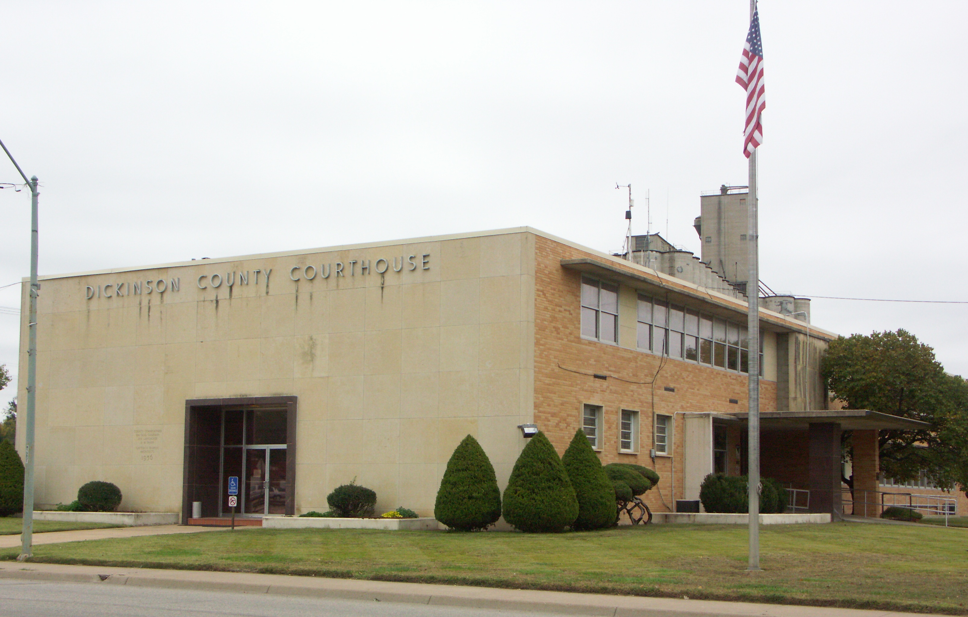
Dickinson County, Kansas 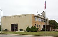 Dickinson County Courthouse in Abilene
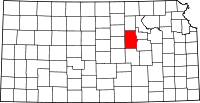
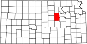
Location in the state of Kansas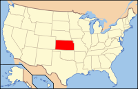
Kansas's location in the U.S.Founded February 20, 1857 Seat Abilene Area
- Total
- Land
- Water
852.12 sq mi (2,207 km²)
847.92 sq mi (2,196 km²)
4.20 sq mi (11 km²), 0.49%Population
- (2010)
- Density
19,754
22.8/sq mi (8.8/km²)Time zone Central: UTC-6/-5 Website www.DkCoKS.org Dickinson County (county code DK) is a county located in Central Kansas, in the Central United States. As of the 2010 census, the county population was 19,754.[1] Its county seat and most populous city is Abilene.[2] It was named in honor of Daniel S. Dickinson.
Contents
History
19th century
In 1887, Mr. Herington successfully got the Chicago, Kansas and Nebraska Railway to build through Herington. He gave the land and right-of-way for Herington to become a division point with shops, two round houses, freight house, bridge yards, telegraph office and many other buildings. He furnished the limestone for the freight house, and for a two story depot that was 28 x 66 feet and later enlarged to 28 x 105 feet.[3]
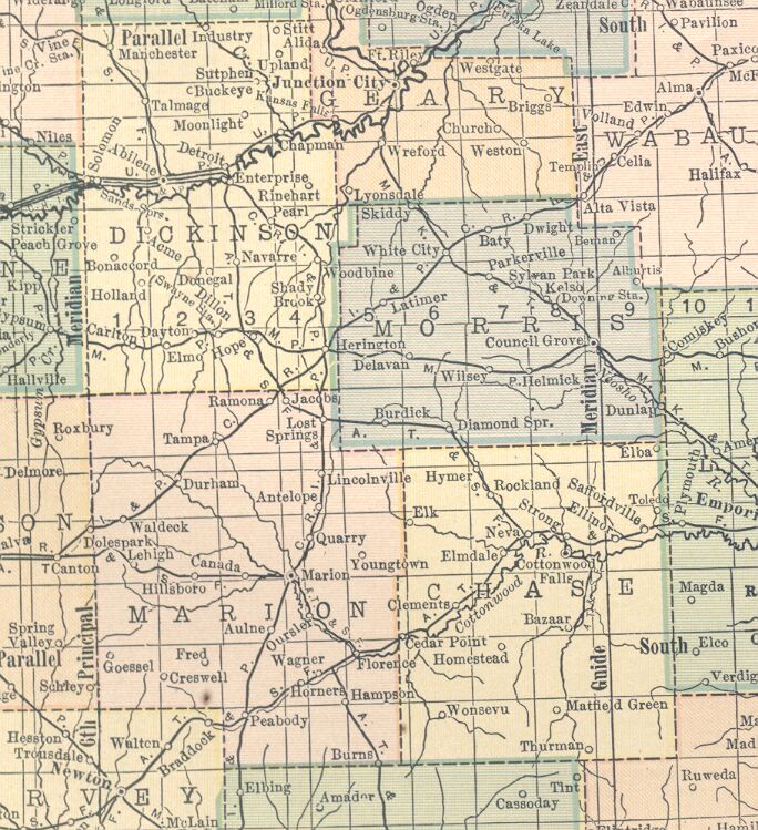
 1914 railroad map.
In 1887, the Chicago, Kansas and Nebraska Railway built a main line from Topeka to Herington.[4] This main line connected Topeka, Valencia, Willard, Maple Hill, Vera, Paxico, McFarland, Alma, Volland, Alta Vista, Dwight, White City, Latimer, Herington.
In 1887, the Chicago, Kansas and Nebraska Railway extended its main line from Herington to Pratt.[4] This main line connected Herington, Ramona, Tampa, Durham, Waldeck, Canton, Galva, McPherson, Groveland, Inman, Medora, Hutchinson, Whiteside, Partridge, Arlington, Langdon, Turon, Preston, Natrona, Pratt. In 1888, this main line was extended to Liberal. Later, this line was extended to Tucumcari, New Mexico and El Paso, Texas. This line is called the "Golden State Limited".
In 1887, the Chicago, Kansas and Nebraska Railway built a branch line north-south from Herington to Caldwell.[4] This branch line connected Herington, Lost Springs, Lincolnville, Antelope, Marion, Aulne, Peabody, Elbing, Whitewater, Furley, Kechi, Wichita, Peck, Corbin, Wellington, Caldwell. By 1893, this branch line was incrementally built to Fort Worth, Texas. This line is called the "OKT".
The Chicago, Kansas and Nebraska Railway was foreclosed in 1891 and was taken over by Chicago, Rock Island and Pacific Railway, which shut down in 1980 and reorganized as Oklahoma, Kansas and Texas Railroad, merged in 1988 with Missouri Pacific Railroad, merged in 1997 with Union Pacific Railroad. Most locals still refer to this railroad as the "Rock Island".
In 1887, Atchison, Topeka and Santa Fe Railway built a branch line from Neva (3 miles west of Strong City) to Superior, Nebraska. This branch line connected Strong City, Neva, Rockland, Diamond Springs, Burdick, Lost Springs, Jacobs, Hope, Navarre, Enterprise, Abilene, Talmage, Manchester, Longford, Oak Hill, Miltonvale, Aurora, Huscher, Concordia, Kackley, Courtland, Webber, Superior. At some point, the line from Neva to Lost Springs was pulled but the right of way has not been abandoned. This branch line was originally called "Strong City and Superior line" but later the name was shortened to the "Strong City line".
In 1996, the Atchison, Topeka and Santa Fe Railway merged with Burlington Northern Railroad and renamed to the current BNSF Railway. Most locals still refer to this railroad as the "Santa Fe".
21st century
In 2010, the Keystone-Cushing Pipeline (Phase II) was constructed north to south through Dickinson County, with much controversy over tax exemption and environmental concerns (if a leak ever occurs).[5][6] A pumping station named Hope was built along the pipeline.
Law and government
Dickinson County was a prohibition, or "dry", county until the Kansas Constitution was amended in 1986 and voters approved the sale of alcoholic liquor by the individual drink with a 30% food sales requirement.[7]
Geography
According to the 2000 census, the county has a total area of 852.12 square miles (2,207.0 km2), of which 847.92 square miles (2,196.1 km2) (or 99.51%) is land and 4.20 square miles (10.9 km2) (or 0.49%) is water.[8]
Adjacent counties
- Clay County (north)
- Geary County (east)
- Morris County (southeast)
- Marion County (south)
- McPherson County (southwest)
- Saline County (west)
- Ottawa County (northwest)
Demographics
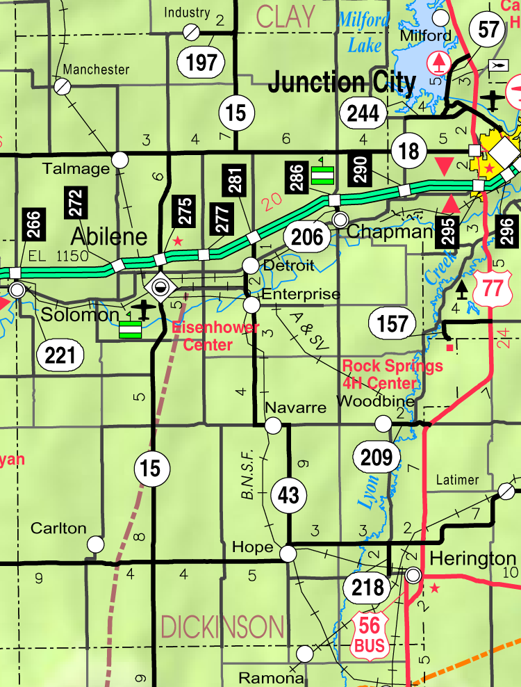
Historical populations Census Pop. %± 1860 378 — 1870 3,043 705.0% 1880 15,251 401.2% 1890 22,273 46.0% 1900 21,816 −2.1% 1910 24,361 11.7% 1920 25,777 5.8% 1930 25,870 0.4% 1940 22,929 −11.4% 1950 21,190 −7.6% 1960 21,572 1.8% 1970 19,993 −7.3% 1980 20,175 0.9% 1990 18,958 −6.0% 2000 19,344 2.0% 2010 19,754 2.1% U.S. Decennial Census  2005 KDOT Map of Dickinson County (map legend)
As of the U.S. Census in 2000,[9] there were 19,344 people, 7,903 households, and 5,421 families residing in the county. The population density was 23 people per square mile (9/km²). There were 8,686 housing units at an average density of 10 per square mile (4/km²). The racial makeup of the county was 96.44% White, 0.58% Black or African American, 0.49% Native American, 0.30% Asian, 0.01% Pacific Islander, 0.82% from other races, and 1.36% from two or more races. Hispanic or Latino of any race were 2.30% of the population.
There were 7,903 households out of which 31.10% had children under the age of 18 living with them, 57.90% were married couples living together, 7.70% had a female householder with no husband present, and 31.40% were non-families. 28.10% of all households were made up of individuals and 14.10% had someone living alone who was 65 years of age or older. The average household size was 2.40 and the average family size was 2.94.
In the county the population was spread out with 25.70% under the age of 18, 6.30% from 18 to 24, 26.30% from 25 to 44, 23.10% from 45 to 64, and 18.60% who were 65 years of age or older. The median age was 40 years. For every 100 females there were 95.10 males. For every 100 females age 18 and over, there were 91.60 males.
The median income for a household in the county was $35,975, and the median income for a family was $43,952. Males had a median income of $30,889 versus $18,526 for females. The per capita income for the county was $17,780. About 5.30% of families and 7.50% of the population were below the poverty line, including 8.70% of those under age 18 and 11.30% of those age 65 or over.
Cities and towns
Incorporated cities
Name and population (2004 estimate):
- Abilene, 6,397 (county seat)
- Herington, 2,469
- Chapman, 1,239
- Solomon, 1,051, of which a portion lies in Saline County
- Enterprise, 813
- Hope, 364
- Woodbine, 206
- Manchester, 102
- Carlton, 38
Unincorporated places
- Buckeye
- Detroit
- Dillon
- Elmo
- Holland
- Industry
- Lyona
- Navarre
- Pearl
- Shady Brook
- Stoney
- Sutphen
- Talmage
- Upland
Townships
Dickinson County is divided into twenty-four townships. The cities of Abilene and Herington are considered governmentally independent and are excluded from the census figures for the townships. In the following table, the population center is the largest city (or cities) included in that township's population total, if it is of a significant size.
Township FIPS Population
centerPopulation Population
density
/km² (/sq mi)Land area
km² (sq mi)Water area
km² (sq mi)Water % Geographic coordinates Banner 03975 148 2 (4) 92 (35) 1 (0) 0.62% 38°39′37″N 97°11′50″W / 38.66028°N 97.19722°W Buckeye 08925 437 5 (12) 94 (36) 0 (0) 0.15% 38°59′1″N 97°12′58″W / 38.98361°N 97.21611°W Center 11675 1,210 13 (34) 92 (35) 2 (1) 2.16% 38°54′32″N 97°6′21″W / 38.90889°N 97.10583°W Cheever 12700 149 2 (4) 93 (36) 0 (0) 0.04% 39°5′58″N 97°11′42″W / 39.09944°N 97.195°W Flora 23550 217 2 (6) 93 (36) 0 (0) 0.08% 39°5′12″N 97°19′4″W / 39.08667°N 97.31778°W Fragrant Hill 24250 251 3 (8) 77 (30) 0 (0) 0.21% 39°4′54″N 97°0′34″W / 39.08167°N 97.00944°W Garfield 25550 189 2 (5) 94 (36) 0 (0) 0.06% 38°49′22″N 97°18′43″W / 38.82278°N 97.31194°W Grant 27625 918 11 (29) 82 (32) 1 (1) 1.58% 38°54′42″N 97°12′22″W / 38.91167°N 97.20611°W Hayes 30900 233 3 (8) 78 (30) 0 (0) 0.04% 38°59′43″N 97°6′8″W / 38.99528°N 97.10222°W Holland 32625 107 1 (3) 93 (36) 0 (0) 0.17% 38°40′19″N 97°18′39″W / 38.67194°N 97.31083°W Hope 33100 519 6 (15) 92 (35) 0 (0) 0.45% 38°39′36″N 97°5′13″W / 38.66°N 97.08694°W Jefferson 35175 166 2 (5) 94 (36) 0 (0) 0.46% 38°44′1″N 97°11′45″W / 38.73361°N 97.19583°W Liberty 40000 405 4 (9) 114 (44) 0 (0) 0.11% 38°49′11″N 96°57′35″W / 38.81972°N 96.95972°W Lincoln 40625 1,669 18 (46) 93 (36) 2 (1) 1.99% 38°54′51″N 97°20′46″W / 38.91417°N 97.34611°W Logan 41850 202 2 (6) 94 (36) 0 (0) 0.23% 38°49′12″N 97°5′3″W / 38.82°N 97.08417°W Lyon 43475 252 3 (8) 86 (33) 1 (0) 0.98% 38°39′32″N 96°59′20″W / 38.65889°N 96.98889°W Newbern 50225 349 4 (10) 94 (36) 0 (0) 0.14% 38°50′6″N 97°11′43″W / 38.835°N 97.19528°W Noble 50800 1,730 21 (55) 81 (31) 1 (0) 1.29% 38°58′59″N 97°0′23″W / 38.98306°N 97.00639°W Ridge 59800 160 2 (4) 94 (36) 0 (0) 0.43% 38°44′14″N 97°5′0″W / 38.73722°N 97.083333°W Rinehart 59900 194 2 (5) 93 (36) 0 (0) 0.40% 38°55′18″N 96°59′30″W / 38.92167°N 96.99167°W Sherman 64925 147 2 (5) 78 (30) 0 (0) 0 % 39°5′6″N 97°6′10″W / 39.085°N 97.10278°W Union 72100 176 2 (5) 94 (36) 0 (0) 0.20% 38°43′38″N 96°58′14″W / 38.72722°N 96.97056°W Wheatland 77625 152 2 (4) 93 (36) 0 (0) 0.18% 38°43′59″N 97°18′27″W / 38.73306°N 97.3075°W Willowdale 79450 258 3 (7) 93 (36) 0 (0) 0.05% 38°59′41″N 97°18′7″W / 38.99472°N 97.30194°W Sources: "Census 2000 U.S. Gazetteer Files". U.S. Census Bureau, Geography Division. http://www.census.gov/geo/www/gazetteer/places2k.html. Education
Unified school districts
- USD 393, Solomon
- Solomon, Rural Areas
- USD 435, Abilene
- Abilene, Rural Areas
- USD 473, Chapman
- Chapman, Carlton, Manchester, Enterprise, Rural Areas
- USD 487, Herington
- Herington, Rural Areas
- District Office In Neighboring County
See also
Information on this and other counties in Kansas
- List of counties in Kansas
- National Register of Historic Places listings in Kansas
- Kansas locations by per capita income
Other information for Kansas
- List of cities in Kansas
- List of unified school districts in Kansas
- List of colleges and universities in Kansas
References
- ^ "2010 County Population and Housing Occupancy Status". U.S. Census Bureau. http://factfinder2.census.gov/faces/tableservices/jsf/pages/productview.xhtml?pid=DEC_10_PL_GCTPL2.ST05&prodType=table. Retrieved March 31, 2011.
- ^ "Find a County". National Association of Counties. http://www.naco.org/Counties/Pages/FindACounty.aspx. Retrieved 2011-06-07.
- ^ Herington History
- ^ a b c Rock Island Rail History
- ^ Keystone Pipeline - Marion County Commission calls out Legislative Leadership on Pipeline Deal; April 18, 2010.
- ^ Keystone Pipeline - TransCanada inspecting pipeline; December 10, 2010.
- ^ "Map of Wet and Dry Counties". Alcoholic Beverage Control, Kansas Department of Revenue. November 2006. http://www.ksrevenue.org/abcwetdrymap.htm. Retrieved 2007-12-28.
- ^ "Census 2000 U.S. Gazetteer Files: Counties". United States Census. http://www.census.gov/tiger/tms/gazetteer/county2k.txt. Retrieved 2011-02-13.
- ^ "American FactFinder". United States Census Bureau. http://factfinder.census.gov. Retrieved 2008-01-31.
Further reading
- Kansas
- History of the State of Kansas; William G. Cutler; A.T. Andreas Publisher; 1883. (Online HTML eBook)
- Kansas : A Cyclopedia of State History, Embracing Events, Institutions, Industries, Counties, Cities, Towns, Prominent Persons, Etc; 3 Volumes; Frank W. Blackmar; Standard Publishing Co; 944 / 955 / 824 pages; 1912. (Volume1 - Download 54MB PDF eBook), (Volume2 - Download 53MB PDF eBook), (Volume3 - Download 33MB PDF eBook)
- USA
- The National Old Trails Road To Southern California, Part 1 (LA to KC); Automobile Club Of Southern California; 64 pages; 1916. (Download 6.8MB PDF eBook)
External links
- County
- Dickinson County - Official Website
- Dickinson County - Directory of Public Officials
- Dickinson County - Information, Skyways
- Historical
- Maps
- Dickinson County Map, KDOT
- Kansas Highway Map, KDOT
- Kansas Railroad Map, KDOT
- Kansas School District Boundary Map, KSDE

Ottawa County Clay County Geary County Saline County 
 Dickinson County, Kansas

McPherson County Marion County Morris County Municipalities and communities of Dickinson County, Kansas Cities Abilene | Carlton | Chapman | Enterprise | Herington‡ | Hope | Manchester | Solomon‡ | Woodbine
Townships Unincorporated
communitiesFootnotes ‡This populated place also has portions in an adjacent county or counties
Categories:- Kansas counties
- Dickinson County, Kansas
- 1857 establishments in the United States


Wikimedia Foundation. 2010.