- Shire of Mount Marshall
-
"Mount Marshall" redirects here. For other uses, see Mount Marshall (New York) and Mount Marshall (Antarctica).
Shire of Mount Marshall
Western Australia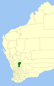
Location in Western AustraliaPopulation: 686(2009)[1] • Density: 0.06/km² (0.2/sq mi) Established: 1923 Area: 10189.5 km² (3,934.2 sq mi) Mayor: Paul Gillett Council Seat: Bencubbin Region: Wheatbelt State District: Central Wheatbelt Federal Division: Durack LGAs around Shire of Mount Marshall: Dalwallinu Yalgoo Sandstone Koorda Shire of Mount Marshall Yilgarn Wyalkatchem Trayning Mukinbudin The Shire of Mount Marshall is a Local Government Area in the Wheatbelt region of Western Australia, about 80 kilometres (50 mi) north-northwest of Merredin and about 300 kilometres (186 mi) northeast of the state capital, Perth. The Shire covers an area of 10,190 square kilometres (3,934 sq mi), and its seat of government is the town of Bencubbin.
Contents
History
The area was first discovered by Surveyor General John Septimus Roe, Mount Marshall and Lake McDermott were named after Captain Marshall McDermont, an early settler to the Swan River Colony. The area was first settled by sandalwood collectors and graziers in 1868. Sandalwood was removed from this area from the 1880s until the 1920s. Permanent settlement and the development and clearing of the land for farms commenced around 1910.
In 1923, the Mount Marshall Road Board was gazetted out of areas formerly managed by Ninghan (Trayning) and Nungarin, and on 1 July 1961, it became a Shire Council following changes to the Local Government Act.[2]
Wards
The shire has been divided into 7 wards, each with one councillor.
- Beacon Ward
- Cleary Ward
- Gabbin Ward
- North Bencubbin Ward
- South Bencubbin Ward
- Welbungin Ward
- Wialki Ward
Towns and localities
References
- ^ Australian Bureau of Statistics (30 March 2010). "Regional Population Growth, Australia, 2008–09". http://www.abs.gov.au/ausstats/abs@.nsf/Latestproducts/3218.0Main%20Features82008-09?opendocument&tabname=Summary&prodno=3218.0&issue=2008-09&num=&view=. Retrieved 4 June 2010.
- ^ WA Electoral Commission, Municipality Boundary Amendments Register (release 2.0), 31 May 2003.
External links
Categories:- Populated places established in 1923
- 1923 establishments in Australia
- Local Government Areas of Western Australia
- Wheatbelt (Western Australia)

Wikimedia Foundation. 2010.