- Perth, Western Australia
-
"Perth, Australia" redirects here. For the town in Tasmania, see Perth, Tasmania.For other uses, see Perth (disambiguation) and Perth, Western Australia (disambiguation).
Perth
Western Australia
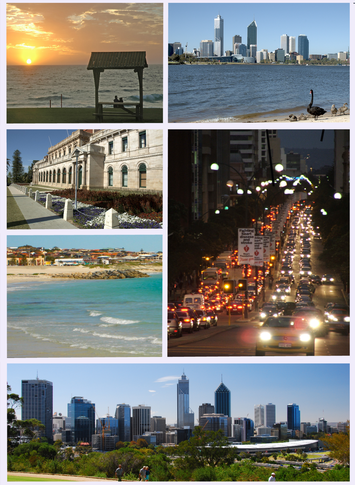
Clockwise from top left: Sunset at City Beach, Black swan and family by the Swan River, St Georges Terrace at night, the city skyline from Kings Park, Sorrento Beach, and Parliament House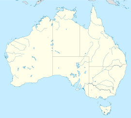
 Perth
PerthPopulation: 1,696,062[1] (4th) • Density: 308/km² (797.7/sq mi) (June 2010)[2] Established: 1829 Area: 5386 km² (2,079.5 sq mi) [3] Time zone: AWST (UTC+8) Location: State District: Perth (and 41 others) Federal Division: Perth (and 10 others) Mean max temp Mean min temp Annual rainfall 24.5 °C
76 °F12.6 °C
55 °F871 mm
34.3 inPerth (
 /ˈpɜrθ/)[8] is the capital and largest city of the Australian state of Western Australia and the fourth most populous city in Australia. The Perth metropolitan area has an estimated population of almost 1,700,000.[9]
The metropolitan area is located in the South West Division of Western Australia, between the Indian Ocean and a low coastal escarpment known as the Darling Range. The central business district and suburbs of Perth are situated on the banks of the Swan River. Shortly after the establishment of the port settlement of Fremantle, Perth was founded on 12 June 1829 by Captain James Stirling as the political centre of the Swan River Colony. As the business and administration centre for the resource-rich state, Perth has grown consistently faster than the national average.[1]
Perth became known worldwide as the "City of Light" when city residents lit their house lights and streetlights as American astronaut John Glenn passed overhead while orbiting the earth on Friendship 7 in 1962.[10][11] The city repeated the act as Glenn passed overhead on the Space Shuttle in 1998.[12][13] Perth is tied for eighth place in The Economist's 2011 list of the World's Most Livable Cities.[14]
Contents
History
Main article: History of Perth, Western AustraliaIndigenous history
Before European colonisation, the area had been inhabited by the Whadjuk Noongar people for over 40,000 years, as evidenced by archaeological findings on the Upper Swan River.[15] These Aborigines occupied the southwest corner of Western Australia, living as hunter-gatherers. The wetlands on the Swan Coastal Plain were particularly important to them, both spiritually, featuring in local mythology, and as a source of food.
Rottnest, Carnac and Garden Islands were also important to the Noongar. About 5,000 years ago the sea levels were low enough that they could walk to the limestone outcrops.
The area where Perth now stands was called Boorloo by the Aboriginals living there at the time of their first contact with Europeans in 1827. Boorloo formed part of Mooro, the tribal lands of the Yellagonga, one of several groups based around the Swan River and known collectively as the Whadjuk. The Whadjuk were part of a larger group of thirteen or more tribes which formed the south west socio-linguistic block known as the Noongar (meaning "the people" in their language), also sometimes called the Bibbulmun.
On 19 September 2006, the Federal Court of Australia brought down a judgment recognising Noongar native title over the Perth metropolitan area, in the case of Bennell v State of Western Australia [2006] FCA 1243.[16] The judgement was overturned on appeal.[17]
Early European sightings
The first documented European sighting of the region was made by the Dutch Captain Willem de Vlamingh and his crew on 10 January 1697.[18] Subsequent sightings between this date and 1829 were made by other Europeans, but as in the case of the sighting and observations made by Vlamingh, the area was considered to be inhospitable and unsuitable for the agriculture which would be needed to sustain a settlement.
The Swan River Colony
Main article: Swan River Colony The Foundation of Perth 1829 by George Pitt Morison is an historically accurate reconstruction of the official ceremony by which Perth was founded.
 The Round House built in 1830 is the oldest remaining building on mainland Western Australia
Although the British Army had established a base at King George Sound (later Albany) on the south coast of western Australia in 1826 in response to rumours that the area would be annexed by France, Perth was the first full-scale settlement by Europeans in the western third of the continent. The British colony would be officially designated Western Australia in 1832, but was known informally for many years as the Swan River Colony after the area's major watercourse.
On 4 June 1829, newly arriving British colonists had their first view of the mainland, and Western Australia's Foundation Day has since been recognised by a public holiday on the first Monday in June each year. Captain James Stirling, aboard the Parmelia, said that Perth was "as beautiful as anything of this kind I had ever witnessed". On 12 August that year, Mrs. Helen Dance, wife of the captain of the second ship Sulphur, cut down a tree to mark the founding of the town.
It is clear that Stirling had already selected the name Perth for the capital well before the town was proclaimed, as his proclamation of the colony, read in Fremantle on 18 June 1829, ended "given under my hand and Seal at Perth this 18th Day of June 1829. James Stirling Lieutenant Governor".[19] The only contemporary information on the source of the name comes from Fremantle's diary entry for 12 August, which records that they "named the town Perth according to the wishes of Sir George Murray".[20] Murray was born in Perth, Scotland, and was in 1829 Secretary of State for the Colonies and Member for Perthshire in the British House of Commons. The town was named after the Scottish Perth,[21][22] in Murray's honour.[23][24][25]
Beginning in 1831, hostile encounters between the British settlers and the Noongar people – both large-scale land users with conflicting land value systems – increased considerably as the colony grew. This violent phase of the region's history culminated in a series of events in which the British overcame the indigenous people, including the execution of the Whadjuk elder Midgegooroo, the death of his son Yagan in 1833, and the Battle of Pinjarra in 1834.
By 1843, when Yellagonga died, his people had begun to disintegrate after having been dispossessed of the land around the main settlement area of Perth. They retreated to the swamps and lakes north of the settlement area including Third Swamp, known to them as Boodjamooling. Boodjamooling continued to be a main camp-site for the remaining Noongar people in the Perth region, and was also used by travellers, itinerants, and homeless people. By the gold-rush days of the 1890s they were joined by miners who were en-route to the goldfields.[26]
In 1850, Western Australia was opened to convicts at the request of farming and business people looking for cheap labour.[27] Queen Victoria announced the city status of Perth in 1856.[28]
Federation and beyond
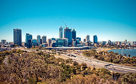 The growing Perth skyline in 2011.
After a referendum in 1900,[29] Western Australia joined the Federation of Australia in 1901.[28] It was the last of the Australian colonies to agree to join the Federation, and did so only after the other colonies had offered several concessions, including the construction of a transcontinental railway line to Perth (via Kalgoorlie) from the eastern states.
In 1933, Western Australia voted in a referendum to leave the Australian Federation, with a majority of two to one in favour of secession.[29] However, an election held shortly before the referendum had turned out the incumbent "pro-independence" government, replacing it with a government which did not support the independence movement. Respecting the result of the referendum, the new government nonetheless petitioned the Agent General of the United Kingdom for independence, where the request was simply ignored.[30]
Perth's growth and relative prosperity, especially since the mid-1960s,[31] has resulted from its role as the main service centre for the state's resource industries, which produce gold, iron ore, nickel, alumina, diamonds, mineral sands, coal, oil, and natural gas.[32] Whilst most mineral and petroleum production takes place elsewhere in the state, the non-base services provide most of the employment and income to the people of Perth.[33]
Gallery
-

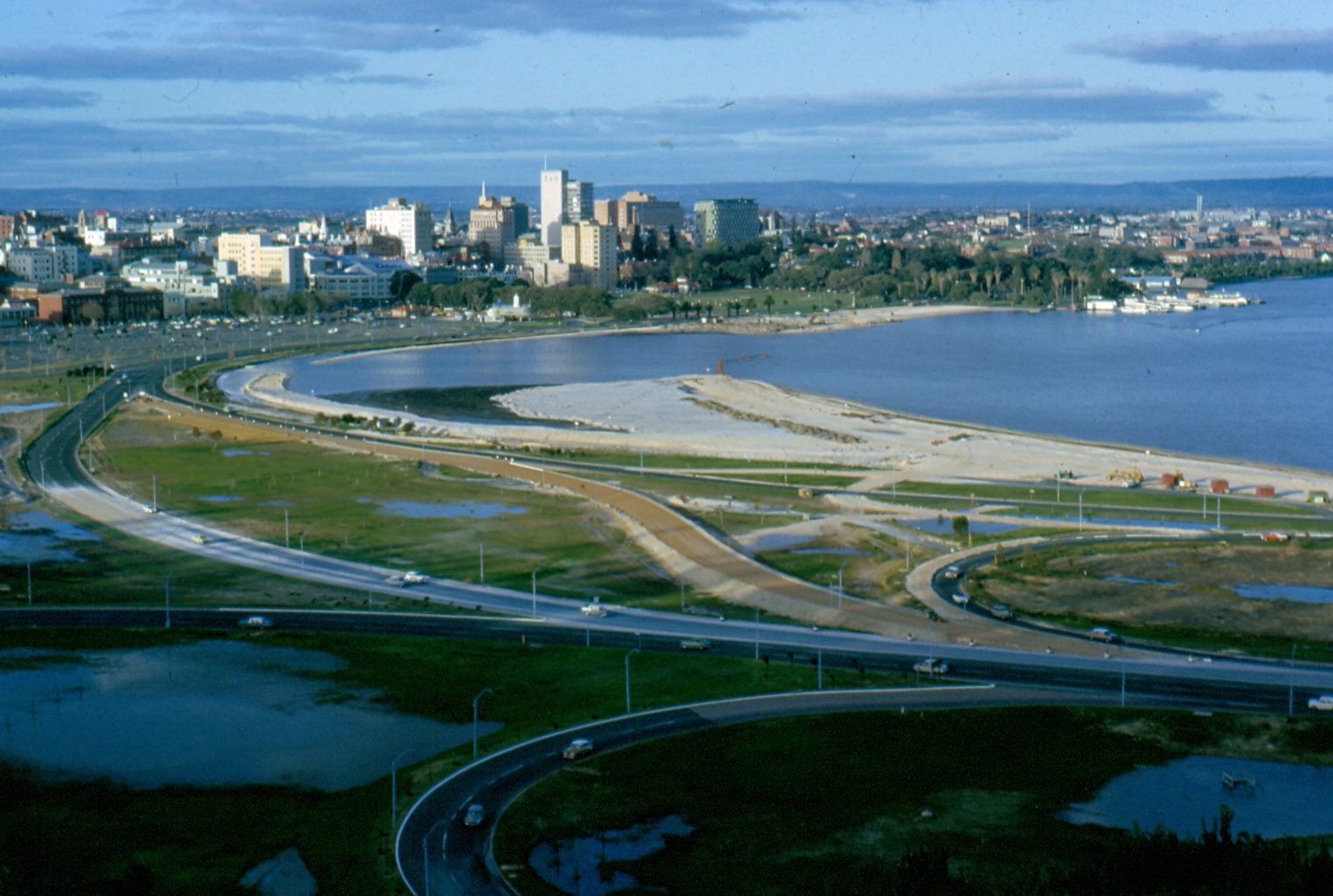
The Perth skyline in 1964.
-

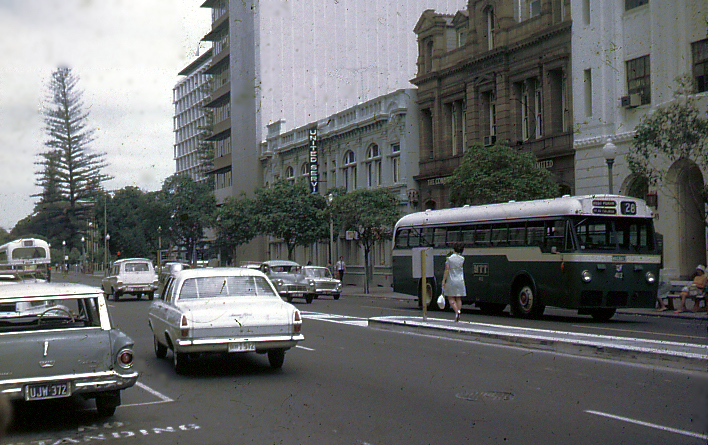
St Georges Terrace in Perth, 1968.
Geography
The nearest city to Perth with a population of more than 500,000 is Adelaide, South Australia, which is 2,104 kilometres (1,307 mi) away. Author Bill Bryson states that Perth is the most remote city on earth,[34] which he justifies by noting that the population of metropolitan Perth is greater than the combined populations of the rest of Western Australia, the Northern Territory and South Australia, west of Adelaide.
However, other measures suggest that Honolulu (population 900,000), which is 3,841 kilometres (2,387 mi) from San Francisco; or Auckland (population 1.35M), which is 2,153 kilometres (1,338 mi) from Sydney, are more isolated.
Perth is geographically closer to both Dili (2,785 kilometres (1,731 mi)) and Jakarta (3,002 kilometres (1,865 mi)) than Sydney (3,291 kilometres (2,045 mi)), Brisbane (3,604 kilometres (2,239 mi)) or Canberra (3,106 kilometres (1,930 mi)).
Central business district
Main article: Perth (suburb)The central business district of Perth is bounded by the Swan River to the south and east, with Kings Park on the western end, while the railway lines form a northern border. This will change in the next few years as a State and Federally funded project named 'The Link' ensures the sinking of a section of the divisive railway line, in addition to the sinking of an existing above-ground bus terminal, will give street-level access from the CBD to Northbridge for the first time in over 100 years. St Georges Terrace is the prominent street of the area with 1.3 million m² of office space in the CBD.[35] Hay Street and Murray Street have most of the retail and entertainment facilities. The tallest building in the city is Central Park, which is the seventh tallest building in Australia.[36] The CBD has recently been the centre of a mining-induced boom, with several commercial and residential projects due for completion, including a 244 m (801 ft) office building for Australian/British mining company BHP Billiton.
 Panorama of the Perth foreshore (in 2007) from Kings Park during the afternoon.
Geology and landforms
 Satellite image of Perth
Perth is set on the Swan River, named after the native black swans in 1697 by Willem de Vlamingh, captain of a Dutch expedition and namer of WA's Rottnest Island.[37] Traditionally, this water body has been known by Aboriginal inhabitants as Derbal Yerrigan.[38] The city centre and most of the suburbs are located on the sandy and relatively flat Swan Coastal Plain, which lies between the Darling Scarp and the Indian Ocean. The soils of this area are quite infertile. The metropolitan area extends to Yanchep in the north and Rockingham to the south, total distance of approximately 90 kilometres (56 mi). From the coast in the west to Mundaring in the east is a total distance of approximately 50 kilometres (31 mi). The Perth metropolitan area covers 5,386.4 km².[3]
Much of Perth was originally built on a series of freshwater wetlands running from Herdsman Lake in the west through to Claisebrook in the east. It has been estimated that up to 80% of Perth was built on reclaimed wetlands.[39]
The coastal suburbs' placement is advantageous due to proximity to Perth's oceanside location and clean beaches. To the east, the city is bordered by a low escarpment called the Darling Scarp. Perth is on generally flat, rolling land – largely due to the high amount of sandy soils and deep bedrock. The Perth metropolitan area has two major river systems; the first is made up of the Swan and Canning Rivers. The second is that of the Serpentine and Murray Rivers, which discharge into the Peel Estuary at Mandurah.
Climate
Perth receives moderate though highly seasonal rainfall, making it the fourth wettest Australian capital city after Darwin, Sydney and Brisbane. Summers are generally hot and dry, lasting from December to late March, with February generally being the hottest month of the year, while winters are relatively cool and wet, making Perth a classic example of a Mediterranean climate (Köppen climate classification Csa).[40][41] Summer is not completely devoid of rain with sporadic rainfall in the form of short-lived thunderstorms, weak cold fronts and on very rare occasions decaying tropical cyclones from Western Australia's north-west which can bring significant falls. The highest ever recorded temperature in Perth was 46.2 °C (115.2 °F) on 23 February 1991, although Perth Airport recorded 46.7 °C (116.1 °F) on the same day.[42][43] On most summer afternoons a sea breeze, also known as "The Fremantle Doctor", blows from the south-west, providing relief from the hot north-easterly winds. Temperatures often fall below 30 °C (86 °F) a few hours after the arrival of the wind change.[44] Perth is a particularly sunny city for a Mediterranean climate, receiving between 2800[45] and 3000 hours[46] of annual sunshine.
Winters are relatively cool and wet, with most of Perth's annual rainfall falling between May and September. The lowest temperature recorded in Perth was −0.7 °C (30.7 °F) on 17 June 2006.[42] The lowest temperature within the Perth metropolitan area was −3.4 °C (25.9 °F) on the same day at Jandakot Airport.[47]
Though most rainfall occurs during winter, the wettest day ever was on 9 February 1992 when 120.6 millimetres (4.75 in) fell.[42] The rainfall pattern has changed in Perth and Southwest Western Australia since the mid-1970s. A significant reduction in winter rainfall has been observed with a greater number of extreme rainfall events in the summer months,[48] such as slow-moving storms on 8 February 1992 which brought 120.6 millimetres (4.75 in) of rain,[49] and a severe thunderstorm on 22 March 2010, which brought 40.2 millimetres (1.58 in) and caused significant damage in the metropolitan area.[50]
Climate data for Perth, Western Australia (temperatures 1993–2010, extremes 1897–2010, rain data 1876–2010) Month Jan Feb Mar Apr May Jun Jul Aug Sep Oct Nov Dec Year Record high °C (°F) 45.8
(114.4)46.2
(115.2)42.4
(108.3)37.6
(99.7)34.3
(93.7)28.1
(82.6)26.3
(79.3)27.8
(82.0)32.7
(90.9)37.3
(99.1)40.3
(104.5)44.2
(111.6)46.2
(115.2)Average high °C (°F) 30.8
(87.4)31.3
(88.3)29.5
(85.1)25.6
(78.1)22.4
(72.3)19.3
(66.7)18.3
(64.9)18.8
(65.8)20.1
(68.2)23.0
(73.4)26.4
(79.5)28.8
(83.8)24.5 Average low °C (°F) 17.8
(64.0)18.1
(64.6)16.5
(61.7)13.6
(56.5)10.6
(51.1)8.5
(47.3)7.8
(46.0)8.1
(46.6)9.4
(48.9)11.2
(52.2)14.2
(57.6)16.2
(61.2)12.7 Record low °C (°F) 8.9
(48.0)8.7
(47.7)6.3
(43.3)4.1
(39.4)1.3
(34.3)−0.7
(30.7)0.0
(32.0)1.3
(34.3)1.0
(33.8)2.2
(36.0)5.0
(41.0)7.9
(46.2)−0.7
(30.7)Rainfall mm (inches) 9.5
(0.374)12.7
(0.5)19.5
(0.768)44.1
(1.736)117.5
(4.626)175.7
(6.917)169.7
(6.681)133.6
(5.26)80.6
(3.173)52.2
(2.055)22.1
(0.87)12.8
(0.504)850.0
(33.465)% humidity 39 38 40 46 50 56 57 54 53 47 44 40 47 Avg. precipitation days 2.1 2.2 4.4 6.6 11.5 15.1 17.3 15.6 15.3 8.8 6.0 3.9 108.8 Sunshine hours 359.6 310.8 294.5 246 210.8 177 186 220.1 228 297.6 321 359.6 3,211 Source: Bureau of Meteorology[51][52] Demographics
Historical populations Year Pop. ±% 1854 4,001 — 1859 6,293 +57.3% 1870 8,220 +30.6% 1881 9,955 +21.1% 1891 16,694 +67.7% 1901 67,431 +303.9% 1911 116,181 +72.3% 1921 170,213 +46.5% 1933 230,340 +35.3% 1947 302,968 +31.5% 1954 395,049 +30.4% 1961 475,398 +20.3% 1966 559,298 +17.6% 1971 703,199 +25.7% 1976 805,747 +14.6% 1981 898,918 +11.6% 1986 994,472 +10.6% 1991 1,143,249 +15.0% 1996 1,244,320 +8.8% 2001 1,339,993 +7.7% 2006 1,445,079 +7.8% 2008 1,546,617 +7.0% Source: ABS Significant overseas-born
populations[53]Country of Birth Population
(2006) United Kingdom
168,483  New Zealand
33,751  Malaysia
18,939  Italy
Italy18,701  South Africa
18,683  India
India14,007  Singapore
11,199  Vietnam
10,081  Ireland
7,706  China
China7,681  Germany
7,617  Netherlands
7,570  Indonesia
7,392  United States
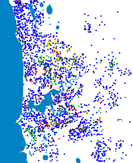
5,524  One dot represents 100 persons born in the United Kingdom (dark blue), China (red), Italy (light green), Malaysia (dark green), South Africa (brown), Singapore (purple) and Vietnam (yellow), based on 2006 Census
Perth is Australia's fourth most populous city, having overtaken Adelaide's population in the early 1980s. At the 2006 Census 1,445,079 persons resident in the Perth statistical area were enumerated.
Ethnic groups
In 2006, the largest ancestry groups in the Perth metropolitan areas were: English (534,555 or 28.6%), Australian (479,174 or 25.6%), Irish (115,384 or 6.2%), Scottish (113,846 or 6.1%), Italian (84,331 or 4.5%) and Chinese (53,390 or 2.9%). There were 3,101 Aboriginals in the city (0.2%).[38]
Perth's population is notable for the high proportion of British-born residents. At the 2006 Census, 142,424 British-born Perth residents were counted,[54] narrowly behind Sydney (145,261),[55] despite having just 35% of the overall population of Sydney.
The ethnic make-up of Perth changed in the second part of the twentieth century, when significant numbers of continental European immigrants arrived in the city. Prior to this, Perth's population had been almost completely Anglo-Celtic in ethnic origin. As Fremantle was the first landfall in Australia for many migrant ships coming from Europe in the 1950s and 1960s, Perth started to experience a diverse influx of people, which included Italians, Greeks, Dutch, Germans, Croats, Bosnians, Serbs, Poles, Czechs, Slovaks, Russians, Ukrainians, Macedonians, Turks and many others. The Italian influence in the Perth and Fremantle area has been substantial, evident in places like the "Cappuccino strip" in Fremantle featuring many Italian eateries and shops. In Fremantle the traditional Italian blessing of the fleet festival is held every year at the start of the fishing season. In Northbridge every December is the San Nicola (Saint Nicholas) Festival, which involves a pageant followed by a concert, predominantly in Italian. Suburbs surrounding the Fremantle area such as Spearwood and Hamilton Hill also contain high concentrations of Italians, Croatians and Portuguese. Perth also has a vibrant Jewish community – numbering 5,082 in 2006[53] – who have emigrated primarily from Eastern Europe and more recently from South Africa.
Another more recent wave of arrivals includes European minorities from Southern Africa. The South Africa–born overtook those born in Italy to become the fourth largest birthplace group after 2001. By 2006, there were 18,825 South Africa–born in Perth, accounting for 1.3% of the city's people.[54] Many Afrikaners and Anglo-Africans from South Africa and Zimbabwe emigrated to Perth during the 1980s and 1990s, with the phrase "packing for Perth" becoming associated with South Africans who choose to emigrate abroad, sometimes regardless of the destination.[56] As a result, the city has been described as "the Australian capital of South Africans in exile".[57] The reason for Perth being so popular among white South Africans has often been the location (closer to Africa than other large cities), the vast amount of expansion and space, and the slightly warmer climate compared to other large Australian cities—Perth has a Mediterranean climate like the area around Cape Town, South Africa.
In the last three decades, Southeast Asia has become an increasingly important source of migrants, with communities from Malaysia, Indonesia, Thailand, Singapore, Hong Kong, Mainland China, and India all now well-established. There were 53,390 persons of Chinese descent in Perth in 2006 – 2.9% of the city's population.[58]
The Indian community includes a substantial number of Parsees who emigrated from Bombay – Perth being the closest Australian city to India – and the India-born population of the city at the time of the 2006 census was 14,094 or 0.8%.[58] Perth is also home to the largest population of Anglo-Burmese in the world; many settled here following the independence of Burma in 1948 and the city is now the cultural hub for Anglo-Burmese worldwide. There is also a substantial Anglo-Indian population in Perth, who also settled in the city following the independence of India.
Governance
Perth houses the Parliament of Western Australia and the Governor of Western Australia.
 Government House, Western Australia
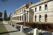 Parliament House, Perth.
At present, 42 of the Legislative Assembly's 59 seats and 18 of the Legislative Council's 36 seats are based in Perth's metropolitan area as of the 2008 state election. Perth is represented by 9 full seats and significant parts of three others in the Federal House of Representatives, with the seats of Canning, Pearce and Brand including some areas outside the metropolitan area. The metropolitan area is divided into over 30 local government bodies, including the City of Perth which administers Perth's central business district.
The state's highest court, the Supreme Court, is located in Perth,[59] along with the District[60] and Family[61] Courts. The Magistrates' Court has six metropolitan locations.[62] The Federal Court of Australia and the Federal Magistrates' Courts occupy the Commonwealth Law Courts building on Victoria Avenue, Perth,[63] which is the also the location for annual Perth sittings of Australia's High Court.[64]
The Metropolitan Region Scheme is the statutory town planning scheme for land use in the Perth metropolitan area, and has been in operation since 1963.[65]
Economy
See also: Economy of Western AustraliaBy virtue of its population and role as the administrative centre for business and government, Perth dominates the Western Australian economy, despite the major mining, petroleum and agricultural export industries located elsewhere in the state.[66] Perth’s function as the State’s capital city, its economic base and population size have also created development opportunities for many other businesses oriented to local or more diversified markets.
Perth’s economy has been changing in favour of the service industries since the 1950s. Although one of the major sets of services it provides are related to the resources industry and, to a lesser extent, agriculture, most people in Perth are not connected to either; they have jobs that provide services to other people in Perth.[67]
As a result of Perth's relative geographical isolation, it has never had the necessary conditions to develop significant manufacturing industries other than those serving the immediate needs of its residents, mining and agriculture and some specialised areas, such as, in recent times, niche ship building and maintenance. It was simply cheaper to import all the needed manufactured goods from either the eastern states or overseas.
Industrial employment influenced the economic geography of Perth. After WWII, Perth experienced suburban expansion aided by high levels of car ownership. Workforce decentralisation and transport improvements made it possible for the establishment of small-scale manufacturing in the suburbs. Many firms took advantage of relatively cheap land to build spacious, single-storey plants in suburban locations where parking, access and traffic congestion were minimal. "The former close ties of manufacturing with near-central and/or rail-side locations were loosened."[66]
Industrial estates such as Kwinana, Welshpool and Kewdale were post-war additions contributing to the growth of manufacturing south of the river. The establishment of the Kwinana industrial area was supported by standardisation of the east-west rail gauge linking Perth with eastern Australia. Since the 1950s, heavy industry has dominated the location including an oil refinery, steel-rolling mill with a blast furnace, alumina refinery, power station and a nickel refinery. Another development, also linked with rail standardisation, was in 1968 when the Kewdale Freight Terminal was developed adjacent to the Welshpool industrial area, replacing the former Perth railway yards.[66]
With significant population growth post-WWII,[68] employment growth occurred not in manufacturing but in retail and wholesale trade, business services, health, education, community and personal services and in public administration. Increasingly it was these services sectors, concentrated around the Perth metropolitan area, that provided jobs.[66]
Education
 The University of Western Australia is located at Crawley
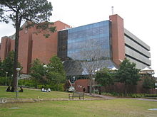 Curtin University in BentleySee also: Education in Western Australia
Perth is home to four public universities: the University of Western Australia, Curtin University, Murdoch University, and Edith Cowan University. There is also one private university, the University of Notre Dame.
The University of Western Australia, which was founded in 1911,[69] is renowned as one of Australia's leading research institutions. The university's monumental neo-classical architecture, most of which is carved from white limestone, is a notable tourist destination in the city. It is the only university in the state to be a member of the Group of Eight, as well as the Sandstone universities.
Curtin University (known as Curtin University of Technology until 2010) is Western Australia's largest university by student population, and was known from its founding in 1966 until 1986 as the Western Australian Institute of Technology (WAIT) and had amalgamated with Western Australian School of Mines and the Muresk Institute. It has a rapidly growing research reputation and is the only Western Australian university to produce PhD recipients of the AINSE gold medal, the highest possible recognition for PhD level science and engineering research excellence in Australia and New Zealand.[70]
Murdoch University was established in the 1970s, and is Australia's largest campus in geographical area (2.27 square kilometres), necessary to accommodate Western Australia's only veterinary school.
Edith Cowan University was established in the early 1990s from the existing Western Australian College of Advanced Education (WACAE) which itself was formed in the 1970s from the existing Teachers Colleges at Claremont, Churchlands, and Mount Lawley. It incorporates the Western Australian Academy of Performing Arts (WAAPA).
The University of Notre Dame Australia was established in 1990. Notre Dame was established as a Catholic university with its lead campus in Fremantle and a large campus in Sydney. Its campus is set in the west end of Fremantle, utilising historic port buildings built in the 1890s, giving Notre Dame a distinct European university atmosphere. Though Notre Dame shares its name with the University of Notre Dame in Indiana USA, it is a separate institution, claiming only "strong ties" with its American namesake.[citation needed]
Colleges of TAFE provide trade and vocational training, including certificate- and diploma-level courses. TAFE began as a system of technical colleges and schools under the Education Department, from which they were separated in the 1980s and ultimately formed into regional colleges. Four exist in the Perth metropolitan area: Central Institute of Technology (formerly Central TAFE); West Coast Institute of Training (northern suburbs); Polytechnic West (eastern and south-eastern suburbs; formerly Swan TAFE); and Challenger Institute of Technology (Fremantle/Peel).
Media
Like the other mainland Australian state capital cities, Perth is served by five analogue free to air stations: ABC (now branded as ABC1), Seven, Nine, Ten and SBS, (branded as SBS One). These channels are also broadcast in digital transmission format. Additional digital-only channels available include One HD, ABC2, ABC3, ABC News 24, SBS Two, 7Two, 7mate, GEM HD, Eleven and GO!. Community station, Access 31, closed in August 2008. In April 2010 a new community station, West TV, began transmission (in digital format only).
Foxtel provides a subscription-based satellite and cable television service. Perth has its own local newsreaders on ABC, Seven, Nine and Ten. Seven's weekly presenters are Rick Ardon and Susannah Carr; presenter for Nine is Greg Pearce, and the presenters for Ten are Craig Smart and Narelda Jacobs. The ABC news anchor is Karina Carvalho.
Television shows produced in Perth include local editions of the current affair program Today Tonight, and other types of programming such as The Force (documentary), and The Western Front (sport). An annual telethon has been broadcast since 1968 to raise funds for charities including Princess Margaret Hospital for Children. The 24 hour Perth Telethon claims to be "the most successful fundraising event per capita in the world"[71] and raised more than A$7.5 million in 2008.
The main newspapers for Perth are The West Australian and The Sunday Times. Localised free community papers cater for each local government area. There are also many advertising newspapers, such as The Quokka. The local business paper for Western Australia is WA Business News.
Radio stations are on AM, FM and DAB+ frequencies. ABC stations include News Radio (585AM), 720 ABC Perth, Radio National (810AM), Classic FM (97.7FM) and Triple J (99.3FM). The 6 local commercial stations are: 92.9, Nova 93.7, Mix 94.5, 96fm, on FM and 882 6PR and 1080 6IX on AM. DAB+ has mostly the same as both FM and AM plus national stations from the ABC/SBS, Radar Radio and Novanation, along with local stations My Perth Digital and HotCountry Perth. Major community radio stations include RTRFM (92.1FM), Sonshine FM (98.5FM),[72] SportFM (91.3FM)[73] and Curtin FM (100.1FM).[74]
Culture
 The distinctive WA Maritime Museum building on Victoria Quay
Perth Cultural Centre is both an area of central Perth and the collective name for the main buildings of the Art Gallery of Western Australia, Western Australian Museum, Alexander Library, State Records Office and Perth Institute of Contemporary Arts (PICA).
The Perth International Arts Festival is a cultural festival which has been held annually since 1953.
Museums and galleries
The Western Australian Museum holds an extensive display of Aboriginal artefacts as well as numerous zoological and social exhibits.
The new (2002) Western Australian Maritime Museum in Fremantle displays maritime objects from all eras and includes a former Royal Australian Navy submarine. It also houses Australia II, the yacht that won the Americas Cup in 1983.
The Art Gallery of Western Australia houses the State Art Collection. It curates and hosts numerous impressive visiting exhibitions, like the 2006 Norman Lindsay exhibition. Additional exhibits occur at PICA and many other smaller venues on a regular basis across Perth.
Sport
Main article: Sport in Western Australia Patersons Stadium, the home stadium of Australian football and many other sports in Perth.
The most popular sports are Australian rules football, cricket, hockey, association football (soccer) and netball[citation needed].
The climate of Perth allows for extensive outdoor sport activity, and this is reflected in the wide variety of sports available to citizens of the city. Perth was host to the 1962 Commonwealth Games and the 1987 America's Cup defence (based at Fremantle). Australian rules football is the most popular spectator sport in Perth – nearly 24% of Western Australians attended matches in 2005.[75]
Perth is home to several professional sporting teams participating in various national competitions:
- Association football (soccer): Perth Glory and Perth Glory (W-League)
- Australian rules football: West Coast Eagles and the Fremantle Football Club
- Baseball: Perth Heat (men)
- Basketball: Perth Wildcats (men) and West Coast Waves (women)
- Cricket: Western Warriors (men) and Western Fury (women)
- Field hockey: Smokefree WA Thundersticks (men) and Smokefree WA Diamonds (women)
- Netball: West Coast Fever (formerly Perth Orioles)
- Rugby league: WA Reds (men)
- Rugby union: Western Force (men)
Perth has hosted numerous state and international sporting events. Ongoing international events include the Hopman Cup during the first week of January at the Burswood Dome and the final leg of the Red Bull Air Race held on a stretch of the Swan River called Perth Water, using Langley Park as a temporary air field. In addition to these Perth has hosted international Rugby Union games, including qualifying matches for 2003 Rugby World Cup. The 1991 and 1998 FINA World Championships were held in Perth.[76] Several motorsport facilities exist in Perth including Perth Motorplex, catering to drag racing and speedway, and Barbagallo Raceway for circuit racing and drifting. Perth also has two thoroughbred racing facilities in Ascot, home of the Railway Stakes and Perth Cup, and Belmont Park.
Music and performing arts
Main article: Music of Perth Burswood Entertainment Complex, where the Resort, Dome, Theatre and Casino venues are located.
Perth Concert Hall is the city's main concert venue and hosts theatre, ballet, opera and orchestral performances. The State Theatre Centre of Western Australia, which was officially opened on 27 January 2011, is home to the Black Swan State Theatre Company and the Perth Theatre Company. This complex is located in Northbridge, and contains three performance spaces: the main 575-seat Heath Ledger Theatre, the Studio Underground and The Courtyard.
Other theatres in Perth include an auditorium within the Perth Convention Exhibition Centre (completed in 2005), the historic His Majesty's Theatre and Burswood Dome, which hosts music concerts. Outdoor concerts are held in Kings Park, Subiaco Oval and Members Equity Stadium and the Convention Centre on the foreshore replaces the Burswood Dome until a more satisfactory building is established.

Because of Perth's relative isolation from other Australian cities overseas artists often exclude it from their Australian tour schedules. This isolation, however, has developed a strong local music scene, leading some to dub Perth the "new Seattle".[77]
Perth has been a hotbed of local rock music producing such nationally and internationally respected acts as Pendulum, John Butler Trio, Eskimo Joe, End of Fashion, Little Birdy, Jebediah, The Sleepy Jackson, The Panics, Karnivool and Birds of Tokyo. The Hip-Hop and R&B scene has seen rise to artists such as Che'Nelle, and Samantha Jade. The local music culture revolves around a series of venues such as The Amplifier Bar and The Rosemount Hotel.[citation needed] The WAMI Awards have been acknowledging local music since 1985.
The more popular rock concerts held in Perth are the Big Day Out (nationwide) and Soundwave. The city is also referenced in the Pavement song "I Love Perth".
Perth has a very changeable and, at times, energetic Folk music culture. Bands such as The Settlers regularly played at Clancy's Fish Pub in Fremantle and the earlier line ups of the Mucky Duck Bush Band that now has regular bush dances in Whiteman Park. A favourite spot was the Hayloft in West Perth – home of WA Folk music in the 1970s and later moving to the Peninsula Hotel in Maylands. Perth is also home to a vibrant alternative sexuality music scene, focused especially around such nightclubs as "The Court" and "Connections". It also has a large growing electro indie scene through such nightclubs as "Capitol", "Amplifier Bar" and "Shape"[citation needed]. Perth is also known for its thriving drum and bass scene and is known as the capital city for drum & bass music in Australia[citation needed].
Other musicians from Perth include the late AC/DC lead singer Bon Scott, and veteran performer and artist Rolf Harris (also known as "The Boy From Bassendean").
Perth is home to the West Australian Ballet, performing classical-based ballet at His Majesty's Theatre (two seasons per year), Quarry Amphitheatre in City Beach (one season per year in conjunction with the Perth International Arts festival)and Regal Theatre in Subiaco (one season per year). WA Ballet also performs its Genesis Choreography Workshops in one season per year, as well as regular touring, education and guest programs. West Australian Symphony Orchestra which performs a regular programme of orchestral music, usually from its base at the Perth Concert Hall. The Perth International Arts Festival also includes music in its schedule. Opera is provided by West Australian Opera.
Western Australia Youth Music[78] allows young musicians in Perth to gain performance opportunities by playing in a musical ensemble. The Western Australian Youth Orchestra is WA Youth Music's premier and flagship ensemble, however the organisation offers several other ensembles including the WA Youth Symphonic Band and the WA Youth Chorale. Acceptance is granted to amateur players under the age of 25 years. Auditions are held in November of each year.
Film and television
Famous actors and media personalities hailing from Perth include: Heath Ledger, Judy Davis, Melissa George, Jessica Gomes, Sara Groen, Rove McManus, Tim Minchin, Russell Napier, Alan Seymour, Sam Worthington, Isla Fisher, Gerard Kennedy, Terry Willesee, Mike Willesee, Roland Rocchiccioli, Liz Harris, Sandra Harris, Simon Reeve, Kevin Sanders, Lisa McCune, Jennifer Hagan.
Perth boasts the internationally regarded Western Australian Academy of Performing Arts of Edith Cowan University, from which many successful actors and broadcasters have launched their careers, including Hugh Jackman, Frances O'Connor, Marcus Graham and William McInnes.
Films which feature Perth include Last Train to Freo, Rabbit-Proof Fence, Two Fists, One Heart, Thunderstruck, Bran Nue Dae, Japanese Story and much of the work of Burleigh Smith.
Religion
Perth is the seat of the Roman Catholic Archdiocese of Perth and of the Anglican Diocese of Perth. Roman Catholics make up about 23% of the population, and Catholicism is the most common single denomination. Other forms of Christianity, predominantly Anglican, make up approximately 28% of the population. Approximately one in five people from Perth profess to having no religion, with 11% of people are not specific as to their beliefs. Buddhism and Islam each claim more than 20,000 adherents, and Perth is also home to less than 5,000 Latter-day Saints and the Perth Australia Temple of the Church of Jesus Christ of Latter-day Saints. Perth has one of the larger Jewish populations in Australia, numbering approximately 20,000, with both Orthodox and Progressive Synagogues and a Jewish Day School. The Bahá’í community in Perth numbers around 1500. Hindus are a fast growing community with over 20,000 adherents in Perth. The Divali (festival of lights) celebration in 2009 attracted over 20,000 visitors. There are Hindu temples in Canning Vale, Anketell and a Swaminarayan Temple north of the Swan River.
Food
Perth has many cuisines from nearly every country. Some of these include Chinese, Indian, Japanese, Malaysian, Korean, Italian, Irish, Turkish cuisines. Many others can be found throughout Perth.
Heritage buildings
There are several heritage buildings located in Perth's CBD. Several of these, such as Bishop and St George's Houses have been repurposed for commercial use. Old Perth Boy's School is currently[when?] undergoing a refurbishment as part of the City Square project. A number of the historic buildings are being converted into luxury accommodation and upmarket food and beverage destinations.
Infrastructure
 The Northbridge Tunnel on the Graham Farmer Freeway
 Perth Underground Train Station
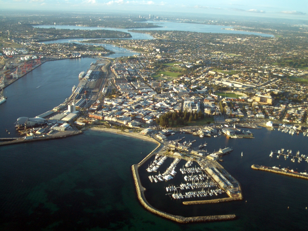
 Aerial view of Fremantle looking east towards Perth
Transport
Main article: Transport in PerthFurther information: TransperthPerth is served by Perth Airport in the city's east for regional, domestic and international flights and Jandakot Airport in the city's southern suburbs for general aviation and charter flights.
Perth has a road network with three freeways and nine metropolitan highways. The Northbridge tunnel, part of the Graham Farmer Freeway, is the only significant road tunnel in Perth.
Perth metropolitan public transport, including trains, buses and ferries, are provided by Transperth, with links to rural areas provided by Transwa. There are 70 railway stations and 15 bus stations in the metropolitan area. The rail system has recently undergone significant redevelopment, with a new railway line built between Perth and Mandurah which doubled the length of Perth's railways. The railway was opened on 23 December 2007, a year after the original deadline.
Recent initiatives include progressive replacement of the bus fleet and the SmartRider contactless smartcard ticketing system. Perth provides zero-fare bus and train trips around the city centre (the "Free Transit Zone"), including three high-frequency CAT bus routes. Additionally, the rail network has been expanded in the northern and southern suburbs as part of the New MetroRail project.
The Indian Pacific passenger rail service connects Perth with Adelaide and Sydney via Kalgoorlie. The Transwa Prospector passenger rail service connects Perth with Kalgoorlie via several Wheatbelt towns, while the Transwa Australind connects to Bunbury, and the Transwa Avonlink connects to Northam.
Rail freight terminates at the Kewdale Rail Terminal, 15 kilometres south-east of the city centre.
Perth's main container and passenger port is at Fremantle, 19 kilometres south west at the mouth of the Swan River.[79] A second port complex is being developed in Cockburn Sound primarily for the export of bulk commodities.
Water supply
Reduced rainfall in the region in recent years has lowered inflow to reservoirs by two-thirds over the last 30 years, and affected groundwater levels. Coupled with the city's relatively high growth rate, this had led to concerns that Perth could run out of water in the near future.[80] The Western Australian State Government has responded by introducing mandatory household sprinkler restrictions in the city. The Kwinana Desalination Plant was opened in November 2006, able to supply over 45 gigalitres (10 billion imperial or 12 billion U.S. gallons) of potable water per year;[81][82] its power requirements were met by the construction of the Emu Downs Wind Farm near Cervantes.[83] Consideration was given to piping water from the Kimberley region, but the idea was rejected in May 2006 due primarily to its high cost.[84] Other proposals under consideration included the controversial extraction of an extra 45 gigalitres of water a year from the Yarragadee aquifer in the south-west of the state. However, in May 2007, the state government announced that a second desalination plant will be built at Binningup, on the coast between Mandurah and Bunbury.[85] A trial winter (1 June – 31 August) sprinkler ban was introduced in 2009 by the State Government, a move which the Government later announced would be made permanent.[86] In September 2009 Western Australia's dams reached 50% overall capacity for the first time since 2000.[87]
See also
Notes
- ^ a b "Regional Population Growth, Australia 2008–2009". Australian Bureau of Statistics. 30 March 2010. http://www.abs.gov.au/ausstats/abs@.nsf/Products/3218.0~2009-10~Main+Features~Main+Features?OpenDocument#PARALINK16.
- ^ "Regional Population Growth, Australia 2009–10". Australian Bureau of Statistics. 31 March 2011. http://www.abs.gov.au/ausstats/abs@.nsf/Latestproducts/3218.0Main%20Features82008-09?opendocument&tabname=Summary&prodno=3218.0&issue=2008-09&num=&view=#PARALINK1.
- ^ a b "3218.0 Population Estimates by Statistical District, 2001 to 2009" (xls). 3218.0 – Regional Population Growth, Australia, 2008–09. Australian Bureau of Statistics. 29 March 2010.
- ^ "Great Circle Distance between PERTH and ADELAIDE". Geoscience Australia. March 2004. http://www.ga.gov.au/bin/distancedraw2?rec1=163285&placename=adelaide&placetype=0&state=SA+&place1=PERTH&place1long=115.858612&place1lat=-31.951941.
- ^ "Great Circle Distance between PERTH and DARWIN CITY". Geoscience Australia. March 2004. http://www.ga.gov.au/bin/distancedraw2?rec1=111004&placename=darwin&placetype=0&state=NT+&place1=PERTH&place1long=115.858612&place1lat=-31.951941.
- ^ "Great Circle Distance between PERTH and MELBOURNE". Geoscience Australia. March 2004. http://www.ga.gov.au/bin/distancedraw2?rec1=248650&placename=melbourne&placetype=0&state=VIC&place1=PERTH&place1long=115.858612&place1lat=-31.951941.
- ^ "Great Circle Distance between PERTH and SYDNEY". Geoscience Australia. March 2004. http://www.ga.gov.au/bin/distancedraw2?rec1=106743&placename=sydney&placetype=0&state=NSW&place1=PERTH&place1long=115.858612&place1lat=-31.951941.
- ^ Macquarie Dictionary, Fourth Edition (2005). Melbourne, The Macquarie Library Pty Ltd. ISBN 1-876429-14-3
- ^ March 2011&Latest 2010 Australian Bureau of Statistics estimated population
- ^ (1970) Perth – a city of light Perth, W.A. Brian Williams Productions for the Government of WA, 1970 (Video recording) The social and recreational life of Perth. Begins with a 'mock-up' of the lights of Perth as seen by astronaut John Glenn in February 1962
- ^ http://adbonline.anu.edu.au/biogs/AS10234b.htm
- ^ Australian Broadcasting Corporation (15 February 2008). "Moment in Time – Episode 1". http://www.abc.net.au/tv/canwehelp/txt/s2160601.htm. Retrieved 14 July 2008.
- ^ Moore, Charles (5 November 1998). "Grandfather Glenn's blast from the past". The Daily Telegraph (UK) (London). http://www.telegraph.co.uk/digitallife/main.jhtml?xml=/connected/1998/11/05/ecnglen05.xml. Retrieved 14 July 2008.
- ^ "Perth the world's 8th most liveable [sic city]" – WA Today. Written by Lucy Rickard. Published 30 August 2011. Retrieved 1 September 2011.
- ^ Sandra Bowdler. "The Pleistocene Pacific". Published in ‘Human settlement’, in D. Denoon (ed) The Cambridge History of the Pacific Islanders. pp. 41–50. Cambridge University Press, Cambridge. University of Western Australia. http://www.archaeology.arts.uwa.edu.au/staff/bowdler__research_interests/the_pleistocene_pacific. Retrieved 26 February 2008.
- ^ "Bennell v State of Western Australia [2006 FCA 1243"]. Federal Court of Australia Decisions. Australasia Legal Information Institute. http://www.austlii.edu.au/au/cases/cth/federal_ct/2006/1243.html. Retrieved 14 April 2007.
- ^ (Northern Territory Government Newsletter)[dead link]
- ^ Major, Richard Henry (1859). "Early Voyages to Terra Australis, now called Australia". Project Gutenberg of Australia. http://gutenberg.net.au/ebooks06/0600361h.html#ch-12. Retrieved 26 February 2008.
- ^ Stirling, James (18 June 1829). Proclamation. wikisource.
- ^ Fremantle, John (1928). Diary & Letters of Admiral Sir C. H. Fremantle, G.C.B. Relating the Founding of the Colony of Western Australia 1829. London: Hazell, Watson & Viey.
- ^ Kimberly, W. B. (1897). History of West Australia. Melbourne: F. W. Niven & Co.. p. 44.
- ^ "Perth". Encyclopaedia Britannica. 9. Encyclopaedia Britannica, Inc.. 1986. pp. 314.
- ^ Uren, Malcolm J. L. (1948). Land Looking West. London: Oxford University Press.
- ^ Crowley, Francis K. (1960). Australia's Western Third. London: Macmillan & Co.
- ^ Statham, Pamela (1981). "Swan River Colony". In Stannage, Tom. A New History of Western Australia. Nedlands: University of Western Australia Press. ISBN 0-85564-181-9.
- ^ "Town of Vincent – History". Adapted from 'History of the Town of Vincent', from Town of Vincent 2001 Annual Report, p.52 (possibly based on J. Gentili and others). Town of Vincent. http://www.vincent.wa.gov.au/2/145/1/history.pm. Retrieved 26 February 2008.
- ^ ":: REGIONAL WA:: Western Australia: History". Regional Web Australia. 23 December 2003. http://www.regionalwa.com.au/WAinfo/PerthHistory.htm. Retrieved 26 February 2008.
- ^ a b "History of the City of Perth" (PDF). City of Perth. 23 March 2005. http://www.cityofperth.wa.gov.au/documentdb/63.pdf. Retrieved 26 February 2008.
- ^ a b "Collections in Perth: 4. Colonial Administration". Collections in Perth. National Archives of Australia. 23 August 2007. http://www.naa.gov.au/naaresources/Publications/research_guides/guides/perth/chapter04.htm. Retrieved 26 February 2008.
- ^ "Deputy Premier 2nd Collier Government 1933–1935". John Curtin Prime Ministerial Library. 11 May 2005. http://john.curtin.edu.au/mccallum/deputy.html. Retrieved 26 February 2008.
- ^ "WA Statistical Indicators June 2002". Australian Bureau of Statistics. 11 July 2002. http://www.abs.gov.au/AUSSTATS/abs@.nsf/7d12b0f6763c78caca257061001cc588/0c312955726b99d4ca256f2a000ffa34!OpenDocument. Retrieved 5 October 2008.
- ^ "Australia's identified mineral resources, 2002" (PDF). Geoscience Australia. 31 October 2002. http://www.ga.gov.au/pdf/RR0112.pdf. Retrieved 26 February 2008.
- ^ "Discussion Paper: Greater Perth Economy And Employment" (PDF). Department for Planning and Infrastructure. 25 August 2003. http://www.dpi.wa.gov.au/mediaFiles/dialogue_GPdp3.pdf. Retrieved 5 October 2008.
- ^ Bryson, Bill (2001). Down Under. ISBN 978-0552997034.
- ^ "Perth, commercial area information". Emporis.com. http://www.emporis.com/en/wm/ci/?id=100506. Retrieved 26 February 2008.
- ^ "World's tallest skyscrapers by country". Emporis.com. http://www.emporis.com/en/bu/sk/st/tp/co/?id=100012. Retrieved 26 February 2008.
- ^ "175th Anniversary of Western Australia – Heritage Icons: January – The Swan River". Department of the Premier and Cabinet (Western Australia). 31 December 2004. http://www.ccentre.wa.gov.au/index.cfm?event=heritageIconsJanuary. Retrieved 13 November 2008.
- ^ a b "Indigenous Affairs" (PDF). Department of Indigenous Affairs. 11 May 2006. http://www.dtf.wa.gov.au/cms/uploadedFiles/200607_02_Part10_Indigenous_Affairs.pdf.
- ^ Godfrey, N. (1989) The value of wetlands. Wetlands in crisis – what can Local Government do?, pp. 4–12. Environmental Protection Agency, Western Australia.
- ^ Tapper, Andrew; Tapper, Nigel (1996). Gray, Kathleen. ed. The weather and climate of Australia and New Zealand (First ed.). Melbourne, Australia: Oxford University Press. p. 300. ISBN 0195533933.
- ^ Linacre, Edward; Geerts, Bart (1997). Climates and Weather Explained. London: Routledge. p. 379. ISBN 0-415-12519-7. http://books.google.com/?id=mkZa1KLHCAQC&lpg=PA379&pg=PA379#v=onepage&q=.
- ^ a b c "Annual Climate Summary for Perth: Near average rainfall with warmer days for Perth in 2008". Australian Bureau of Meteorology. 2 January 2009. http://www.bom.gov.au/climate/current/annual/wa/archive/2008.perth.shtml. Retrieved 5 August 2009.
- ^ "Perth Airport climate statistics". Australian Bureau of Meteorology. http://www.bom.gov.au/climate/averages/tables/cw_009021_All.shtml. Retrieved 30 July 2009.
- ^ "Heatwaves in Perth". Australian Bureau of Meteorology. June 2005. http://www.bom.gov.au/weather/wa/sevwx/perth/heatwaves.shtml. Retrieved 5 August 2009.
- ^ "Weather Centre – World Weather – Average Conditions – Perth". BBC. http://www.bbc.co.uk/weather/world/city_guides/results.shtml?tt=TT003050. Retrieved 14 June 2010.
- ^ "Perth Climate Guide, Western Australia". Weather2travel.com. http://www.weather2travel.com/climate-guides/australia/western-australia/perth.php. Retrieved 15 October 2011.
- ^ "Jandakot Airport climate statistics". Australian Bureau of Meteorology. http://www.bom.gov.au/climate/averages/tables/cw_009172_All.shtml. Retrieved 30 July 2009.
- ^ "How extreme south-west rainfalls have changed" (PDF). Indian Ocean Climate Initiative. 2000. http://www.water.wa.gov.au/Tools/Water+Education+Tools/Resources/Downloads_GetFile.aspx?id=931. Retrieved 5 August 2009.
- ^ "Warm season storms". Australian Bureau of Meteorology. 2003. http://www.bom.gov.au/weather/wa/sevwx/perth/storms_warm.shtml. Retrieved 26 March 2010.
- ^ "Storm brings huge damage bill" (web page). The West Australian. 2010. http://au.news.yahoo.com/thewest/a/-/newshome/6967134/storm-brings-huge-damage-bill/. Retrieved 23 March 2010.
- ^ Western Australian Climate Services Centre (Bureau of Meteorology) (January 2011). "Perth Metro Climate Averages" (PDF). ftp://ftp.bom.gov.au/anon/home/waroda2/Perth_Metro_climatic_averages/perth_means.pdf. Retrieved 6 March 2011.
- ^ Western Australian Climate Services Centre (Bureau of Meteorology) (January 2011). "Perth Metro Climatic Extremes" (PDF). ftp://ftp.bom.gov.au/anon/home/waroda2/Perth_Metro_climatic_averages/perth_extremes.pdf. Retrieved 6 March 2011.
- ^ a b Australian Bureau of Statistics (25 October 2007). "Community Profile Series : Perth (Statistical Division)". 2006 Census of Population and Housing. http://www.censusdata.abs.gov.au/ABSNavigation/prenav/ProductSelect?newproducttype=Community+Profiles&collection=Census&period=2006&areacode=505&breadcrumb=LP¤taction=201&action=401. Retrieved 19 September 2008.
- ^ a b Australian Bureau of Statistics (25 October 2007). "Perth (Statistical Division)". 2006 Census QuickStats. http://www.censusdata.abs.gov.au/ABSNavigation/prenav/LocationSearch?collection=Census&period=2006&areacode=505&producttype=QuickStats&breadcrumb=PL&action=401. Retrieved 28 February 2008.
- ^ Australian Bureau of Statistics (25 October 2007). "Sydney (Statistical Division)". 2006 Census QuickStats. http://www.censusdata.abs.gov.au/ABSNavigation/prenav/LocationSearch?collection=Census&period=2006&areacode=105&producttype=QuickStats&breadcrumb=PL&action=401. Retrieved 28 February 2008.
- ^ Packing for Perth: The Growth of a Southern African Diaspora, Eric Louw, Gary Mersham, Asian and Pacific Migration Journal, Vol. 10, No. 2, 2001 303]
- ^ Yeld, John (6 March 2006). "Packing for Perth because of the poo!". IOL. Cape Argus. http://www.int.iol.co.za/?set_id=1&click_id=&art_id=vn20060306104143710C509596. Retrieved 14 August 2007.
- ^ a b Australian Bureau of Statistics (25 October 2007). "Community Profile Series : Perth (Statistical Division)". 2006 Census of Population and Housing. http://www.censusdata.abs.gov.au/ABSNavigation/prenav/ProductSelect?newproducttype=Community+Profiles&collection=Census&period=2006&areacode=505&breadcrumb=LP¤taction=201&action=401. Retrieved 28 May 2008.
- ^ "Jurisdiction". Supreme Court of WA. 16 October 2008. http://www.supremecourt.wa.gov.au/content/about/default.aspx. Retrieved 16 October 2008.
- ^ "About the District Court". District Court of WA. 16 October 2008. http://www.districtcourt.wa.gov.au/A/aboutDistrictCourt.aspx?uid=7689-4890-3639-8152. Retrieved 16 October 2008.
- ^ "About the Family Court". Family Court of WA. 16 October 2008. http://www.familycourt.wa.gov.au/A/about_the_family_court.aspx?uid=0585-2574-5706-9153. Retrieved 16 October 2008.
- ^ "Magistrate Court Locations". Department of Justice. 16 October 2008. http://www.justice.wa.gov.au/M/magistrates_locations.aspx?uid=0987-0974-4964-6070. Retrieved 16 October 2008.
- ^ "WA Registry". Federal Court of Australia. 2 August 2008. http://www.fedcourt.gov.au/contacts/contacts_wa.html. Retrieved 16 October 2008.
- ^ "2007 Annual Report" (PDF). High Court of Australia. 18 March 2008. http://www.hcourt.gov.au/annual_reports/2007annual.pdf. Retrieved 16 October 2008.
- ^ "Regional Planning Schemes". WA Planning Commission. Archived from the original on 19 July 2008. http://web.archive.org/web/20080719211450/http://www.wapc.wa.gov.au/Region+schemes/default.aspx. Retrieved 16 October 2008.
- ^ a b c d "Greater Perth Economy and Employment". WA Department of Planning and Infrastructure. 25 August 2003. http://www.dpi.wa.gov.au/mediaFiles/dialogue_GPdp3.pdf. Retrieved 1 January 2009.
- ^ "Structure of the WA Economy". WA Department of Treasury and Finance. 24 January 2006. http://www.dtf.wa.gov.au/cms/uploadedFiles/structure_wa_economy_2005.pdf. Retrieved 10 September 2008.
- ^ "Australian Historical Population Statistics 2008". Australian Bureau of Statistics. 5 August 2008. http://abs.gov.au/AUSSTATS/abs@.nsf/productsbyCatalogue/632CDC28637CF57ECA256F1F0080EBCC?OpenDocument. Retrieved 1 January 2009.
- ^ "Visitors – History of the University". University of Western Australia. http://www.uwa.edu.au/visitors/about/history. Retrieved 14 April 2007. "The University of Western Australia has helped to shape the careers of more than 75,000 graduates since it was established in 1911."
- ^ "AINSE Gold Medals". Ainse.edu.au. http://www.ainse.edu.au/home2/gold_medals. Retrieved 26 September 2010.
- ^ "About Telethon", telethon.7perth.com.au.
- ^ "Sonshine FM's website". Sonshinefm.ws. http://sonshinefm.ws/. Retrieved 14 June 2010.
- ^ "SportFM's website". Sportfm.com.au. http://www.sportfm.com.au/. Retrieved 14 June 2010.
- ^ "Curtin FM's website". Curtinfm.com.au. http://www.curtinfm.com.au/. Retrieved 14 June 2010.
- ^ "Sports Attendance". Australian Bureau of Statistics. 25 Jan 2007. p. 15. http://www.ausstats.abs.gov.au/ausstats/subscriber.nsf/0/DE260FBDF0C4696ACA25726D0075ECAE/$File/41740_2005-06.pdf. Retrieved 30 May 2009.
- ^ Marsh, David (28 May 1997). "'New Era' For Swimming". The West Australian (West Australian Newspapers Ltd): p. 139.
- ^ "Creative WA". Tourism Western Australia. http://www.westernaustralia.com/en/Things_to_See_and_Do/People_and_Lifestyle/Pages/Creative_WA.aspx. Retrieved 12 September 2007.
- ^ "Western Australian Youth Music Association". Wayma.asn.au. http://www.wayma.asn.au. Retrieved 14 June 2010.
- ^ "Port Information". Fremantle Ports. http://www.fremantleports.com.au/Shipping/Business/PortInformation.asp. Retrieved 14 April 2007.
- ^ Dortch, Eloise (7 May 2005). "Plan for a second desalination plant". The West Australian (West Australian Newspapers Ltd): p. 1. "A document dated 12 January obtained by The West Australian under Freedom of Information laws shows that the Water Corporation fears Perth will begin running out of water by late 2008 without one of the two developments."
- ^ "Premier opens Australia's first major desalination plant". Water Corporation. 19 November 2006. http://www.watercorporation.com.au/m/media_detail.cfm?id=3301. Retrieved 14 April 2007. "When fully operational it will produce on average 130 million litres per day and supply 17 per cent of Perth's needs."
- ^ "Kwinana desalination plant open in months". ABC News Online (Australian Broadcasting Corporation). 26 September 2006. http://www.abc.net.au/news/newsitems/200609/s1748557.htm. Retrieved 14 April 2007.
- ^ "Water Technology – Perth Seawater Desalination Plant, Seawater Reverse Osmosis (SWRO), Kwinana". Water Corporation. 15 November 2007. http://www.water-technology.net/projects/perth/. Retrieved 27 February 2008.
- ^ "Kimberley Water Source Project" (PDF). Department of Water. 28 April 2006. http://portal.water.wa.gov.au/portal/page/portal/PlanningWaterFuture/Publications/KimberleyWaterSource/Content/FindingsFactsheetApril2006_000.pdf. Retrieved 27 February 2008.
- ^ "Southern Seawater Desalination Project". Water Corporation. http://www.watercorporation.com.au/D/desalination_plant2.cfm. Retrieved 25 September 2009.
- ^ "Winter sprinkler ban made permanent". ABC News. 9 September 2009. http://www.abc.net.au/news/stories/2009/09/09/2681052.htm. Retrieved 25 September 2009.
- ^ "Dams at record levels". ABC News. 15 September 2009. http://www.abc.net.au/news/stories/2009/09/15/2686535.htm. Retrieved 25 September 2009.
External links
Landmarks of Perth Buildings and structures Precincts Chinatown · NorthbridgeNature and parks Cultural institutions Sport Transportation Perth Station · Esplanade StationEntertainment Perth Concert Hall · Perth ArenaBeaches and islands Cottesloe Beach · Coogee BeachCapital cities of Australia List of cities in Australia Cities of Western Australia Capital city PerthMetropolitan cities Regional cities Large towns Cities of Australia Australian Capital Territory Canberra (national capital)New South Wales Albury · Armidale · Bathurst · Broken Hill · Cessnock · Coffs Harbour · Dubbo · Gosford · Goulburn · Grafton · Griffith · Lake Macquarie · Lismore · Lithgow · Maitland · Newcastle · Nowra · Orange · Queanbeyan · Sydney · Tamworth · Wagga Wagga · WollongongNorthern Territory Queensland Brisbane · Bundaberg · Cairns · Caloundra · Gladstone · Gold Coast · Gympie · Hervey Bay · Mackay · Maryborough · Mount Isa · Rockhampton · Sunshine Coast · Toowoomba · TownsvilleSouth Australia Adelaide · Mount Gambier · Murray Bridge · Port Augusta · Port Lincoln · Port Pirie · Victor Harbor · WhyallaTasmania Victoria Western Australia Commonwealth Games host cities 1930: Hamilton • 1934: London • 1938: Sydney • 1950: Auckland • 1954: Vancouver • 1958: Cardiff • 1962: Perth • 1966: Kingston • 1970: Edinburgh • 1974: Christchurch • 1978: Edmonton • 1982: Brisbane • 1986: Edinburgh • 1990: Auckland • 1994: Victoria • 1998: Kuala Lumpur • 2002: Manchester • 2006: Melbourne • 2010: Delhi • 2014: Glasgow • 2018: "Gold Coast •
Coordinates: 31°57′8″S 115°51′32″E / 31.95222°S 115.85889°E
Categories:- Host cities of the Commonwealth Games
- Australian capital cities
- Cities in Western Australia
- Coastal cities in Australia
- Perth, Western Australia
- Populated places established in 1829
-


Wikimedia Foundation. 2010.