- Shire of Dandaragan
Infobox Australian Place | type = lga
name =Shire of Dandaragan
state =wa
region =Wheatbelt
area =6716.3
est =1890
seat =Jurien Bay
pop =2,884 (2006 census)
imagesize= 180
caption = Location inWestern Australia
logo =Dandaragan logo.png
url =http://www.dandaragan.wa.gov.au
mayor =Shane Love
fedgov =O'Connor
stategov =Moore
near-nw =
near-n = Coorow
near-ne = Coorow
near-w =
near-e = Moora
near-sw =
near-s = Gingin
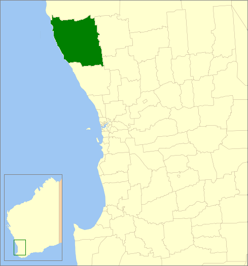
near-se = Victoria PlainsThe Shire of Dandaragan is a Local Government Area located in the Wheatbelt region of
Western Australia , about convert|200|km|mi|0 north of the state capital, Perth. The Shire covers an area of convert|6716|km2|sqmi|0 and its seat of government is the town of Jurien Bay.History
In 1890, the Dandaragan Road Board was gazetted. On 1 July 1961, it became the Shire of Dandaragan following changes to the Local Government Act. [WA Electoral Commission, "Municipality Boundary Amendments Register" (release 2.0), 31 May 2003.] Until the late 1960s it was a sparsely populated agricultural shire, but the coastal towns of Jurien Bay and Cervantes and the popularity of
The Pinnacles Desert with tourists have helped to fuel the shire's growth.Wards
The shire has been divided into 2 wards. The shire president is elected from amongst the councillors.
* North Ward (5 councillors)
* South Ward (4 councillors)Towns/Localities
* Badgingarra
* Cataby
* Cervantes
* Dandaragan
* Jurien Bay
*Nambung National Park
* Regans Ford
* Wedge IslandReferences
External links
* [http://www.dandaragan.wa.gov.au Shire of Dandaragan website]
Wikimedia Foundation. 2010.