- Chester Heights, Pennsylvania
-
Borough of Chester Heights Borough Country United States State Pennsylvania County Delaware Elevation 131 ft (39.9 m) Coordinates 39°53′22″N 75°28′15″W / 39.88944°N 75.47083°W Area 2.1 sq mi (5.4 km2) - land 2.1 sq mi (5 km2) - water 0.0 sq mi (0 km2), 0% Population 2,481 (2000) Density 1,184.8 / sq mi (457.5 / km2) Incorporated 1945 Timezone EST (UTC-5) - summer (DST) EDT (UTC-4) ZIP Code 19017 Area code 610 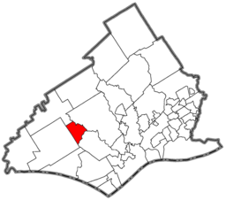 Location of Chester Heights in Delaware County
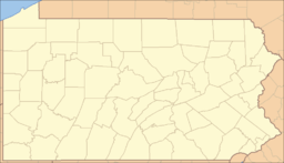
 Location of Chester Heights in Pennsylvania
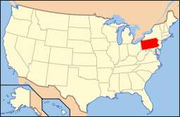 Location of Pennsylvania in the United States
Website: http://www.chesterheights.org Chester Heights is a borough in Delaware County, Pennsylvania, United States. The population was 2,481 at the 2000 census. Most of the borough lies south of U.S. 1, about a mile southwest of Wawa, Pennsylvania.
Contents
History
The History of Chester Heights predates grants of William Penn., when the Swedes had penetrated some distance inland from the Delaware River and had found the rich soil very conducive to productive farming. To a remarkable extent, the area had continued to be so used until the last decade. In the 18th and 19th centuries, the Borough was part of Aston Township, though this northernmost section of Aston did not have a village aspect as such. With the advent of a railroad, which made its first run-through on Christmas Day 1833, a concentration of houses developed. With the reach of the automobile, a settlement of homes sprang up along the oldest road in the Borough. That route—now #261 or Valleybrook Road was once known as the "Logtown Road" and was one of the earliest routes from Chester settlement to the interior. It wanders over and along the West Branch of Chester Creek and is noted for its abrupt curves at the Borough's southern end.
An 1836 School Building on Valleybrook Road and Llewelyn Road was, in its day, rented by its owners to Aston for $2 a month for use as the school for this area. It was subsequently known as the Logtown School and changed to the Chester Heights School in 1880. A second, much later stone school building stands in its place today. The Borough was the Fourth Ward of Aston and had been referred to for some time as Chester Heights and Wawa. It was in the northern or "Wawa" area that, over the past one-hundred years or more, several large land parcels were acquired for summer residences. To date, most of these tracts have remained relatively unchanged, though they are now used as year-round private residences. ("Wawa" was the Indian name for wild goose.)
In 1852 the cornerstone of the Catholic Church "St. Thomas the Apostle" was laid, and it stands today with the addition of a parochial school and residences. In 1872 an association of Methodists purchased a farm in Aston, incorporating as the Chester Heights Camp-Meeting Associations, and it still convenes each July for religious retreats. The Borough of Chester Heights was officially incorporated in 1945.
Finally, approximately one dozen early fieldstone or brick dwellings remain intact though not necessarily restored. The oldest homes date to 1720 or earlier; many of them were established by 1777 when " a number of the stragglers from the defeated American Army, hungry, demoralized and exhausted in their flight from the field at Brandywine, collected in the neighborhood of Logtown, where they passed the night, sleeping in the outbuildings and open fields."* Altogether, the houses represent an historically valuable span of 18th Century to Victorian Architecture in the Borough.[1]
Geography
Chester Heights is located at 39°53′22″N 75°28′15″W / 39.88944°N 75.47083°W (39.889539, -75.470931)[2].
According to the United States Census Bureau, the borough has a total area of 2.1 square miles (5.4 km2), all of it land.
Demographics
As of the census[3] of 2000, there were 2,481 people, 1,056 households, and 664 families residing in the borough. The population density was 1,184.8 people per square mile (458.3/km²). There were 1,117 housing units at an average density of 533.4 per square mile (206.4/km²). The racial makeup of the borough was 93.67% White, 2.30% African American, 0.08% Native American, 1.89% Asian, 0.12% Pacific Islander, 0.28% from other races, and 1.65% from two or more races. Hispanic or Latino of any race were 1.29% of the population.
There were 1,056 households out of which 29.3% had children under the age of 18 living with them, 49.7% were married couples living together, 9.8% had a female householder with no husband present, and 37.1% were non-families. 29.9% of all households were made up of individuals and 6.3% had someone living alone who was 65 years of age or older. The average household size was 2.32 and the average family size was 2.93.
In the borough the population was spread out with 23.1% under the age of 18, 6.0% from 18 to 24, 35.2% from 25 to 44, 26.4% from 45 to 64, and 9.3% who were 65 years of age or older. The median age was 37 years. For every 100 females there were 89.4 males. For every 100 females age 18 and over, there were 85.5 males.
The median income for a household in the borough was $70,236, and the median income for a family was $74,375. Males had a median income of $51,835 versus $43,750 for females. The per capita income for the borough was $37,707. About 2.6% of families and 4.3% of the population were below the poverty line, including 5.2% of those under age 18 and 3.1% of those age 65 or over.
Historical populations Census Pop. %± 1950 474 — 1960 534 12.7% 1970 597 11.8% 1980 1,302 118.1% 1990 2,273 74.6% 2000 2,481 9.2% www.dvrpc.org/data/databull/rdb/db82/appedixa.xls Economy
 A building of the Wawa Food Markets headquarters
Wawa Food Markets has its headquarters in Chester Heights.[4][5]
References
- ^ History of Delaware County, Pennsylvania, Henry Graham Ashmead, 1884, page 293
- ^ "US Gazetteer files: 2010, 2000, and 1990". United States Census Bureau. 2011-02-12. http://www.census.gov/geo/www/gazetteer/gazette.html. Retrieved 2011-04-23.
- ^ "American FactFinder". United States Census Bureau. http://factfinder.census.gov. Retrieved 2008-01-31.
- ^ "About Wawa." Wawa Inc. Retrieved on February 18, 2011. "Headquarters Red Roof, Baltimore Pike Wawa, Pennsylvania 19063."
- ^ "Chester Heights borough, Pennsylvania." U.S. Census Bureau. Retrieved on February 18, 2011.
External links
Categories:- Populated places established in 1945
- Boroughs in Delaware County, Pennsylvania


Wikimedia Foundation. 2010.