- Beltline, Calgary
-
For other uses, see Beltline (disambiguation).
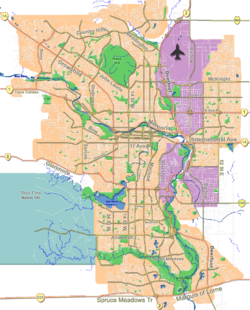
Beltline — Neighbourhood — The high density residential buildings in the Beltline district Location of Beltline in Calgary
Coordinates: 51°02′23″N 114°04′17″W / 51.03972°N 114.07139°W Country  Canada
Province  Alberta
City  Calgary
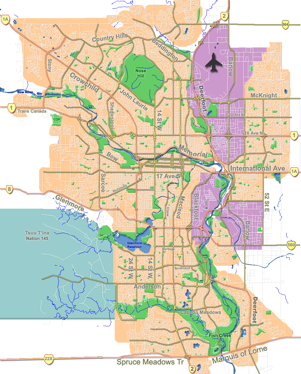
Quadrant SW Ward 8 Established 1905 (Connaught) 2003 (Merged) Government[1] - Administrative body Calgary City Council - Alderman John Mar Elevation 1,050 m (3,445 ft) Population (2008)[2] - Total 17,818 Postal code T3C, T2R The Beltline is a region of central Calgary, Alberta, Canada. The area is located immediately to the south of Calgary's downtown (south of 9th Avenue and the Canadian Pacific Railway tracks), and is sometimes considered part of downtown. The neighbourhood is bound on the south by the popular 17th Avenue, on the west by 14th Street West and on the east by the Elbow River.
The first established district in the neighbourhood was Connaught in 1905, followed by Victoria Park in 1914. When the region and its redevelopment plan were formally established in 2003, it amalgamated the inner city neighbourhoods of Victoria Park and Connaught.[3] As of April 2009, there were 18,341 people residing in the Beltline and its districts.[2]
The district is named for an early 20th century streetcar route.[4]
Contents
Districts
The City of Calgary officially recognizes four separate communities in the Beltline: West Connaught, Connaught Centre, Victoria Park, and East Victoria Park. They are areas of equal north-south orientation and divided by Eighth Street SW, Fourth Street SW, Macleod Trail (1st Street SE), and the Elbow River.[5]
The Beltline contains a number of less formal city districts within its boundaries. These include Midtown, the Design District, Victoria Park Business Revitalization Zone[6] (Victoria), the 4th Street BRZ (located mostly within Mission), the Uptown 17th BRZ, the Warehouse District, and a portion of the Rivers District.
Rivers District
The eastern portion of the Beltline is part of the large Rivers District. This area includes the eastern section of the Beltline (the Victoria Park portion), the downtown neighbourhood of the Downtown East Village, the Stampede Grounds, the Calgary Zoo, and Fort Calgary. Like the Beltline, the East Village is at the forefront of major revitalization initiatives, thus making the Rivers District a hotbed for potential new and rejuvenated development. In the past, the East Village has been regarded as undesirable, mainly due to its proximity to the only remaining industrial area in the downtown area and the railway. Currently, the East Village is notoriously rife with social problems such as drugs and prostitution. Part of the city's revitalization plan includes a large urban campus for the University of Calgary.
17th Avenue
17th Avenue, which is on the southern extremity of the Beltline district has already established itself as a vibrant mixed-use area. With a dense concentration of bars, restaurants, nightclubs, and shops, the street is effectively Calgary's primary "party street". Behind this lively commercial development are residential areas. The street also "dead-ends" at the Stampede Grounds on its east side, and is thus central to the party-like atmosphere that overtakes the city during the Calgary Stampede festival. 17th Avenue was nicknamed the "Red Mile" in 2004 during the playoff run of Calgary's NHL team, the Calgary Flames. During this time, it was not uncommon to see over 100,000 fans crowding the street and its bars and pubs on game nights.
Midtown
 Emerald Stone, a residential tower in the Beltline district
Also of note, the Midtown district which comprises the northern portion of the Beltline is seeing its own unique development push. Some of the Beltline's tallest and densest residential developments are planned for this area. Its primary street, 10th Avenue, will be its focal point and may include a streetcar.
Connaught
Connaught was established in 1905, and comprises the western part of the Beltline, west of 4th Street W. Residents in this community had a median household income of $38,960 in 2000, and 26.1% of residents living in the neighbourhood were low-income.[1]
Victoria Park

Victoria Park comprises the eastern part of the Beltline, is bisected by Macleod Trail, and contains the Warehouse district. It was named after Queen Victoria, who is celebrated in a monument to the Second Boer War located in Central Memorial Park. Victoria Park is adjacent to the Stampede Grounds and the Pengrowth Saddledome arena. Residents in this community had a median household income of $28,843 in 2000, and there were 34.2% low income residents living in the neighbourhood.[1]
Redevelopment
 The Lougheed House a National Historic Site of Canada.
The Beltline is a neighbourhood in transition. The district, along with the Rivers District and the Downtown East Village, are presently in the midst of an ambitious urban planning and rejuvenation venture planned by the city's municipal government to increase the residential density of central Calgary. On May 15, 2006 the Calgary City Council approved the Beltline Area Redevelopment Plan.[7] The plan details land use policies and implementation recommendations which are designed to be implemented concurrently with the broader Land Use Bylaw redesign, to take effect in 2008. It aims to accommodate up to 40,000 residents in the neighbourhood by 2035.
A report on the Beltline ARP was presented to the Calgary Planning Commission on September 20, 2007. A public open house and information session occurred in late October 2007, with a Public Council Hearing occurring on November 12, 2007.[8]
The area is intended to operate as a mixed-use region and is to include a mix of commercial services and high density condominium and apartment towers. Many of these residential structures are already under construction, and even more are in the proposal stages. Currently there are over 37 major residential towers in some stage of development in the community.
Victoria Park is a region of focused municipal redevelopment. The City of Calgary has declared it a Business Revitalization Zone (BRZ) and is encouraging a progressive redevelopment of the much maligned community. The 42 and 34-story residential Arriva project, the tallest condominium development west of Toronto; the Sasso and Vetro development; the Colours project; and the multi-use Hotel Arts Centre, suggest a vibrant and renewed future for Victoria Park, with a great deal of investment and interest. The district is also one of the city's most historic. Not only does it include two of the city's oldest neighbourhoods, but it also encompasses the Stampede Grounds, the site of Calgary's annual Calgary Stampede which sees over 1.25 million visitors per year.
In 2007, Victoria Park was one of the first first communities to get its own Wi-Fi Network. WestNet Wireless deployed the high speed network, which offers fiber optic speeds over Wi-Fi.
Education
 Victoria School is designated an historic site
Two public schools are located in Beltline, the Connaught Community School and the Victoria Community School.[3] Western Canada High School is located along the 17th Avenue boundary of the community, and serves the area. One block outside the Beltline is St. Mary's High School which serves most of the Roman Catholic high school students in the area
Social issues
 13 Ave SW in Beltline, with Downtown Calgary in background
There is a significant mix of economic groups in the community. With new revitalization, a number of middle and upper income groups are establishing themselves in the area due to the close proximity to downtown.[9] However, low income residents still make up a large proportion of the population (28.3% in 2001[10]). The Mustard Seed Calgary is located in the Beltline at 102 11 Ave SE. There are also many poorly maintained and dilapidated buildings with low rents. A large portion of Victoria Park in particular is in poor condition due to the city's decision to restrict development on lands needed for Calgary Stampede expansion.[11] Owners of this land were generally not interested in improving buildings they knew would be removed soon. As a result, a number of seemingly abandoned buildings were occupied illegally by squatters. As the city has finalized land purchases and made final decisions on land use, this has decreased dramatically.
Victoria Park has been traditionally associated with drugs and prostitution. This problem persists today in the eastern portion of the Beltline. Attempts have also been made to deal with a large street drug problem, and the province of Alberta operates a methadone clinic in the area.[12] The clinic has had both positive and negative effects on the community. Despite efforts to deal with these problems, some residents and visitors still find they are frequently approached with unwanted offers to buy or sell drugs and/or sex.
The median household income in 2005 was $43,087 in the Beltline.[10] (compared with $67,283 Calgary average). Immigrants made up 31.3% of the residents in 2006, this compares against an immigrant population of 24.8% for Calgary overall. The majority of the buildings (95.8%) are apartments, and 70.9% of the dwellings were used for renting in 2006.
References
- ^ a b c City of Calgary (2004). "Ward 8 Profile" (PDF). http://www.calgary.ca/docgallery/bu/cns/community_social_statistics/ward_8_profile.pdf. Retrieved 2007-05-09.
- ^ a b City of Calgary. "City of Calgary Population Comparisons" (PDF). http://www.calgary.ca/docgallery/bu/cityclerks/popcomparisonbycomm.pdf. Retrieved 2009-10-05.
- ^ a b Federation of Calgary Communities. "Beltline Community Association". http://www.calgarycommunities.com/communities/beltline.php. Retrieved 2007-01-21.
- ^ "Beltline redevelopment is busting out." Geoffrey Scotton, The Calgary Herald, March 25, 2001.
- ^ "Approved Beltline Area Redevelopment Plan" (PDF). http://www.calgary.ca/DocGallery/BU/planning/pdf/centre_city/beltline/beltline_plan_one.pdf. Retrieved 2007-08-25.
- ^ Victoria Park BRZ. "Victoria Park". http://www.victoriapark.org. Retrieved 2007-05-10.
- ^ City of Calgary. "Beltline - Area Redevelopment Plan" (PDF). http://www.calgary.ca/DocGallery/BU/planning/pdf/centre_city/beltline/beltline_plan_one.pdf. Retrieved 2007-09-28.
- ^ "Beltline Planning". Archived from the original on September 30, 2007. http://web.archive.org/web/20070930201054/http://www.calgary.ca/portal/server.pt/gateway/PTARGS_0_0_104_0_0_35/http;/content.calgary.ca/CCA/City+Hall/Business+Units/Development+and+Building+Approvals+and+Land+Use+Planning+and+Policy/Land+Use+Planning/Centre+City/Beltline+Planning/Beltline+Planning.htm. Retrieved 2007-08-25.
- ^ FFWD Magazine (May 2003). "Beltline united in urban vision". http://www.ffwdweekly.com/Issues/2003/0522/city1.htm. Retrieved 2007-05-10.
- ^ a b City of Calgary (2006). "Beltline - Community Social Statistics" (PDF). http://www.calgary.ca/docgallery/bu/cns/community_social_statistics/beltline.pdf. Retrieved 2007-05-03.
- ^ Calgary Communities - Restricted development in Beltline
- ^ A-Channel Article - Methadone Clinic
External links
- Calgary Beltline Communities - Mainly pictures of the beltline area.
- Beltline Victoria and Connaught Info Site
- Victoria Park Info Site

Downtown West End Downtown Downtown East Village Sunalta
Scarboro
Inglewood  Beltline

Bankview Mount Royal Cliff Bungalow, Mission Coordinates: 51°02′23″N 114°04′17″W / 51.03972°N 114.07139°W
Categories:- Neighbourhoods in Calgary
- Shopping districts and streets in Canada


Wikimedia Foundation. 2010.