- Maryland Route 56
-
Maryland Route 56
Big Pool Road 
Route information Maintained by MDSHA Length: 8.08 mi[1] (13.00 km) Major junctions West end:  I-70 in Big Pool
East end:  MD 68 near Pinesburg
Location Counties: Washington Highway system Maryland highway system
Interstate • US • State • Minor • Former • Turnpikes←  MD 55
MD 55MD 57  →
→Maryland Route 56 (MD 56) is a state highway in the U.S. state of Maryland. Known as Big Pool Road, the state highway runs 8.08 miles (13.00 km) from Interstate 70 (I-70) in Big Pool east to MD 68 near Pinesburg in western Washington County. MD 56, which features a pair of one-lane bridges, provides access to Fort Frederick State Park and the eastern trailhead of the Western Maryland Rail Trail. The state highway was first constructed in the mid 1910s from what is now U.S. Route 40 (US 40) south to Big Pool. The highway was extended east toward the village of Big Spring in the early 1930s and to MD 68 in the late 1950s. MD 56 was truncated at I-70 in the mid 1990s.
Contents
Route description
MD 56 begins at the westbound I-70 ramps of Exit 12. Big Pool Road continues as a county highway north for 1.38 miles (2.22 km) to an intersection with US 40 (National Pike) in Indian Springs. The state highway crosses I-70 (Eisenhower Memorial Highway), intersects the eastbound ramps of the diamond interchange, then curves southeast into the village of Big Pool, where the highway passes the eastern trailhead for the Western Maryland Rail Trail. The rail trail is adjacent to CSX's Lurgan Subdivision, which in turn is adjacent to the Big Pool, a reservoir that was part of the Chesapeake and Ohio Canal and is now used for recreation as part of Chesapeake and Ohio Canal National Historical Park. MD 56 veers east away from the railroad track through farmland and passes the entrance to Fort Frederick State Park. The state highway crosses Green Spring Run before reaching the hamlet of Big Spring, where the highway parallels the Lurgan Subdivision. MD 56 crosses Camp Spring Run on a one-lane bridge before veering east again at Big Spring Road, which heads north toward Clear Spring. The state highway crosses Little Conococheague Creek on a one-lane bridge built in 1907 prior to intersecting Dam Number 5 Road, which heads south to Power Plant and Dam No. 5 on the Potomac River.[2] MD 56 reaches its eastern terminus at MD 68 (Clear Spring Road) in the hamlet of Charlton near Pinesburg.[1][3]
History
The first section of MD 56 was constructed as a state-aid road from US 40 south to Big Pool in 1916.[4] In 1930, the state highway was extended east to the access road to Fort Frederick State Park.[5][6] The access road was designated MD 44 between 1946 and 1969.[7][8] MD 56 was extended east to Four Locks Road in Big Spring in two sections between 1930 and 1934.[5][9][10] The state highway was extended to its eastern terminus at MD 68 near Pinesburg in 1958.[11] Big Pool Road originally had a right-angle turn at Ernstville Road in Big Pool.[12] That intersection was bypassed when a curve was constructed concurrent with the construction of MD 56's interchange with I-70 in 1964.[13][14] The portion of MD 56 between US 40 and I-70 was transferred to county maintenance around 1995.[15]
Junction list
The entire route is in Washington County.
Location Mile[1] Destinations Notes Big Pool 0.00 I-70 west (Eisenhower Memorial Highway) / Big Pool Road north – Hancock, Indian SpringsWestern terminus; Big Pool Road north was formerly MD 56 0.12 I-70 east (Eisenhower Memorial Highway) – HagerstownI-70 Exit 12 1.29 Fort Frederick State Park Former MD 44 Pinesburg 8.08 MD 68 (Clear Spring Road) – Clear Spring, WilliamsportEastern terminus 1.000 mi = 1.609 km; 1.000 km = 0.621 mi References
- ^ a b c "Highway Location Reference: Washington County" (PDF). Maryland State Highway Administration. 2009. http://www.marylandroads.com/Location/2009_WASHINGTON.pdf. Retrieved 2010-11-16.
- ^ "NBI Structure Number: 100000210023010". National Bridge Inventory. http://nationalbridges.com/nbi_record.php?StateCode=42&struct=100000210023010. Retrieved 2010-11-16.
- ^ Google, Inc. Google Maps – Maryland Route 56 (Map). Cartography by Google, Inc. http://maps.google.com/maps?f=d&source=s_d&saddr=MD-56+E%2FBig+Pool+Rd&daddr=MD-56+E%2FBig+Pool+Rd+to:MD-56+E%2FBig+Pool+Rd&geocode=FcSxXAIdYJNZ-w%3BFQ-1XAId6r9a-w%3BFc7NXAIdXoxb-w&hl=en&mra=ls&sll=39.622417,-77.994604&sspn=0.030346,0.077162&ie=UTF8&t=h&z=13. Retrieved 2010-11-16.
- ^ Report of the State Roads Commission of Maryland. 1916-1919. Baltimore: Maryland State Roads Commission. January 1920. p. 20. http://www.archive.org/details/annualreportsofs1916mary. Retrieved 2010-11-16.
- ^ a b Report of the State Roads Commission of Maryland. 1927-1930. Baltimore: Maryland State Roads Commission. 1930-10-01. p. 232. http://www.archive.org/details/reportofstateroa1927mary. Retrieved 2010-11-16.
- ^ Maryland Geological Survey. Map of Maryland Showing State Road System: State Aid Roads and Improved County Road Connections (Map) (1930 ed.).
- ^ Maryland State Roads Commission. Maryland: Official Highway Map (Map) (1946-47 ed.).
- ^ Maryland State Roads Commission. Maryland: Official Highway Map (Map) (1969 ed.).
- ^ Maryland Geological Survey. Map of Maryland Showing State Road System: State Aid Roads and Improved County Road Connections (Map) (1933 ed.).
- ^ Report of the State Roads Commission of Maryland. 1931-1934. Baltimore: Maryland State Roads Commission. 1934-12-28. p. 339. http://www.archive.org/details/reportofstateroa1931mary. Retrieved 2010-11-16.
- ^ Maryland State Roads Commission. Maryland: Official Highway Map (Map) (1958 ed.).
- ^ United States Geological Survey. Hancock, WV quadrangle (Map). 1:48,000. 15 Minute Series (Topographic) (1901 ed.). http://historical.mytopo.com/quad.cfm?quadname=Hancock&state=WV&series=15. Retrieved 2010-11-16.
- ^ "NBI Structure Number: 100000210096010". National Bridge Inventory. http://nationalbridges.com/nbi_record.php?StateCode=42&struct=100000210096010. Retrieved 2010-11-16.
- ^ Maryland State Roads Commission. Maryland: Official Highway Map (Map) (1965 ed.).
- ^ Maryland State Highway Administration. Maryland: Official Highway Map (Map) (1995 ed.).
External links
Roads in Washington County, Maryland State highways 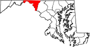
U.S. Highways Interstate Highways Categories:- State highways in Maryland
- Roads in Washington County, Maryland


Wikimedia Foundation. 2010.