- Maryland Route 858
-
Maryland Route 858
Route information Maintained by MDSHA Location Counties: Washington Highway system Maryland highway system
Interstate • US • State • Minor • Former • Turnpikes←  MD 856
MD 864  →
→Maryland Route 858 (MD 858) is a collection of unsigned state highways in the U.S. state of Maryland. These four highways are service roads constructed or old alignments maintained to provide access to private property or county highways whose access was compromised by the reconstruction of MD 67 in Washington County in the late 1950s and 1960s. In addition to the four existing sections of MD 858, there are five sections that existed in the past.
Contents
Existing highways
- MD 858A is the designation for the unnamed 0.02-mile (0.032 km) access road from U.S. Route 40 Alternate (US 40 Alternate) to the Maryland State Highway Administration's Boonsboro shop and salt dome. This piece of highway, which lies just east of MD 67's present northern terminus, was the original northern terminus of MD 67.[1]
- MD 858E is the designation for the 0.29-mile (0.47 km) portion of Woodstock Lane from Park Hall Road north to road end paralleling the northbound side of MD 67 north of Rohrersville. MD 858E originally continued south 0.65 miles (1.05 km) from Park Hall Road to a dead end south of Locust Grove Road.[1][2]
- MD 858F is the designation for Main Street, which runs 1.00 mile (1.61 km) between intersections with MD 67 on either side of the village of Rohrersville. MD 858F is the longest remaining segment of MD 858.[1][3]
- MD 858G is the designation for an unnamed 0.07-mile (0.11 km) section of old alignment of MD 67 south of Rohrersville. MD 858G originally continued south 0.22 miles (0.35 km) to an intersection with Trego Road.[1][4]
Former highways
- MD 858B is the former designation for Appletown Road, a 0.25-mile (0.40 km) section of old alignment of MD 67 on the southbound side of the highway from MD 67 north to a dead end near Boonsboro.[5]
- MD 858C is the former designation for Appleton Road, a 0.89-mile (1.43 km) section of old alignment of MD 67 on the northbound side of the highway from a dead end south of King Road to a dead end north of Netz Road.[6]
- MD 858D is the former designation for Mount Carmel Church Road, a 1.11-mile (1.79 km) loop of old alignment of MD 67 on the southbound side of the highway north of Rohrersville.[7]
- MD 858H is the former designation for a 0.65-mile (1.05 km) section of Gapland Road that forms a loop of old alignment of MD 67 on the southbound side of the highway in Gapland.[8]
- MD 858I is the former designation for Weverton Road, a 1.83-mile (2.95 km) section of old alignment of MD 67 from a dead end near MD 67's former southern terminus in Weverton north to a dead end north of Garretts Mill Road. MD 67's original southern terminus was a short distance south of the southern terminus of MD 858I at U.S. Route 340 before it was cut off by the construction of the US 340 divided highway in 1964. MD 858I was originally the longest segment of MD 858.[9][10]
- MD 858J is the former designation for Boteler Road, a 1.15-mile (1.85 km) loop of old alignment of MD 67 through Brownsville.[11]
References
- ^ a b c d "Highway Location Reference: Washington County" (PDF). Maryland State Highway Administration. 2009. http://www.marylandroads.com/Location/2009_WASHINGTON.pdf. Retrieved 2010-11-30.
- ^ Google, Inc. Google Maps – Maryland Route 858E (Map). Cartography by Google, Inc. http://maps.google.com/maps?f=d&source=s_d&saddr=Woodstock+Ln&daddr=Woodstock+Ln&geocode=FTYEWgId0O5e-w%3BFcAWWgId4_Re-w&hl=en&mra=ls&sll=39.459656,-77.664371&sspn=0.007604,0.01929&ie=UTF8&ll=39.456127,-77.66377&spn=0.007605,0.01929&t=h&z=16. Retrieved 2010-11-30.
- ^ Google, Inc. Google Maps – Maryland Route 858F (Map). Cartography by Google, Inc. http://maps.google.com/maps?f=d&source=s_d&saddr=Main+St&daddr=Millbrook+Rd&geocode=FeieWQIdmPte-w%3BFf_RWQIdsfBe-w&hl=en&mra=ls&sll=39.438463,-77.664177&sspn=0.007607,0.01929&ie=UTF8&t=h&z=15. Retrieved 2010-11-30.
- ^ Google, Inc. Google Maps – Maryland Route 858G (Map). Cartography by Google, Inc. http://maps.google.com/maps?f=d&source=s_d&saddr=Unknown+road&daddr=Unknown+road&geocode=FfyJWQIdN-9e-w%3BFXiNWQIdoO9e-w&hl=en&mra=ls&sll=39.422312,-77.663963&sspn=0.003804,0.009645&ie=UTF8&ll=39.423013,-77.66444&spn=0.001902,0.004823&t=h&z=18. Retrieved 2010-11-30.
- ^ Google, Inc. Google Maps – Former Maryland Route 858B (Map). Cartography by Google, Inc. http://maps.google.com/maps?f=d&source=s_d&saddr=MD-67+S%2FRohrersville+Rd&daddr=Appletown+Rd&geocode=FeCaWgIdIDBf-w%3BFRKlWgIdaDNf-w&hl=en&mra=ls&sll=39.492301,-77.648084&sspn=0.007601,0.01929&ie=UTF8&t=h&z=17. Retrieved 2010-11-30.
- ^ Google, Inc. Google Maps – Former Maryland Route 858C (Map). Cartography by Google, Inc. http://maps.google.com/maps?f=d&source=s_d&saddr=Appletown+Rd&daddr=Appletown+Rd&geocode=FdhmWgId2B1f-w%3BFaKUWgIdYy9f-w&hl=en&mra=ls&sll=39.476949,-77.652161&sspn=0.007602,0.01929&ie=UTF8&t=h&z=15. Retrieved 2010-11-30.
- ^ Google, Inc. Google Maps – Former Maryland Route 858D (Map). Cartography by Google, Inc. http://maps.google.com/maps?f=d&source=s_d&saddr=MD-67+N%2FRohrersville+Rd&daddr=Mt+Carmel+Church+Rd+to:Mt+Carmel+Church+Rd&geocode=FZwgWgIdJPpe-w%3BFWY9WgIdAPte-w%3BFSlPWgIdFRJf-w&hl=en&mra=ls&sll=39.470092,-77.655015&sspn=0.015206,0.038581&ie=UTF8&ll=39.466978,-77.659607&spn=0.015207,0.038581&t=h&z=15. Retrieved 2010-11-30.
- ^ Google, Inc. Google Maps – Former Maryland Route 858H (Map). Cartography by Google, Inc. http://maps.google.com/maps?f=d&source=s_d&saddr=Gapland+Rd&daddr=Gapland+Rd&geocode=FTUxWQIdSRFf-w%3BFftKWQIdJwBf-w&hl=en&mra=ls&sll=39.399832,-77.655766&sspn=0.003805,0.009645&ie=UTF8&t=h&z=16. Retrieved 2010-11-30.
- ^ Google, Inc. Google Maps – Former Maryland Route 858I (Map). Cartography by Google, Inc. http://maps.google.com/maps?f=d&source=s_d&saddr=Weverton+Rd&daddr=Weverton+Rd&geocode=FWkkWAIdRate-w%3BFT6FWAIdKrhe-w&hl=en&mra=ls&sll=39.352842,-77.677159&sspn=0.015232,0.038581&ie=UTF8&t=h&z=14. Retrieved 2010-11-30.
- ^ Maryland State Roads Commission. Maryland: Official Highway Map (Map) (1964 ed.).
- ^ Google, Inc. Google Maps – Former Maryland Route 858J (Map). Cartography by Google, Inc. http://maps.google.com/maps?f=d&source=s_d&saddr=Boteler+Rd&daddr=Boteler+Rd+to:Boteler+Rd&geocode=FRnCWAIdLOBe-w%3BFTfbWAIds_Be-w%3BFcz0WAIdAQVf-w&hl=en&mra=ps&sll=39.376407,-77.664392&sspn=0.007613,0.01929&ie=UTF8&t=h&z=15. Retrieved 2010-11-30.
External links
Roads in Washington County, Maryland State highways 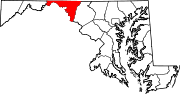
U.S. Highways Interstate Highways Categories:- State highways in Maryland
- Roads in Washington County, Maryland


Wikimedia Foundation. 2010.