- Mira Loma, California
-
"Wineville" redirects here. For the 1920s kidnappings and murders, see Wineville Chicken Coop Murders.
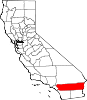
Mira Loma — Former census-designated place — Location in Riverside County and the state of California
Coordinates: 33°59′5″N 117°30′55″W / 33.98472°N 117.51528°WCoordinates: 33°59′5″N 117°30′55″W / 33.98472°N 117.51528°W Country  United States
State  California
County Riverside Inc. into Jurupa Valley July 1, 2011 Area[1] - Total 8.149 sq mi (21.107 km2) - Land 7.997 sq mi (20.712 km2) - Water 0.152 sq mi (0.395 km2) 1.87% Elevation 722 ft (220 m) Population (2010) - Total 21,930 - Density 2,691.1/sq mi (1,039/km2) Time zone PST (UTC-8) - Summer (DST) PDT (UTC-7) ZIP code 91752 Area code(s) 951 FIPS code 06-47976 GNIS feature ID 1656568 Mira Loma was a census-designated place (CDP) in Riverside County, California, United States. The population was 21,930 at the 2010 census, up from 17,617 at the 2000 census. Mira Loma was known as Wineville prior to 1930. The name was changed that year to help disassociate the community from the Wineville Chicken Coop Murders. On July 1, 2011, Mira Loma became part of the newly incorporated City of Jurupa Valley.
Contents
Geography
According to the United States Census Bureau, the CDP has a total area of 8.1 square miles (21 km2), of which, 8.0 square miles (21 km2) of it is land and 0.2 square miles (0.52 km2) of it (1.87%) is water.
History
Rancho Jurupa/Jurupa Valley was originally granted by the Mexican government to Sn. Dn. Juan Bandini, on September 28, 1838.[2]
Originally known as Wineville, it is located in the modern day "Jurupa" area of unincorporated Riverside County. It is separated from the city of Riverside by the Santa Ana River to the south, borders the Ontario/Fontana area of San Bernardino County to the north and west, and Pedley / Glen Avon to the east. The community officially changed its name from Wineville on November 1, 1930, due in large part to the negative publicity surrounding the Wineville Chicken Coop Murders.[3]
Incorporation into the City of Jurupa Valley
On March 8, 2011, voters passed Measure A by a 54.03% YES vote, incorporating the areas of Mira Loma, Pedley, Rubidoux, Glen Avon, and Sunnyslope into the new city Jurupa Valley. The effective date of incorporation was July 1, 2011.[4]
Demographics
2010
The 2010 United States Census[5] reported that Mira Loma had a population of 21,930. The population density was 2,691.0 people per square mile (1,039.0/km²). The racial makeup of Mira Loma was 12,577 (57.4%) White, 383 (1.7%) African American, 240 (1.1%) Native American, 465 (2.1%) Asian, 43 (0.2%) Pacific Islander, 7,250 (33.1%) from other races, and 972 (4.4%) from two or more races. Hispanic or Latino of any race were 14,846 persons (67.7%).
The Census reported that 21,882 people (99.8% of the population) lived in households, 28 (0.1%) lived in non-institutionalized group quarters, and 20 (0.1%) were institutionalized.
There were 5,277 households, out of which 2,797 (53.0%) had children under the age of 18 living in them, 3,415 (64.7%) were opposite-sex married couples living together, 647 (12.3%) had a female householder with no husband present, 461 (8.7%) had a male householder with no wife present. There were 335 (6.3%) unmarried opposite-sex partnerships, and 31 (0.6%) same-sex married couples or partnerships. 527 households (10.0%) were made up of individuals and 164 (3.1%) had someone living alone who was 65 years of age or older. The average household size was 4.15. There were 4,523 families (85.7% of all households); the average family size was 4.30.
The population was spread out with 6,618 people (30.2%) under the age of 18, 2,722 people (12.4%) aged 18 to 24, 5,848 people (26.7%) aged 25 to 44, 5,256 people (24.0%) aged 45 to 64, and 1,486 people (6.8%) who were 65 years of age or older. The median age was 30.4 years. For every 100 females there were 103.3 males. For every 100 females age 18 and over, there were 105.3 males.
There were 5,640 housing units at an average density of 692.1 per square mile (267.2/km²), of which 3,902 (73.9%) were owner-occupied, and 1,375 (26.1%) were occupied by renters. The homeowner vacancy rate was 2.6%; the rental vacancy rate was 3.6%. 15,806 people (72.1% of the population) lived in owner-occupied housing units and 6,076 people (27.7%) lived in rental housing units.
2000
As of the census[6] of 2000, there were 17,617 people, 4,556 households, and 3,863 families residing in the CDP. The population density was 2,733.9 people per square mile (1,056.2/km²). There were 4,684 housing units at an average density of 726.9 per square mile (280.8/km²). The racial makeup of the CDP was 62.7% White, 1.9% African American, 0.6% Native American, 2.2% Asian, <0.1% Pacific Islander, 28.3% from other races, and 2.3% from two or more races. Hispanic or Latino of any race were 62.1% of the population.
There were 4,556 households out of which 47.6% had children under the age of 18 living with them, 67.0% were married couples living together, 11.0% had a female householder with no husband present, and 15.2% were non-families. 10.1% of all households were made up of individuals and 2.8% had someone living alone who was 65 years of age or older. The average household size was 3.84 and the average family size was 4.05.
In the CDP the population was spread out with 34.0% under the age of 18, 10.3% from 18 to 24, 28.9% from 25 to 44, 21.1% from 45 to 64, and 5.7% who were 65 years of age or older. The median age was 30 years. For every 100 females there were 105.3 males. For every 100 females age 18 and over, there were 105.6 males.
The median income for a household in the CDP was $67,530, and the median income for a family was $68,834. Males had a median income of $33,356 versus $25,275 for females. The per capita income for the CDP was $20,655. About 9.5% of families and 14.0% of the population were below the poverty line, including 17.7% of those under age 18 and 13.2% of those age 65 or over.
Politics
In the state legislature Mira Loma is located in the 31st Senate District, represented by Republican Robert Dutton, and in the 66th Assembly District, represented by Republican Kevin Jeffries. Federally, Mira Loma is located in California's 44th congressional district, which has a Cook PVI of R +6[7] and is represented by Republican Ken Calvert.
References
- ^ U.S. Census
- ^ Jurupa grant
- ^ "Jurupa Valley History: Mira Loma History". Riverside County Planning Department. 2006. http://www.tlma.co.riverside.ca.us/planning/content/areaplan/jurupa/content/jurupa_history_noflash.html. Retrieved 2008-01-26.
- ^ Stokley, Sandra (8 March 2011). "Jurupa cityhood approved". The Press-Enterprise. http://www.pe.com/localnews/riverside/stories/PE_News_Local_D_wcity09.1c6fd801c.html. Retrieved 9 March 2011.
- ^ All data are derived from the United States Census Bureau reports from the 2010 United States Census, and are accessible on-line here. The data on unmarried partnerships and same-sex married couples are from the Census report DEC_10_SF1_PCT15. All other housing and population data are from Census report DEC_10_DP_DPDP1. Both reports are viewable online or downloadable in a zip file containing a comma-delimited data file. The area data, from which densities are calculated, are available on-line here. Percentage totals may not add to 100% due to rounding. The Census Bureau defines families as a household containing one or more people related to the householder by birth, opposite-sex marriage, or adoption. People living in group quarters are tabulated by the Census Bureau as neither owners nor renters. For further details, see the text files accompanying the data files containing the Census reports mentioned above.
- ^ "American FactFinder". United States Census Bureau. http://factfinder.census.gov. Retrieved 2008-01-31.
- ^ "Will Gerrymandered Districts Stem the Wave of Voter Unrest?". Campaign Legal Center Blog. http://www.clcblog.org/blog_item-85.html. Retrieved 2008-02-10.
Municipalities and communities of Riverside County, California County seat: Riverside Cities Banning | Beaumont | Blythe | Calimesa | Canyon Lake | Cathedral City | Coachella | Corona | Desert Hot Springs | Eastvale | Hemet | Indian Wells | Indio | Jurupa Valley | La Quinta | Lake Elsinore | Menifee | Moreno Valley | Murrieta | Norco | Palm Desert | Palm Springs | Perris | Rancho Mirage | Riverside | San Jacinto | Temecula | Wildomar
CDPs Aguanga | Anza | Bermuda Dunes | Cabazon | Cherry Valley | Coronita | Crestmore Heights | Desert Center | Desert Edge | Desert Palms | East Hemet | El Cerrito | El Sobrante | French Valley | Garnet | Glen Avon | Good Hope | Green Acres | Highgrove | Home Gardens | Homeland | Idyllwild-Pine Cove | Indio Hills | Lake Mathews | Lake Riverside | Lakeland Village | Lakeview | March ARB | Mead Valley | Meadowbrook | Mecca | Mesa Verde | Mira Loma | Mountain Center | North Shore | Nuevo | Oasis | Pedley | Ripley | Romoland | Rubidoux | Sky Valley | Sunnyslope | Temescal Valley | Thermal | Thousand Palms | Valle Vista | Vista Santa Rosa | Warm Springs | Whitewater | Winchester | Woodcrest
Unincorporated
communitiesAlberhill | Alessandro | Arcilla | Arnold Heights | Belltown | Biskra Palms | Bly | Bonnie Bell | Box Springs | Cactus City | Cahuilla | Cahuilla Hills | Chiriaco Summit | East Blythe | Edgemont | El Cariso | Gilman Hot Springs | La Cresta | Lost Lake | Mortmar | Murrieta Hot Springs | River Bend Lodge | Sun City Palm Desert
Indian
reservationsAgua Caliente Indian Reservation | Cabazon Indian Reservation | Cahuilla Reservation | Colorado River Indian Reservation | Los Coyotes Reservation | Morongo Reservation | Ramona Indian Reservation | Santa Rosa Indian Reservation | Soboba Reservation | Torres-Martinez Indian Reservation
Ghost towns Alamo Bonito | Auld | Bergman | Caleb | Eagle Mountain | Hell | La Placita | Midland | Pinacate | Saahatpa | Terra Cotta
Categories:- Jurupa Valley, California
- Former census-designated places in California
- Populated places on the Santa Ana River
- Populated places in California with Hispanic majority populations


Wikimedia Foundation. 2010.