- Mecca, California
-
Mecca — Census-designated place — "Welcome to Mecca" sign Location in Riverside County and the state of California
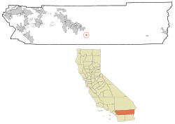
Coordinates: 33°34′24″N 116°4′25″W / 33.57333°N 116.07361°WCoordinates: 33°34′24″N 116°4′25″W / 33.57333°N 116.07361°W Country  United States
State  California
County Riverside Area[1] - Total 6.959 sq mi (18.023 km2) - Land 6.959 sq mi (18.023 km2) - Water 0 sq mi (0 km2) 0% Elevation -180 ft (-55 m) Population (2010) - Total 8,577 - Density 1,232.5/sq mi (475.9/km2) Time zone PST (UTC-8) - Summer (DST) PDT (UTC-7) ZIP code 92254 Area code(s) 760 FIPS code 06-46660 GNIS feature ID 1652751 Mecca is a census-designated place (CDP) in Riverside County, California, United States. The population was 8,577 at the 2010 census, up from 5,402 at the 2000 census.
The unincorporated community is served by State Route 111, a north-south highway on the eastern shore of the Salton Sea.
Rapid growth in population, development and employment in the 2000s gave Mecca a new identity as the fastest growing area in California. A new public school complex, tens of thousands of new homes, a proposed commercial aviation airport in nearby Thermal and economic development as part of the Coachella Valley Free Enterprise Zone is positively contributing to living there.
About two-thirds of the local population are in the federal poverty range, the majority are migrant laborers and every May, the population triples to 25,000 to 40,000 gave Mecca the distinction as the highest population density of any community in rural California (about 15,000 per square mile).[citation needed]
A 2006 documentary film, Mecca: A Legacy of Cesar Chavez, reveals details about the area. It was distributed nationwide by the National Educational Telecommunications Association and discusses poverty, health care, and farmworker history of the area.
Recently, the Torres-Martinez Band of Mission Indians of the Cahuilla tribe who got federal monetary damage payments from land loss by the creation of the Salton Sea in 1905, opened a new gaming operation: Red Earth Casino to generate employment and recreation desperately needed in Mecca and the Salton Sea area.
On March 3, 2008, twenty-two cars of a sixty-three unit Union Pacific freight train running between Colton and El Centro derailed near Mecca, causing a long-term evacuation of forty homes and precipitating the long-term closure of both the railroad and State Route 111 due to the leakage of both hydrochloric acid and phosphoric acid. Closure of the highway greatly affected travel between the eastern Coachella Valley and eastern Imperial County.
Mecca was a featured location in Roger Corman's 1966 film The Wild Angels, starring Peter Fonda, Nancy Sinatra and Bruce Dern. This film inspired the outlaw biker film genre, and marks Peter Fonda's first appearance as a biker - three years prior to Easy Rider.
Contents
Geography & Climate
Mecca is located at 33°34′24″N 116°4′25″W / 33.57333°N 116.07361°W (33.573388, -116.073536).[2]
According to the United States Census Bureau, the CDP has a total area of 7.0 square miles (18 km2), all of it land.
Climate data for Mecca, CA Month Jan Feb Mar Apr May Jun Jul Aug Sep Oct Nov Dec Year Record high °F (°C) 93
(34)100
(38)107
(42)110
(43)119
(48)126
(52)125
(52)123
(51)126
(52)117
(47)100
(38)95
(35)126
(52)Average high °F (°C) 72.1
(22.3)76.0
(24.4)82.7
(28.2)89.5
(31.9)97.4
(36.3)104.5
(40.3)108.7
(42.6)107.9
(42.2)103.4
(39.7)92.9
(33.8)79.5
(26.4)70.7
(21.5)90.5 Average low °F (°C) 40.1
(4.5)43.4
(6.3)49.3
(9.6)54.8
(12.7)62.6
(17.0)68.5
(20.3)75.2
(24.0)75.4
(24.1)68.9
(20.5)57.9
(14.4)45.7
(7.6)38.5
(3.6)56.8 Record low °F (°C) 13
(−11)19
(−7)23
(−5)34
(1)32
(0)48
(9)53
(12)51
(11)45
(7)28
(−2)24
(−4)18
(−8)13
(−11)Precipitation inches (mm) 0.55
(14)0.60
(15.2)0.34
(8.6)0.09
(2.3)0.02
(0.5)0.00
(0)0.14
(3.6)0.20
(5.1)0.21
(5.3)0.28
(7.1)0.30
(7.6)0.42
(10.7)3.15
(80)Source: http://www1.ncdc.noaa.gov/pub/data/normals/1981-2010/products/station/USC00045502.normals.txt [3] Demographics
2010
The 2010 United States Census[4] reported that Mecca had a population of 8,577. The population density was 1,232.5 people per square mile (475.9/km²). The racial makeup of Mecca was 2,686 (31.3%) White, 40 (0.5%) African American, 47 (0.5%) Native American, 17 (0.2%) Asian, 7 (0.1%) Pacific Islander, 5,543 (64.6%) from other races, and 237 (2.8%) from two or more races. Hispanic or Latino of any race were 8,462 persons (98.7%).
The Census reported that 8,577 people (100% of the population) lived in households, 0 (0%) lived in non-institutionalized group quarters, and 0 (0%) were institutionalized.
There were 1,854 households, out of which 1,374 (74.1%) had children under the age of 18 living in them, 1,185 (63.9%) were opposite-sex married couples living together, 339 (18.3%) had a female householder with no husband present, 175 (9.4%) had a male householder with no wife present. There were 142 (7.7%) unmarried opposite-sex partnerships, and 10 (0.5%) same-sex married couples or partnerships. 98 households (5.3%) were made up of individuals and 26 (1.4%) had someone living alone who was 65 years of age or older. The average household size was 4.63. There were 1,699 families (91.6% of all households); the average family size was 4.70.
The population was spread out with 3,372 people (39.3%) under the age of 18, 1,141 people (13.3%) aged 18 to 24, 2,353 people (27.4%) aged 25 to 44, 1,368 people (15.9%) aged 45 to 64, and 343 people (4.0%) who were 65 years of age or older. The median age was 23.7 years. For every 100 females there were 111.2 males. For every 100 females age 18 and over, there were 110.8 males.
There were 2,020 housing units at an average density of 290.3 per square mile (112.1/km²), of which 815 (44.0%) were owner-occupied, and 1,039 (56.0%) were occupied by renters. The homeowner vacancy rate was 1.1%; the rental vacancy rate was 8.7%. 3,978 people (46.4% of the population) lived in owner-occupied housing units and 4,599 people (53.6%) lived in rental housing units.
2000
As of the census[5] of 2000, there were 5,402 people, 1,049 households, and 958 families residing in the CDP. Mecca is predominately an agricultural community - with a large portion of its population consisting of migrant farm-workers employed throughout the Coachella Valley. The population density was 4,167.1 people per square mile (1,604.4/km²). There were 1,059 housing units at an average density of 816.9 per square mile (314.5/km²). The racial makeup of the CDP was 24.1% White, 0.1% African American, 1.0% Native American, 0.7% Asian, 70.7% from other races, and 3.4% from two or more races. Hispanic or Latino of any race were 98.0% of the population.
 Mecca Community and Health Care Center.
There were 1,049 households out of which 67.0% had children under the age of 18 living with them, 68.4% were married couples living together, 13.9% had a female householder with no husband present, and 8.6% were non-families. 4.0% of all households were made up of individuals and 1.0% had someone living alone who was 65 years of age or older. The average household size was 5.0 and the average family size was 5.0.
In the CDP the population was spread out with 39.8% under the age of 18, 14.4% from 18 to 24, 29.0% from 25 to 44, 13.1% from 45 to 64, and 3.7% who were 65 years of age or older. The median age was 23 years. For every 100 females there were 128.9 males. For every 100 females age 18 and over, there were 135.0 males.
The median income for a household in the CDP was $22,973, and the median income for a family was $21,250. Males had a median income of $16,897 versus $11,901 for females. The per capita income for the CDP was $6,389. About 43.0% of families and 45.5% of the population were below the poverty line, including 52.1% of those under age 18 and 16.8% of those age 65 or over.
Politics
In the state legislature Mecca is located in the 40th Senate District, represented by Democrat Denise Moreno Ducheny, and in the 80th Assembly District, represented by Democrat Manuel Perez. Federally, Mecca is located in California's 45th congressional district, which has a Cook PVI of R +3[6] and is represented by Republican Mary Bono Mack.
References
- ^ U.S. Census
- ^ "US Gazetteer files: 2010, 2000, and 1990". United States Census Bureau. 2011-02-12. http://www.census.gov/geo/www/gazetteer/gazette.html. Retrieved 2011-04-23.
- ^ NOAA. "1981-2010 MONTHLY NORMALS for Mecca, CA". NOAA. http://www1.ncdc.noaa.gov/pub/data/normals/1981-2010/products/station/USC00045502.normals.txt. Retrieved 2011-07-19.
- ^ All data are derived from the United States Census Bureau reports from the 2010 United States Census, and are accessible on-line here. The data on unmarried partnerships and same-sex married couples are from the Census report DEC_10_SF1_PCT15. All other housing and population data are from Census report DEC_10_DP_DPDP1. Both reports are viewable online or downloadable in a zip file containing a comma-delimited data file. The area data, from which densities are calculated, are available on-line here. Percentage totals may not add to 100% due to rounding. The Census Bureau defines families as a household containing one or more people related to the householder by birth, opposite-sex marriage, or adoption. People living in group quarters are tabulated by the Census Bureau as neither owners nor renters. For further details, see the text files accompanying the data files containing the Census reports mentioned above.
- ^ "American FactFinder". United States Census Bureau. http://factfinder.census.gov. Retrieved 2008-01-31.
- ^ "Will Gerrymandered Districts Stem the Wave of Voter Unrest?". Campaign Legal Center Blog. http://www.clcblog.org/blog_item-85.html. Retrieved 2008-02-10.
Municipalities and communities of Riverside County, California County seat: Riverside Cities Banning | Beaumont | Blythe | Calimesa | Canyon Lake | Cathedral City | Coachella | Corona | Desert Hot Springs | Eastvale | Hemet | Indian Wells | Indio | Jurupa Valley | La Quinta | Lake Elsinore | Menifee | Moreno Valley | Murrieta | Norco | Palm Desert | Palm Springs | Perris | Rancho Mirage | Riverside | San Jacinto | Temecula | Wildomar
CDPs Aguanga | Anza | Bermuda Dunes | Cabazon | Cherry Valley | Coronita | Crestmore Heights | Desert Center | Desert Edge | Desert Palms | East Hemet | El Cerrito | El Sobrante | French Valley | Garnet | Glen Avon | Good Hope | Green Acres | Highgrove | Home Gardens | Homeland | Idyllwild-Pine Cove | Indio Hills | Lake Mathews | Lake Riverside | Lakeland Village | Lakeview | March ARB | Mead Valley | Meadowbrook | Mecca | Mesa Verde | Mira Loma | Mountain Center | North Shore | Nuevo | Oasis | Pedley | Ripley | Romoland | Rubidoux | Sky Valley | Sunnyslope | Temescal Valley | Thermal | Thousand Palms | Valle Vista | Vista Santa Rosa | Warm Springs | Whitewater | Winchester | Woodcrest
Unincorporated
communitiesAlberhill | Alessandro | Arcilla | Arnold Heights | Belltown | Biskra Palms | Bly | Bonnie Bell | Box Springs | Cactus City | Cahuilla | Cahuilla Hills | Chiriaco Summit | East Blythe | Edgemont | El Cariso | Gilman Hot Springs | La Cresta | Lost Lake | Mortmar | Murrieta Hot Springs | River Bend Lodge | Sun City Palm Desert
Indian
reservationsAgua Caliente Indian Reservation | Cabazon Indian Reservation | Cahuilla Reservation | Colorado River Indian Reservation | Los Coyotes Reservation | Morongo Reservation | Ramona Indian Reservation | Santa Rosa Indian Reservation | Soboba Reservation | Torres-Martinez Indian Reservation
Ghost towns Alamo Bonito | Auld | Bergman | Caleb | Eagle Mountain | Hell | La Placita | Midland | Pinacate | Saahatpa | Terra Cotta
Categories:- Census-designated places in Riverside County, California
- Populated places in California with Hispanic majority populations
- Populated places in the Colorado Desert
- Coachella Valley


Wikimedia Foundation. 2010.